Northern Plains Update: Severe Risks This Weekend, Cool Into September. E.
Key Points: August 25, 2017
Synopsis: Good morning! We are tracking our next disturbance moving into western areas this morning, and this will lead to a risk for severe weather this afternoon and even in South Dakota. This disturbance will also bring rains to portions of North Dakota as well as much of Minnesota and Wisconsin. The pattern through next weekend will feature the coolest air in Minnesota and Wisconsin with the Dakotas seeing closer to normal temperatures. Have a blessed weekend!
Today’s Video (4 min):
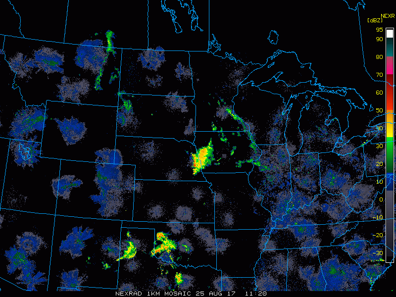
Current radar shows our next system off to our west.
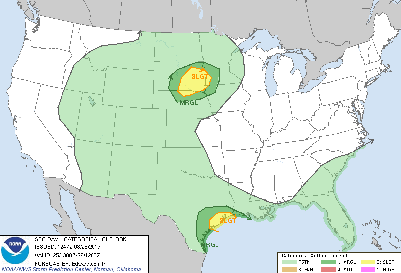
SPC highlights severe risks in South Dakota and SW Minnesota this afternoon and evening.
Projected radar through Sunday morning.
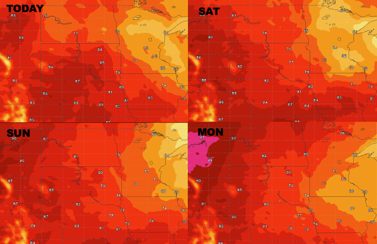
High temperatures next 4 days.
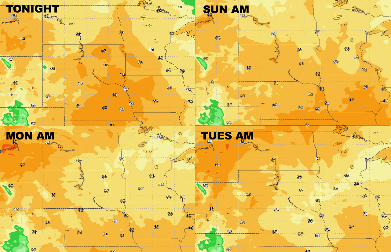
Low temperatures next 4 days.
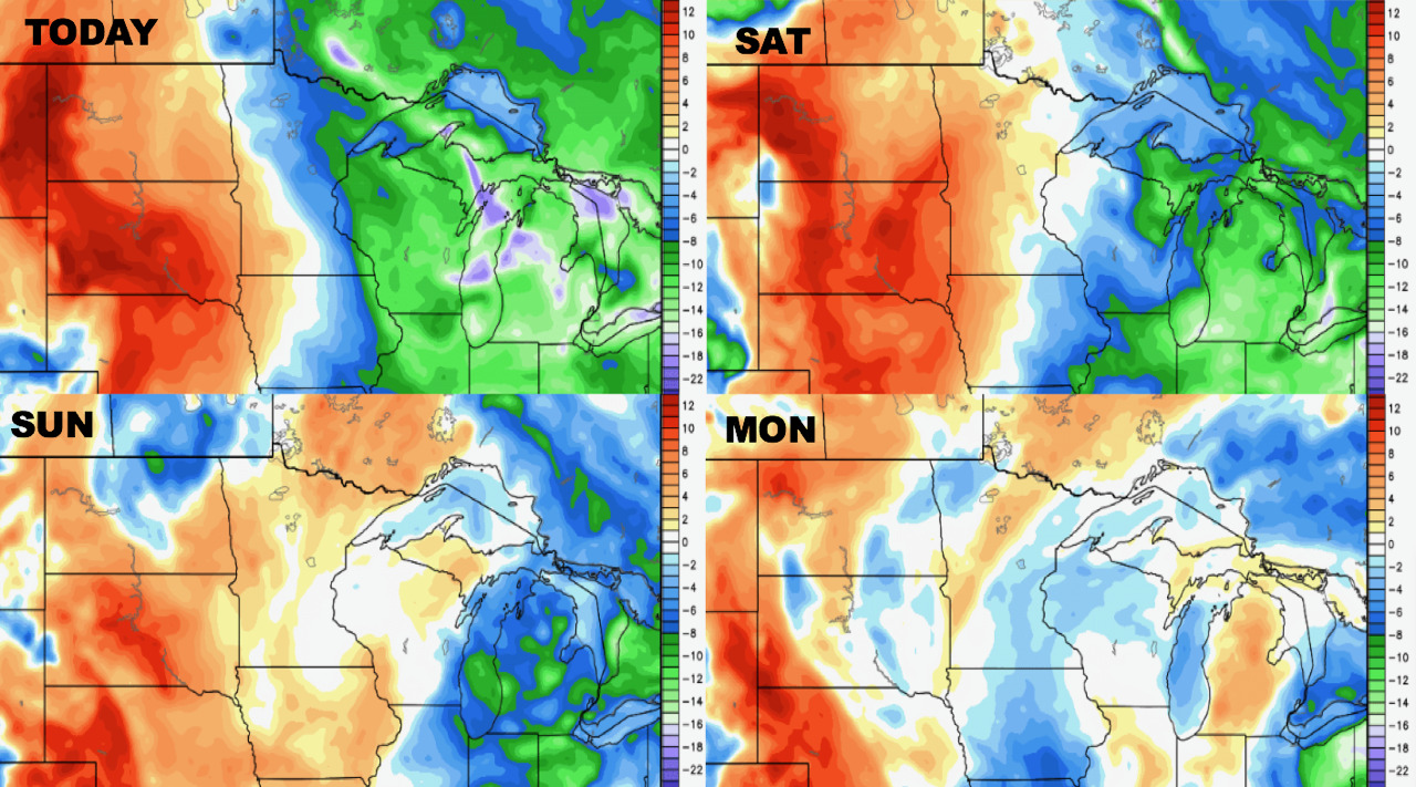
Dew point anomalies through Monday are below.
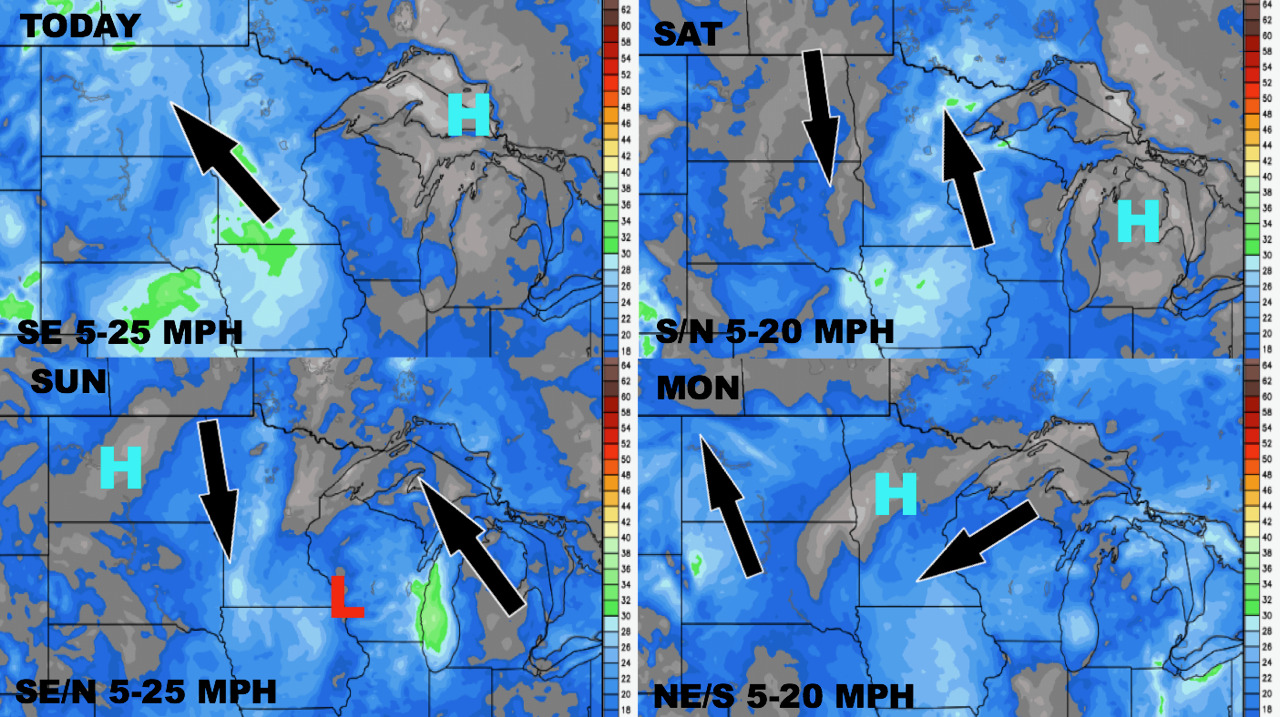
Wind forecast through the weekend is below.
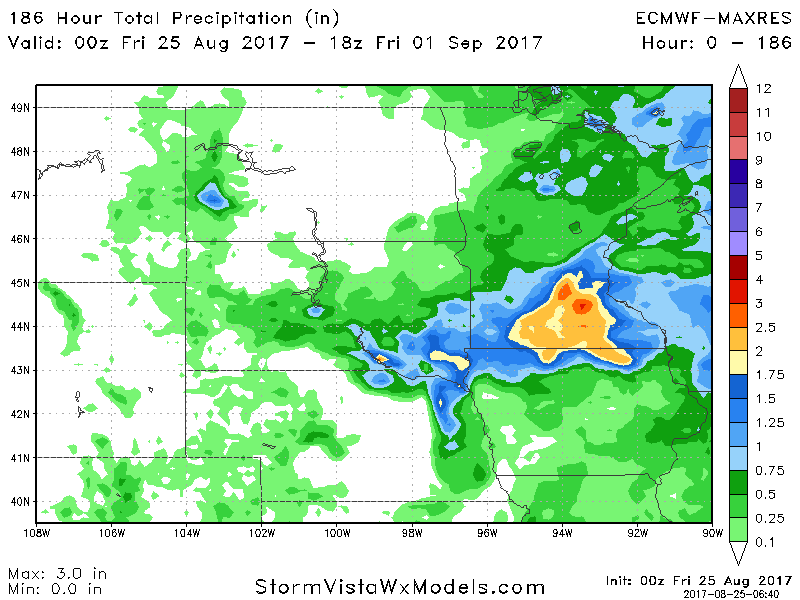
Total rainfall through next Friday is shown below. Note heaviest rains east.