Key Points: September 26, 2017
Synopsis: Good Tuesday morning! Rain continues to fall across eastern portions of zone 9. This will slowly end this afternoon with some sunshine expected across the western and central Dakotas. High pressure will move into the region Wednesday with fair conditions and seasonable temperatures. Another cold front will move through the region Thursday with perhaps a spotty shower along with increasingly cooler conditions across Minnesota and Wisconsin. Our next rain maker looks to approach Saturday into Sunday with additional rains. This wetter than normal regime will continue into next week thanks to a stronger than normal Pacific jet stream. Have a blessed day!
Today’s Video (7 min):
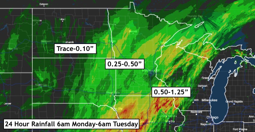
Rainfall over the last 24 hours is shown below.
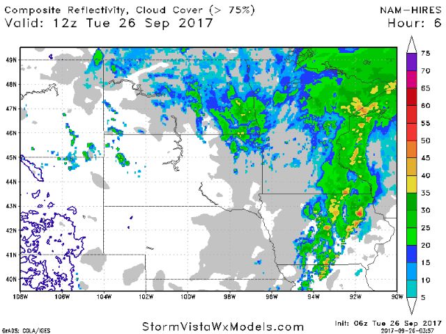
Rainfall will slowly end this afternoon. This projected radar through tonight is shown below.
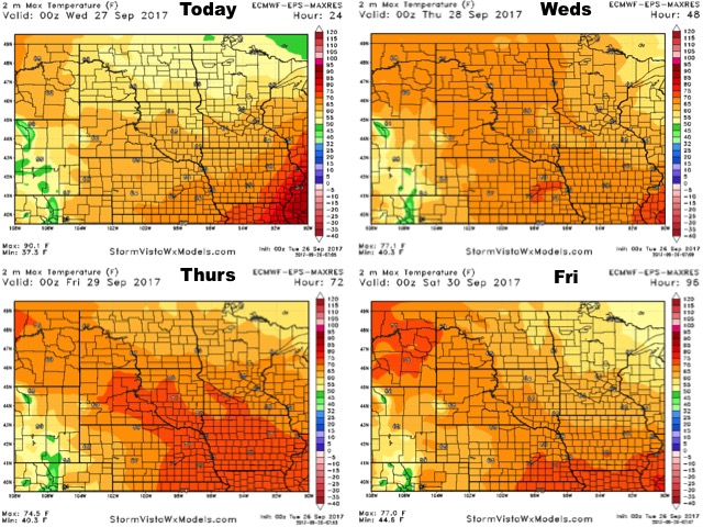
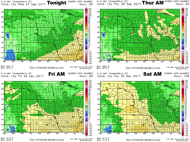
High temperatures over the next 4 days are shown below.
Low temperatures look to behave similarly.
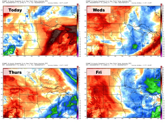
Humidity will be up and down, but ultimately above normal especially west.
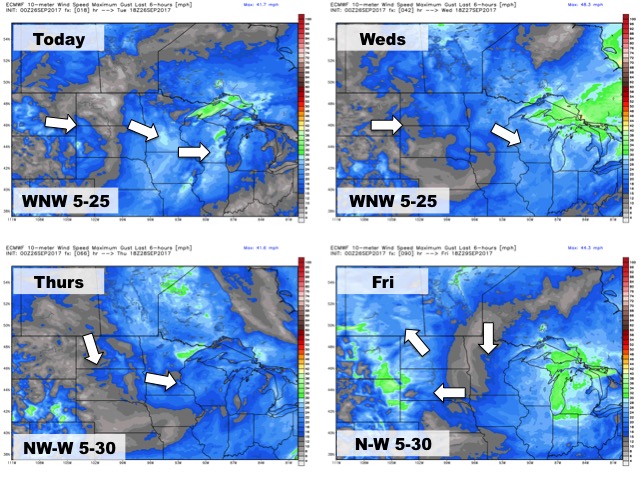
The wind forecast through the end of the week is shown below.
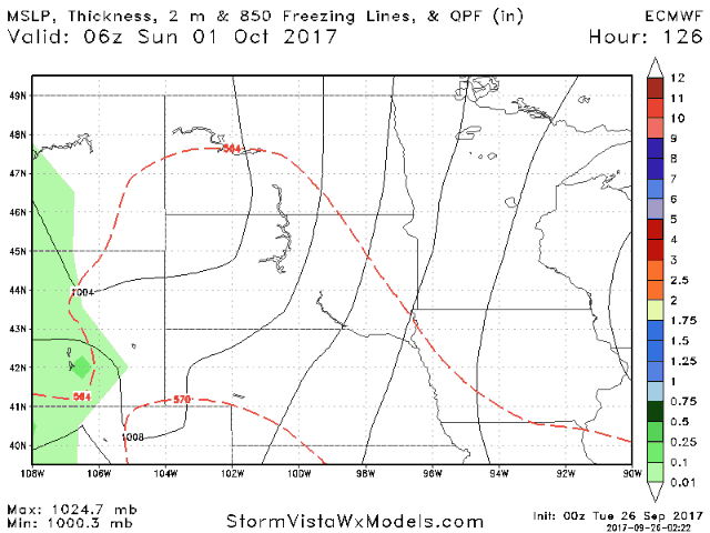
Our next rainfall chance comes this weekend. The European model for this event is shown below.
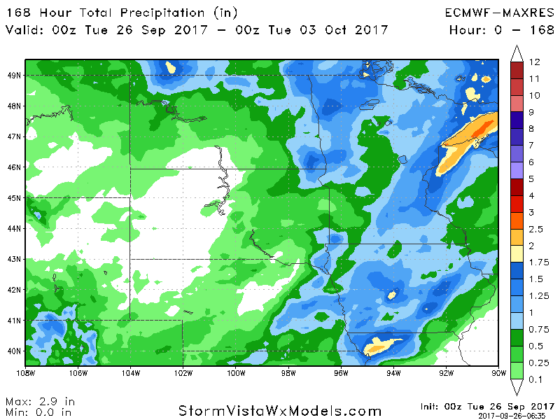
Total rainfall over the next 7 days is below.
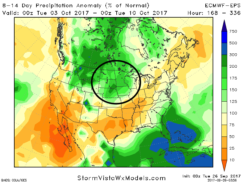
Week 2 continues to look active across the region with above normal precipitation, possibly causing some harvest delays.