Northern Plains Update: Rain and Storms Today, Cooler Drier Midweek. E.
Key Points: August 21, 2017
Synopsis: Good Monday morning! We are tracking some thunderstorms across South Dakota and southern Minnesota bringing heavy rain as well as spotty reports of hail and damaging winds. Additional storms are expected in eastern portions of the zone today into tonight as a cold front moves through. Cooler, drier conditions are expected through midweek before northwest flow brings a renewed threat for thunderstorms in the Dakotas by Friday. Cool conditions look to continue through the beginning of September with near to below normal rainfall expected. Have a blessed day!
Today’s Video (5:47):
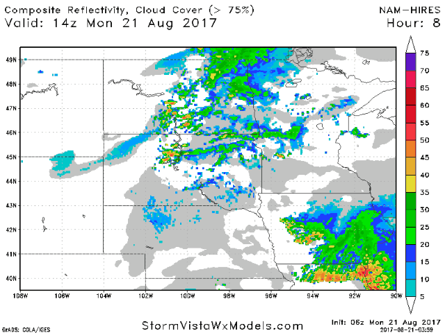
Current radar as of 8 AM CDT:

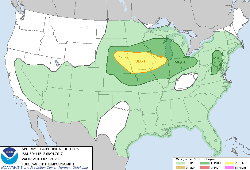
SPC is highlighting southern areas for a risk of severe weather through this evening.
Projected radar through this evening.
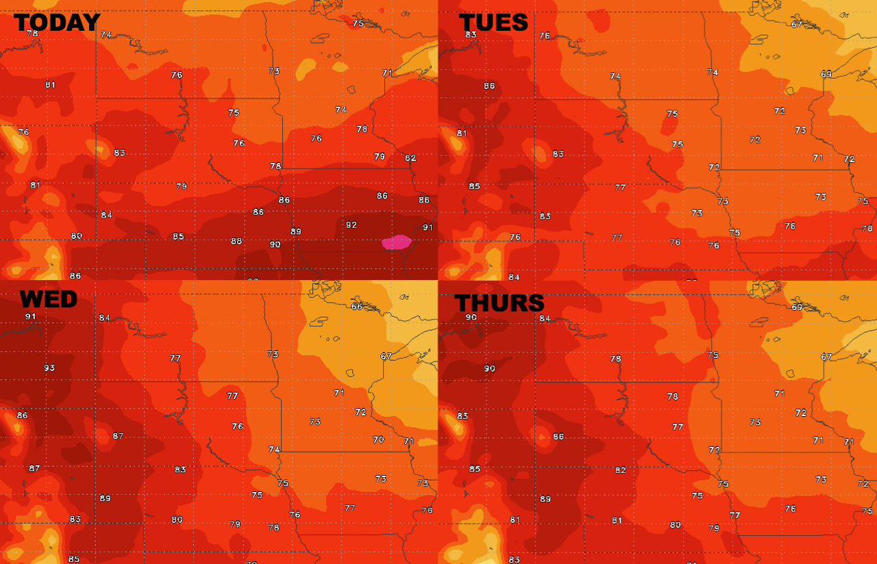
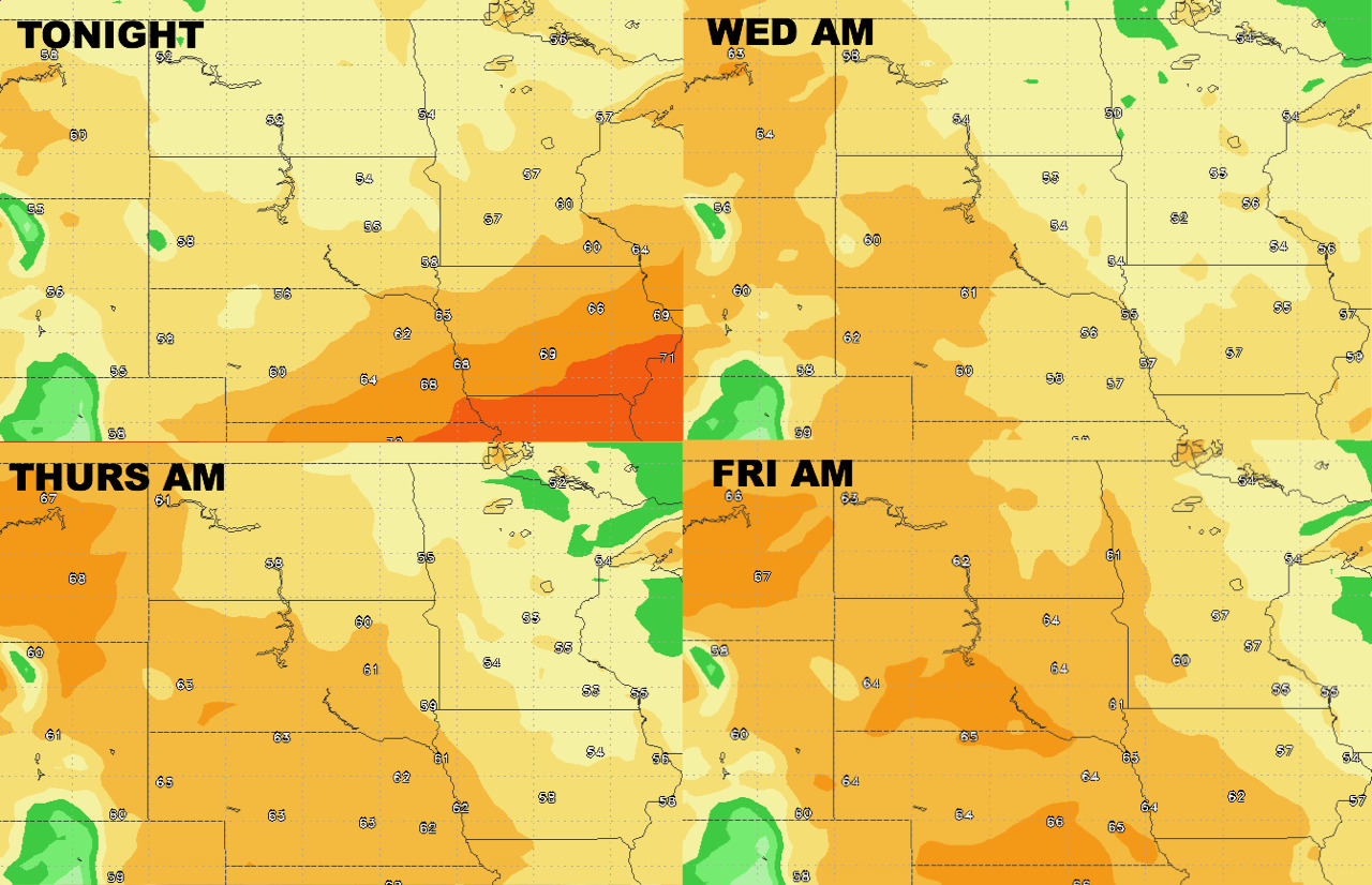
High temperatures trend cooler especially east this week.
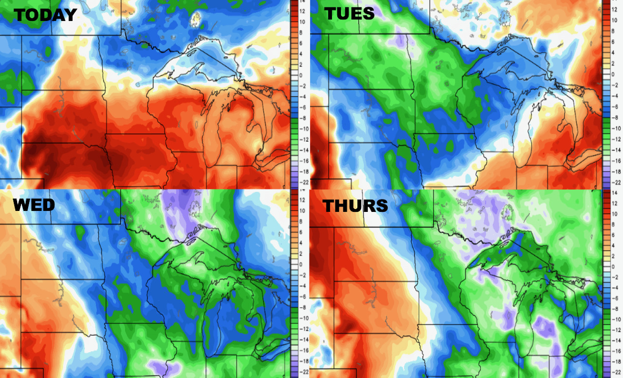
Low temperatures over the next 4 days.
Humidity rises through the week in the west, but stays low in the east.
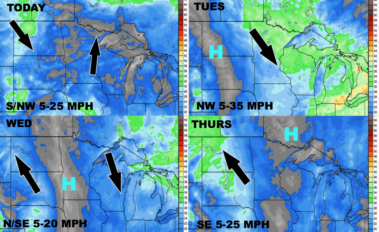
Wind forecast over the coming days.
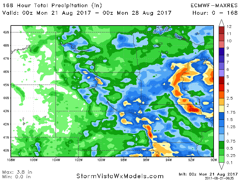
Total precipitation through next Sunday.