Northern Plains Update: Hot Through Midweek, Turning Wet Into the Weekend. E.
Key Points: September 12, 2017
Synopsis: Good Tuesday morning! High pressure is sliding east of the region leading to an increase in heat and humidity. A weak disturbance will move through the Dakotas this afternoon leading to a small shower and storm threat. Heat will continue tomorrow and Thursday ahead of a strong cold front. Friday into the weekend will feature increased rainfall chances along with a much cooler regime across the Dakotas. This front will also spark a severe threat in the Dakotas for Friday. Temperatures will rebound next week, but the wetter than normal regime looks to continue as the storm track remains nearby. Have a blessed day!
Today’s Video (6 min):
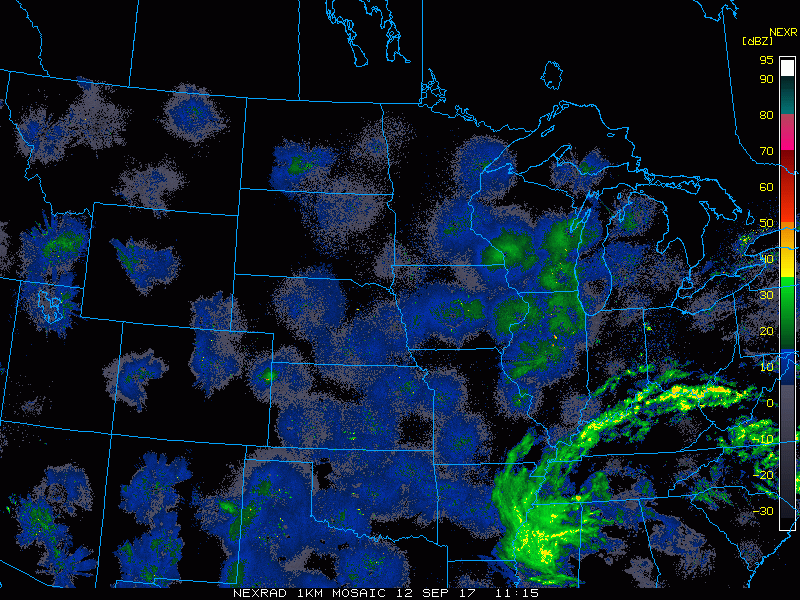
Current radar scanning clear this morning.
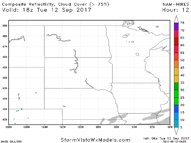
A weak disturbance will bring some showers and storms this afternoon to the Dakotas. Projected radar:
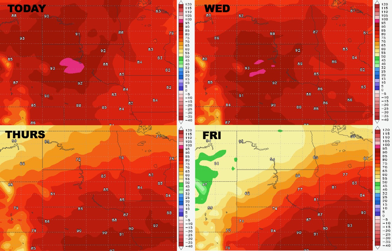
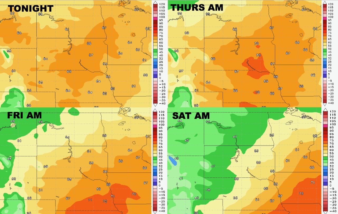
High temperatures over the next 4 days show the heat giving way to cooler conditions by Friday northwest.
Low temperatures follow a similar pattern.
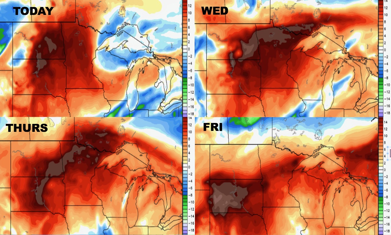
Humidity will stay high through the end of the week.
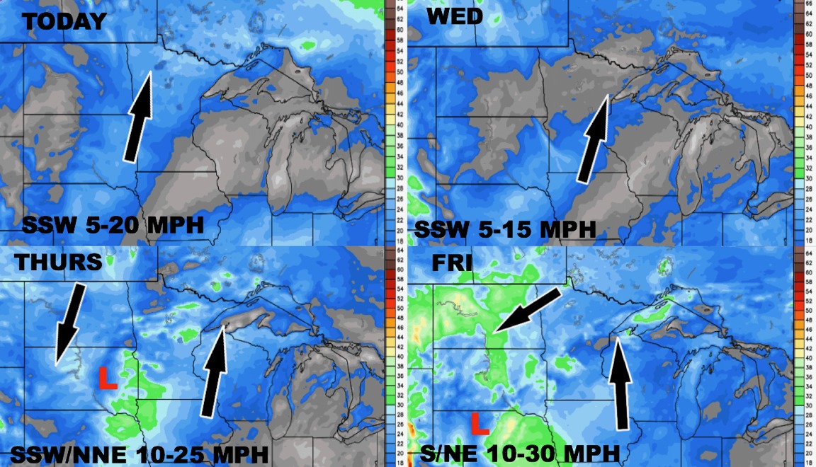
Winds will also increase as the front approaches by the end of the week.
Total rainfall over the next week will be heaviest north and west.
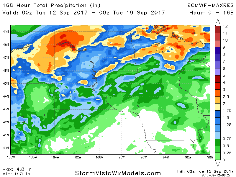
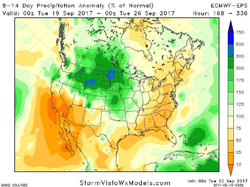
Week 2 continues to also look wetter than normal across the northern Plains and Upper Midwest.