Northern Plains Update: Heat This Weekend West, Much Cooler Next Week! E.
Key Points: August 31, 2017
Synopsis: Good Thursday morning! High pressure has settled into the region behind the cold front from yesterday. A warm front will move into the Dakotas today into tomorrow leading to an increased shower and storm threat while eastern areas stay dry through tomorrow morning. This rain threat pushes east tomorrow afternoon into Saturday morning and behind it, briefly hot conditions are expected across the Dakotas. Some places may approach 100 degrees across South Dakota! Much cooler air returns early next week behind a strong cold front. We are still watching for patchy frost across Minnesota and Wisconsin later next week, but uncertainty remains high. Stay tuned!
Today’s Video (5:31):
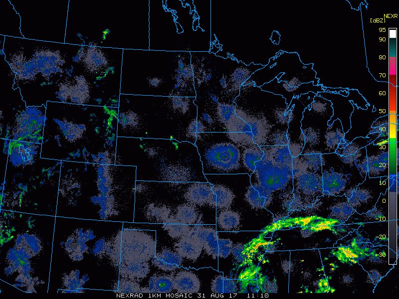
Current radar largely dry this morning as high pressure settles in behind the cold front from yesterday.
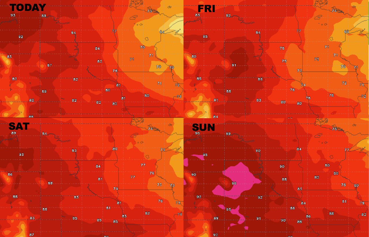
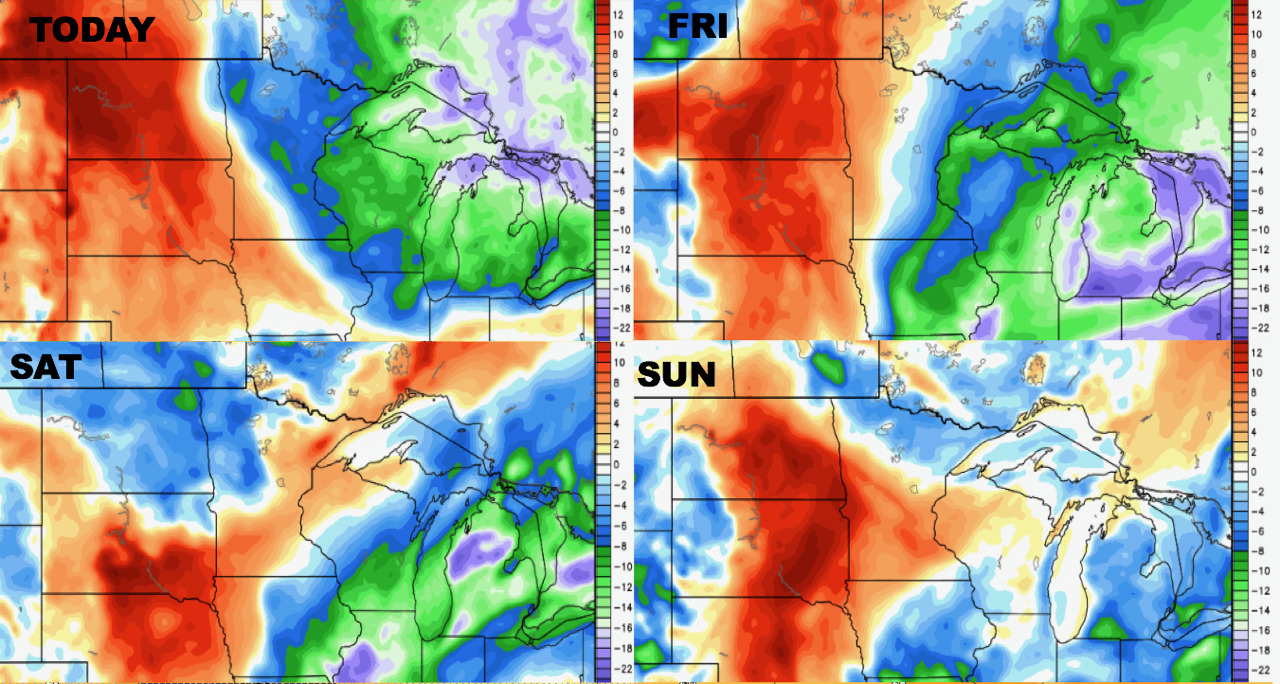
High temperatures gradually warm across the region over the next 4 days.
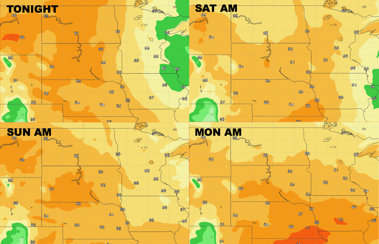
Low temperatures follow similarly over the weekend, warming gradually.
Humidity remains highest compared to normal across the Dakotas and lower east.
Winds over the next 4 days are shown below.

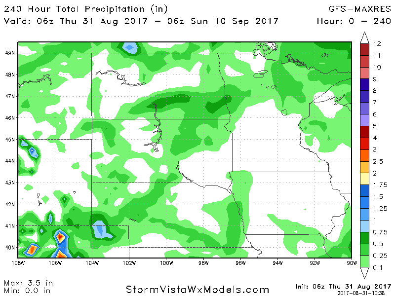
Total precipitation over the next 10 days looks light, and mostly occurring over the next 2 days.