Northern Plains Update: Dry rest of the week, Warmth builds by the weekend. E.
Key Points: September 6, 2017
Synopsis: Good Wednesday morning! Spotty frost has been reported across portions of the region this morning thanks to high pressure and temperatures in the 30s. High pressure will stick around through the balance of the week as temperatures begin to moderate back to seasonable levels by the end of the week, and even above normal as we get into the weekend. A cold front looks to push through early next week bringing temperatures back to normal values for this time of year, but rainfall with the front looks light at this time. Have a blessed day!
Today’s Video (3 min):
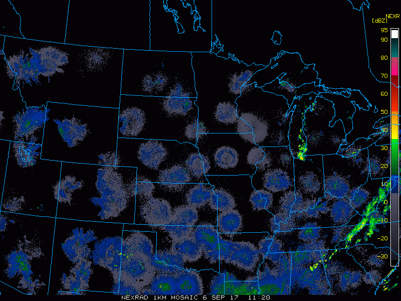
Current radar is scanning clear this morning.
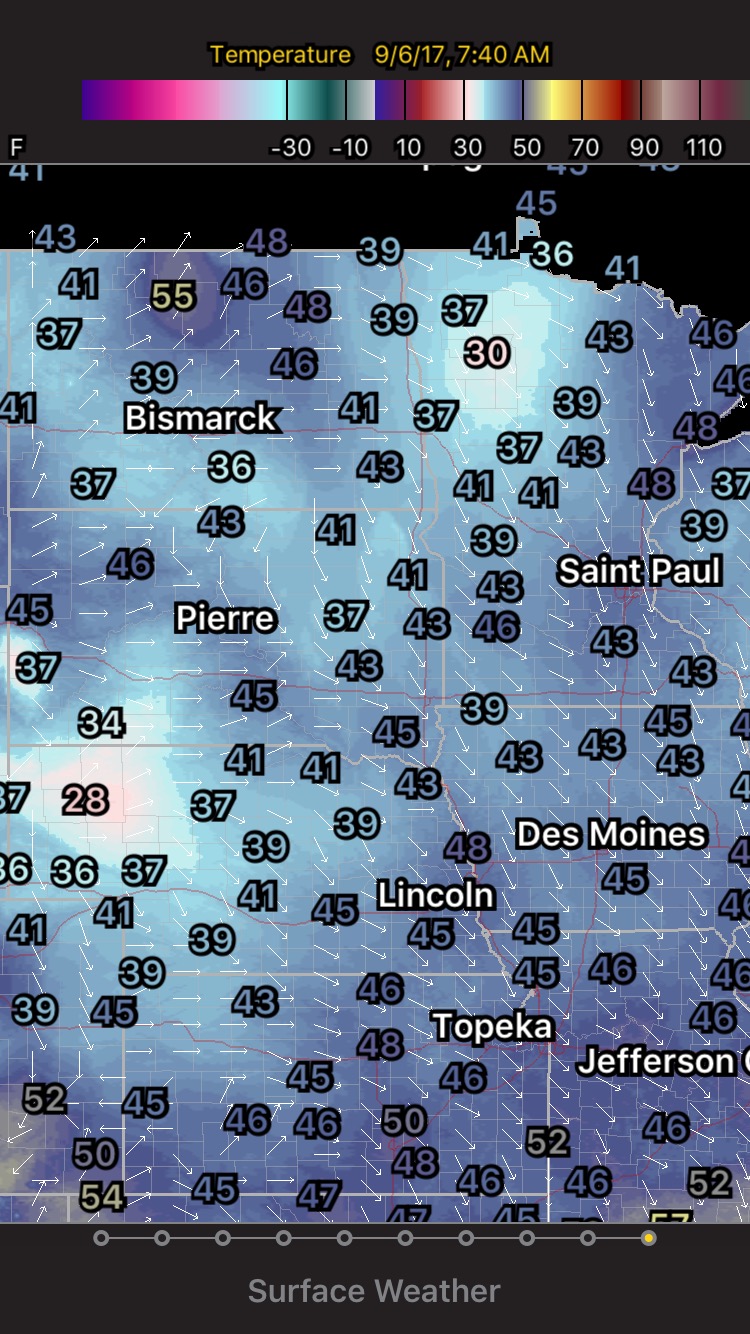
Spotty frost likely occurred in portions of the region this morning. Here are temperatures from 6:40 AM CDT. Send us your reports!
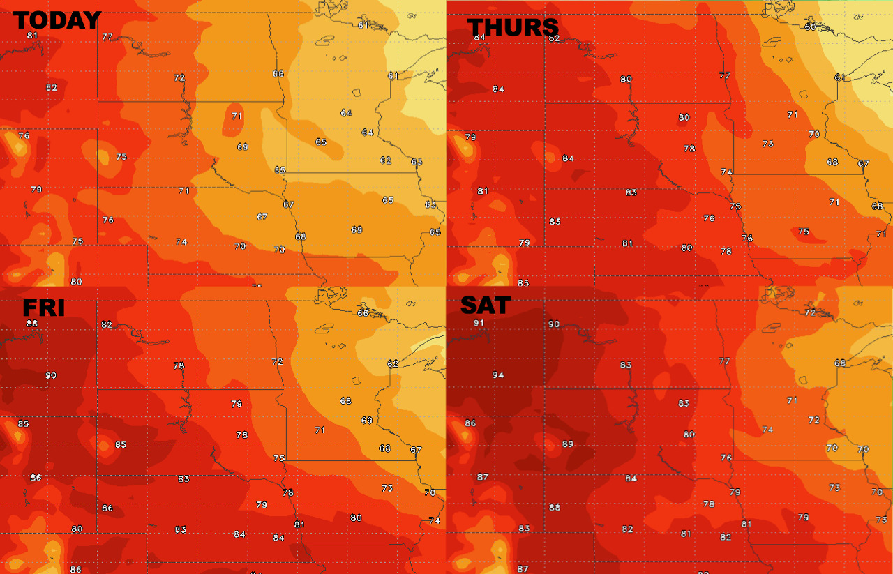
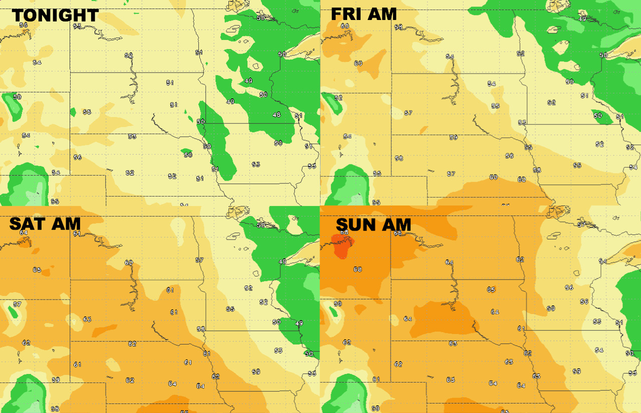
High temperatures moderate toward the weekend.
Low temperatures look to do the same.
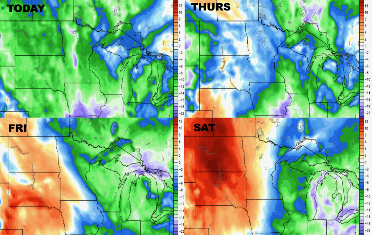
Humidity also builds above normal by the weekend.
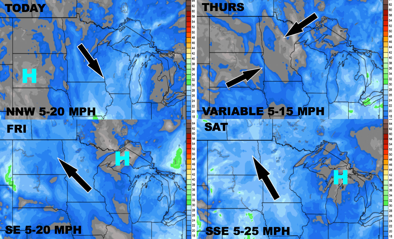
Wind forecast over the next 4 days is below.
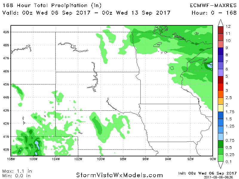
Total precipitation looks very light over the next 7 days. The European model is below.