Northern Plains Update: Drier Times Ahead, Temperature Roller Coaster Especially East. E.
Key Points: August 28, 2017
Synopsis: Good Monday morning! High pressure has anchored itself across the region today. This will lead to a dry day along with temperatures in the 70s east and 80s west. Dry weather looks to continue tomorrow with only some spotty showers possible east Wednesday with the passage of a cold front. A strong cold front is possible early next week. This time frame (later next week) is the timeframe we are watching for frost possibilities across the region. There are still plenty of uncertainties with respect to the strength of this airmass as well as cloud cover and winds – these factors will ultimately dictate the extent of any frost threats so stay tuned! Have a blessed day.
Today’s Video (6:41):
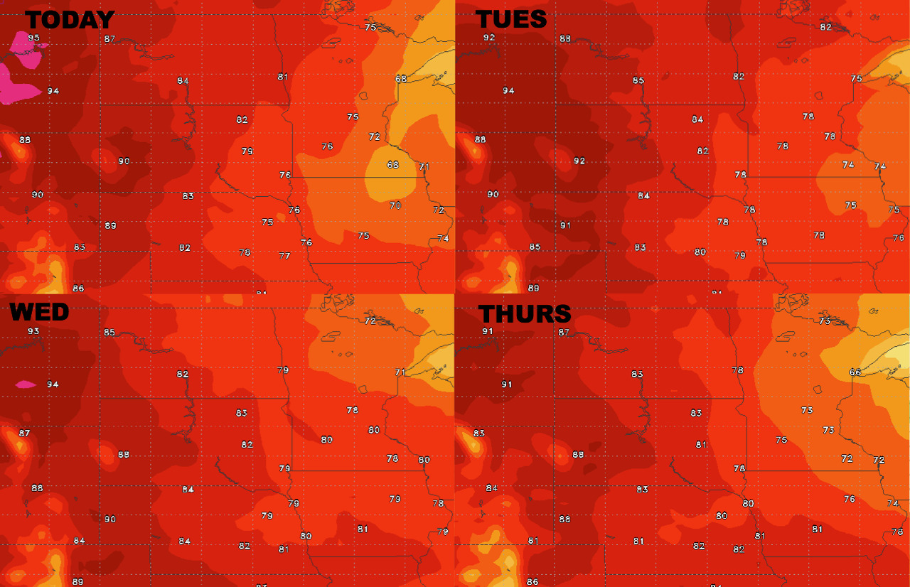
High temperatures over the next 4 days.
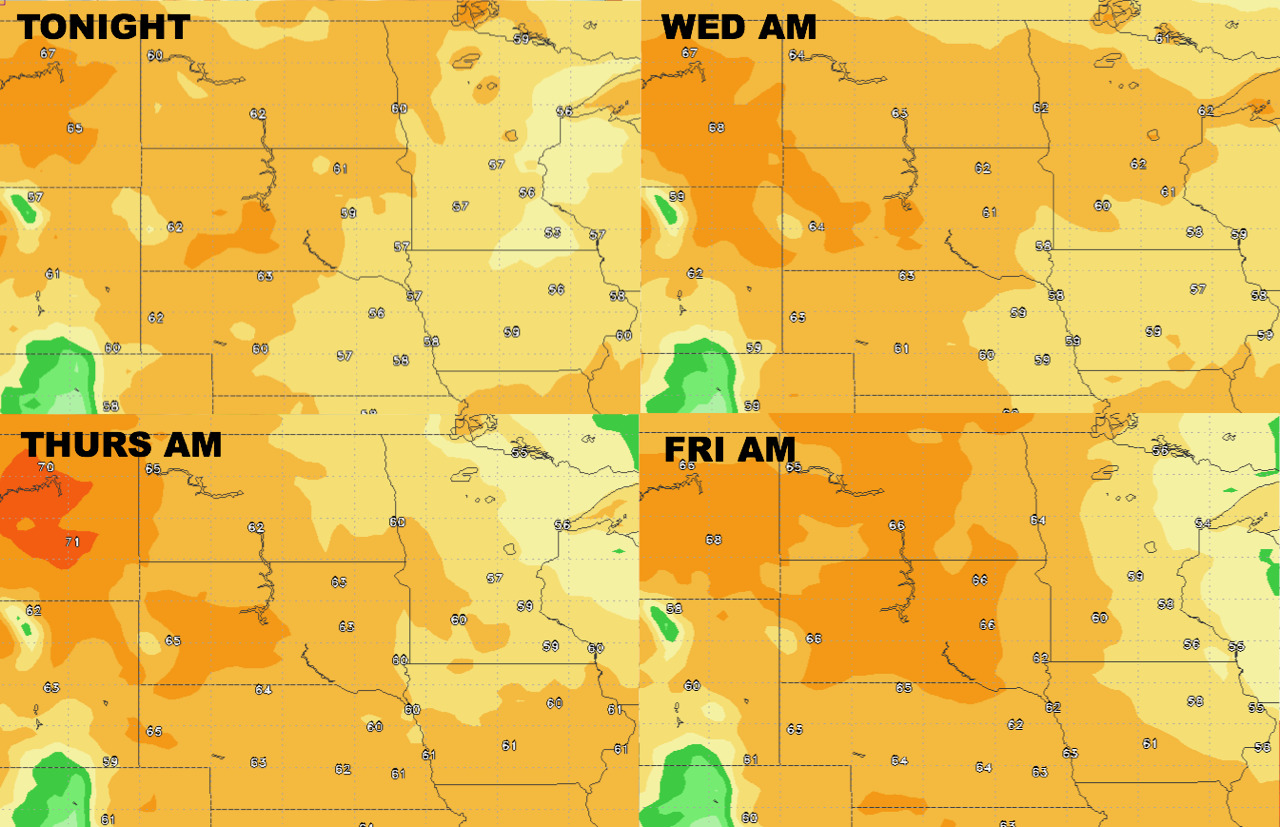
Low temperatures over the next 4 days.
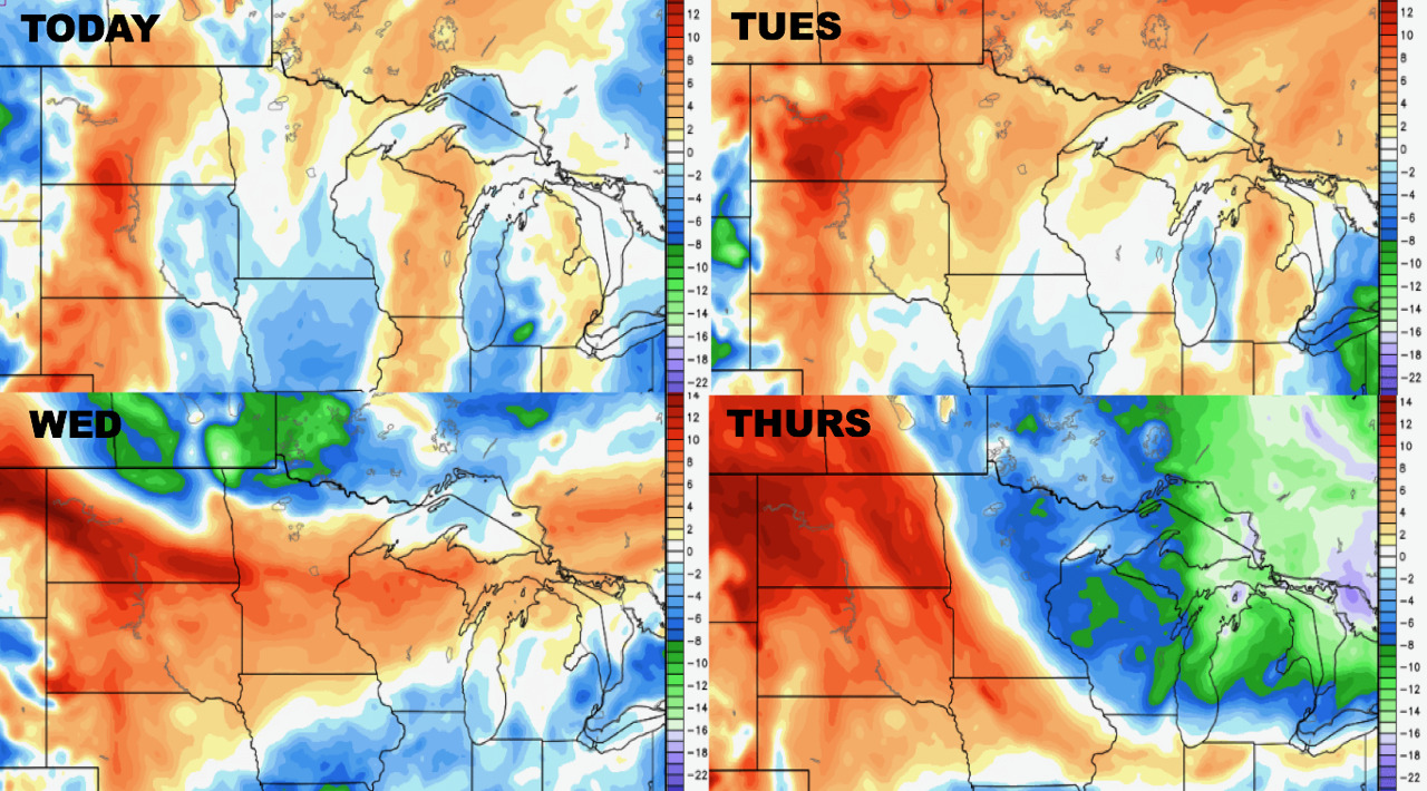
Humidity looks highest west over the next week or so.
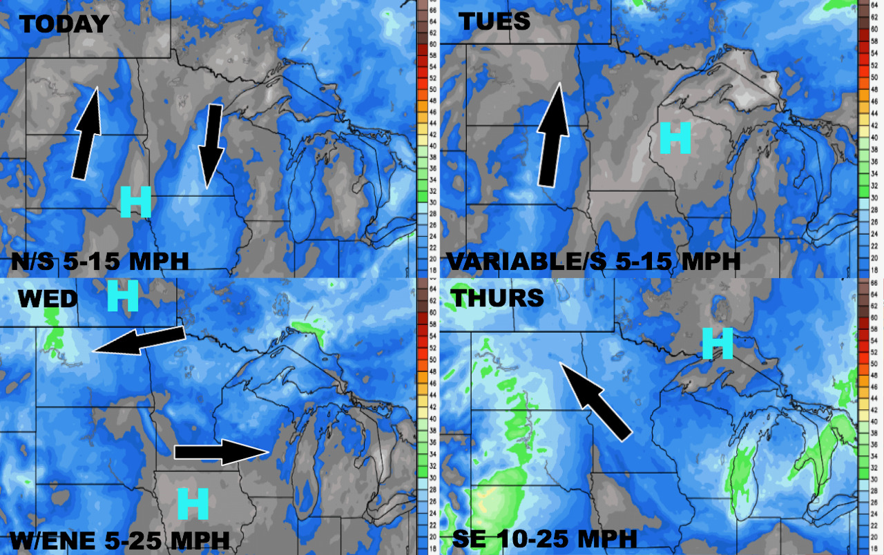
Wind forecast over the coming days shows generally light winds, with highest gusts coming Thursday.
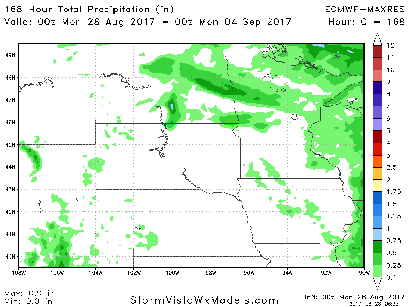
Total precipitation forecast over the next 7 days looks quite light thanks to cooler, drier air filtering in.
Cooler air looks likely in week 2, which is where we are eying frost risks across zone 9.
