Northern Plains Update: Drier Pattern This Week, Trending Cooler Especially East. E.
Key Points: August 29, 2017
Synopsis: Good Tuesday morning! The radar is scanning clear again this morning as high pressure continues to hold firm. A cold front will push into the region tonight and tomorrow, bringing a small threat of some rain and thunderstorms to South Dakota and Minnesota. However, given the dry airmass, coverage of these showers will be fairly low and rainfall amounts will also be low. Another warm front will bring a similar threat of rainfall to North Dakota and Minnesota Friday with warmer temperatures expected this weekend. These warm temperatures will be short lived as a stronger cold front looks to move through next week. Behind this (after 9/6), a frost threat exists especially across Minnesota in week 2. Have a blessed day!
Today’s Video (4 min):
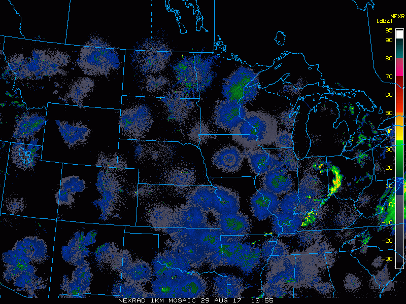
Current radar scanning clear.
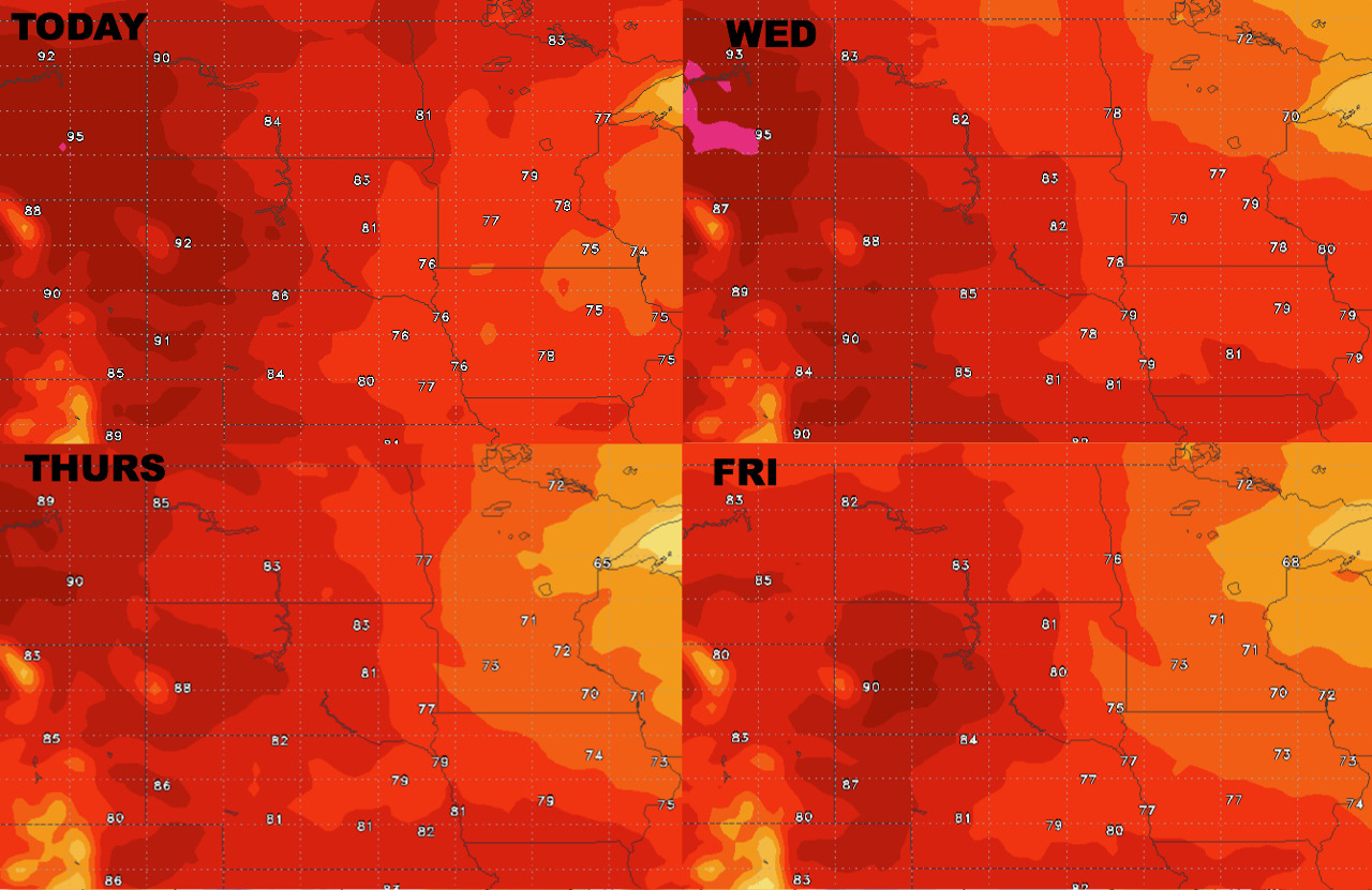
High temperatures over the next 4 days show the warmest conditions across the Dakotas.
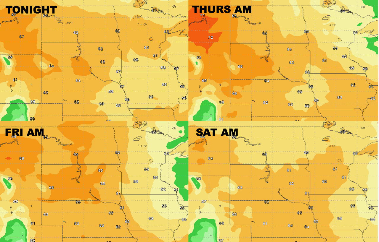
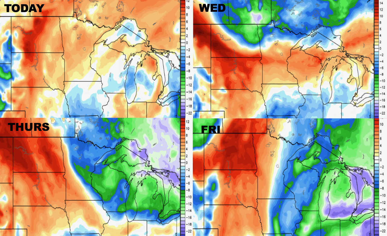
Low temperatures through Friday are shown below.
Dew points anomalies over the next 4 days show the most “humid” conditions compared to normal across the Dakotas.
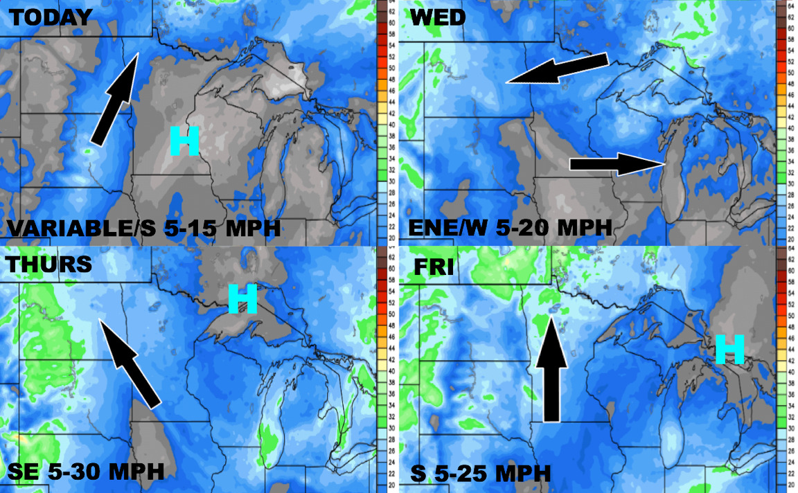
Wind forecast through Friday shows breezy conditions in the Dakotas later in the week.
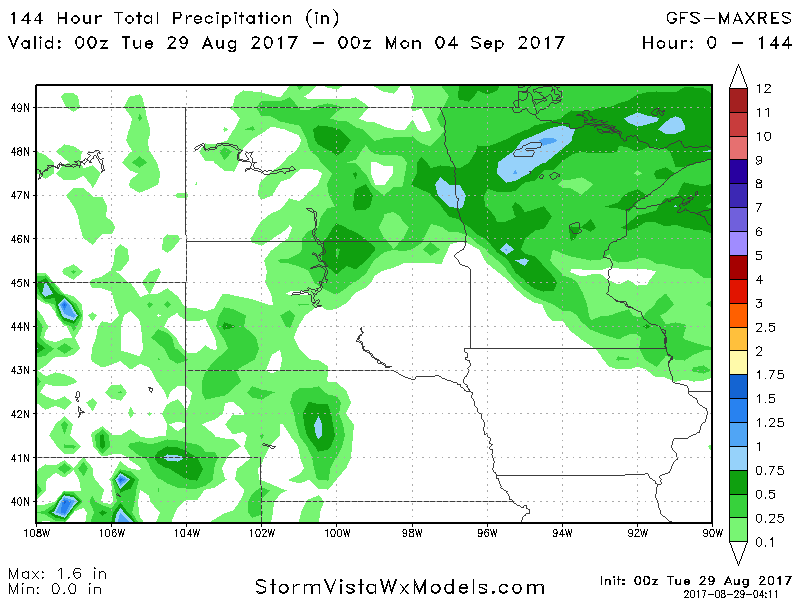
Total precipitation looks relatively light through weekend, with heaviest rains found in northern Minnesota.