Key Points: September 25, 2017
Synopsis: Good morning! Plenty of rainfall fell over the weekend thanks to a slow moving frontal boundary nearby. This system will continue to slowly push off to the south and east early this week brining additional rains especially to central and eastern portions of zone 9. Mid-to-late week does look to dry out across the region, but latest data suggests this drier period is temporary. The next chance for rainfall likely comes this weekend as another disturbance pushes toward the region. After a few cooler days to start this week, seasonable to slightly warmer than normal conditions are expected to return this week and into next weekend. Have a blessed day! -Ed
Today’s Video (6 min):
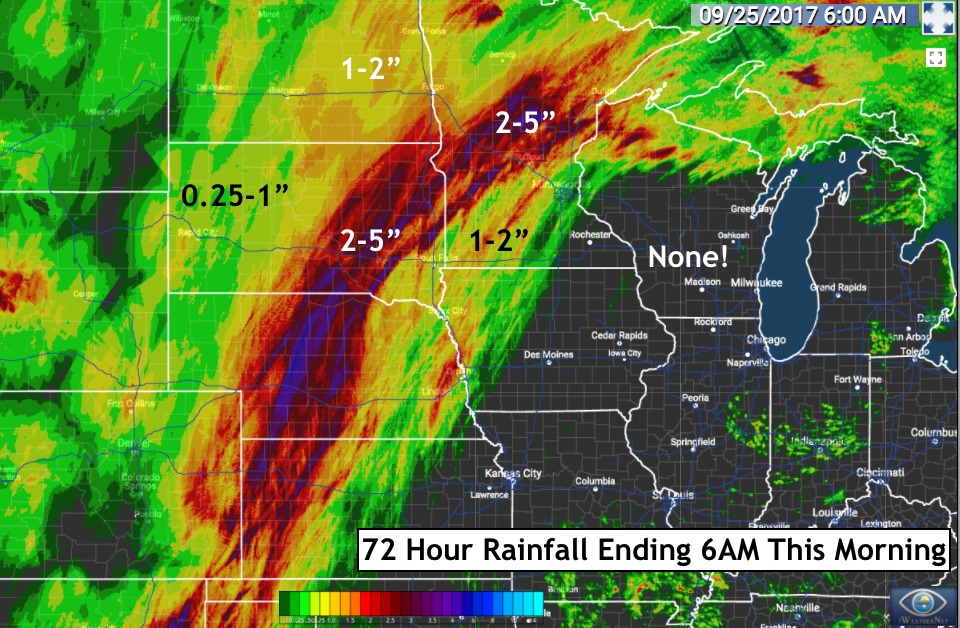
It was certainly a wet weekend! Here’s a look at the rain that fell.
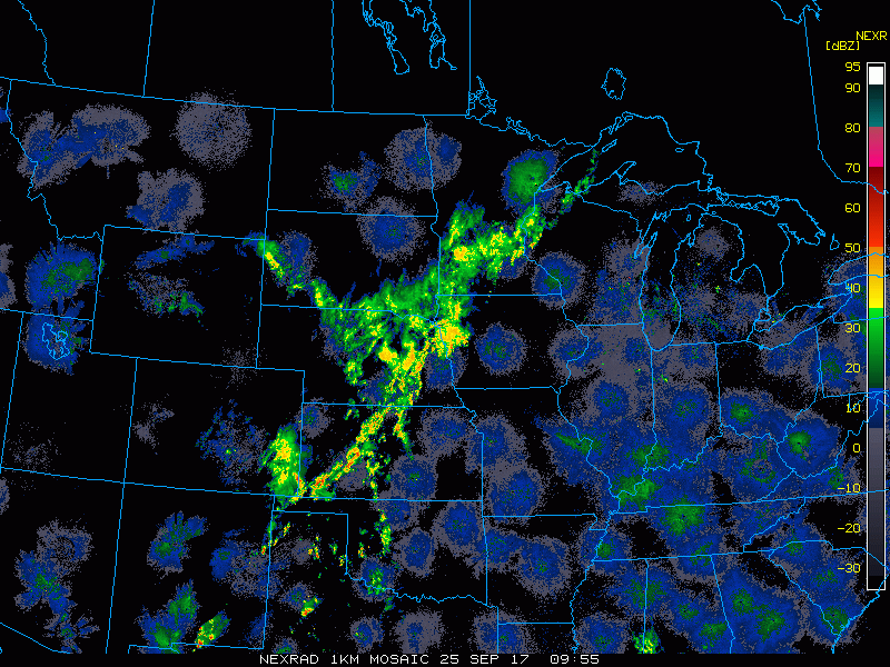
Current radar shows more rains this morning across the region.
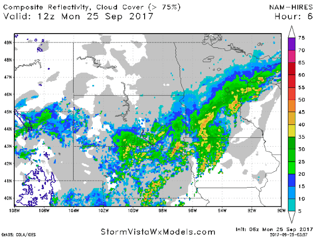
Projected radar through Tuesday shows the progression of the rains early this week.
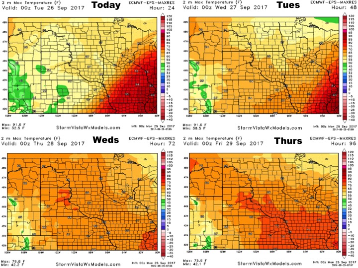
High temperatures will be dictated by the front draped across the region.
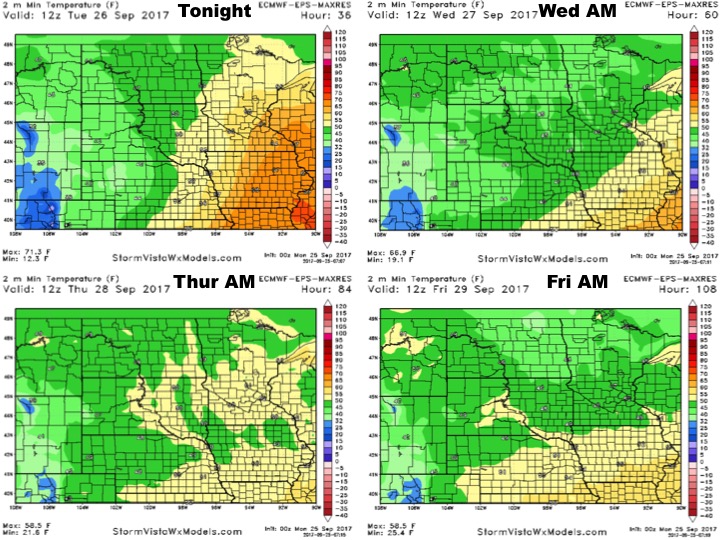
Low temperatures will react similarly.
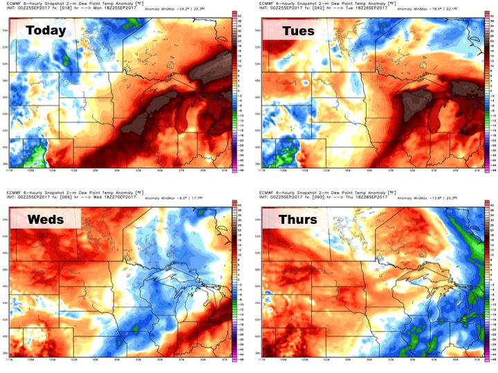
Humidity will go up and down, but will likely be above normal toward the end of the week.
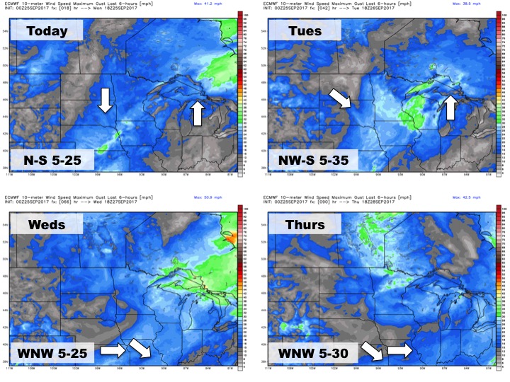
The wind forecast over the next 4 days is below.
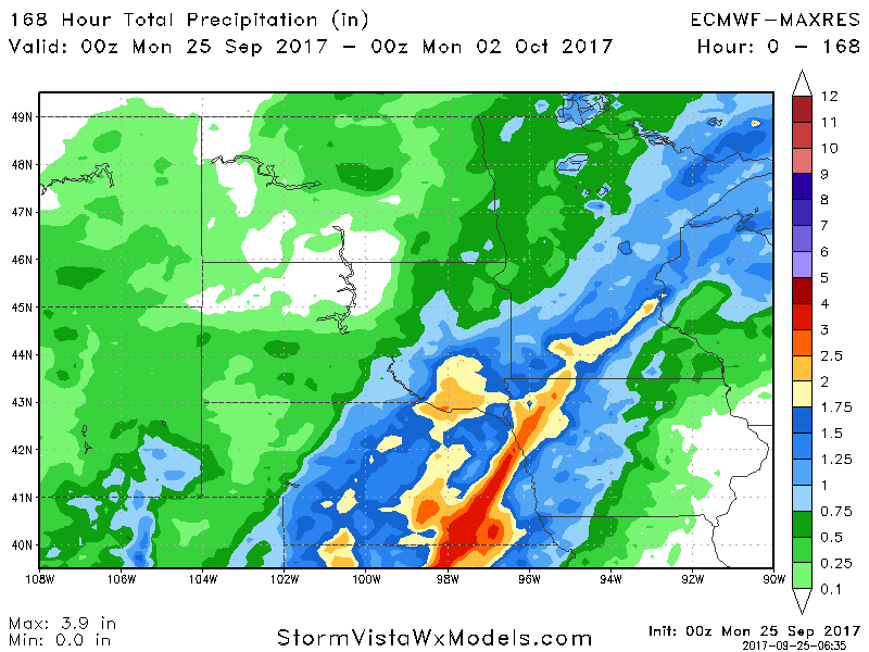
Total rainfall through next weekend looks heavy especially across southeastern South Dakota and Minnesota.