Northern Plains Update: Active Next Few Days, Warming Up Late Week. E.
Key Points: August 15, 2017
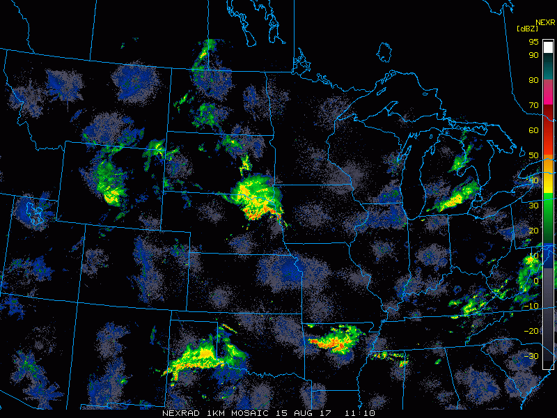
Synopsis: Good Tuesday morning! Current radar is showing showers across the central Dakotas, moving north and east. Through the day today, this system will expand in coverage bringing some rains to the Dakotas and some stronger storm risks to southern South Dakota. This system will push eastward overnight into Minnesota and Wisconsin bringing additional rains to these areas. Temperatures will continue to run near to below normal much of this week before warming slightly above normal into the weekend and early next week. Have a blessed day!
Today’s Video (7 min):
Current radar:
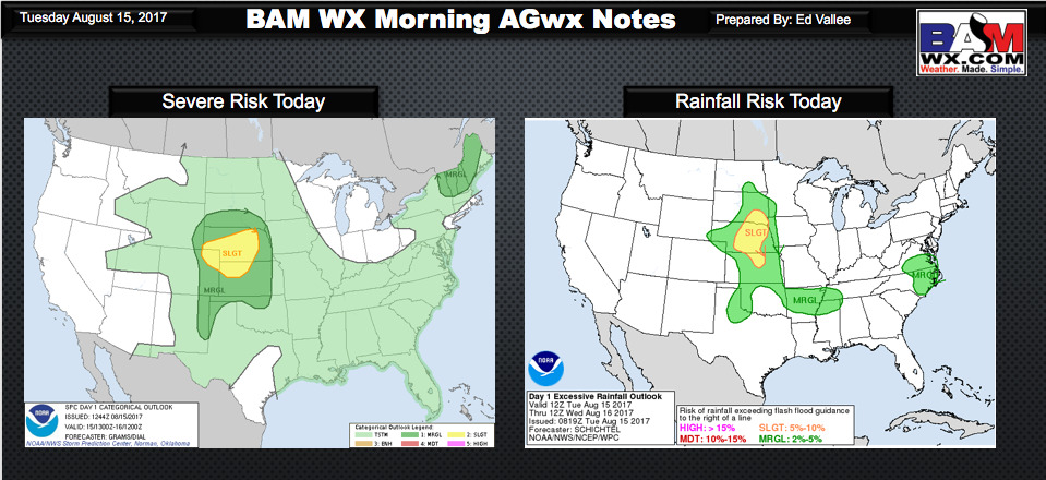
Some strong thunderstorms and heavy rain are expected today in South Dakota. The SPC and WPC outlooks are below.
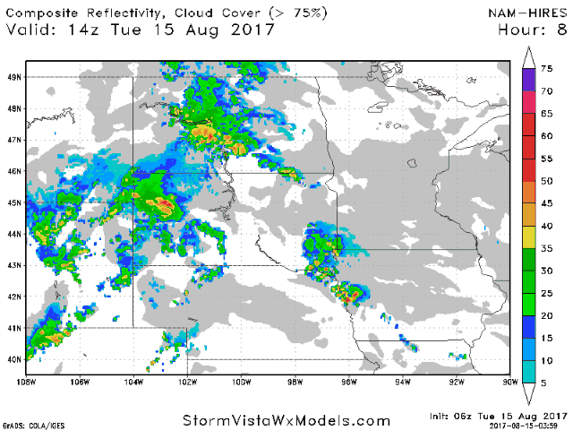
Projected radar through Thursday morning.
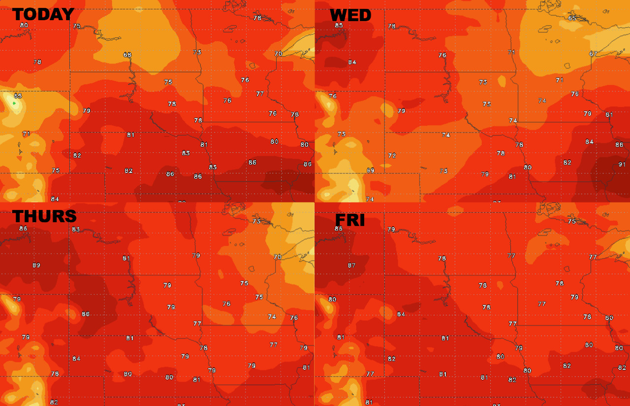
High temperatures next 4 days.
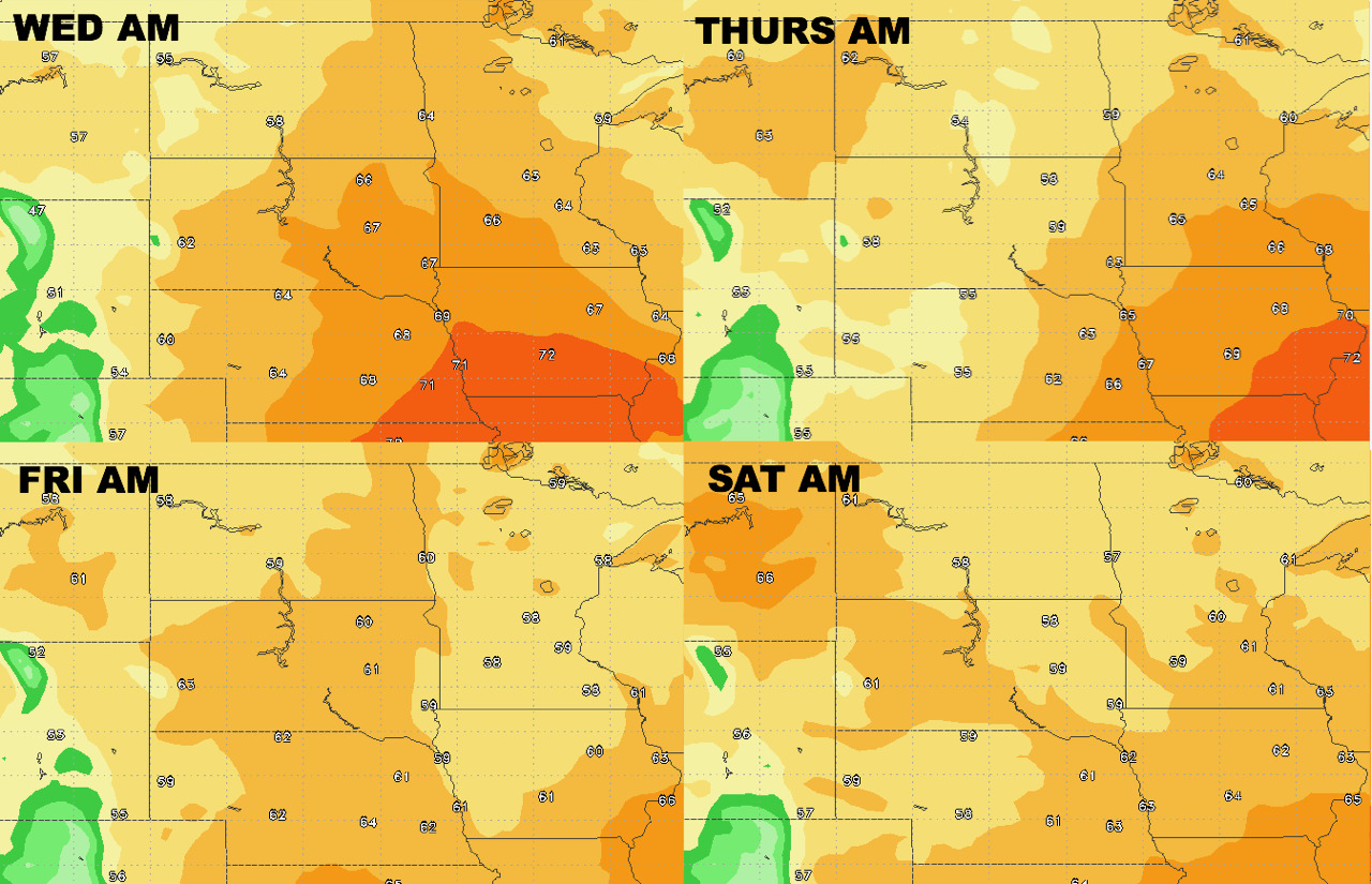
Low temperatures next 4 days.
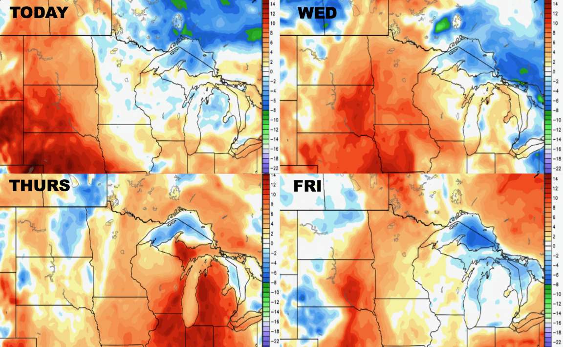
Humidity looks to stay high through the end of the week compared to normal.
Winds forecast through the end of the week.

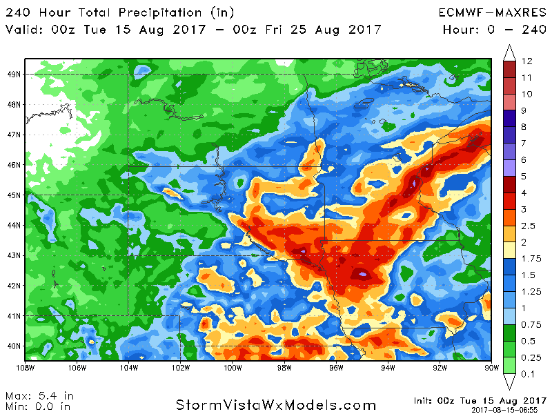
Total rainfall expected through day 10 looks heaviest south and east.