Key Points: October 5, 2017
Synopsis: Good Thursday morning! We are tracking a slow moving front across the region that is leading to a few showers across southern Minnesota and Wisconsin. This front will be the focal point of heavy rains tonight through Saturday morning in southeastern portions of zone 9. Briefly cooler, but certainly drier conditions are expected to return later Saturday into early next week as an area of high pressure settles into the region. Have a blessed day!
Today’s Video (6 min):
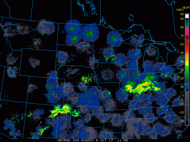
Current radar shows a few showers in portions of Minnesota this morning while most remain dry.
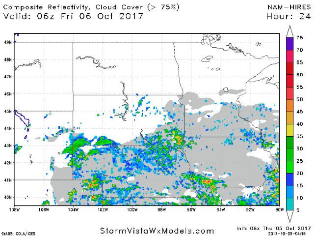
More rains get into South Dakota tonight then push northeastward into Minnesota and Wisconsin during the morning Friday. Projected radar is shown below.
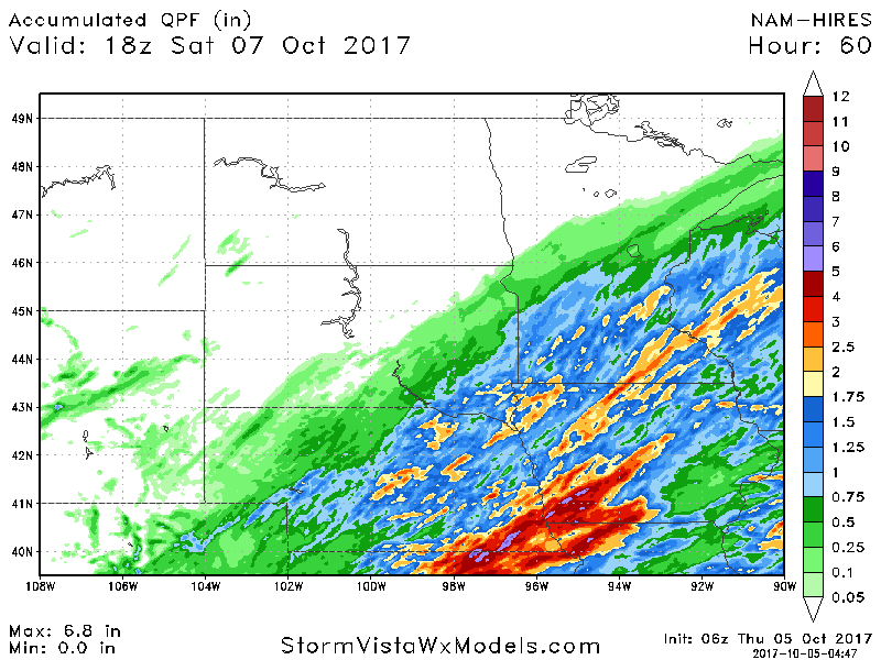
Total rains will be impressive in southeastern areas with some seeing 1-3″. Note not much (if any) rain will fall in North Dakota!
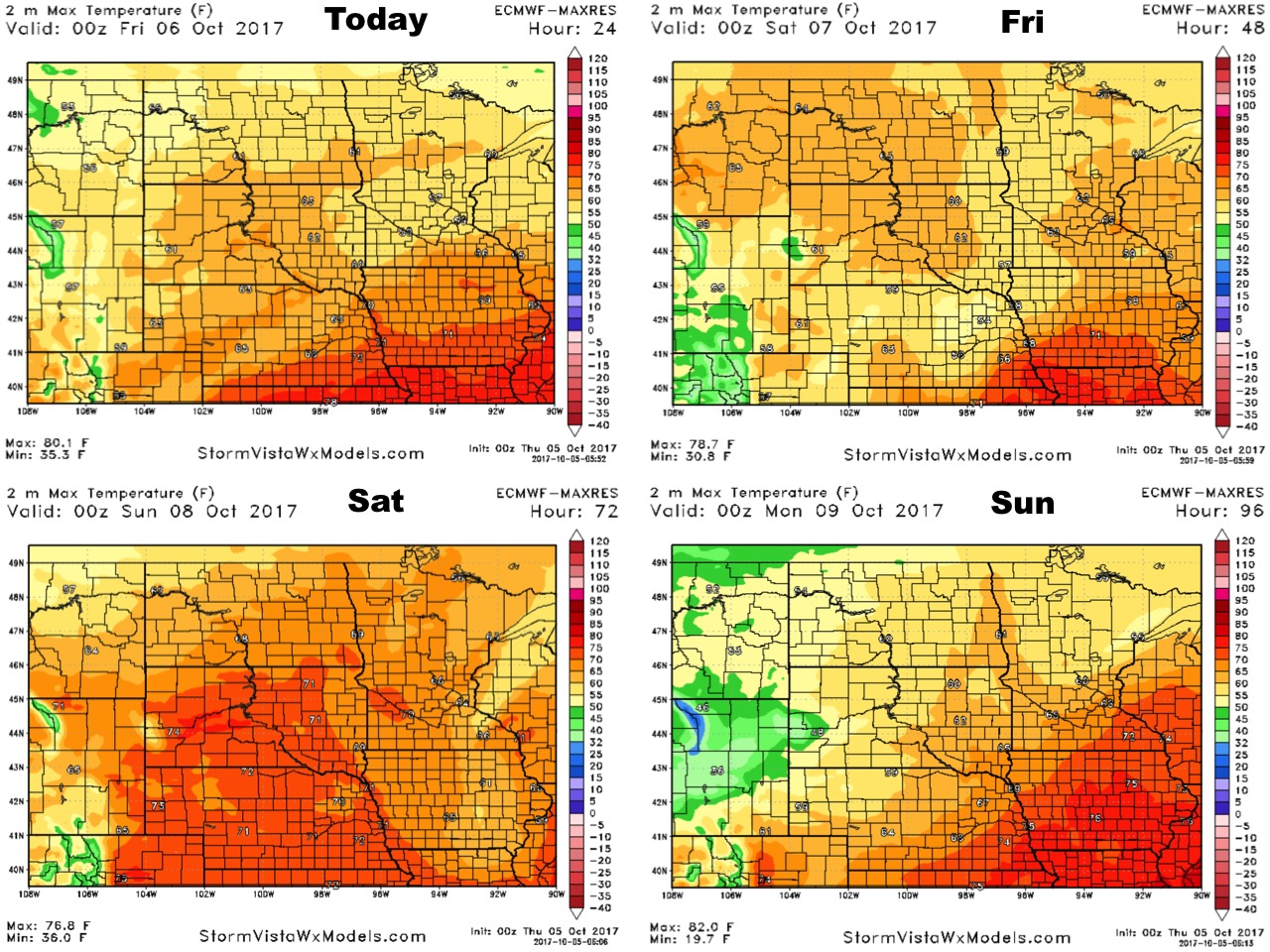
High temperatures over the coming days are shown below.
Low temperatures will promote some frosty conditions into early next week north and west.

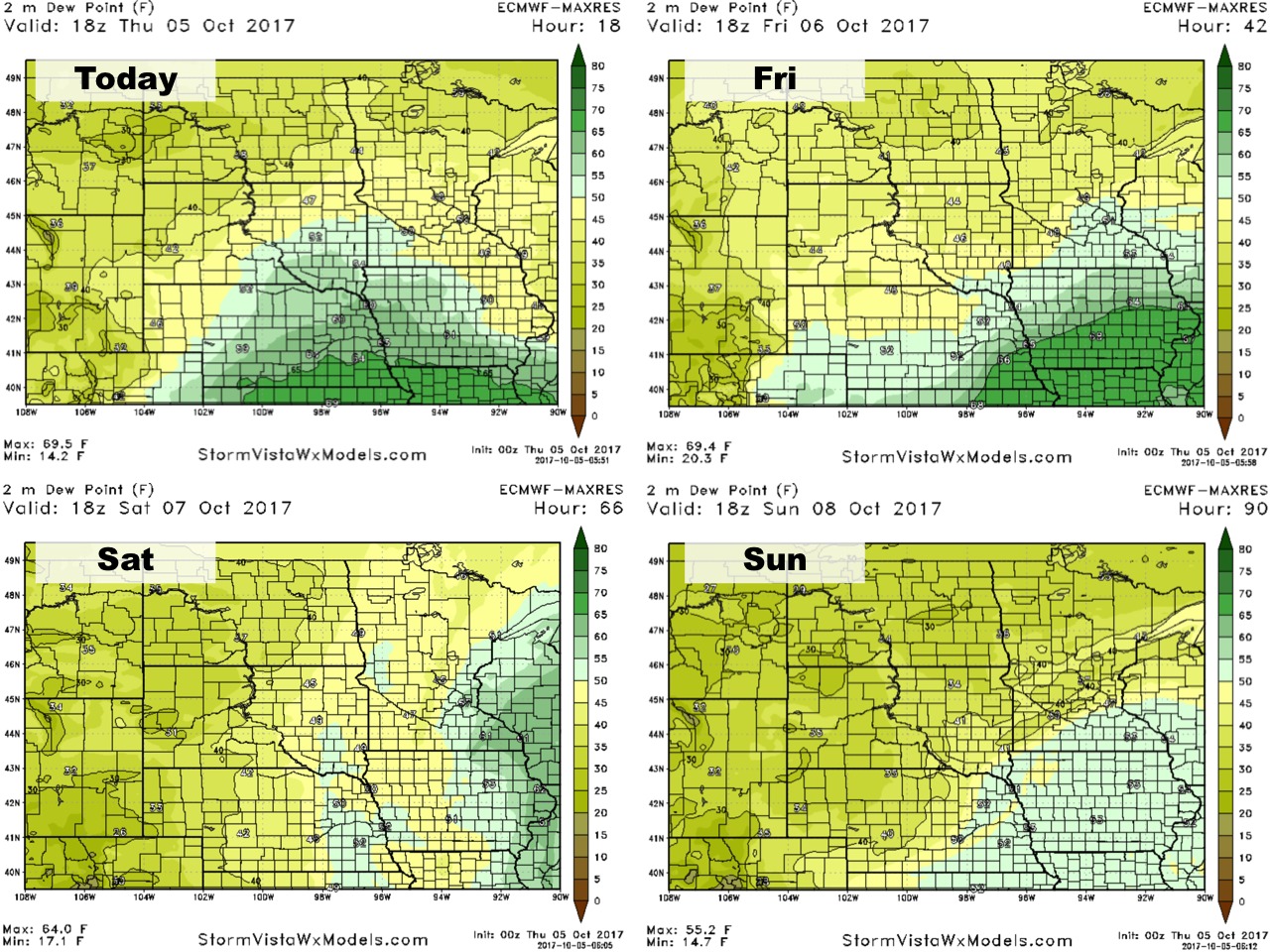
Dew points compared to normal are shown below.
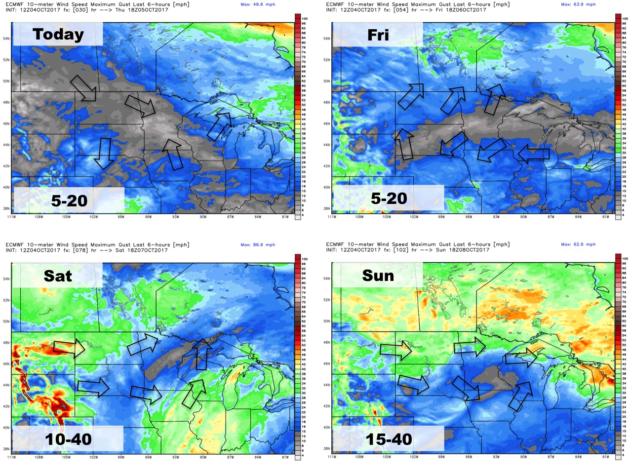
Wind forecast through the weekend is shown below.
After a wet few days through the weekend, the 6-10 day rainfall looks very dry!
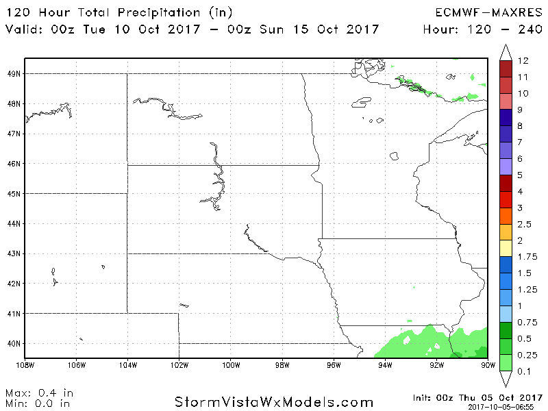
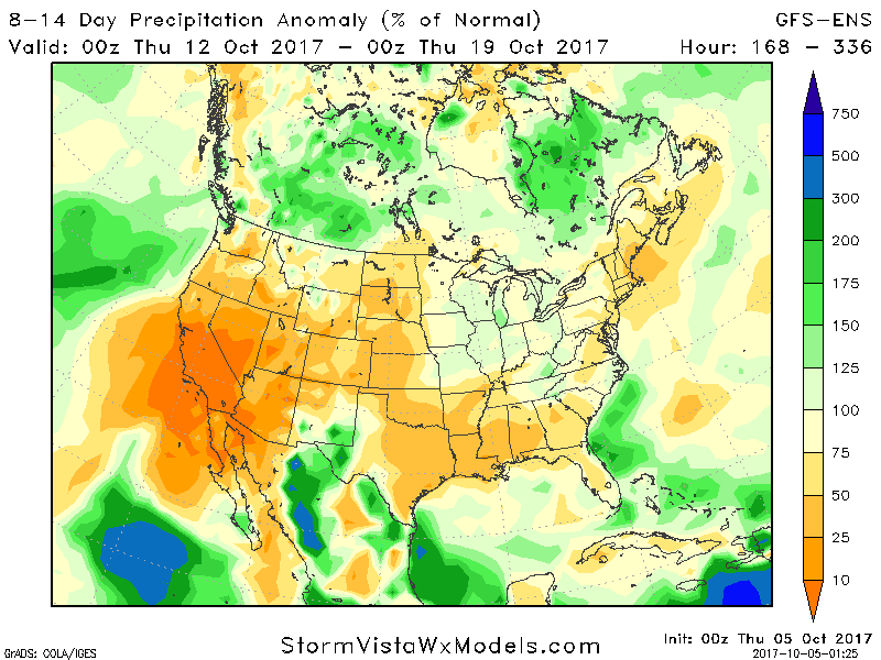
Week 2 rainfall also looks fairly dry with rainfall below normal.