Northern Plains Regional Forecast Update: Dry today, storm chances return mid-week. N.
Key Points – August 7, 2017
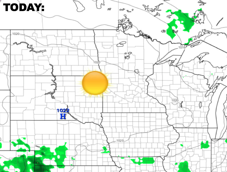
Synopsis: Very nice weather on the way for today with lots of sunshine across the region as high pressure moves overhead. Changes arrive heading through mid-week with showers and storms returning, some possibly strong. The video below goes into detailed analysis regarding the rain chances this week, and a look at the longer range forecast.
Today’s Video (7:38):
Expect mostly sunny skies and pleasant temps today.
The next rain/storm risks will arrive across the western Dakotas late Tuesday, then spreads east across the region heading into Wednesday as an upper-level disturbance combines with a front moving through. Here is a look at the upper-level energy forecast through Thursday. Basically, think of the bolder colors to be where rain would occur.
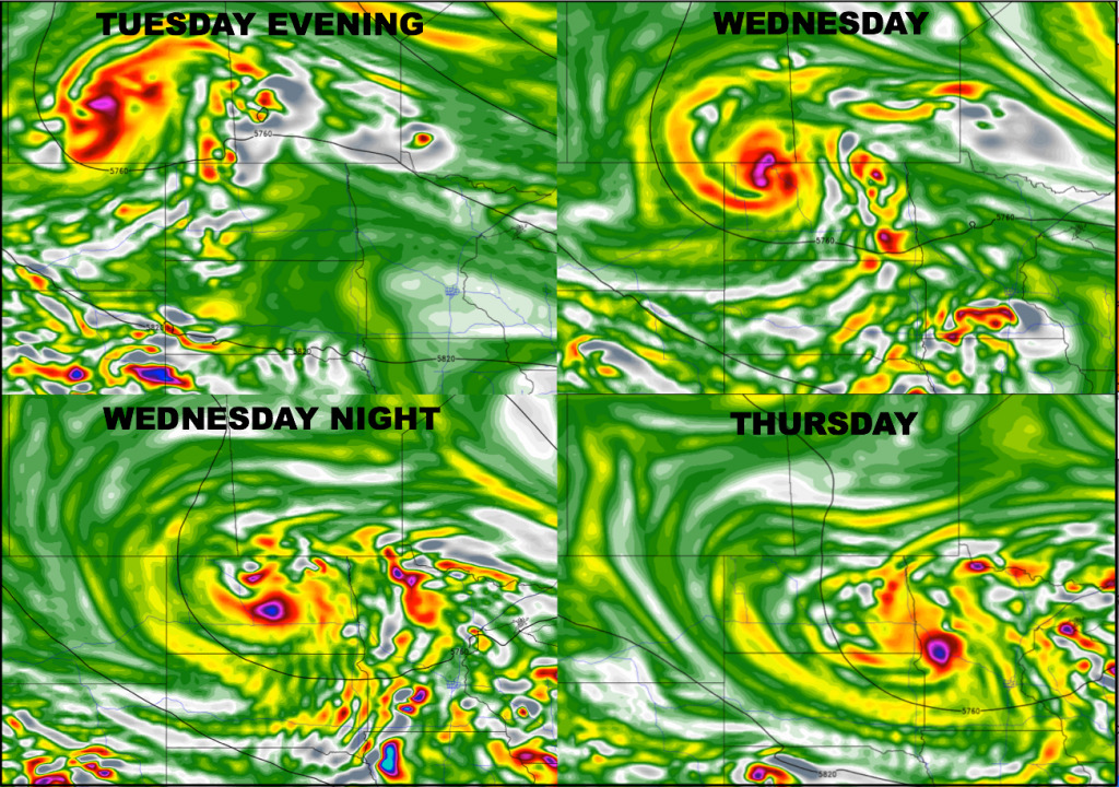
The Storm Prediction Center has placed a marginal severe risk over the eastern half of South Dakota, southeast North Dakota, and southwest Minnesota. This is not looking to be a major deal, but a few severe wind gusts/hail cannot be ruled out.

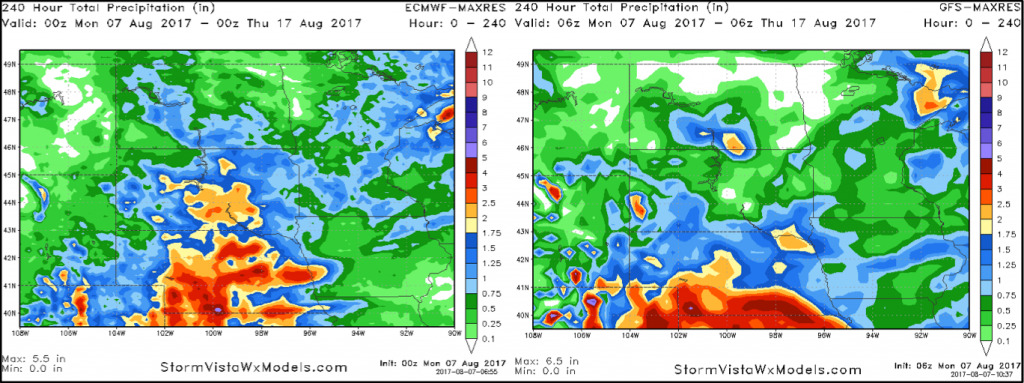
The region should catch a break from any storm chances late Thursday into early Friday, then additional chances late Friday through Saturday. Here is a look at 10-day rainfall guidance from the GFS and European models. Overall, both models are very similar regarding rainfall distribution.
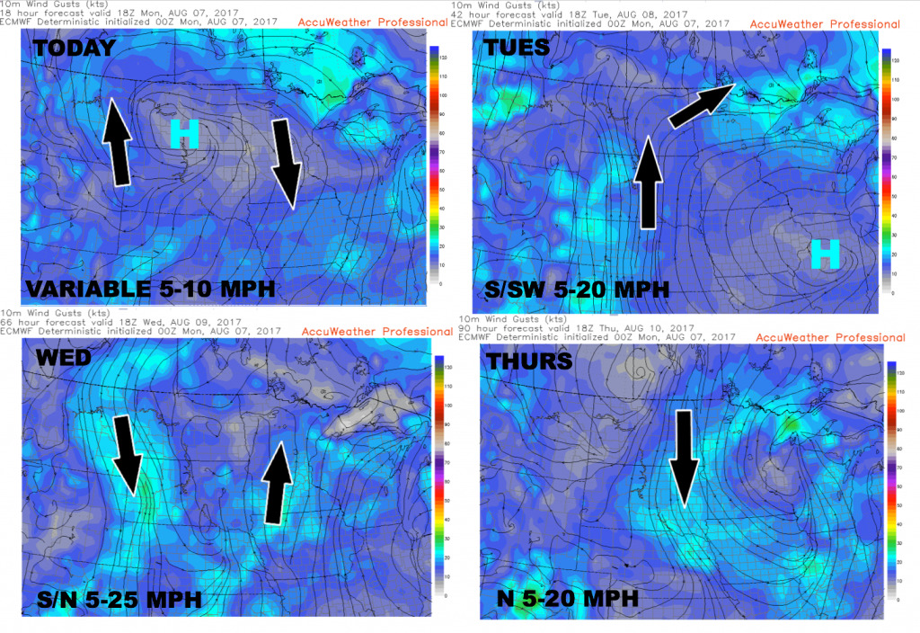
Wind forecast over the next 4 days.
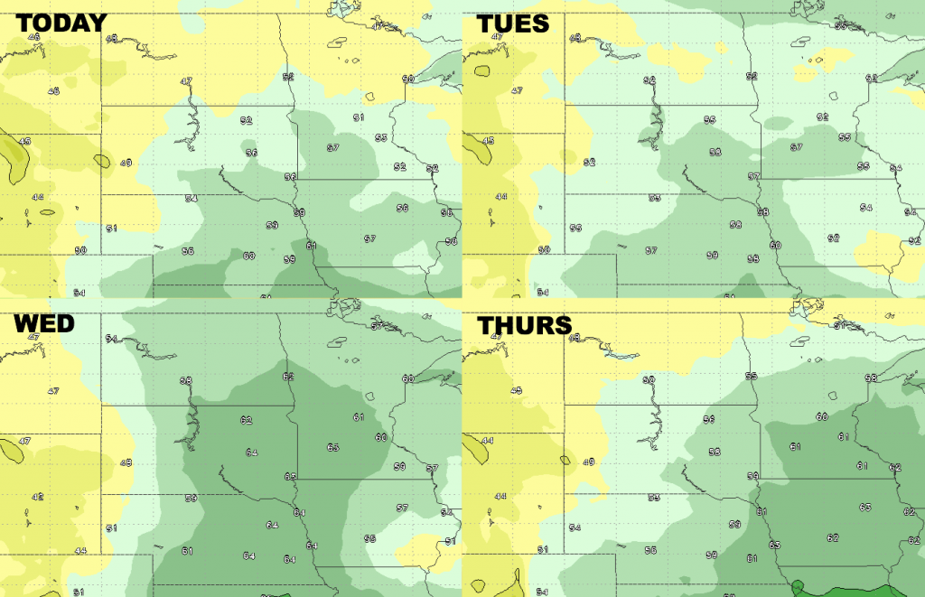
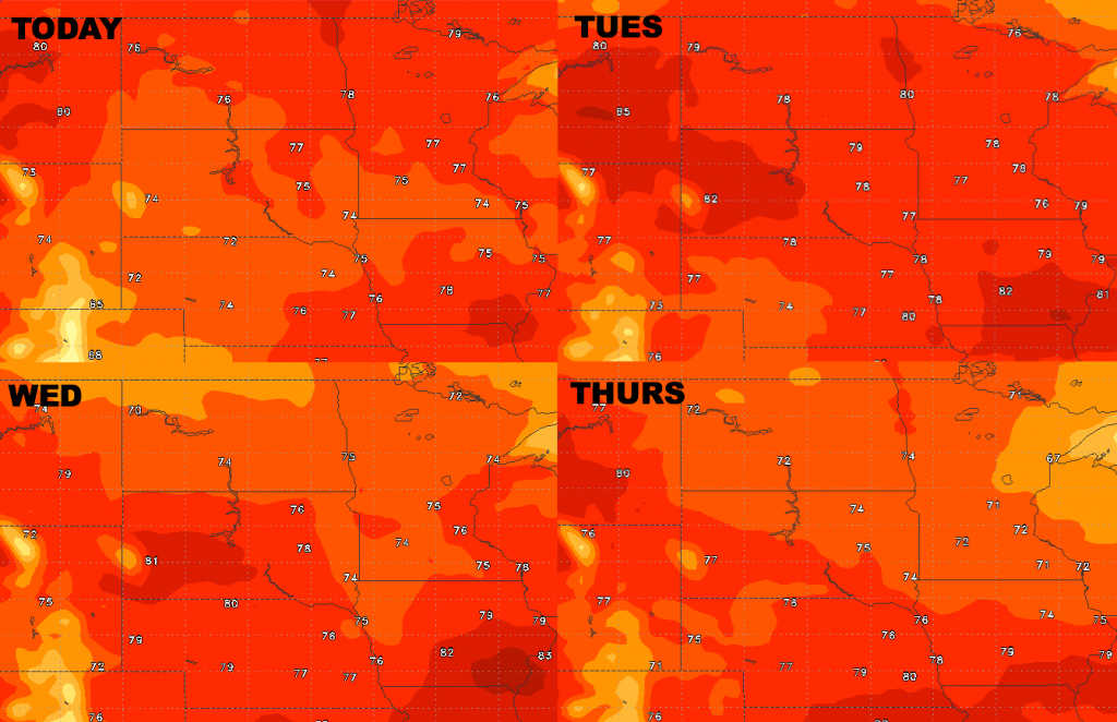
High temperature guidance over the next 4 days.. staying pleasant for August.
Low temperature guidance is shown below.

Here are the dew points from normal…increasing moisture levels through mid-week, then drier air builds back in behind the cold front on Thursday from northwest to southeast.