Key Points – Wednesday, August 9, 2017
Synopsis: Good Wednesday morning! Unsettled forecast today as a slow-moving upper-level disturbance moves across the northern Plains. Potential for isolated strong to severe storms heading through this afternoon into tonight. This system will continue to move east into late week with dry air building in from west to east. Additional storm chances arrive Friday into the weekend, targeting mainly the southwest half of the region. Detailed analysis in the video. Have a blessed day, and let us know if you have any questions!
Today’s Video (8 min):
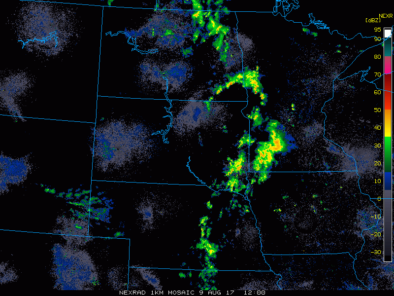
Current radar this morning (animation from 7-7:45am) showing scattered showers and storms working across the eastern Dakotas into Minnesota this morning.
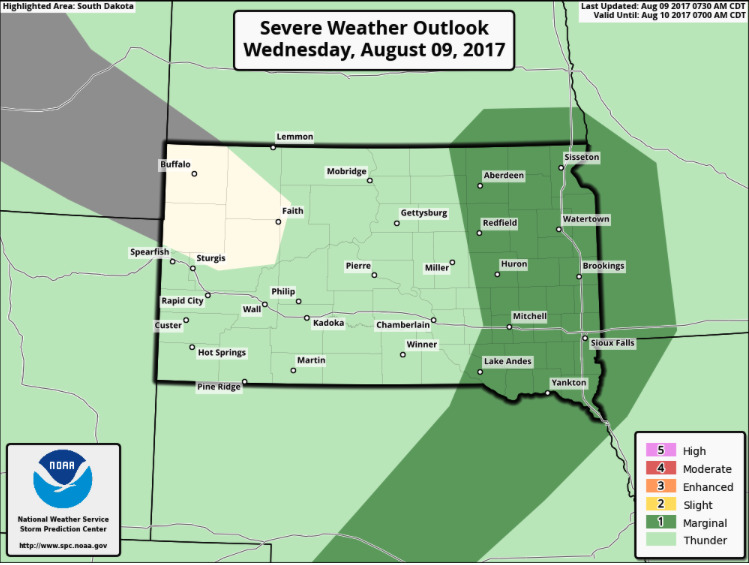
The Storm Prediction Center has placed a marginal severe risk for this afternoon and evening across eastern South Dakota, southwest Minnesota, and far southeast North Dakota. Isolated hail/damaging wind gusts the main concern.
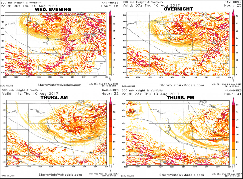
Here is the upper-level energy forecast heading through Thursday. Notice the concentrated areas of energy across southeast North Dakota, eastern South Dakota into western Minnesota by 7pm CT this evening (first panel). This will be along a cold front sweeping through and that is where we need to watch for increased storms this evening with isolated strong/severe threat. Note how than energy sweeps east overnight, and the entire upper-level system slowly starts to move east from Minnesota into Wisconsin Thursday afternoon.
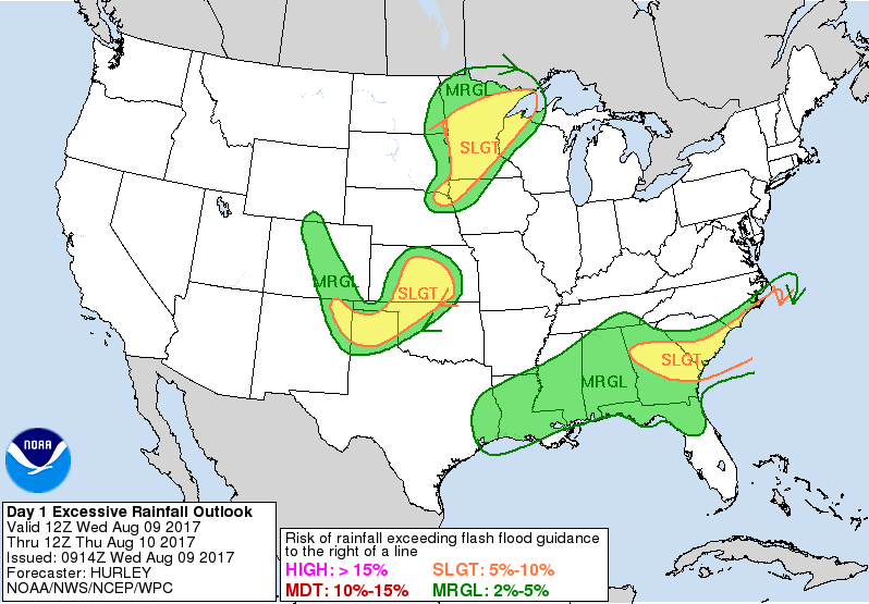
Locally heavy rains can be expected, particularly across Minnesota today into tonight where the system slows down. NOAA WPC has placed a slight risk for excessive rainfall in that area.
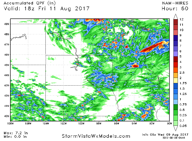
Here is the rainfall forecast from the hi-res NAM over the next 60 hours.
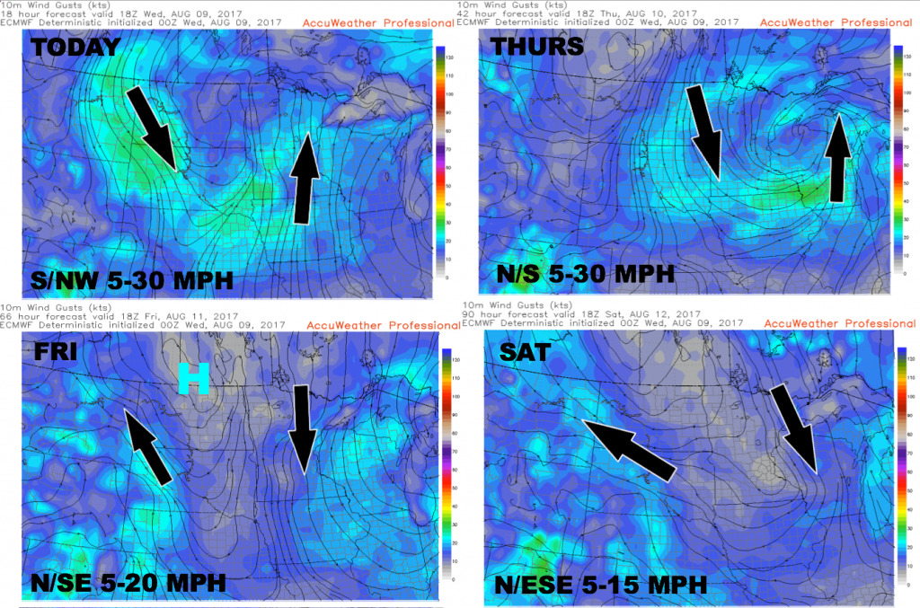
Here is the wind forecast over the next 4 days.
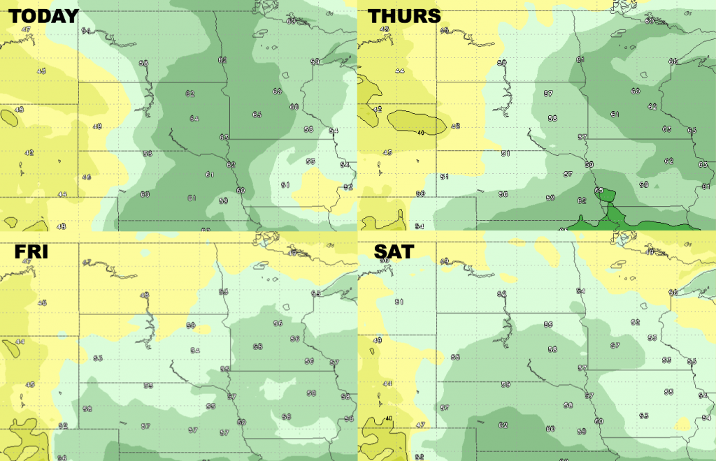
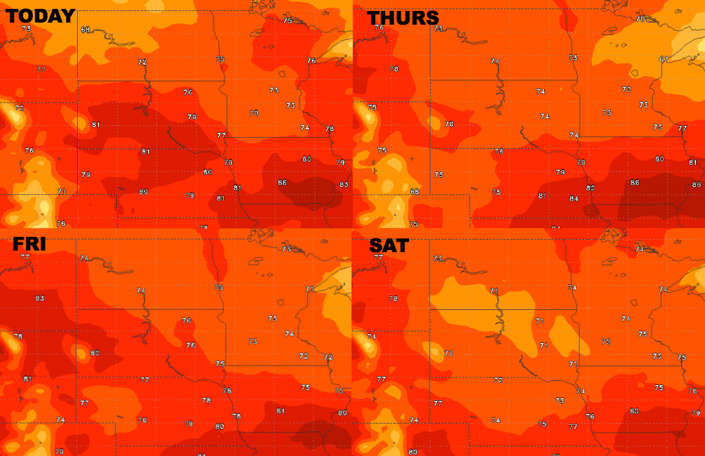
High temperature guidance…pleasant temperatures for August continue.
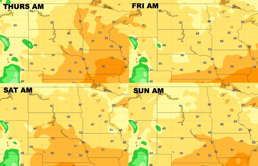
Low temperature guidance over the next 4 nights is shown below.
Dew point guidance is shown below. Drier air builds in from northwest to southeast heading through late week.