Key Points – Tuesday, August 8, 2017:
***We are so excited for this week and all of you that have signed up for our open house! As a reminder, you will receive all of our product via email, just make sure you’re looking at the right forecast locally; remember, the advantage of having a team of meteorologists at your fingertips can be priceless. With our service you will have access to our team of meteorologists 24/7.
Throughout the week we really want you to take advantage of the content we put out and use it to your advantage! At anytime this week you feel like you have seen enough to make a decision and you’re ready to sign up we will offer you a 20% off discount if you sign up BEFORE your trial expires August 11th. Please do not hesitate to reach out to us at anytime if you have any questions. Have a blessed week! -BAM staff.***
Synopsis: Good Tuesday morning! After a very nice start to the week, changes are on the way for mid-week with shower and storm chances as a stout upper-level disturbance moves across the region. This wave will slow down as it moves east into Minnesota and Wisconsin with lingering storm chances through Thursday. Drier air builds in from west to east late week. Detailed analysis in the video.
Today’s Video (7 min):
Today is overall another decent day, but scattered storms will be possible over the western sections of the Dakotas later this afternoon and evening, moving east into tonight. Below is an animation of the latest HRRR model forecast radar through 1am Wednesday.
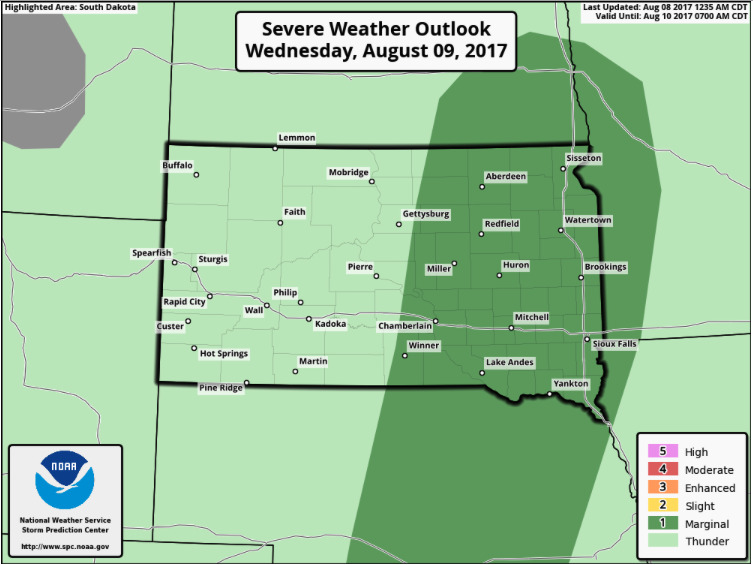
The Storm Prediction Center places the eastern half of South Dakota, southeast North Dakota, and western Minnesota under a marginal risk for isolated hail/wind threat on Wednesday.
Scattered showers and storms will be likely on Wednesday as this disturbance and cold front moves across the region, most numerous across the eastern Dakotas and Minnesota. Showers and storms will slowly shift east into Minnesota/Wisconsin on Thursday as the Dakotas dry out.
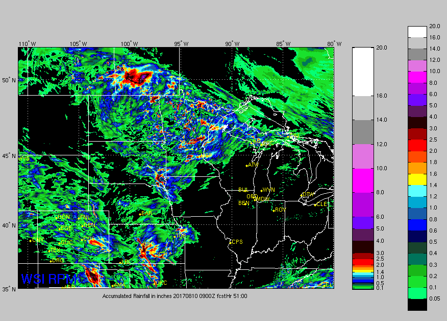
Rainfall guidance through Thursday morning is shown below. More numerous coverage from North Dakota eastward throughout Minnesota into Wisconsin.
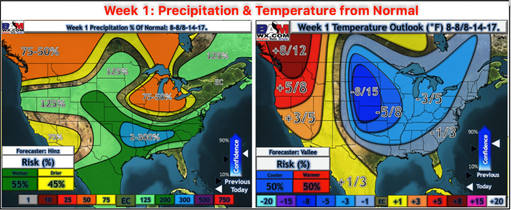
Here is the updated week 1 precipitation and temperature from normal outlook.
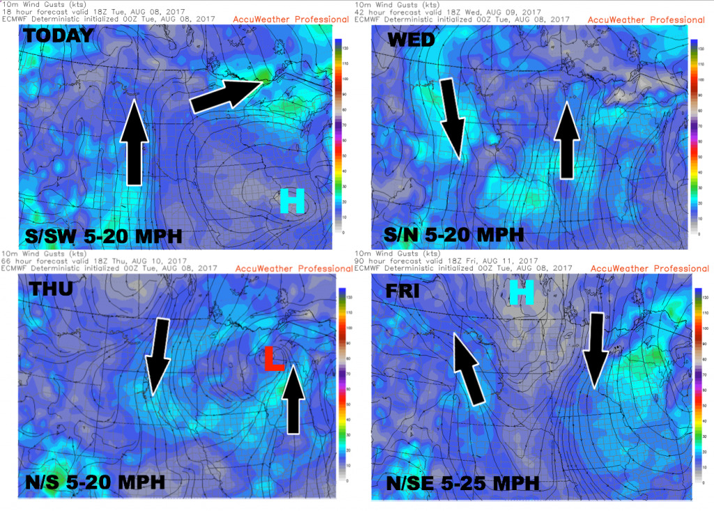
Wind forecast over the next 4 days.
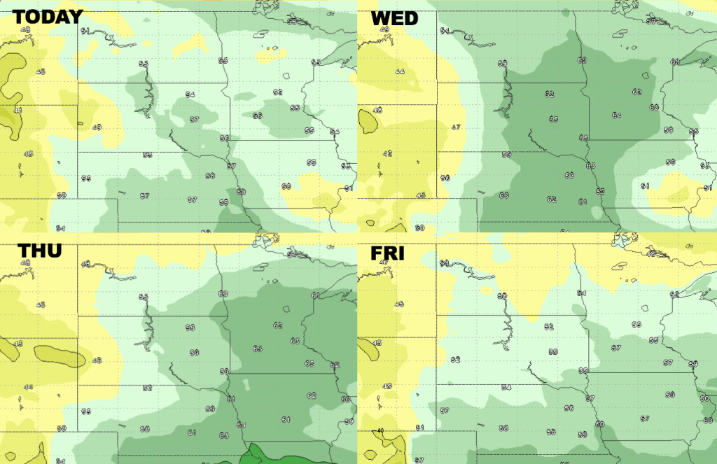
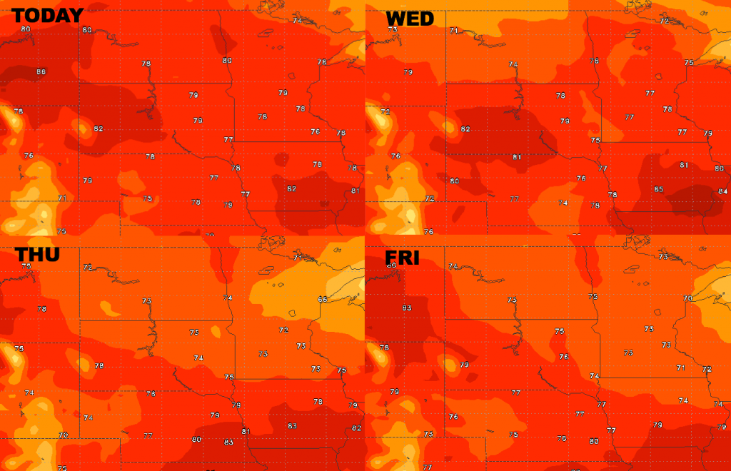
High temperature guidance over the next 4 days.
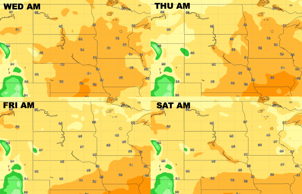
Low temperature guidance tonight – Friday night.
Here are the forecast dew points from normal. More humid mid-week, then drier air builds back in from northwest to southeast late week.