Key Points – Thursday, August 10, 2017:
***Hope you’re having a great week! As a reminder, you will receive all of our products via email, just make sure you’re looking at the right forecast locally; remember, the advantage of having a team of meteorologists at your fingertips can be priceless. With our service you will have access to our team of meteorologists 24/7. Also, make sure to watch the videos in their entirety to get a true sense of the information we provide and how it can be of value to you.
At anytime this week you feel like you have seen enough to make a decision and you’re ready to sign up we will offer you a 20% off discount if you sign up BEFORE your trial expires August 11th. Please do not hesitate to reach out to us at anytime if you have any questions. Have a blessed week! -BAM staff.***
Synopsis: Good Thursday morning. Some healthy rain amounts have fallen from southeast North Dakota into Minnesota and north-central Wisconsin over the past 24 hours. This system will continue to influence the forecast today with additional scattered rain chances from Minnesota into Wisconsin, with dry conditions across most of the Dakotas as high pressure builds in. This system will move east of the region by Friday, then we will watch additional storm chances work in through the weekend mainly across the southwestern half of the area. Detailed analysis in today’s video. Have a blessed day, and let us know if you have any questions!
Today’s video (6:35):
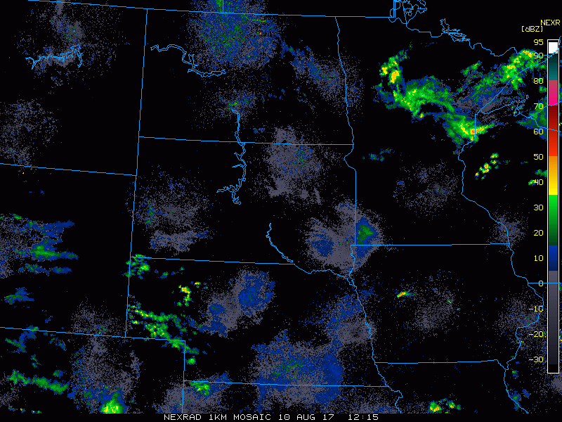
Current radar shows scattered showers continuing to pin-wheel around an area of low pressure slowly tracking east across Minnesota into Wisconsin, with dry conditions across the Dakotas.
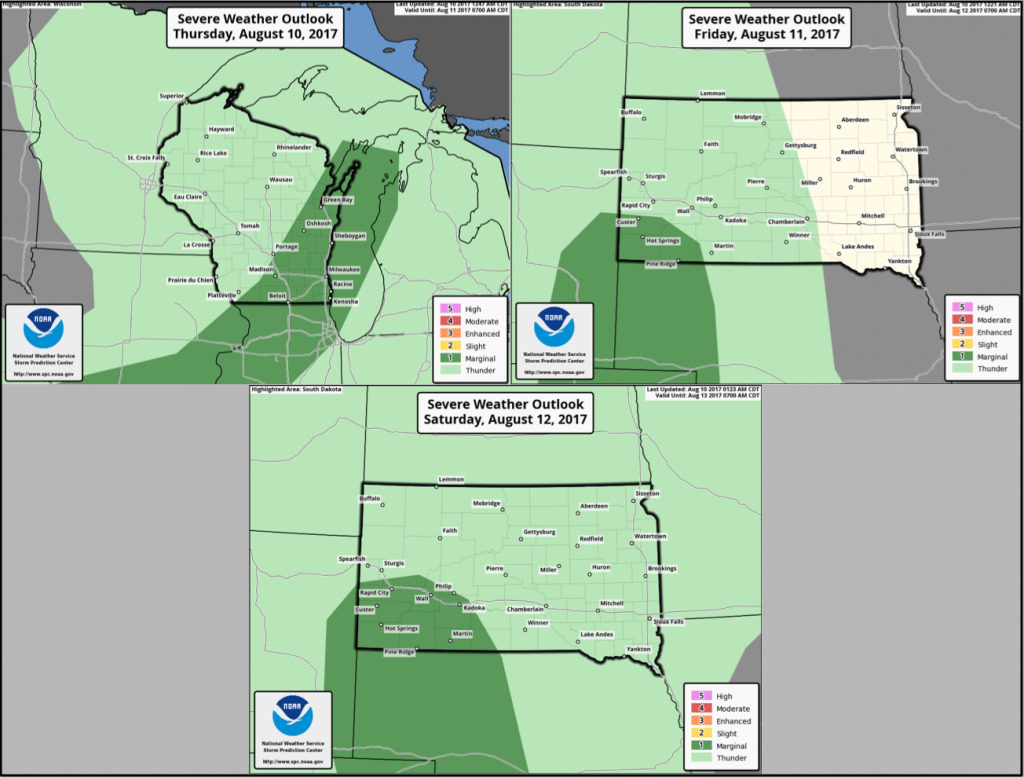
Here are the severe storm risks over the next 3 days. A marginal risk across southeast Wisconsin today for wind/hail, and can’t rule out an isolated, brief spin-up with an area of low pressure moving through. Marginal risk covers southwest South Dakota for both Friday and Saturday as additional storm chances work in.
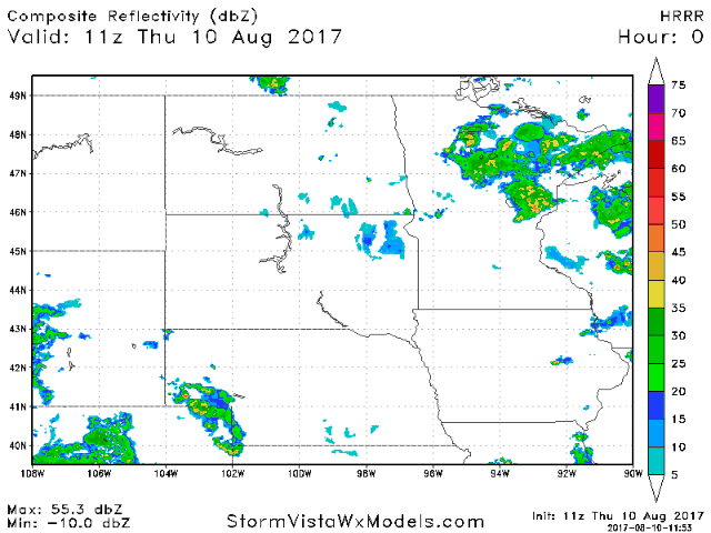
Heading through this afternoon, additional scattered showers and storms should bubble up across much of Minnesota and Wisconsin, (perhaps extending into the far east Dakotas). Certainly not as widespread as yesterday as the system continues to pull east.
Additional energy will work into the Dakotas late Friday, and this trend will continue heading through the weekend. Expecting most of the energy and storm risks to stay focused from the Dakotas into southwest Minnesota, with locations further north and east under the influence of high pressure keeping things dry.
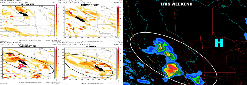
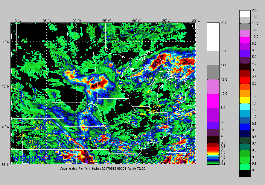
Here is the forecast accumulated rainfall through early Sunday. This model is indicating locally heavy rain totals from these storm clusters this weekend across the Dakotas into southern Minnesota. This may be too aggressive, but something to watch.
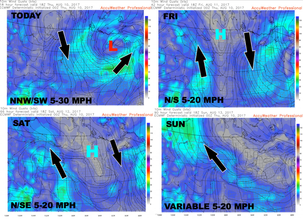
Here is the wind forecast over the next 4 days:
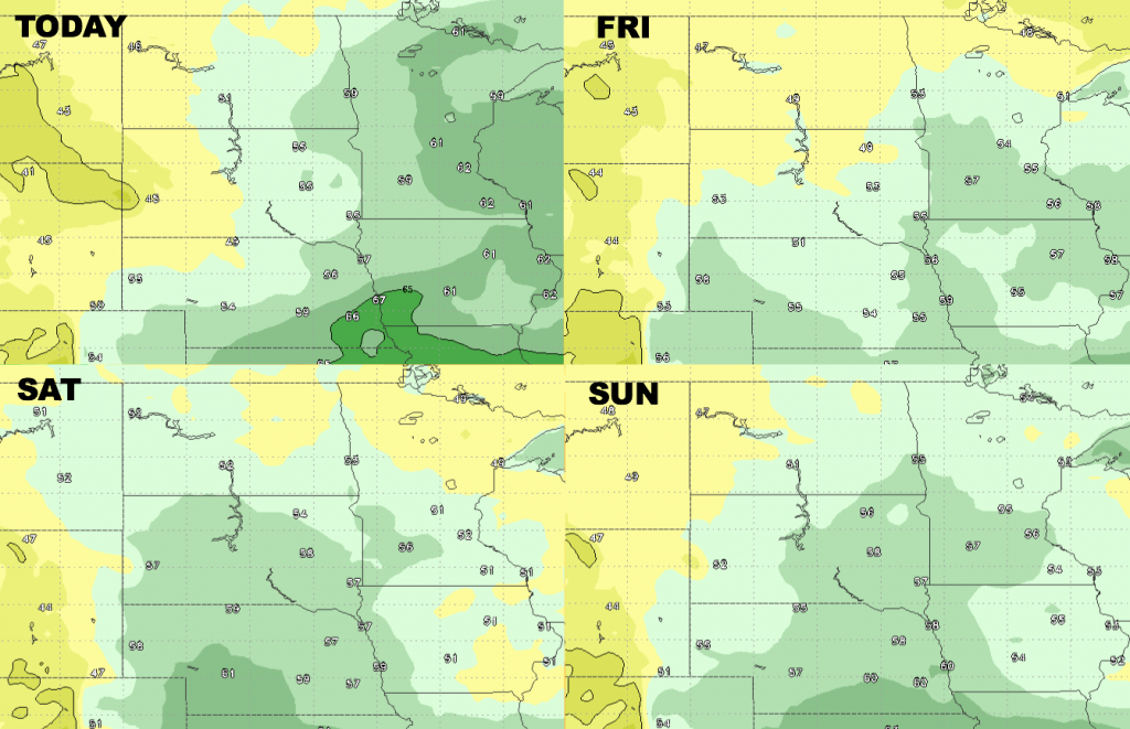
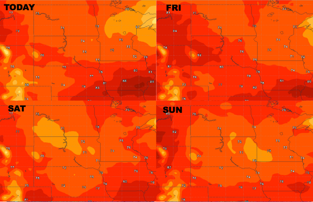
Looking at high temperatures from today-Sunday, it remains comfortable.
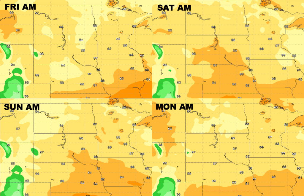
Low temperature guidance over the next 4 days is shown below.
Here are the forecast dew points from normal…a bit humid across the eastern half of the region today, with a very dry air mass moving into the Dakotas. Drier air will build in area-wide on Friday. A bit more moisture building back in from the south through the weekend, but not very humid.