Key Points – Monday, October 2, 2017:
Synopsis: Good Monday morning! Big weather story in the short-term will be heavy rain and flash flood concerns as a potent disturbance interacts with a frontal boundary tonight bringing very heavy rain and storms to Minnesota and southeast South Dakota overnight. The weather pattern looks to become drier by mid-week as this front shifts well south of the area.
Today’s video (6:48):
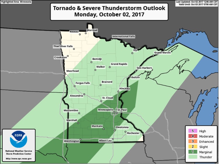
Marginal threat for a few stronger storms with wind and hail from late this afternoon through tonight. Heavy rainfall is the biggest threat here.
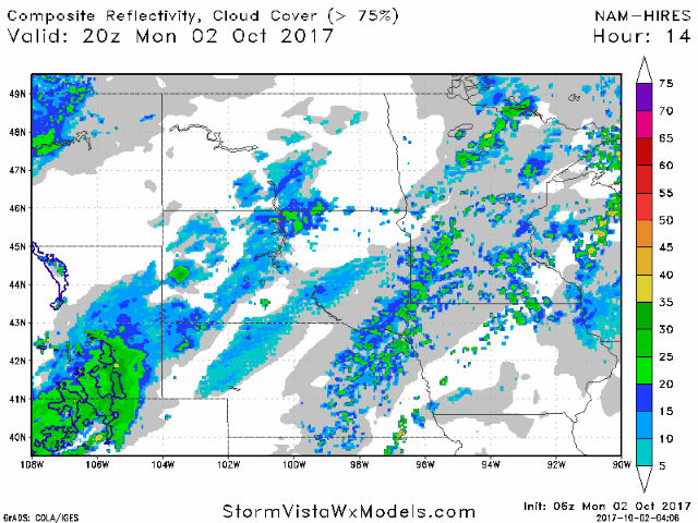
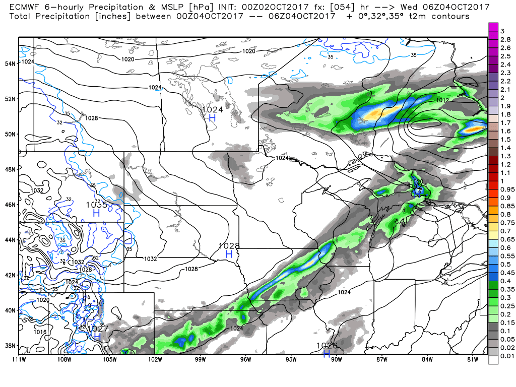
Below is a future radar animation from the latest hi-res NAM showing the storms ramping up beginning this evening and continuing throughout the overnight hours, mainly from central Minnesota into southeast South Dakota.
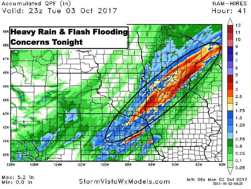
Very heavy rains of 2-5″ appears rather likely tonight in the circled area on the map below off the latest hi-res NAM model.
A drier and cool weather pattern sets in mid to late week. We may see another round of rain chances on Friday, especially south. Confidence is lower at this time.
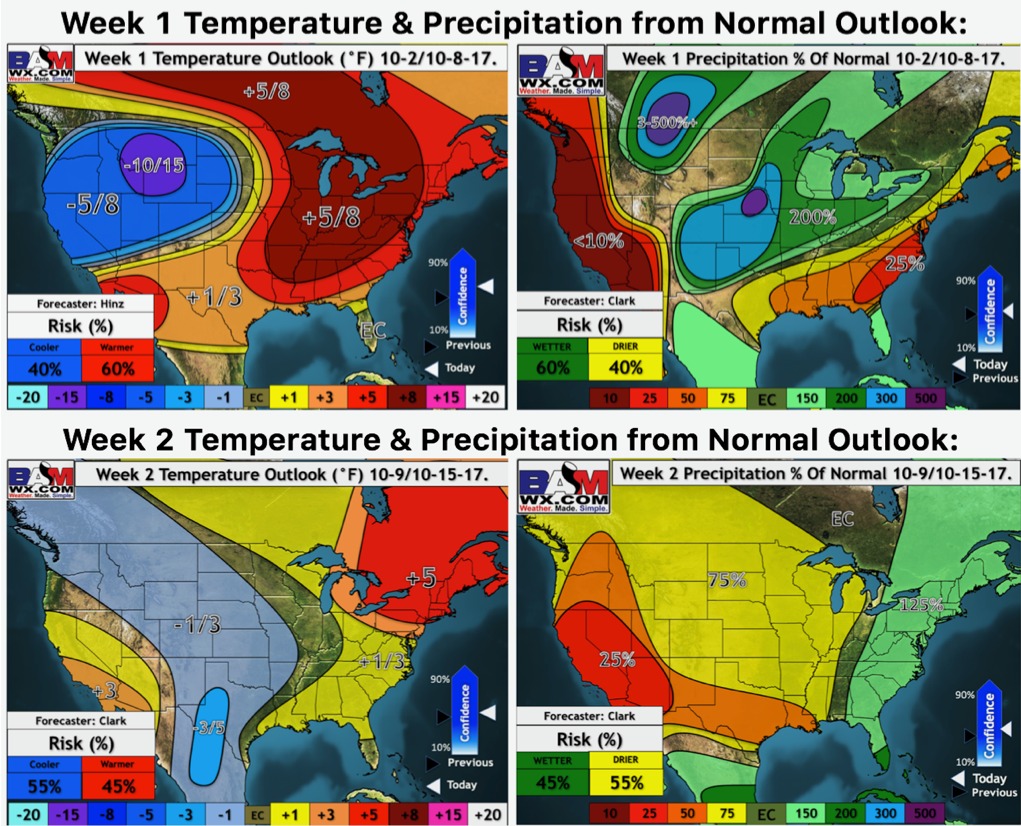
Latest weeks 1 and 2 outlooks:
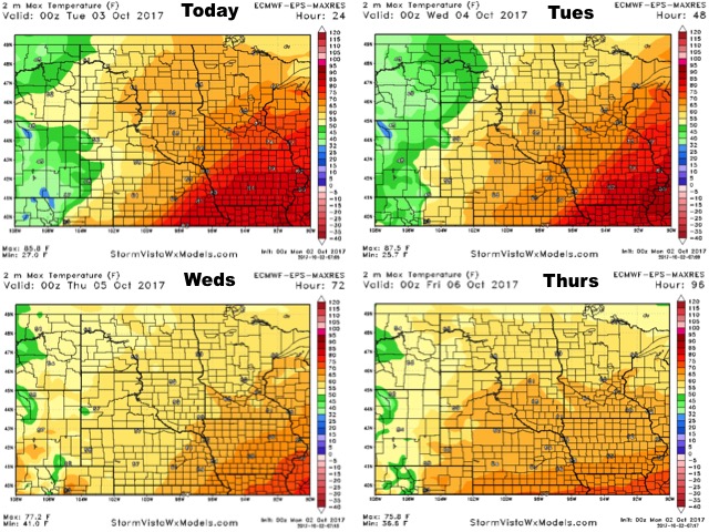
High temperature guidance over the next 4 days:
Low temperature guidance over the next 4 days:

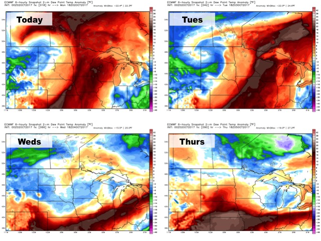
Dew points from normal are shown below. Drier air takes over mid-week.
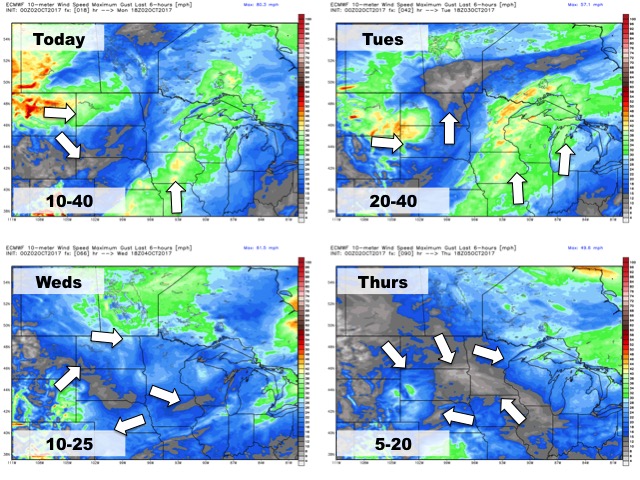
Wind forecast over the next 4 days: