Northern Plains Forecast Update: Active weekend ahead, multiple rainfall chances into next week. E.
Key Points: August 11, 2017
Synopsis: Good Friday morning! An active weather pattern looks to continue across the region through next week with multiple chances for both severe weather and rainfall, particularly across the Dakotas. The first threat comes tonight with storms across South Dakota, then more widespread storms look to occur this weekend with large hail and damaging winds the main threats. Above normal rainfall looks to continue into next week with temperatures largely below normal. More details are covered in the video so make sure to watch! Have a blessed day and weekend. -Ed
Today’s Video (6 minutes):
Current radar is scanning clear this morning.
Later today and into the weekend, severe weather is likely especially in the Dakotas. The next 3 days of severe weather outlooks are below.
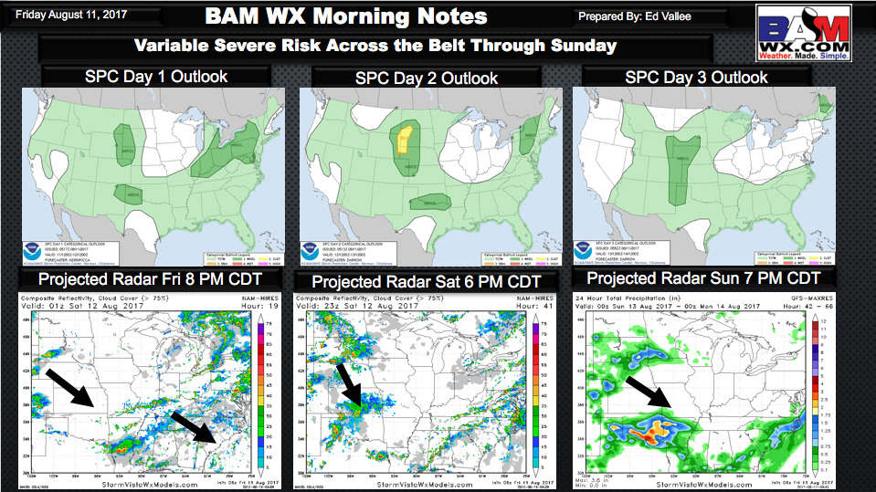
Simulated radar over the coming days is shown below with more detailed timing in the video!
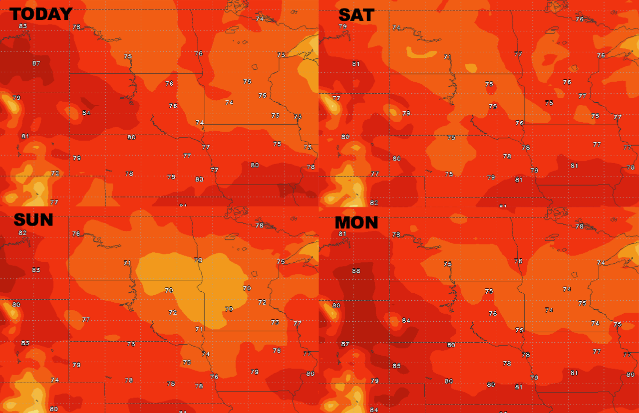
High temperatures over the next 4 days.
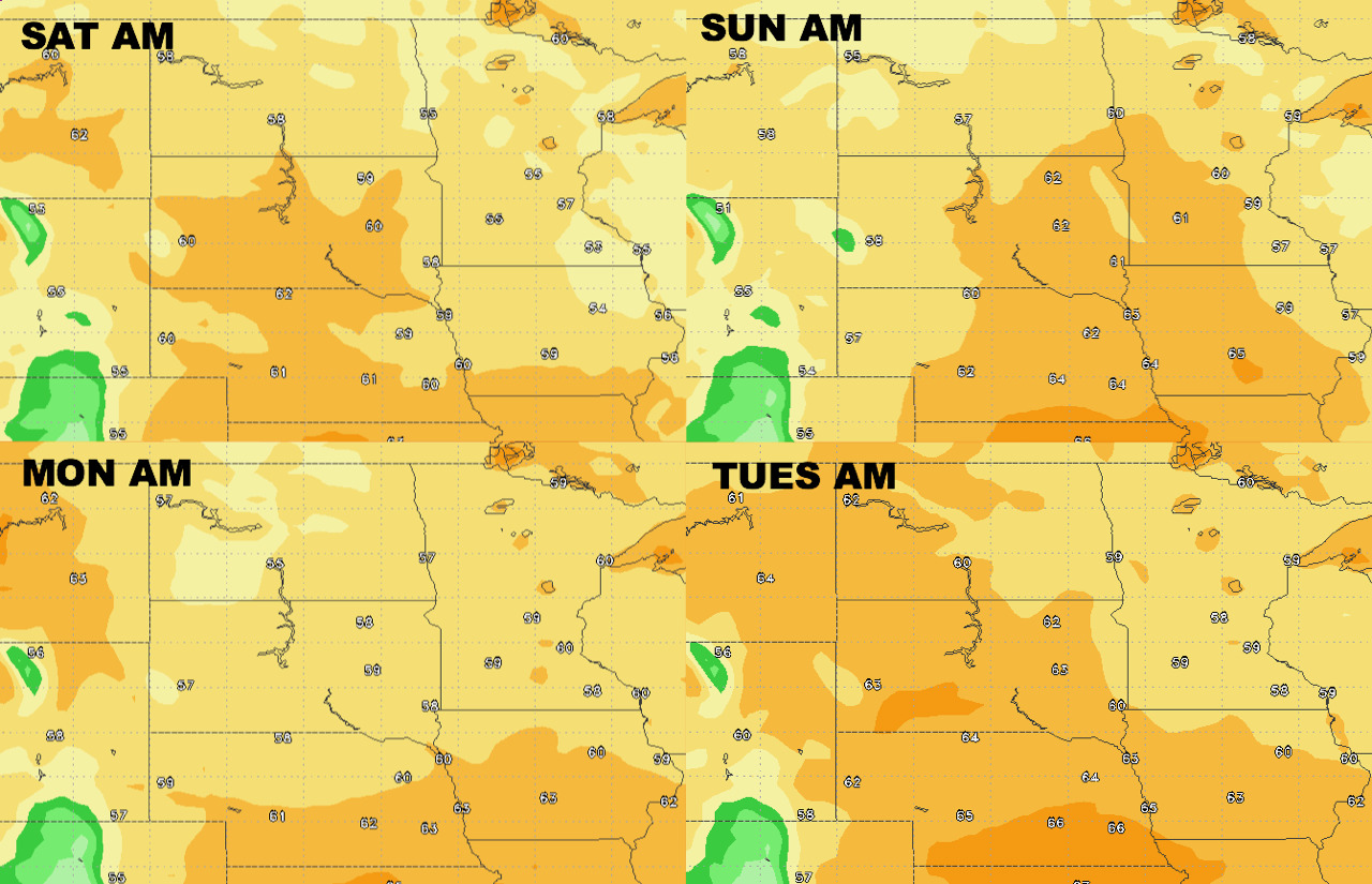
Low temperatures over the next 4 days.
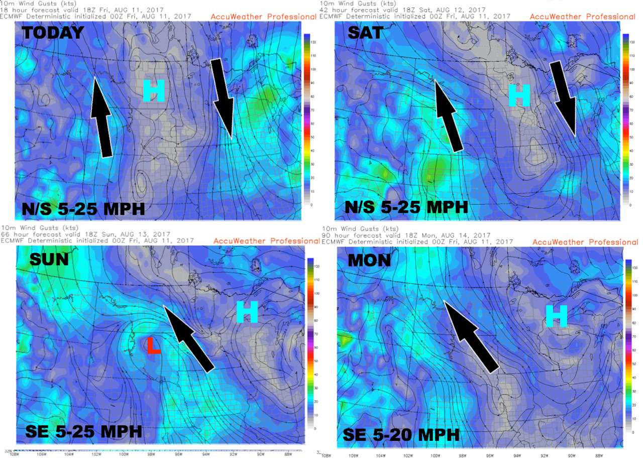
Wind forecast through Monday.
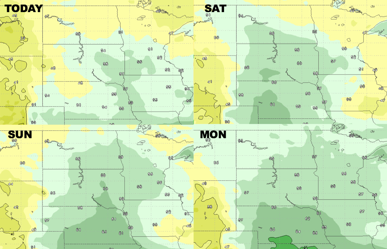
Humidity looks moderate through the weekend, highest across the Dakotas.
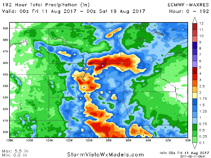
Total rainfall through next Friday.