Good Friday morning!
Synopsis: Anticipating a very nice day overall as our mid-week system that brought heavy rain continues to move into the Great Lakes. Additional storm chances will move in this weekend. Detailed analysis on these storm chances in the video, as well as a look into next week and beyond. Have a great Friday, and let us know if you have any questions!
Today’s Video (6:50):
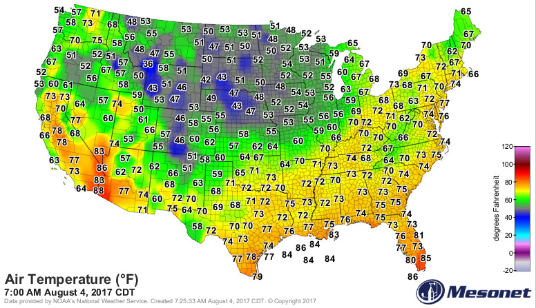
Temperatures are a big story this morning, running way below normal for early August standards.
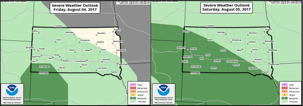
Here are the severe weather outlooks over the next 2 days. A marginal severe risk tonight across southwest South Dakota. On Saturday, a marginal risk covers the southwest half of South Dakota.
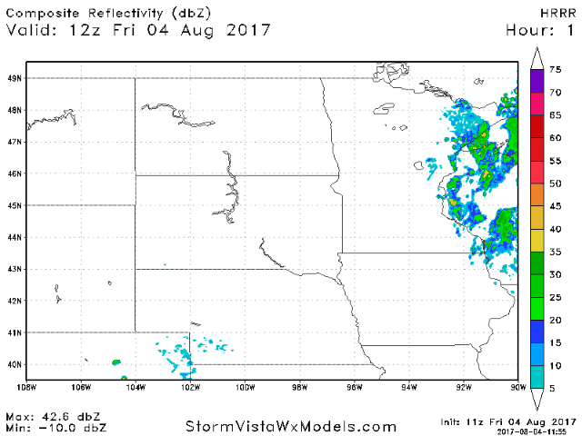
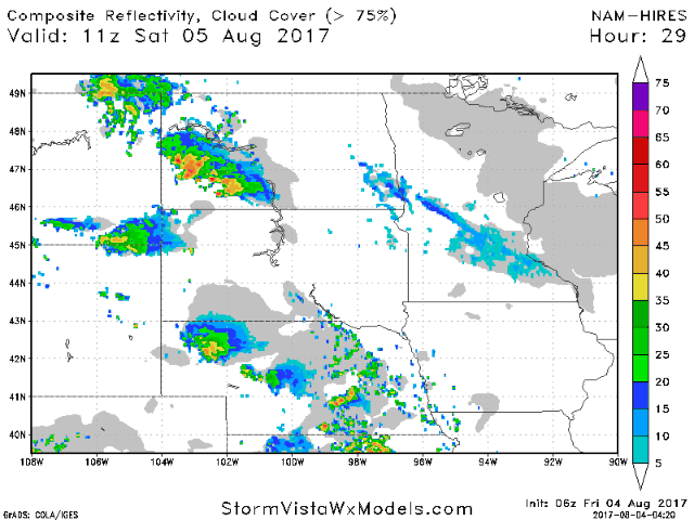
Going through the day, we may see isolated storms over eastern/northeast Minnesota, as well as the western Dakotas. Many areas will see a nice day with mostly sunny skies. Scattered storms are expected to ride into the western Dakotas tonight. Below is an animation of the HRRR model future radar through midnight tonight.
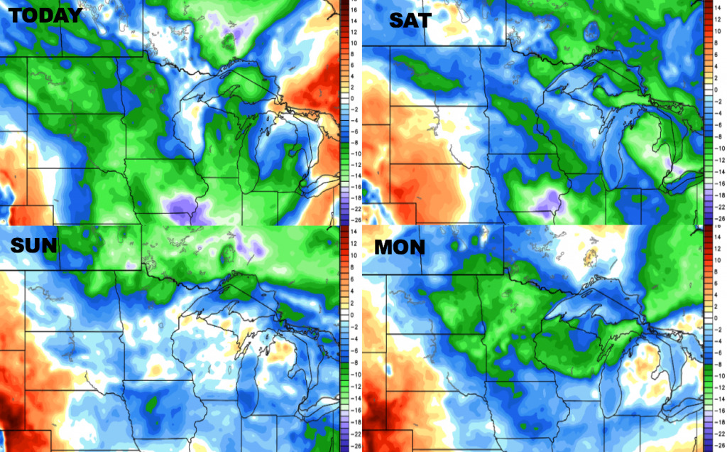
Additional storm chances this weekend as multiple pieces of energy move across the area. The best focus for storms will be from the Dakotas into southwest Minnesota. Here is a look at the upper-level energy forecast through Sunday.
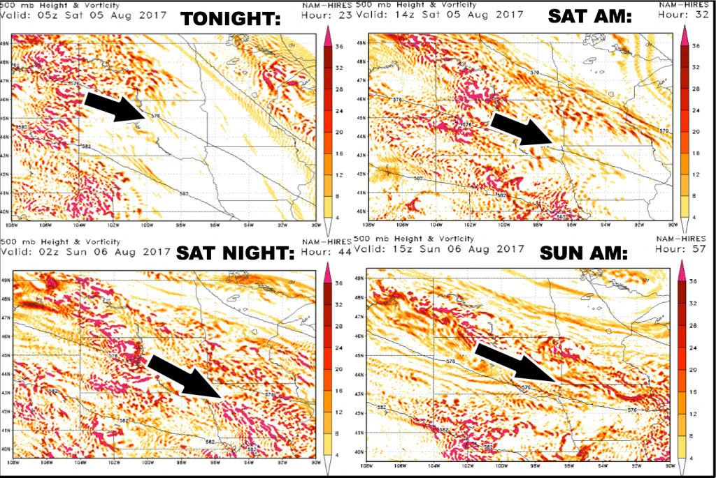
Here is the animated future radar off the hi-res NAM model going through Saturday and Sunday.
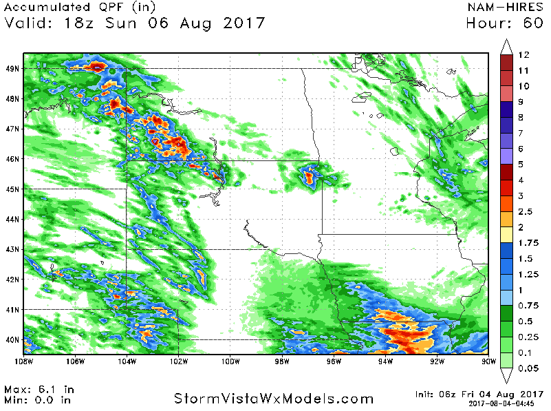
Here is the rainfall accumulation forecast over the next 60 hours from the hi-res NAM.
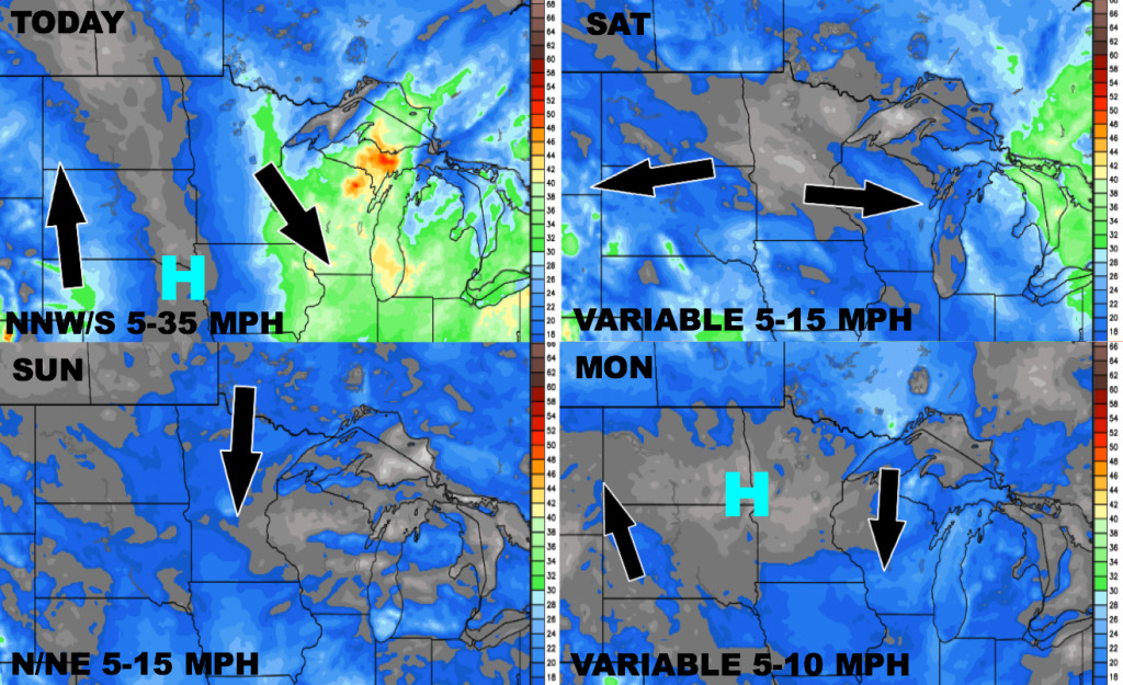
Wind forecast over the next 4 days is shown below.
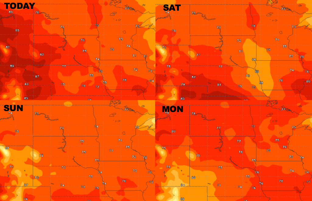
High temperature guidance over the next 4 days:
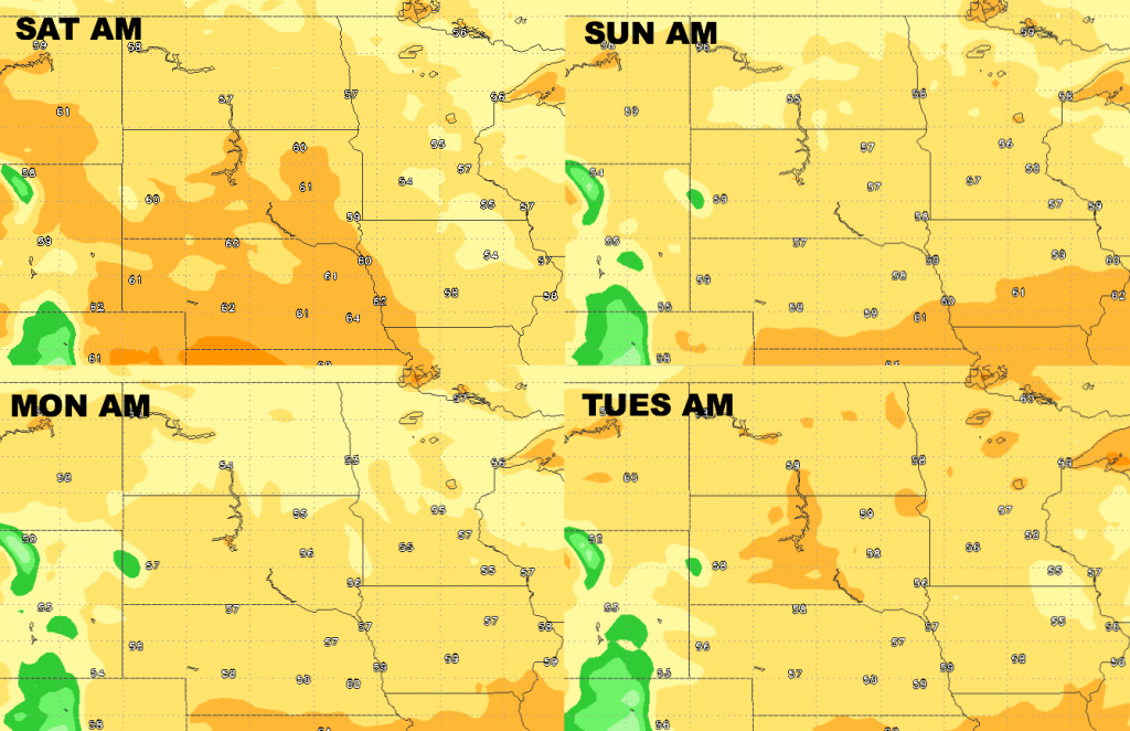
Low temperature guidance over the next 4 days:
Dew points from normal into early next week.