Key Points – Tuesday, July 25, 2017:
Synopsis: Good Tuesday morning! Quiet radar today, that will change as we get into Wednesday and early Thursday especially north and east for flash flooding rains and severe storms. After this system moves east, we see a noticeably cooler pattern settle in for much of next week, although drier risks are in the cards as well across parts of the central Plains. If you have any questions, please let us know! Have a blessed day.
Today’s video (6 min):
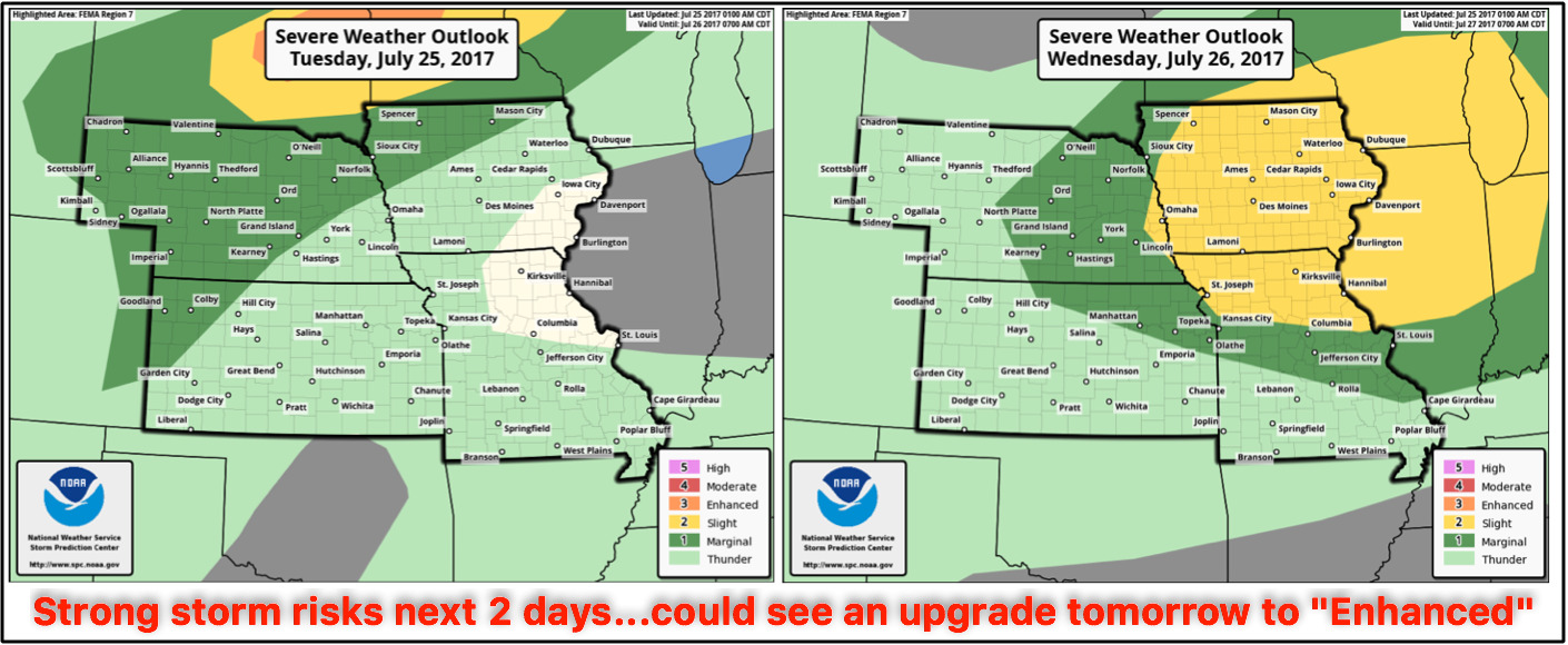
Strong storm threats next 2 days…damaging winds and very heavy rainfall being the biggest threats.
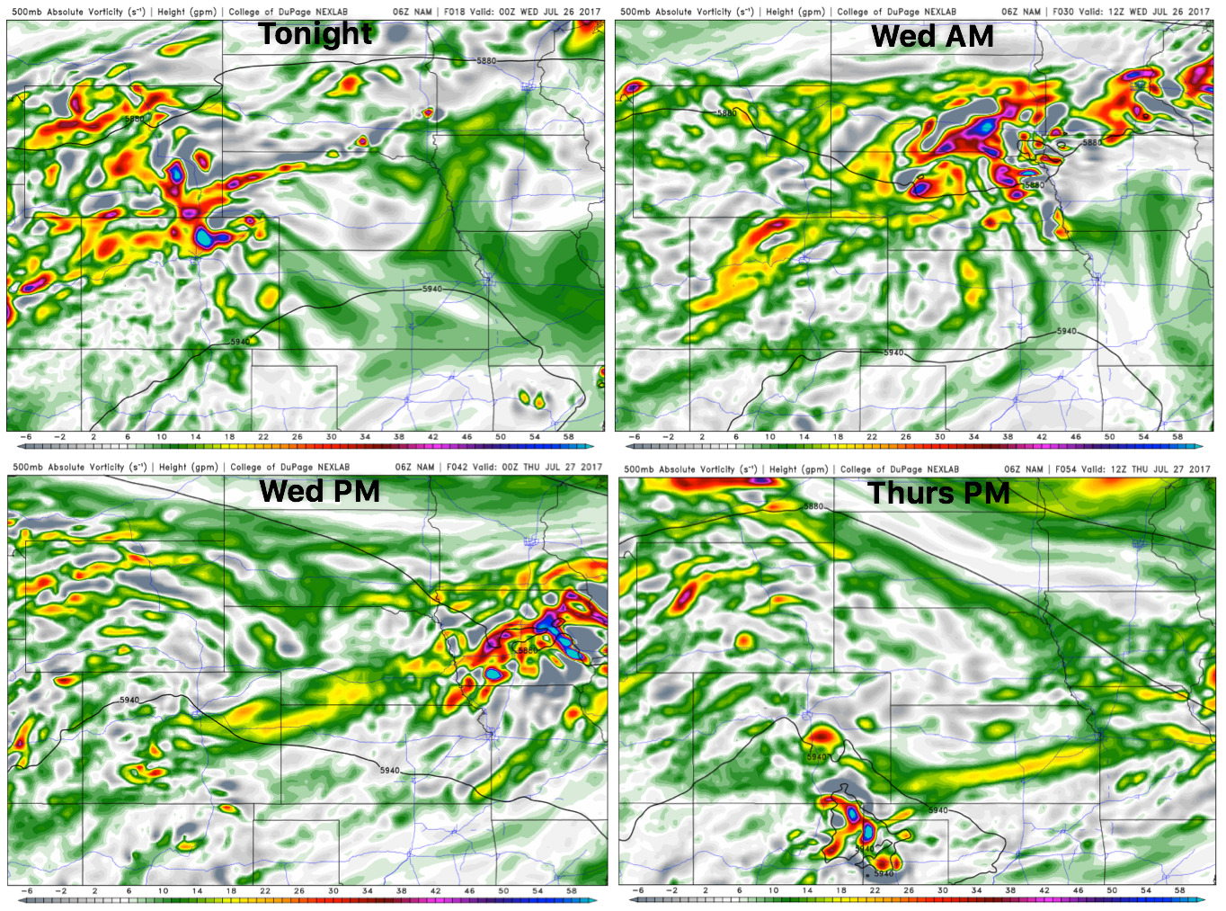
Energy forecast into Thursday morning…focus next 24 hours will be across Nebraska and Iowa mainly, with Wednesday night into Thursday pushing across NE Kansas, Iowa and northern Missouri.
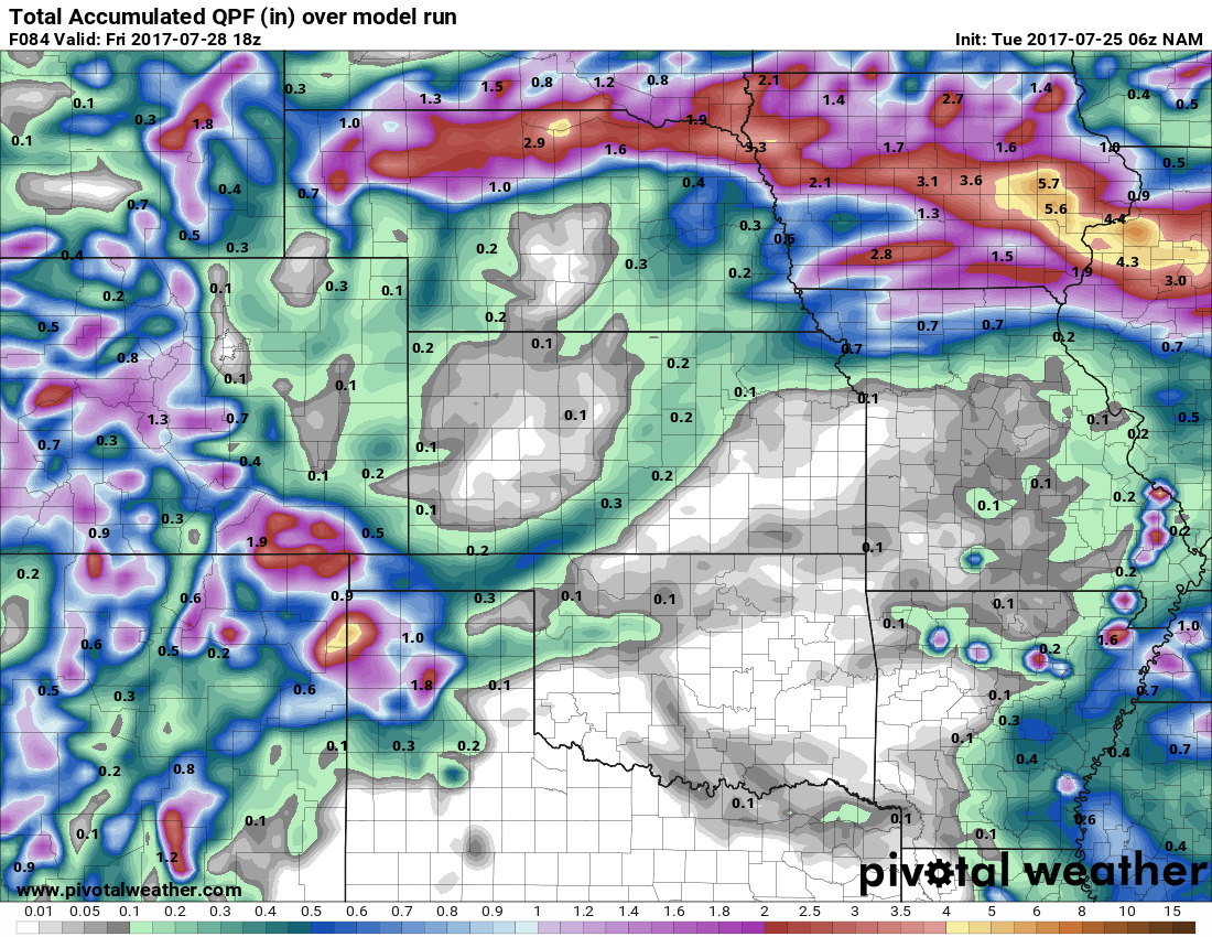
Rainfall guidance next 4 days…the overall takeaway is the data is seeing the storm cluster event well; with that being said, use this as guidance for where the heaviest rain will fall not the exact numbers. Certainly localized 3″+ is possible across Nebraska and Iowa.
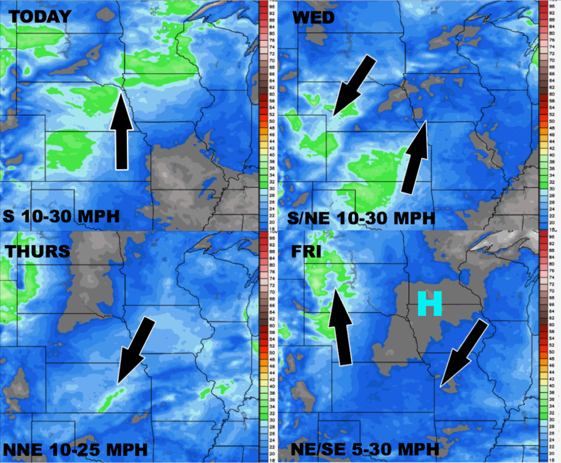
Wind forecast into late week:
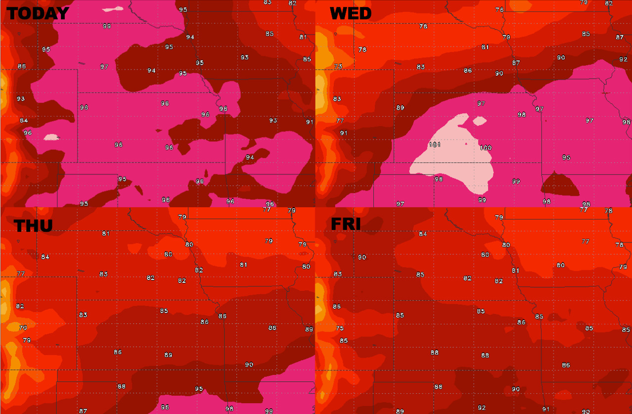
High temperature forecast guidance into Friday
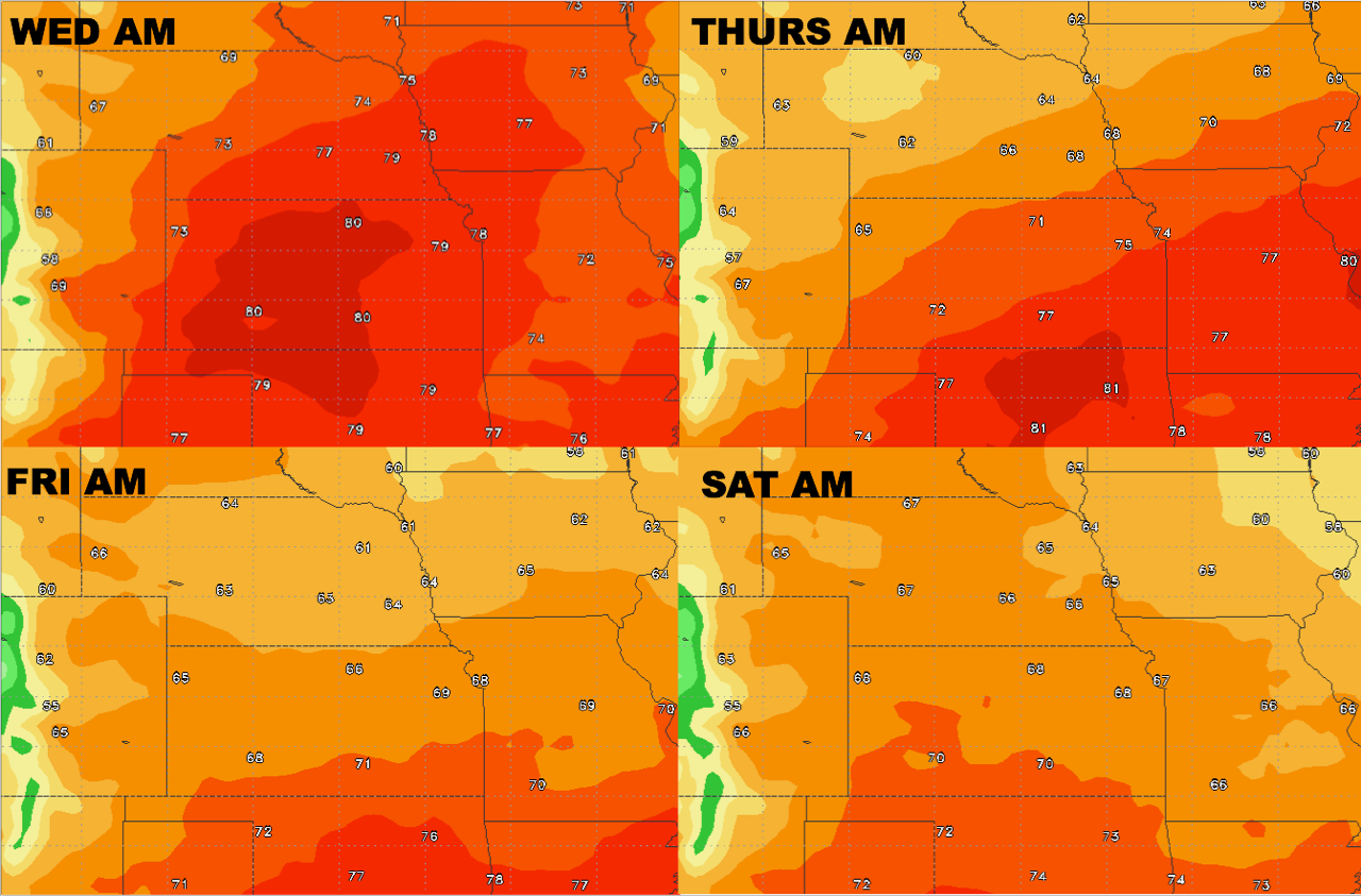
Overnight lows into early weekend:
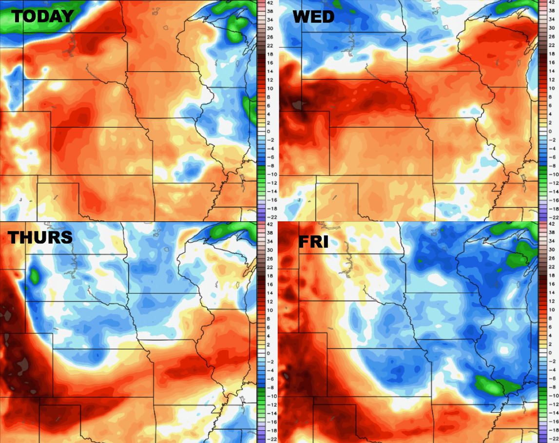
Dew points from normal guidance as well:
Confidence:
- Above average confidence an impressive storm cluster pushes east Wednesdays into Thursday AM across the northern zone locations.
- Average but increasing confidence for strong storms and localized flash flooding here as well.
- Increasing confidence for a cooler pattern to settle in across the central US getting into next week.