Key Points – Thursday, August 3, 2017:
Synopsis: Good Thursday morning! Storm chances will continue to target mainly the eastern portions of the area today. Surface high pressure builds in tonight and Friday with cooler and drier air, then storm chances return to the forecast this weekend. Detailed analysis in the video below. Have a great day, and let us know if you have any questions!
Today’s video (7 min):
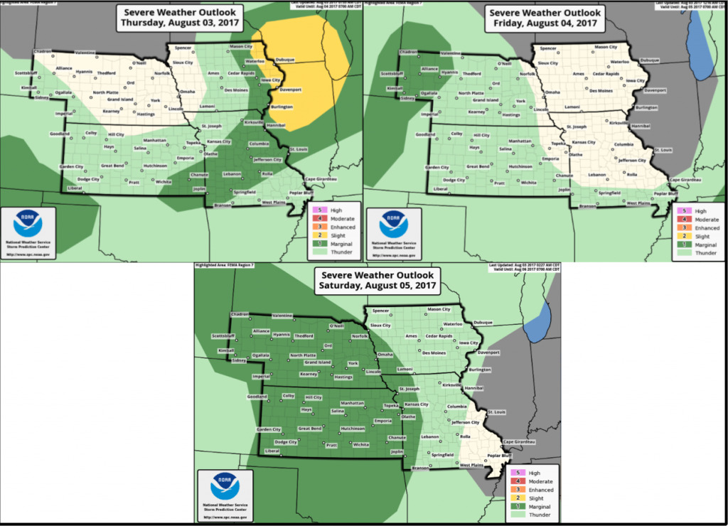
Here are the Storm Prediction Center severe weather outlooks over the next 3 days.
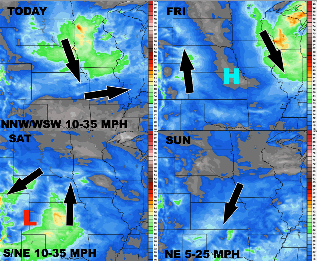
Wind forecast guidance next 4 days:
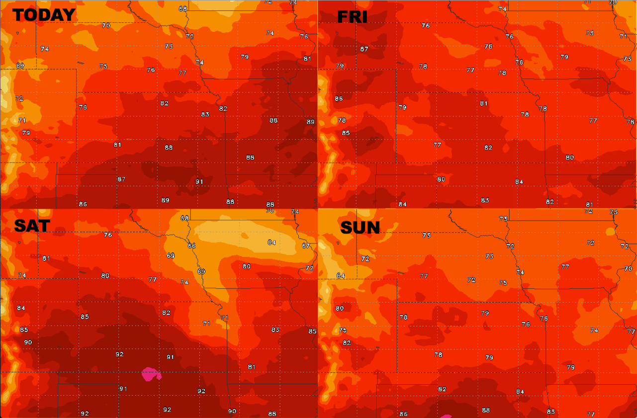
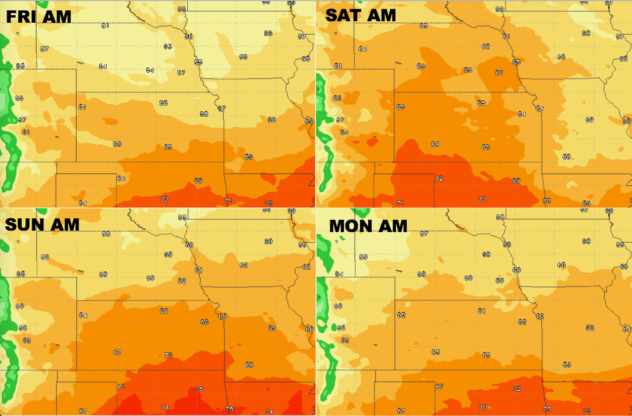
High temperature guidance into the weekend:
Overnight lows here as well into early next week:
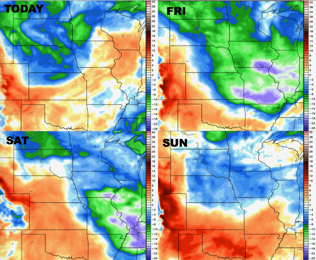
Dew points from normal show the cooler pattern sweeping in as the cold front passes east: