Key Points – Monday, July 24, 2017:
Synopsis: Good Monday morning! Today we discuss the strong storm chances into mid-week, especially as a frontal boundary works its way east. Temperatures are overall warm across the central Plains through Thursday before the cold front knocks it down…we also discuss in the video how the pattern is more conducive to seasonal/cooler temps into next week to open August. If you have any questions please let us know, have a blessed day!
Today’s video (8 min):
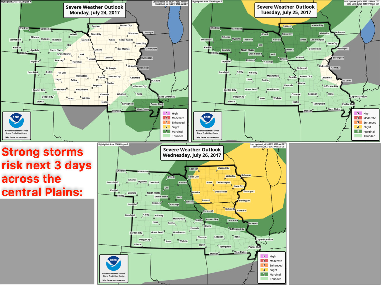
Strong storms threat next 3 days:
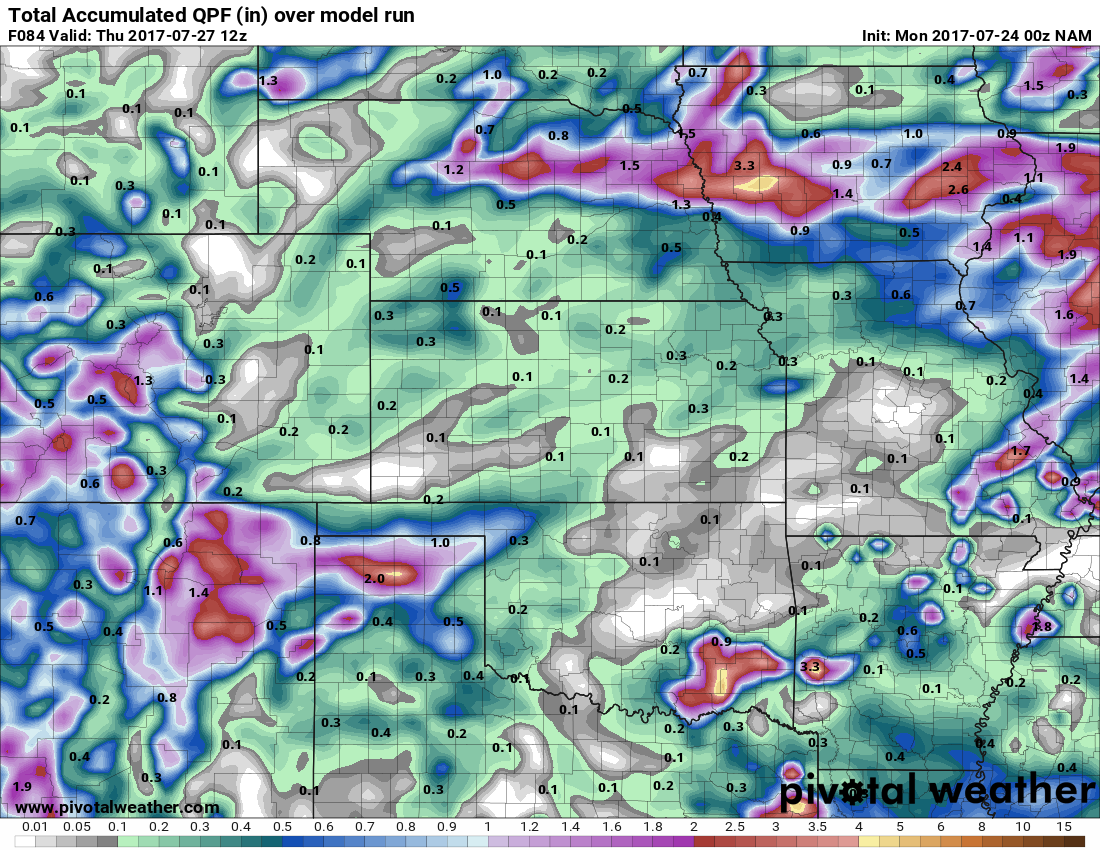
Rainfall accumulation guidance into mid-week…focus will be across Nebraska, Iowa and southeast Missouri for 1-3″ with isolated higher amounts possible…locations across western Missouri and Kansas will remain drier through mid-week.
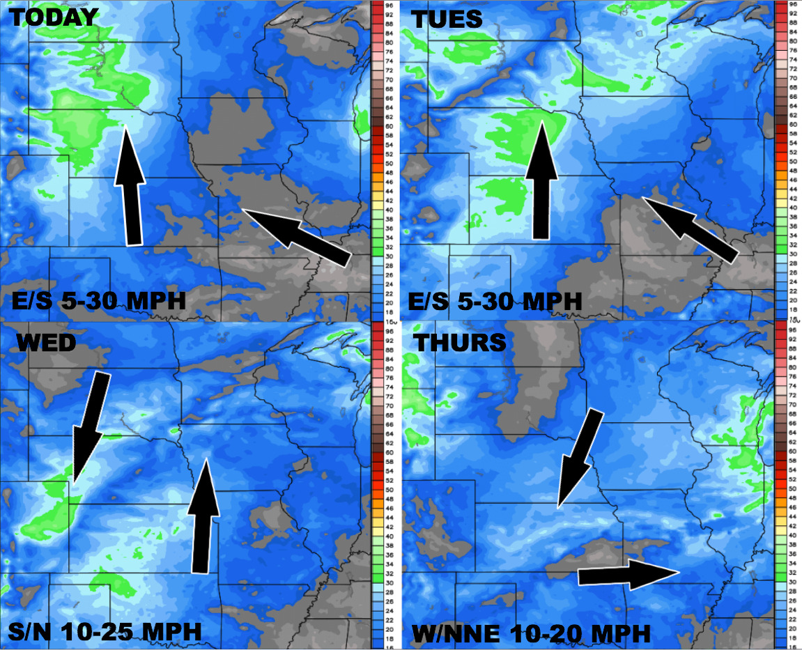
Wind forecast next 4 days:
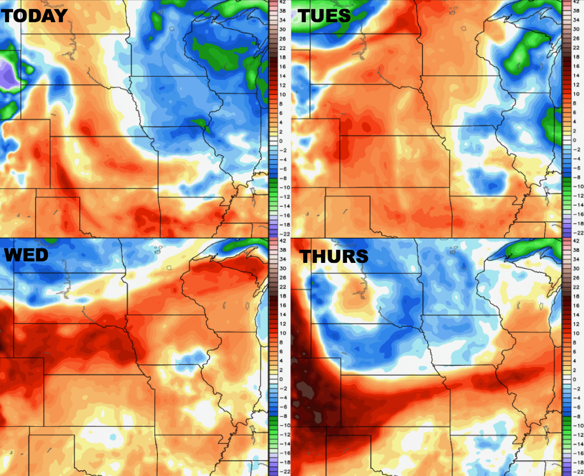
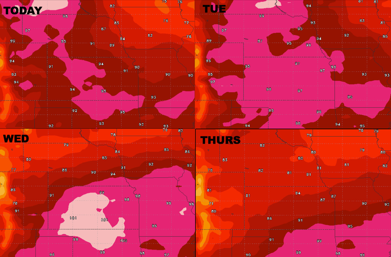
High temperature forecast into Thursday:
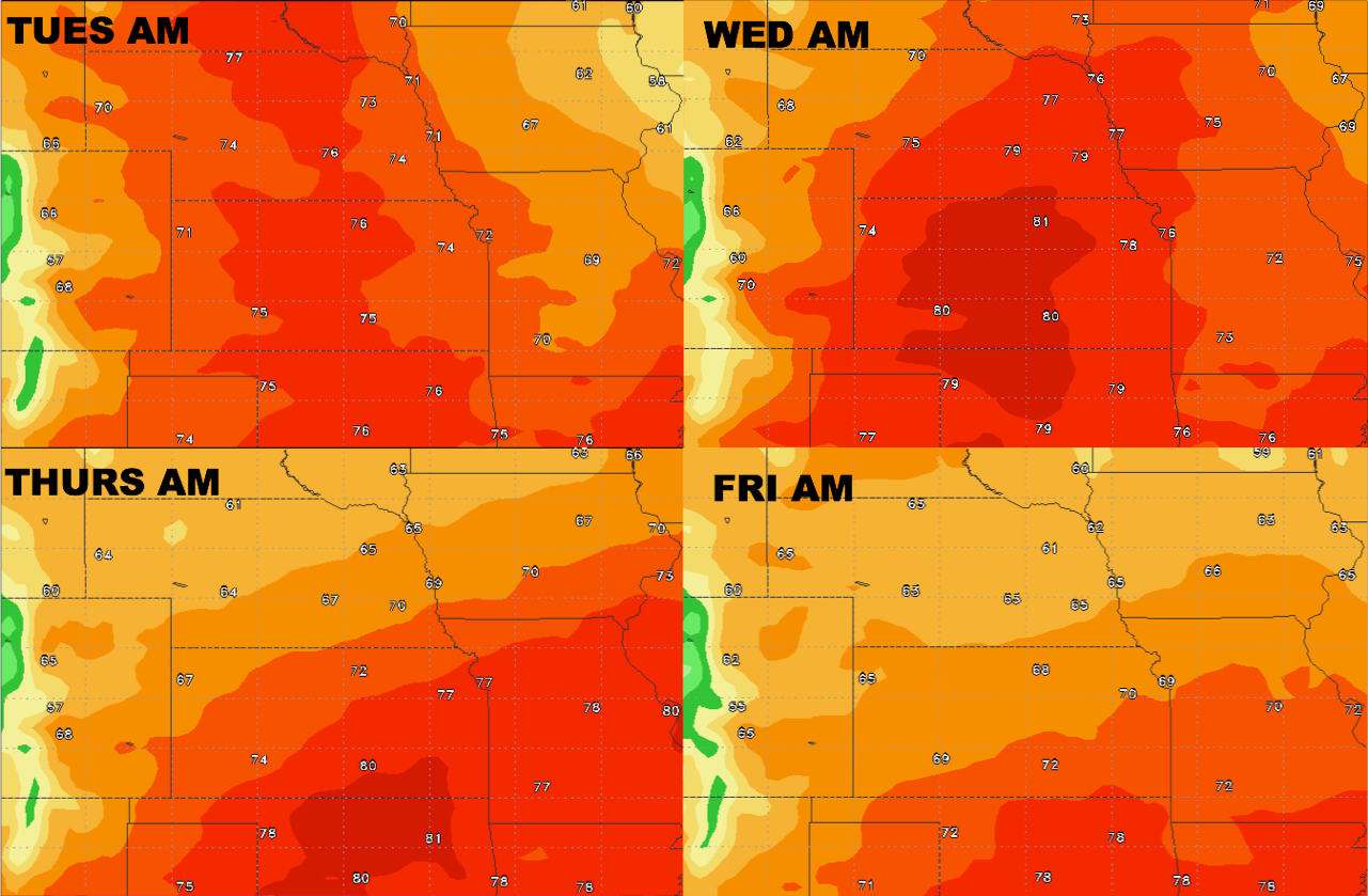
Overnight lows into late week:
Dew points from normal into mid-week: