Key Points – Thursday, July 27, 2017:
Synopsis: Good Thursday morning! Today we discuss the rainfall setting up shop mainly south and west across the forecast area as we head into the weekend, drier conditions will work their way in across the eastern parts of Nebraska into Iowa…a much cooler pattern settles in as well compared to recent heat to end July. If you have any questions please don’t hesitate to reach out, have a blessed day!
Today’s video (time):
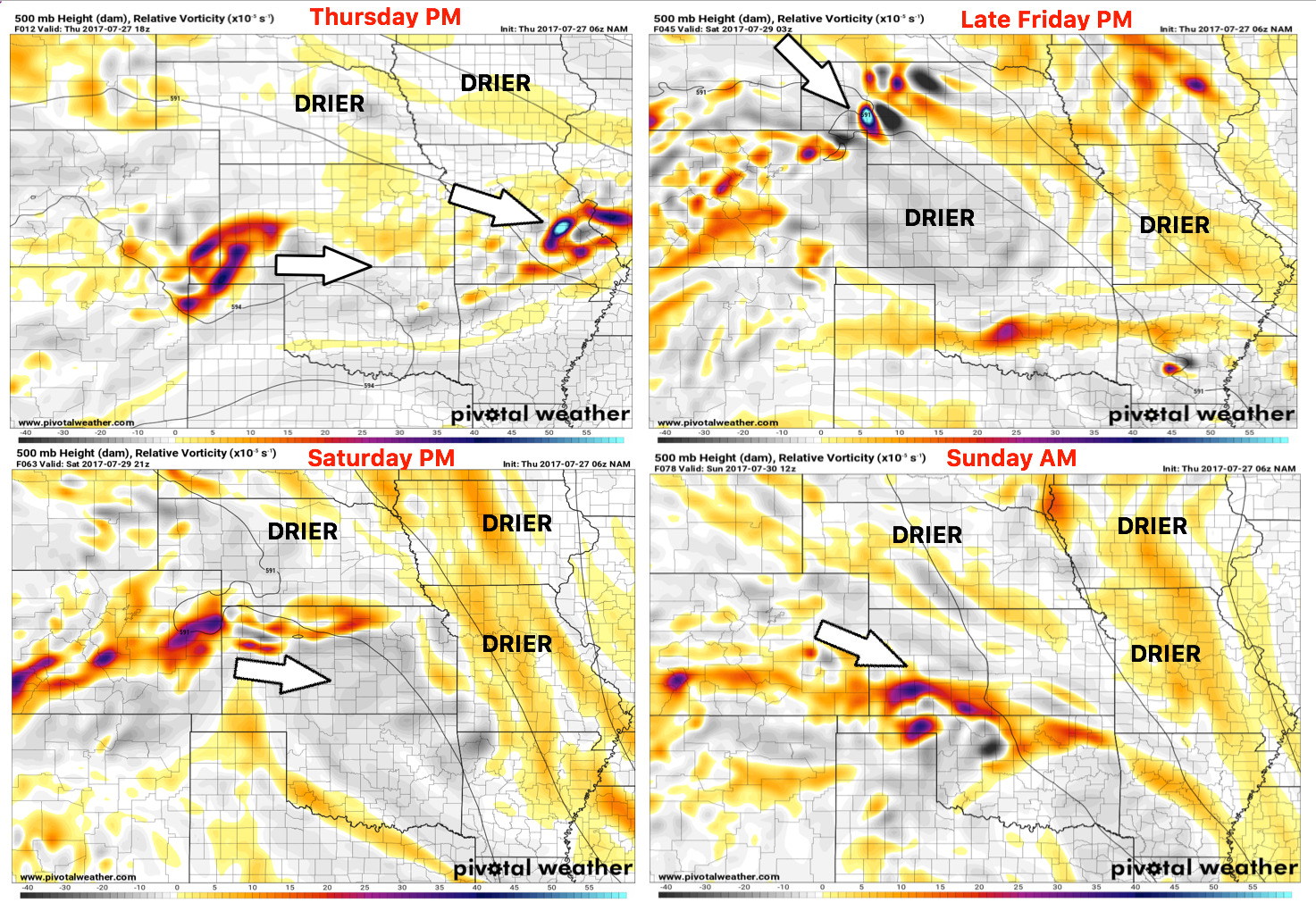
Upper-level energy forecast into Sunday morning…much of the northern half of the forecast area will stay drier in this time period, beyond today, the focus of the rainfall will mainly be across western Nebraska and western Kansas locations as well as eastern Colorado. Although the risk is small, can’t rule out an isolated stronger storm later Friday night across western Nebraska.
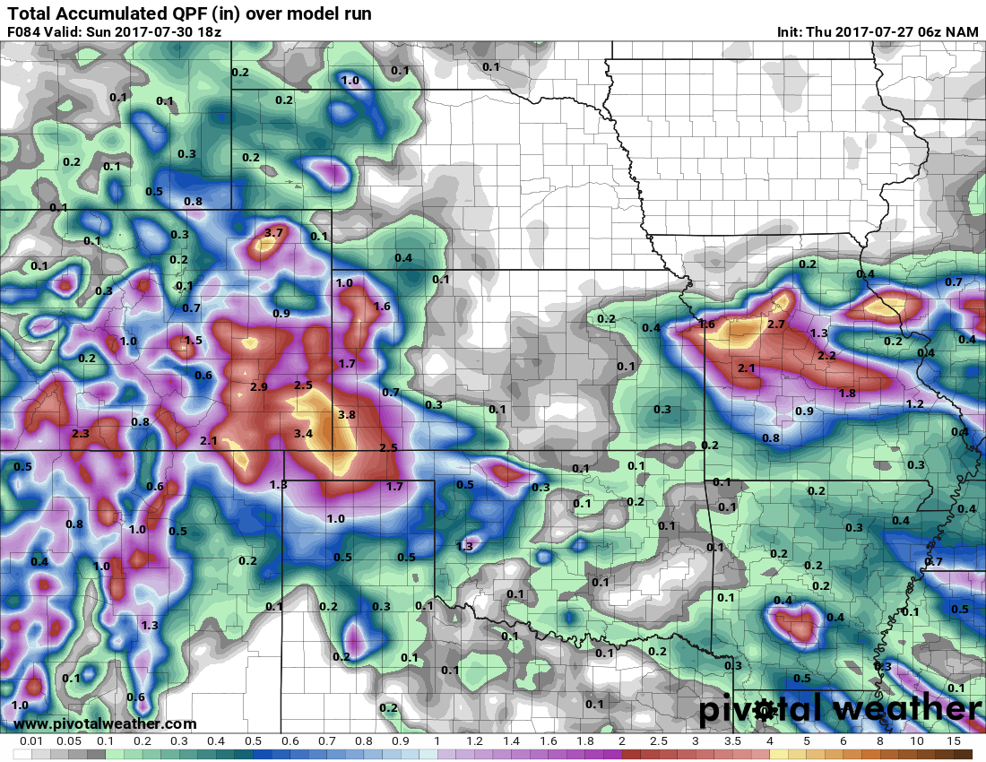
Thoughts on rainfall accumulation guidance…as discussed above, the eastern half of Nebraska and Iowa stay with the rainfall focused across western Nebraska, western Kansas/eastern Colorado as well as the remainder of rainfall across Missouri. Where the storms develop, 1-3″ with localized higher amounts possible.
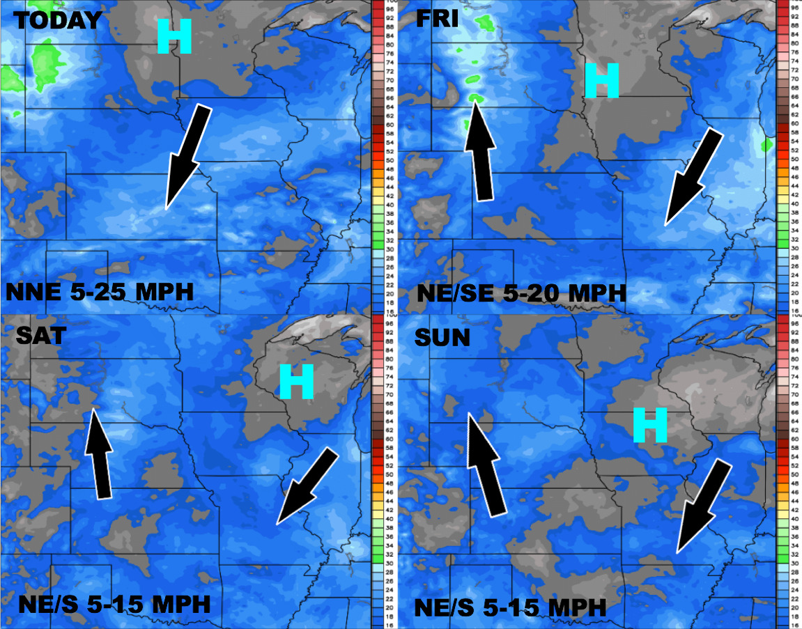
Wind forecast over the next 4 days:
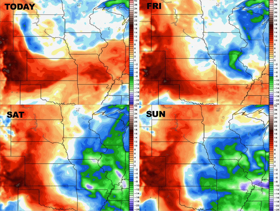
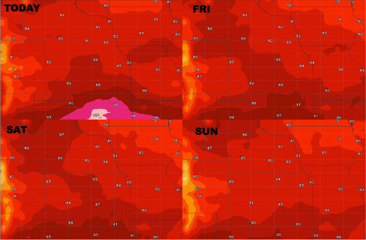
Temperature relief is on its way for the central Plains as we head late week into the weekend:
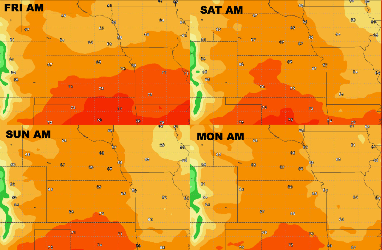
Overnight temperature guidance:
Dew points from normal…certainly less humid air across the eastern half of the Zone, more humid conditions persist west.