Key Points – Monday, July 31, 2017:
Synopsis: Good Monday morning! We discuss the rainfall that fell this weekend across the western half of the forecast area, nice to see that verify from late last week’s discussion. Rainfall moves out to the south and east today, it’s Tuesday night into Wednesday morning we are watching a nice piece of energy move south work its way into Nebraska and locations further south for scattered storms. It’s also Wednesday night into Thursday that a cold front will sweep through the central Plains that’ll spark additional showers and storms. Also, we are about to go into a stretch of unseasonable cold weather running as much as 8-15º below normal over the next week. Have a blessed day!
Today’s video (5 min):
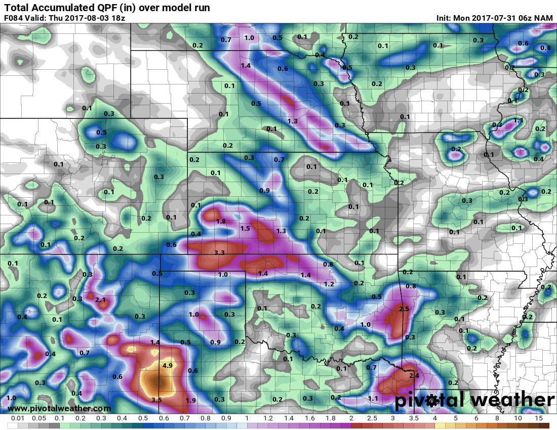
Rainfall guidance next into mid-week, main focus of rainfall will be across central Nebraska and Kansas with 1-2″ possible, can’t rule out an isolated higher total as well especially across southwest Kansas.
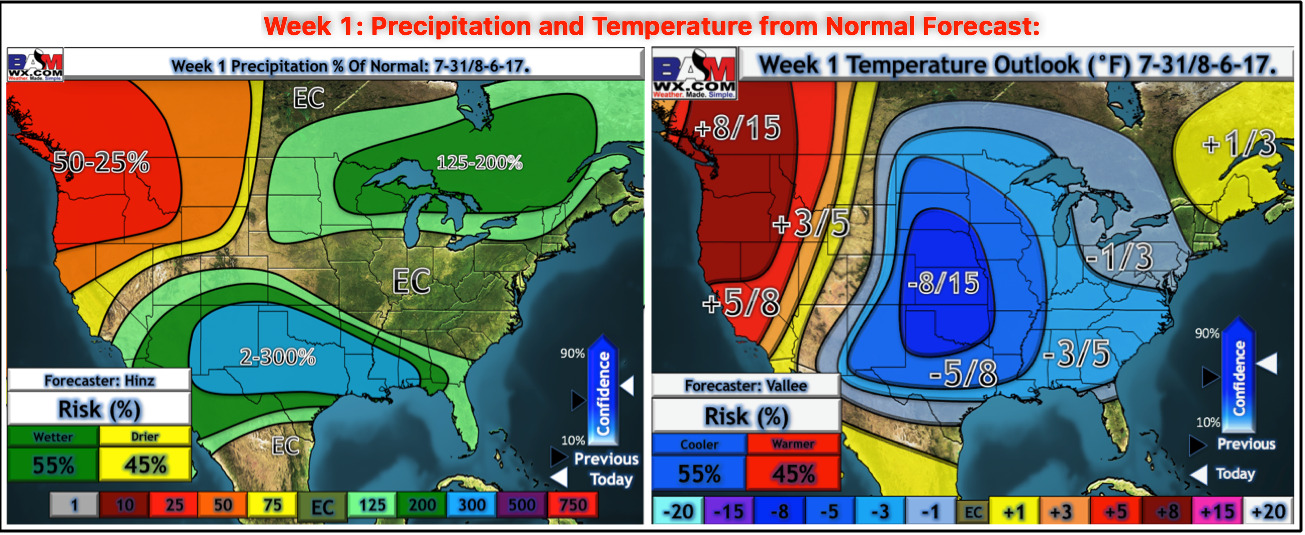
Here’s updated week 1 temperature and precipitation from normal outlooks updated this morning on the site…much cooler with hit or miss rainfall across the central Plains.
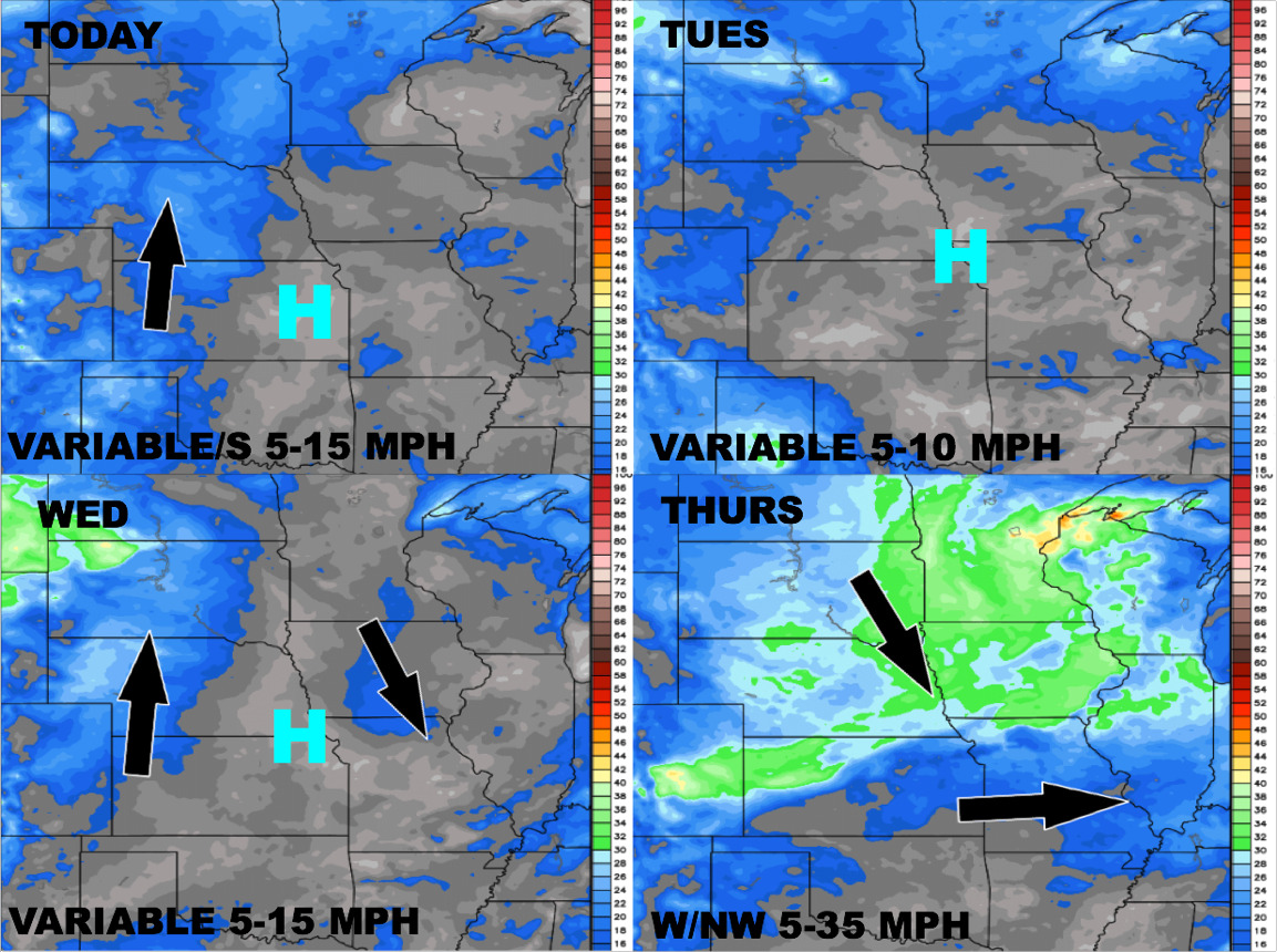
Wind forecast next 4 days:
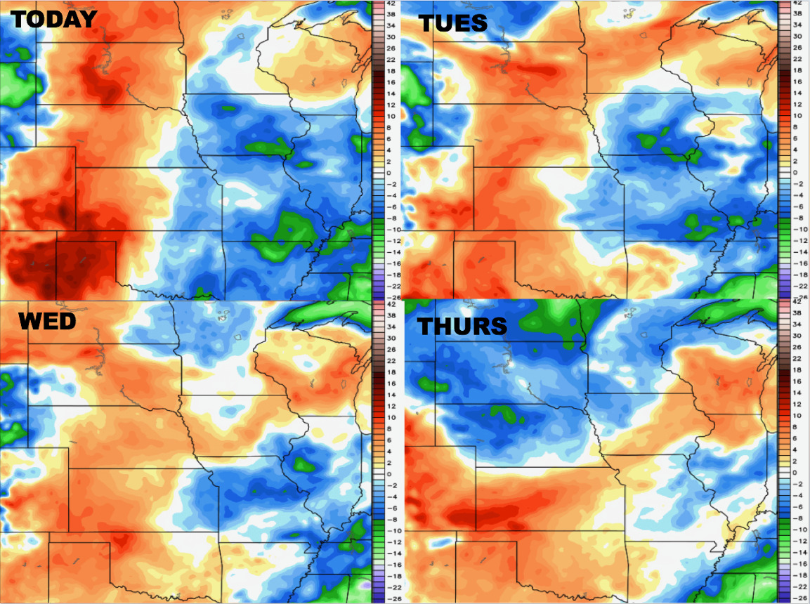
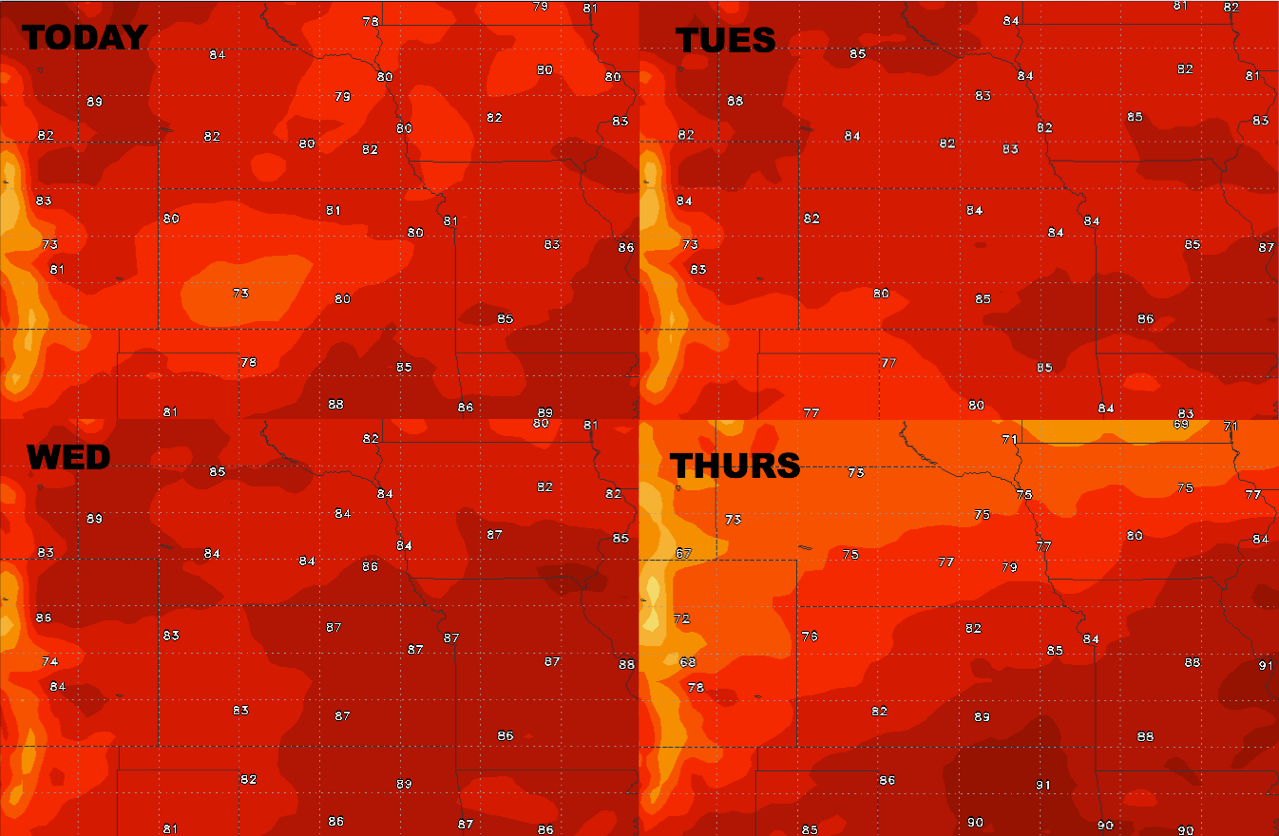
High temperature guidance for the central Plains this week:
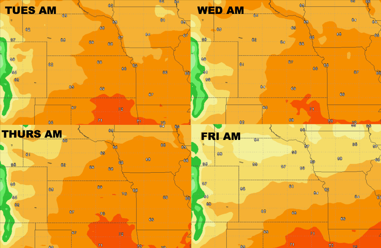
Overnight lows this week:
Dew points from normal: