Key Points – Wednesday, July 19, 2017:
Synopsis: Good Wednesday morning! Today we discuss the rainfall relief that fell over the past 24 hours, not everyone cashed in but some fairly widespread rains moved through. The story here over the next couple of days is the excessive heat that’ll be across the central Plains as well as quite elevated overnight lows 75º+. Main focus of today in the video is a cluster of storms moving through to the north and east of the area overnight, can’t rule out a few strong storms and excessive rainfall as well (although again, it’s hit or miss with the chances). We discuss the multiple rounds of storms, especially to the north, forecasted to move east as we head into late week. If you have any questions please don’t hesitate to reach out, have a blessed day!
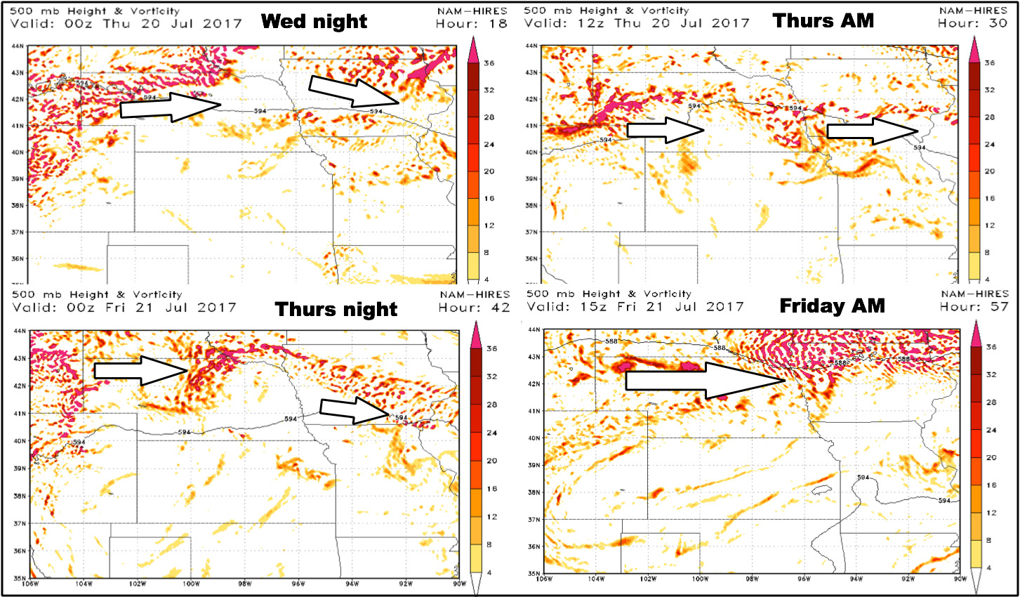
Upper-level energy guidance over the next 2 days…we discuss in high detail of where these storms move through in the video:
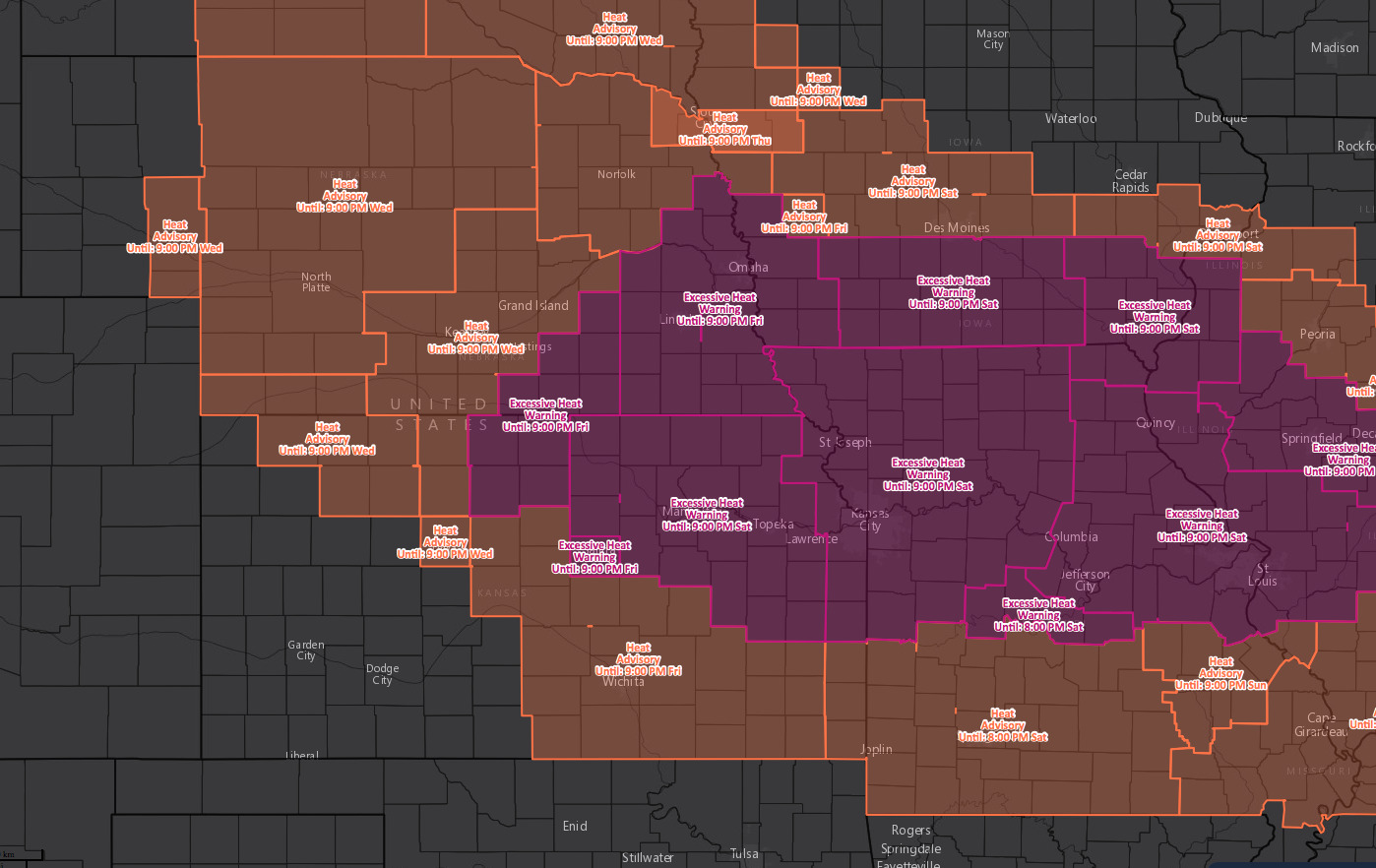
Excessive heat advisory/warning map forecasted through Saturday:
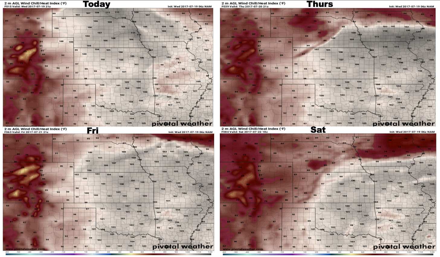
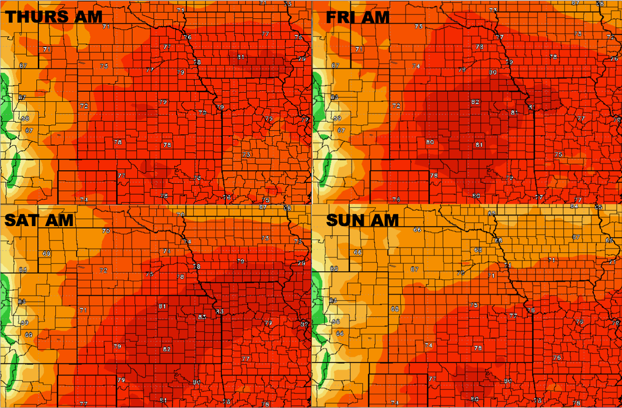
Forecasted heat indices over the next 4 days:
Temperature forecast as well through the weekend is quite warmer than normal:
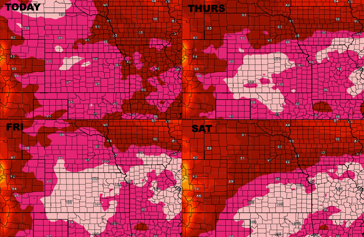
Overnight lows will be quite elevated as well, which is concerning for the crop health this time of year:
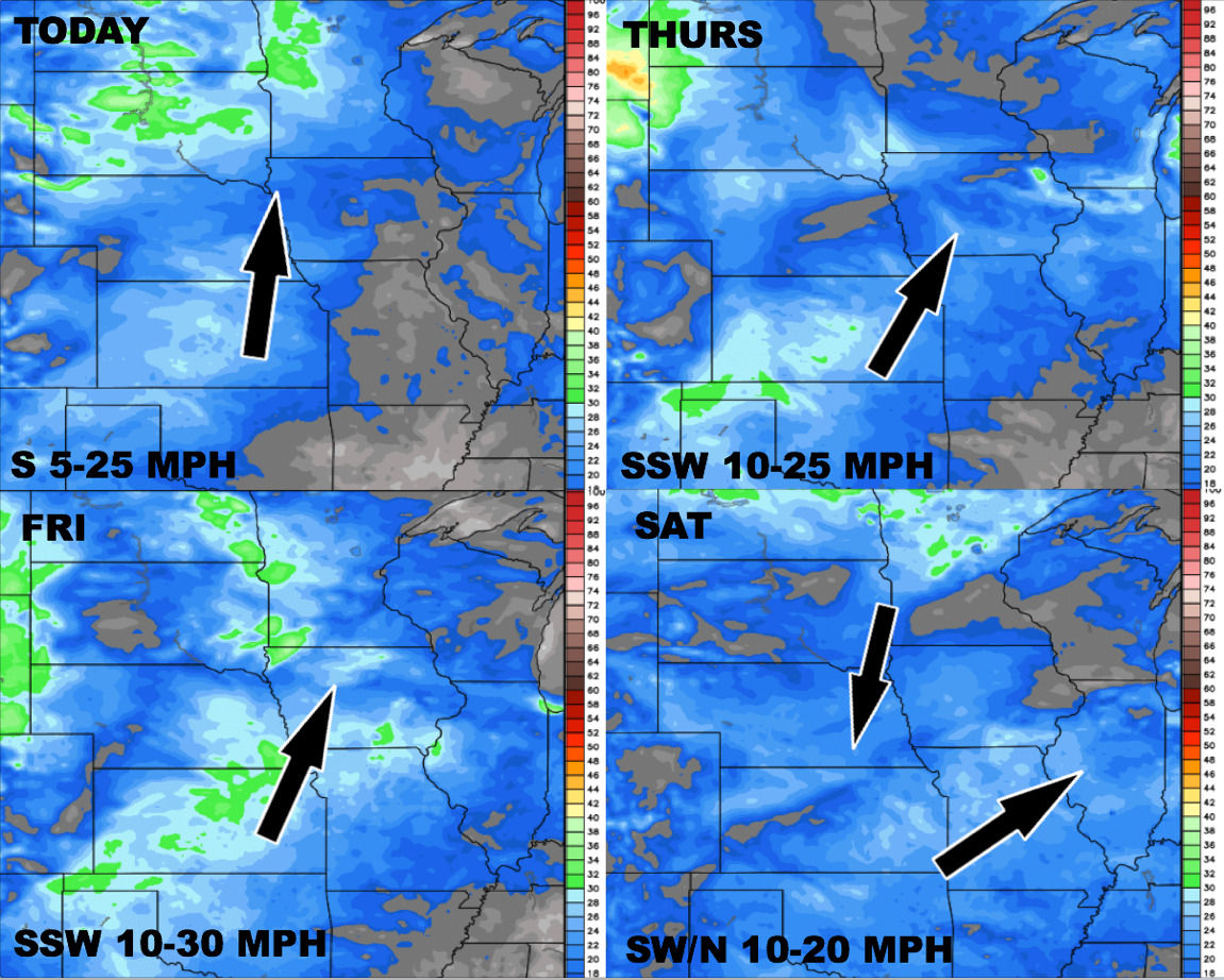
Wind forecast over the next 4 days:
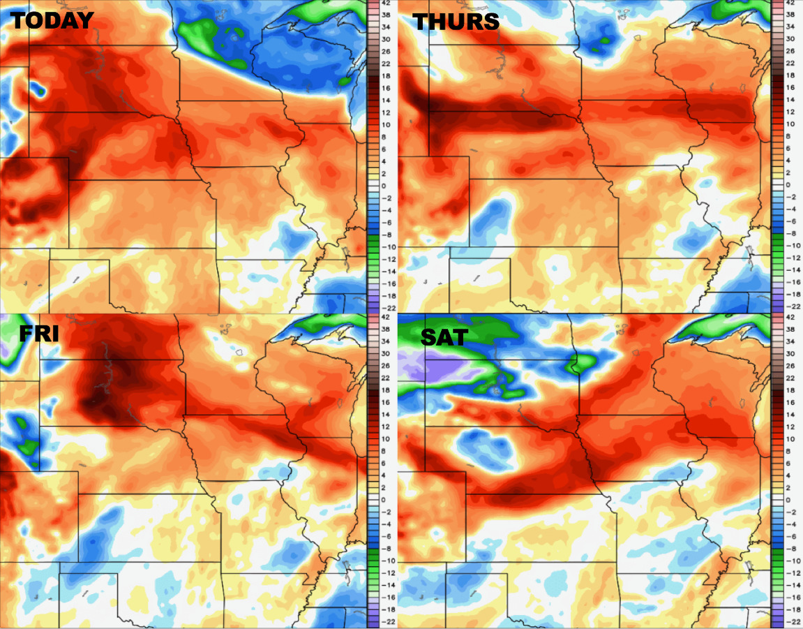
Dew points from normal:
Video (7:30 min):