Key Points – Wednesday, July 26, 2017:
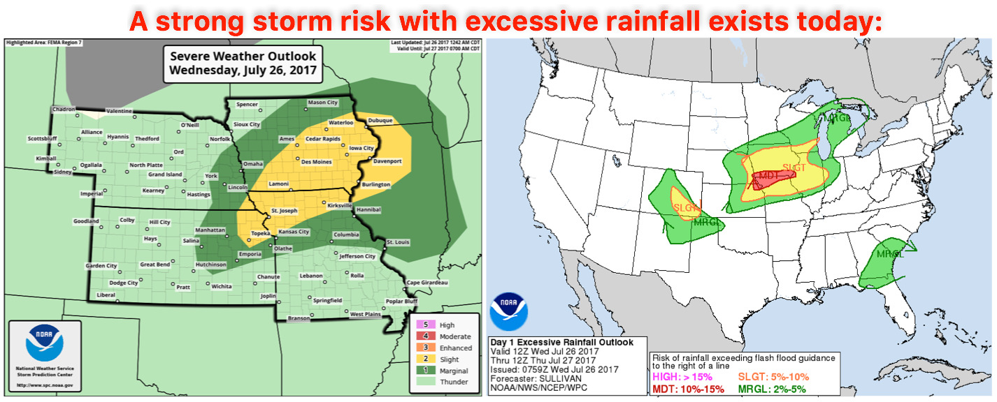
Synopsis: Good Wednesday morning! The focus of the convection is further south than our computer model guidance had this morning, which is why we have rainfall in locations like Kansas who were originally not getting in on much rainfall. Exceedingly heavy rainfall is expected today across southeast Nebraska, southern Iowa, eastern Kansas and northern Missouri…there’s actually a moderate excessive rainfall risk in these areas as well (shown below). A much cooler pattern settles in late week into the week as well into next week across the central Plains. All the details in the video, if you have any questions please let us know. Have a blessed day!
Today’s video (7 min):
Strong storms with excessive rainfall risks exists today:
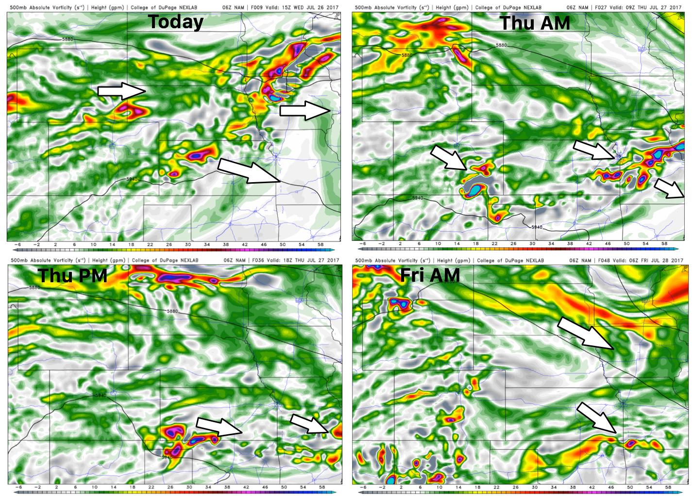
Upper-level energy forecast next 2 days…heavy rain and thunderstorms favor southern Iowa and northern Missouri today and overnight the threat pushes south and east across Missouri. Friday cold air advects in across the central Plains, ushering in much nicer weather into the weekend.
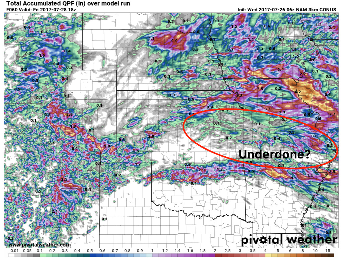
Total rainfall next 2-3 days guidance…our best guidance has the rainfall pushing south and east into Thursday, parts of eastern Kansas and Missouri are likely underdone with rainfall totals as discussed in the video…but localized 3″+ will be on the table here.
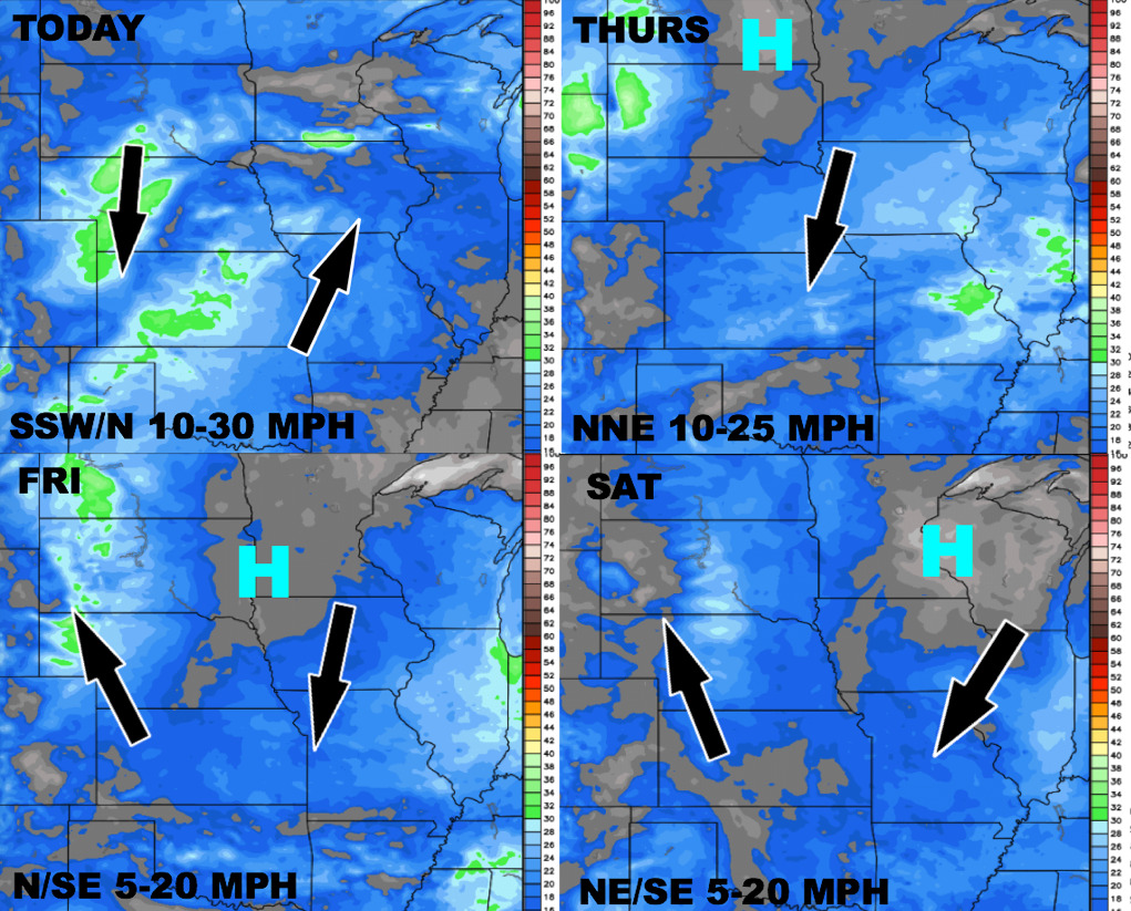
Wind forecast into the weekend:
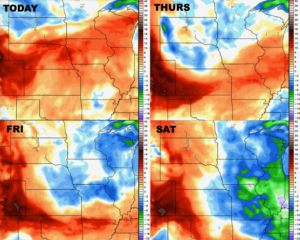
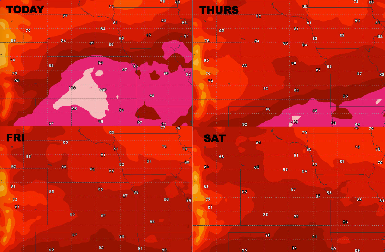
High temperatures certainly cool off as the system pushes east:
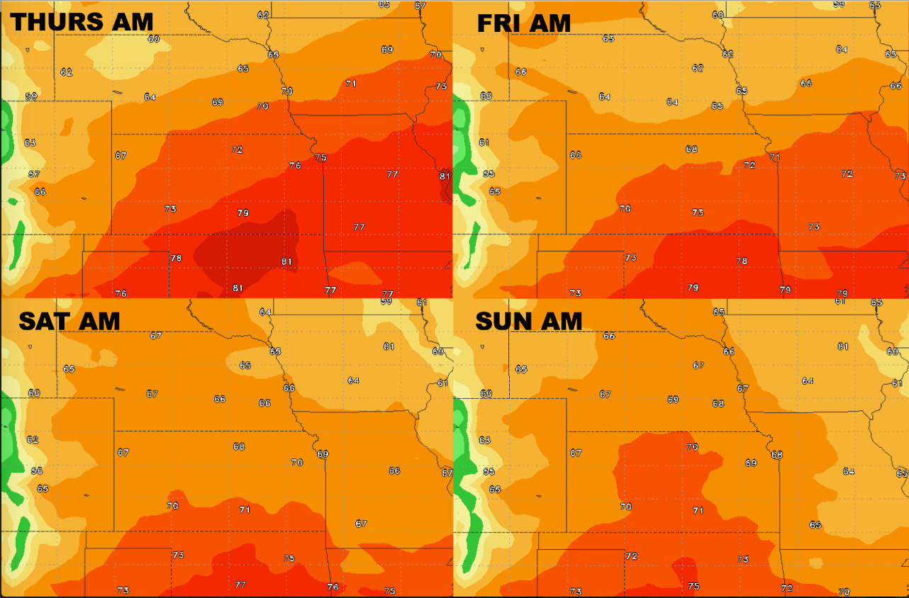
Overnight lows take a dive as well…nice relief ahead from recent warmth:
Dew points from normal over the next 4 days: