Key Points – Thursday, July 20, 2017:
Synopsis: Excessive heat risks continue over the next 4 days…we believe temperature relief is ahead into next week, but we have some serious heat still to work in and elevated overnight lows heading into the weekend. In the video we discuss the continued trend for storms to ride over the ridge into the weekend, unfortunately, areas to the south will stay drier than normal until the energy starts to sink south late weekend into early next week. If you have any questions please don’t hesitate to reach out, have a blessed day!
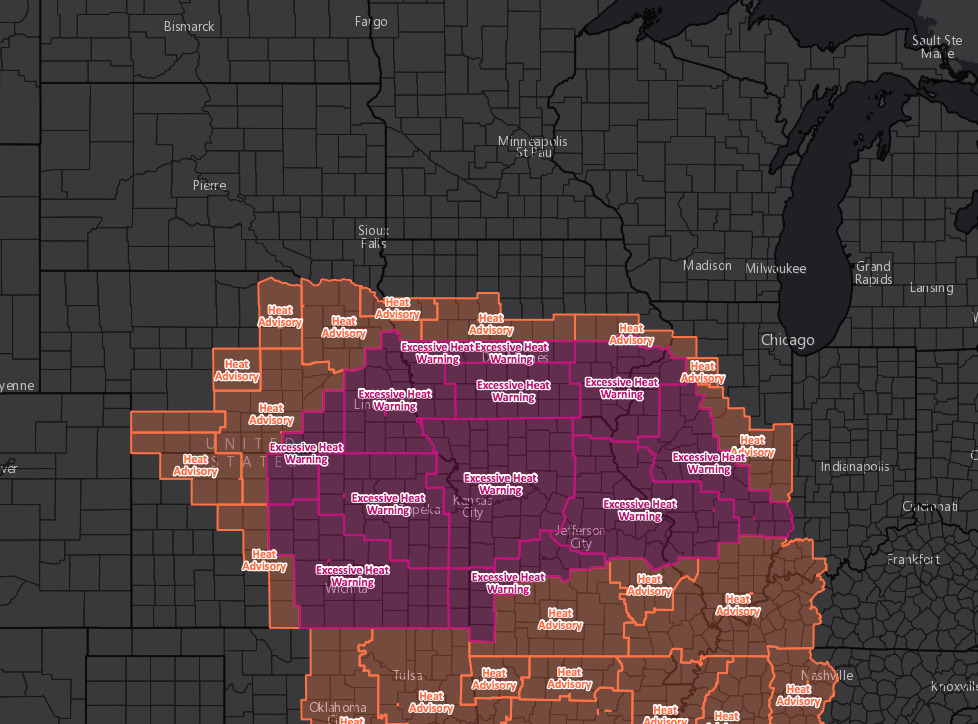
Excessive heat advisories and warnings through Saturday:
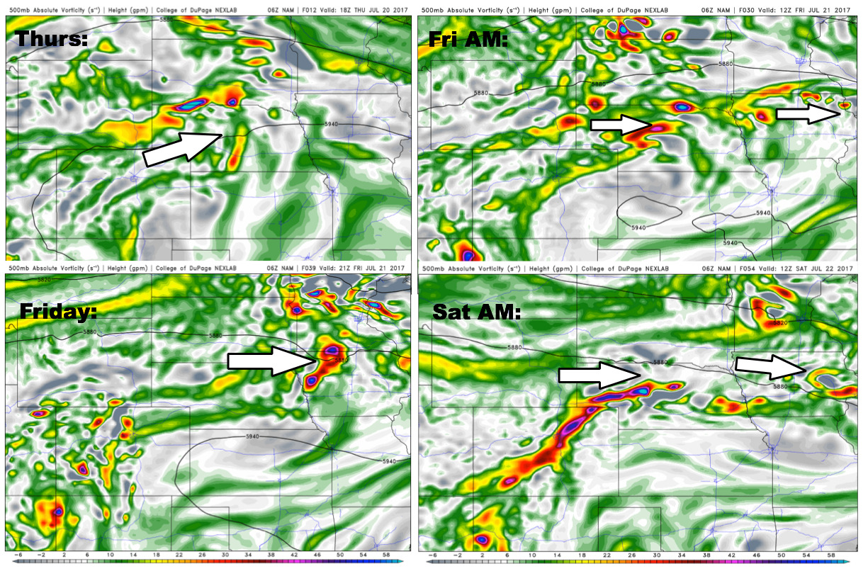
Energy forecast over the next 2-3 days…we highlight in detail rainfall coverage as well in the video…watching the energy sinking into the southern half of the central Plains later Saturday into Sunday into early next week as well.
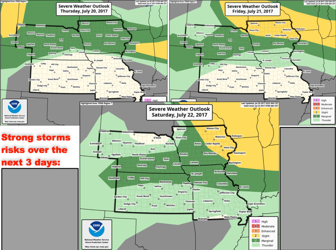
Strong storms risks next 3 days focused mainly across the northern half of the central Plains:
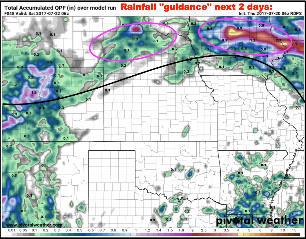
Rainfall guidance over the next 2 days…the pink circled areas are where we feel the highest focus of rainfall will be located…certainly localized higher amounts will be possible as the moisture flowing overtop of the ridge will be conducive to heavy rainfall as we’ve seen the past 3 days.
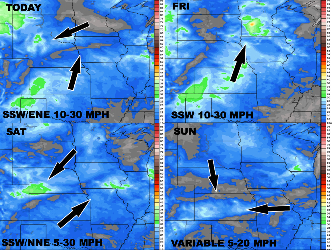
Wind forecast into early next week:
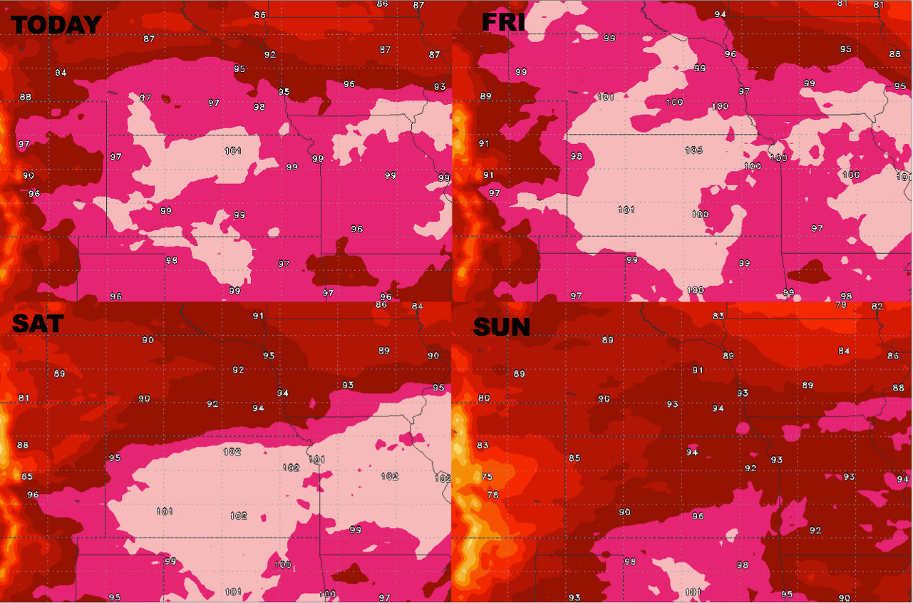
Temperature forecast for highs over the next 4 days:
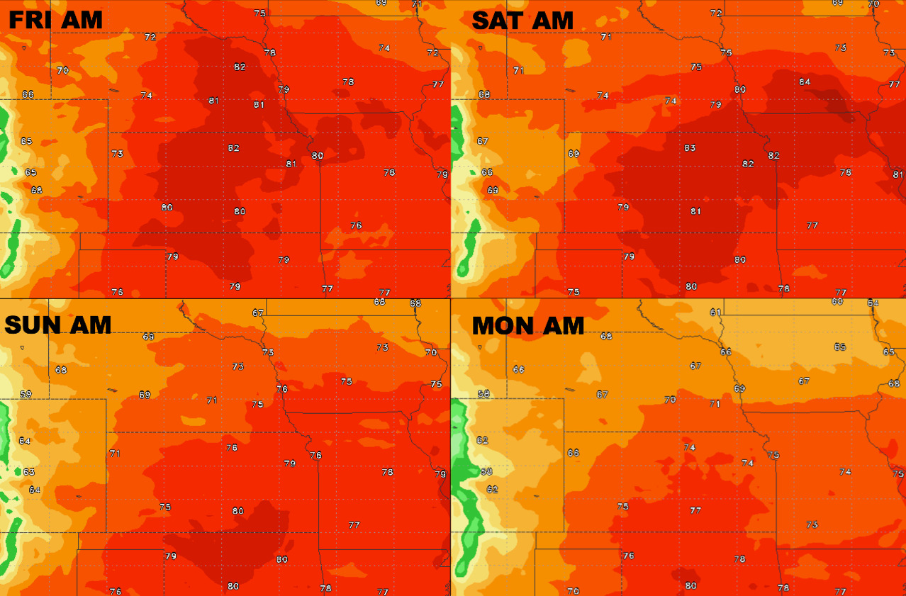
Overnight temperatures will be elevated into the weekend as well:
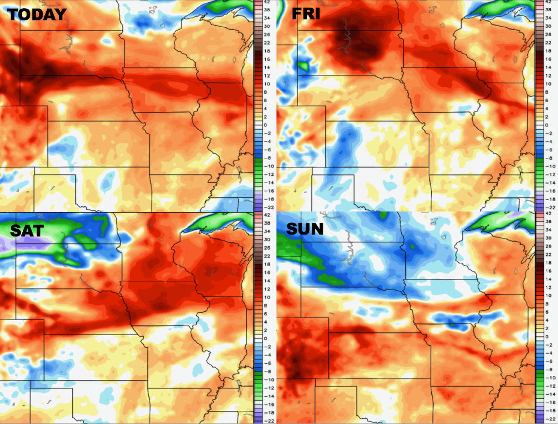
Dew points from normal into early next week:
Confidence:
- High confidence the next 4 days will hold excessive heat for many locations across the central Plains.
- Above average confidence multiple waves of moisture still possible overtop of the ridge into the weekend…areas south will stay drier.
- Increasing confidence we see a cooler pattern work in into next week across the central Plains that we have seen this week.
Video (6 min):