Key Points – Wednesday, July 12, 2017:
Synopsis: Good Wednesday morning! Today we discuss the energy continuing to move across the central Plains today into Thursday that will be responsible for additional storms, some strong, and heavy localized rainfall as well. Very warm as well, heat indices certainly topping 100º on the table today, it’ll be warm until the cold front sweeps through on Thursday and breaks the oppressive humidity as well. If you have any questions please don’t hesitate to reach out, have a blessed day!
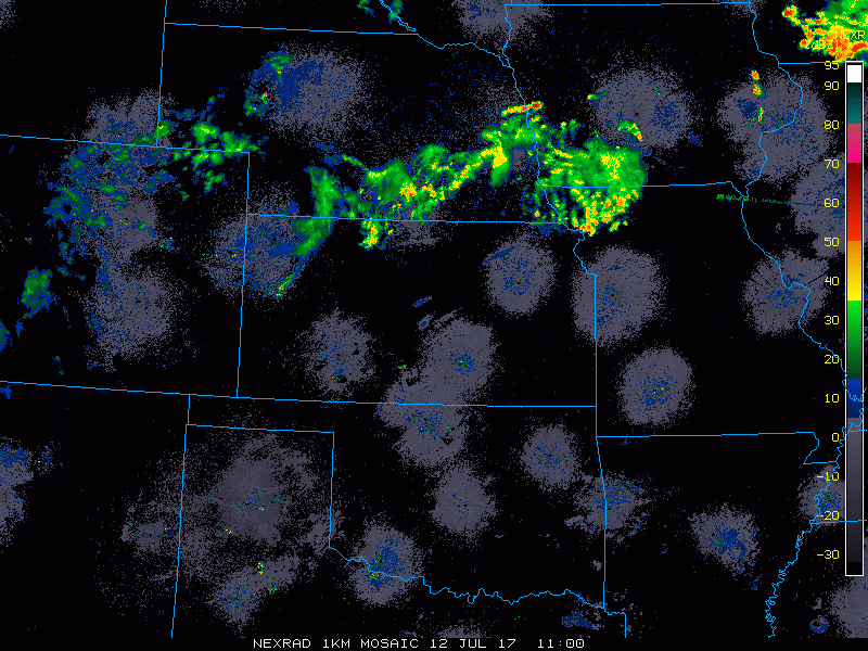
Current Radar:
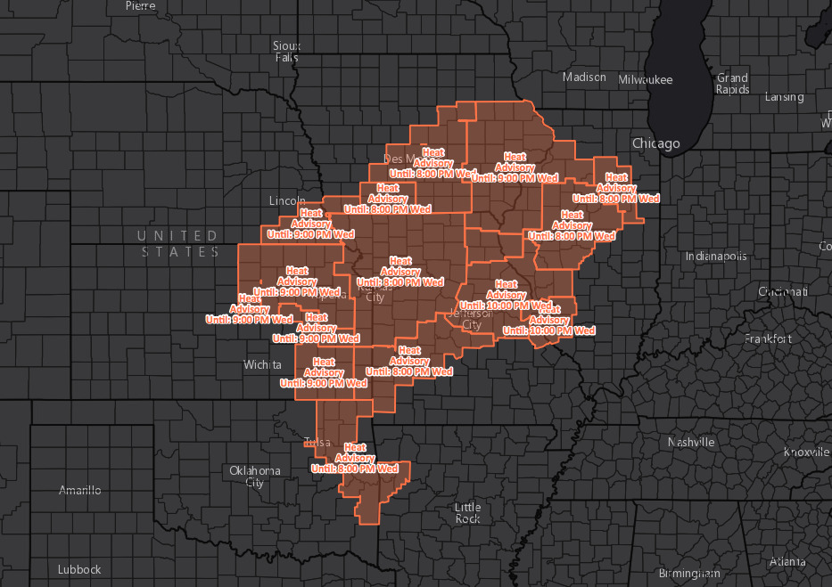
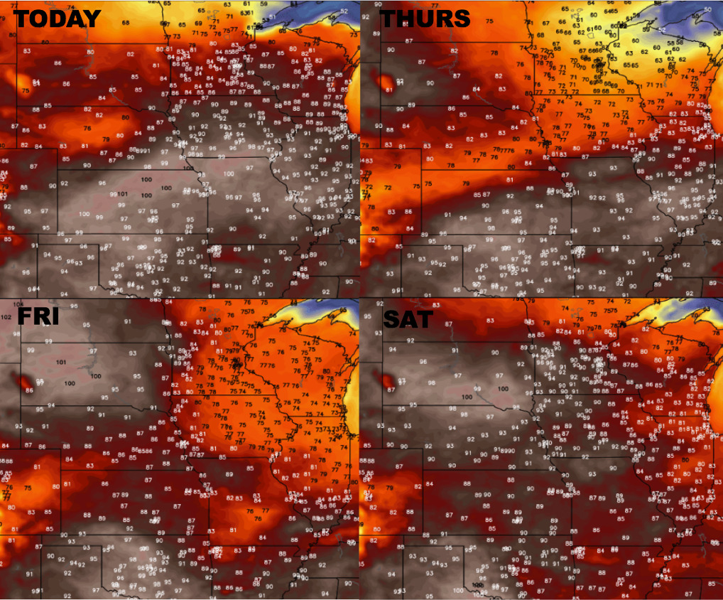
Heat advisory issued this morning throughout the day for excessive heat indices near or over 100ºF.
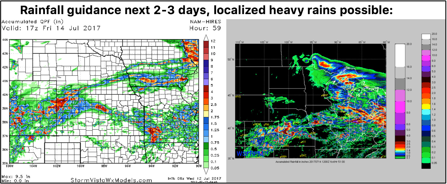
Strong storm risk today focused mainly across eastern Nebraska into Iowa…a good portion of Iowa is under a slight risk for excessive rainfall as well today meaning flash flooding can’t be ruled out.
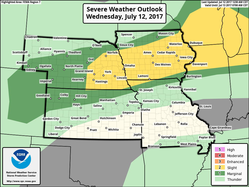
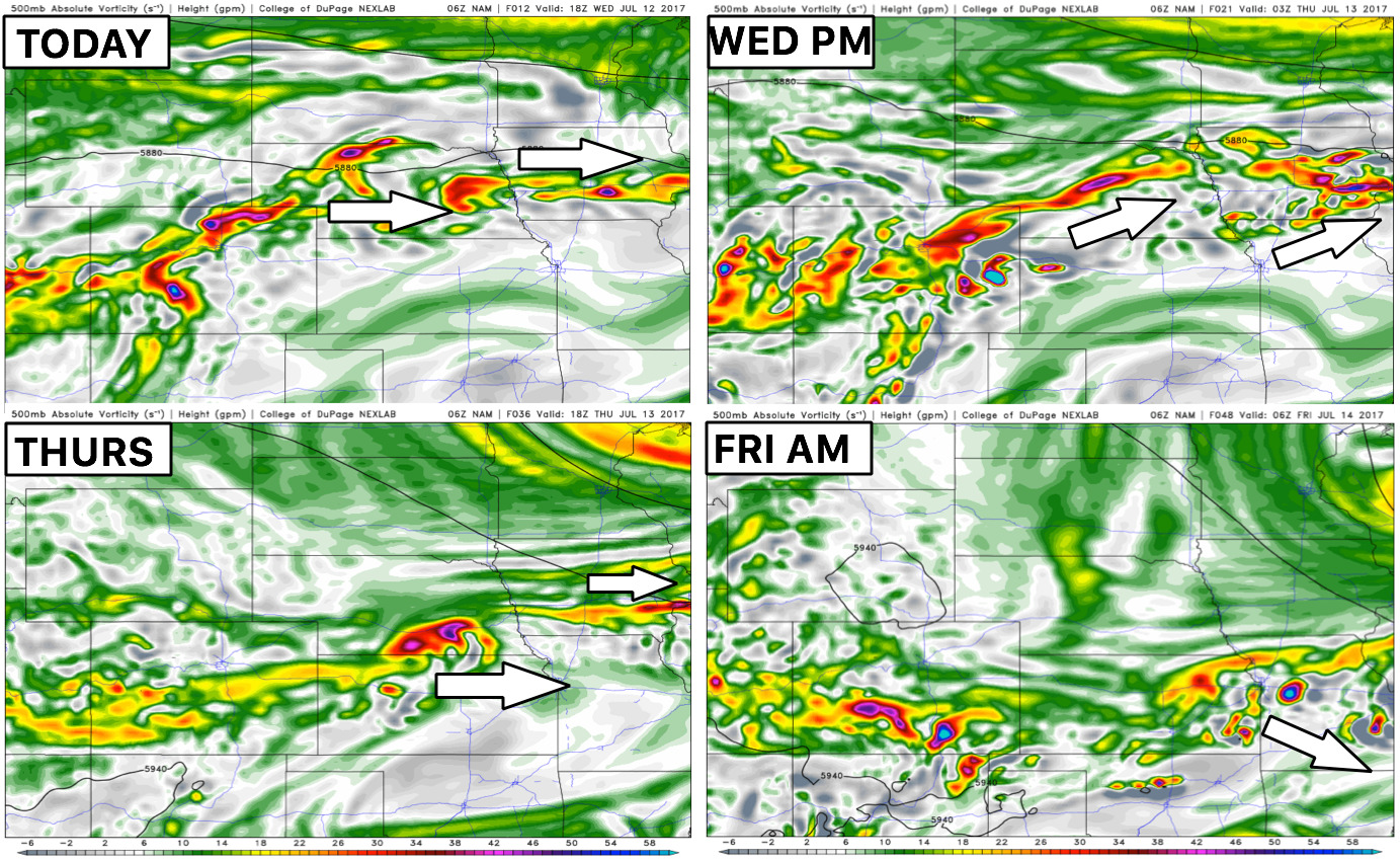
Here’s where the energy will be focused over the next 2 days:
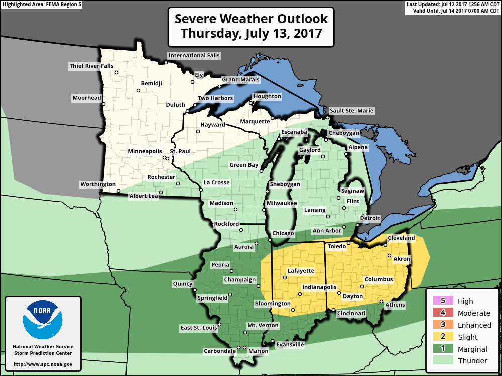
Strong storm risk on Thursday into Friday morning shifts south across mainly Kansas and Missouri as the front sags south…some localized heavy rainfall will be possible here as well.
Today rainfall next 60 hours guidance from our 2 best hi-resolution models in this pattern right now…heavy localized rainfall on the table here across the central Plains…not everyone gets in on these, but certainly not everyone will be dry. Can’t rule out 1-3″ with 4″+ in isolated areas on the table once again.
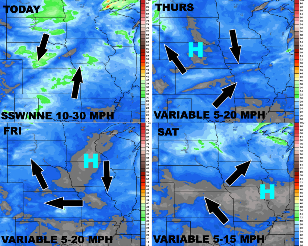
Wind forecast next 4 days into early weekend:
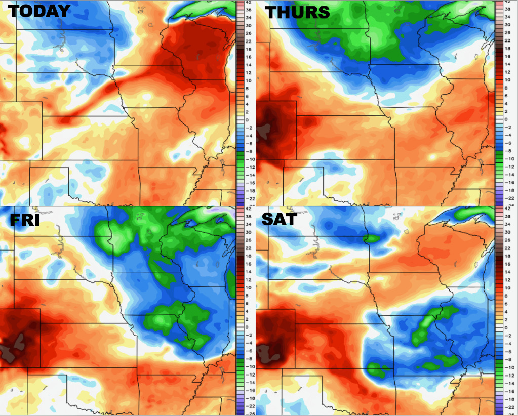
Temperature forecast into the weekend and well:
Dew point from normal forecast:
Confidence:
- Above average confidence more showers and storms move east across parts of the central Plains today, some being strong to heavy.
- Average confidence additional showers and storms push further south across more of Kansas and Missouri on Thursday as the cold front pushes south and east.
- Average confidence localized 3″+ certainly on the table in some locations over the next 2 days.
- Above average confidence we are very warm over the next day and half before getting knocked down by a cold front later on Thursday.
Video (6 min):