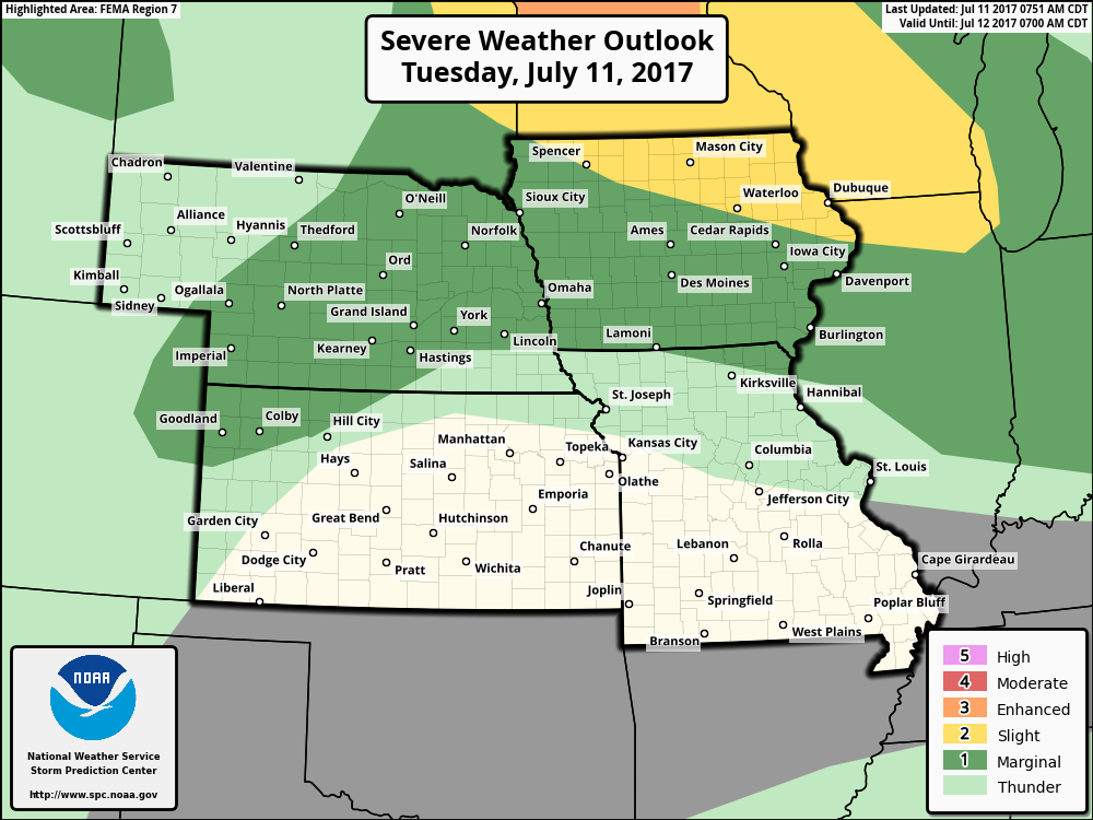
Key Points – Tuesday, July 11, 2017:
Synopsis: Good Tuesday morning! In today’s video we discuss the constant flow of energy moving across the central Plains through Friday with localized heavy rainfall and strong storms on the table. Model rainfall forecasts are doing better than yesterday, but with all of this energy moving through it’s certainly underdone once again. We stay humid and very warm through mid-week until a front sweeps through and knocks down the warmth Thursday into Friday. Have a blessed day!
Current Radar:
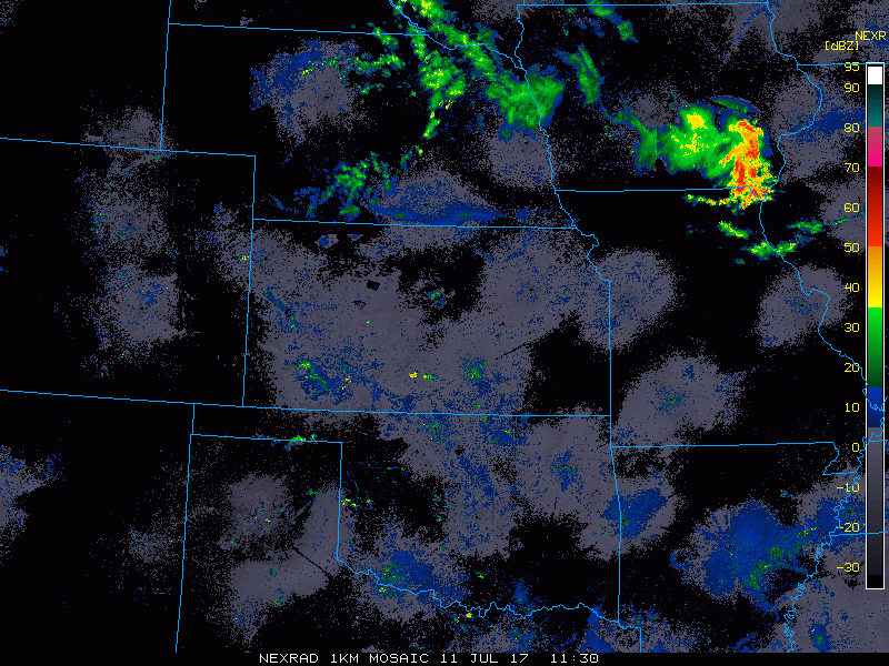
In this northwest flow pattern, it’s better to show you where the energy is than a model simulated radar because often times, like yesterday, it’s wrong. In the video we discuss the details, here’s where the energy is focused over the next 2 days below. Focus is mainly across Nebraska and Iowa and far northwest Kansas through Thursday morning.
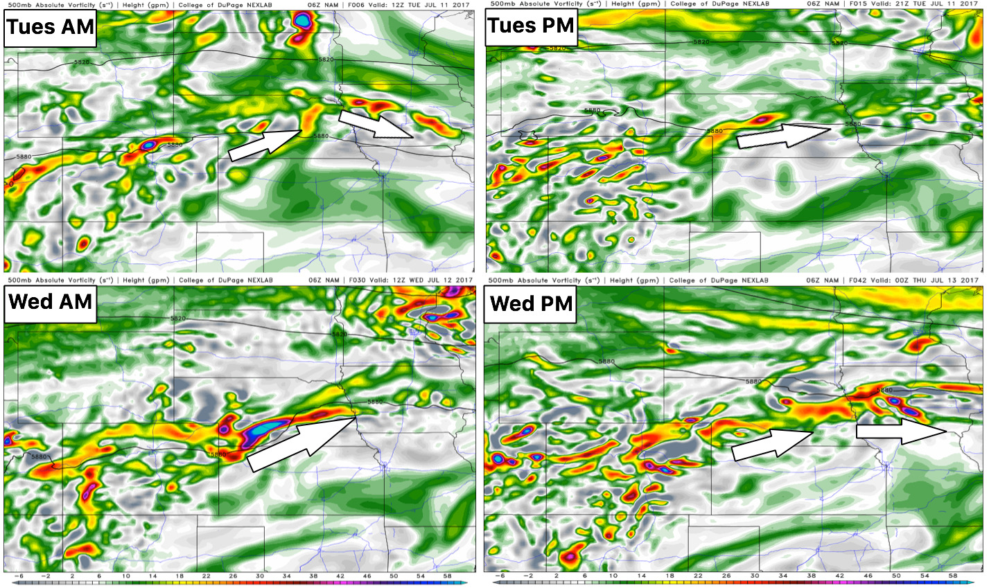
Strong storm risk area guidance for today…main focus will be across Nebraska and Iowa:
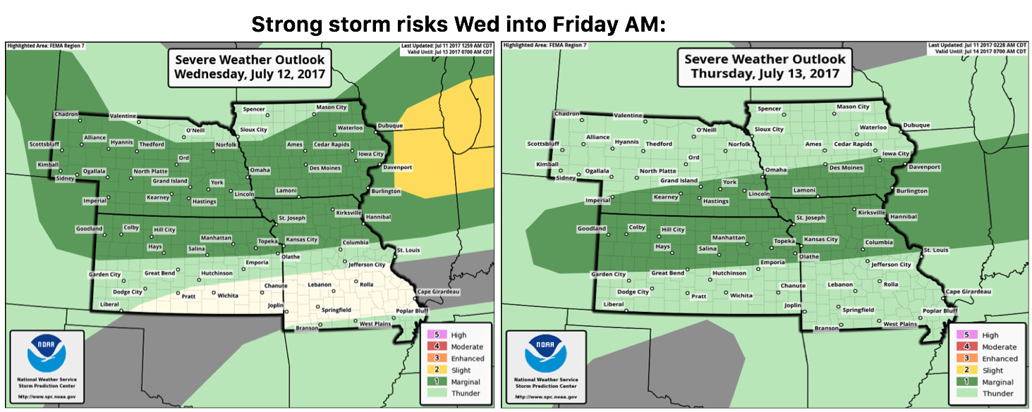
Working more into Thursday morning into the evening the energy will start off across the Nebraska and Iowa and then shifts off to Kansas and parts of Missouri on Friday.
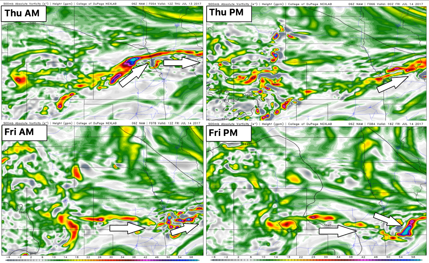
Strong storm risks on Wednesday into Friday morning:
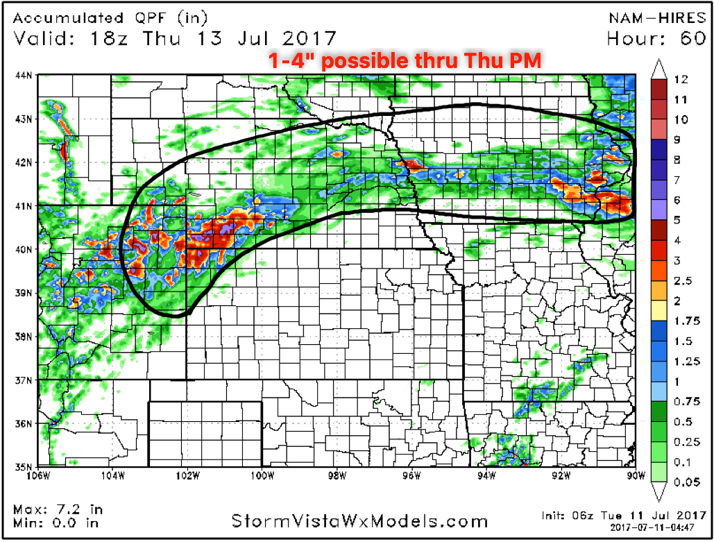
Rainfall guidance over the next 60 hours…as mentioned above the actual model is likely slightly underdone in the area circled below.
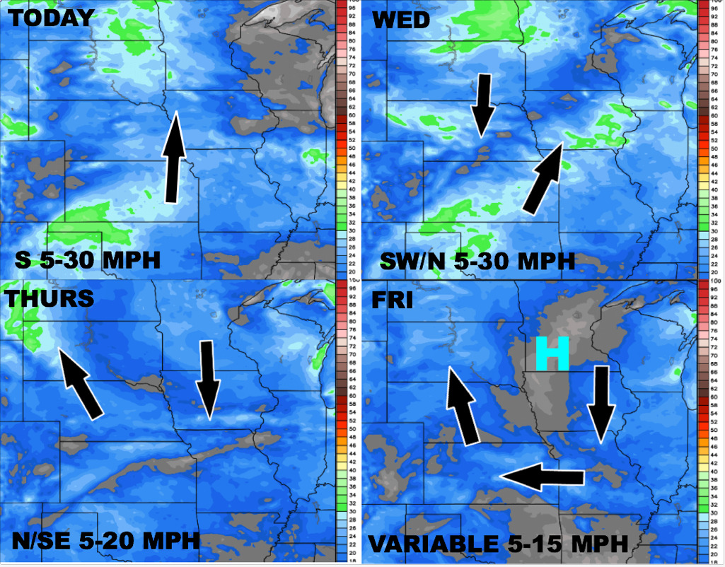
Today’s wind forecast over the next 4 days through late week:
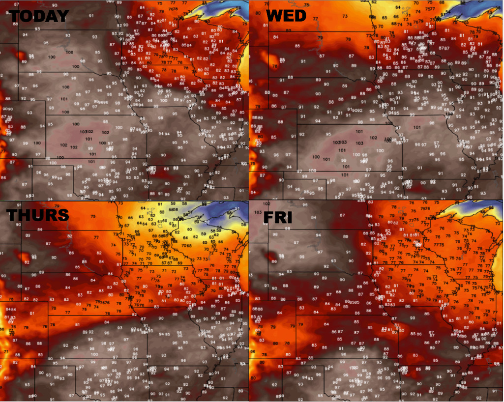
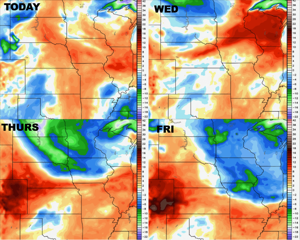
Temperature forecast through Friday shows the elevated heat before getting knocked down a bit on Thursday/Friday as a front sweeps east:
Dew points from normal forecast over the next 4 days as well shows the muggy conditions persisting through Thursday/Friday when the front knocks down the humidity in the eastern parts of the Zone:
Confidence:
- Above average confidence additional showers and storms will work across Nebraska and Iowa today into Thursday, some being heavy and strong in nature.
- Average confidence more storms will be focused shifting across the southern half of the zone later on Thursday into Friday, again, some heavy/strong storms possible.
- High confidence we are very warm through Thursday across the central Plains before a front sweeps through and knocks down the heat and humidity.
Video (6 min):