Key Points – Tuesday, May 16, 2017:
Synopsis: Good Tuesday morning! Absolutely packed forecast today, everything is on the table from damaging winds, large hail, isolated tornadoes and excessive rainfall tonight into Wednesday morning. Additional heavy rainfall possible late week into the weekend, as well as a cooler than normal pattern that looms into week 2. If you have any questions please don’t hesitate to reach out.
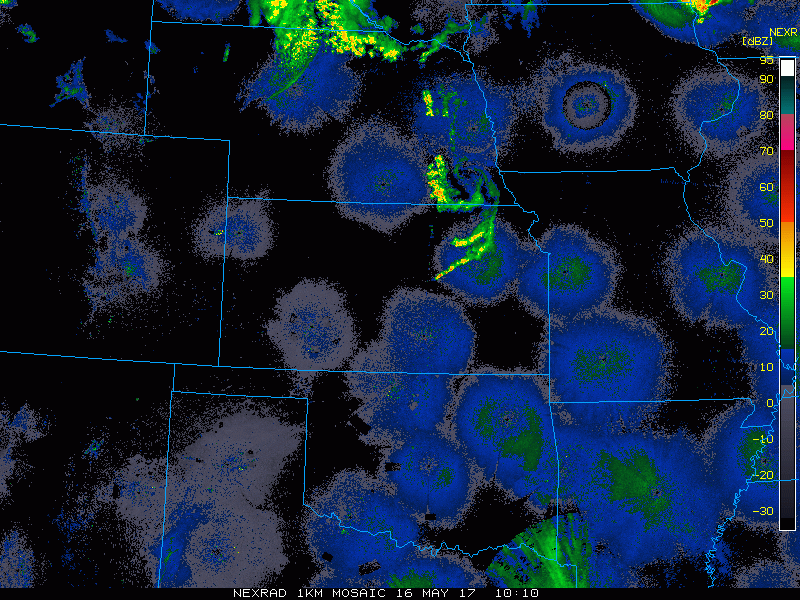
Current Radar:
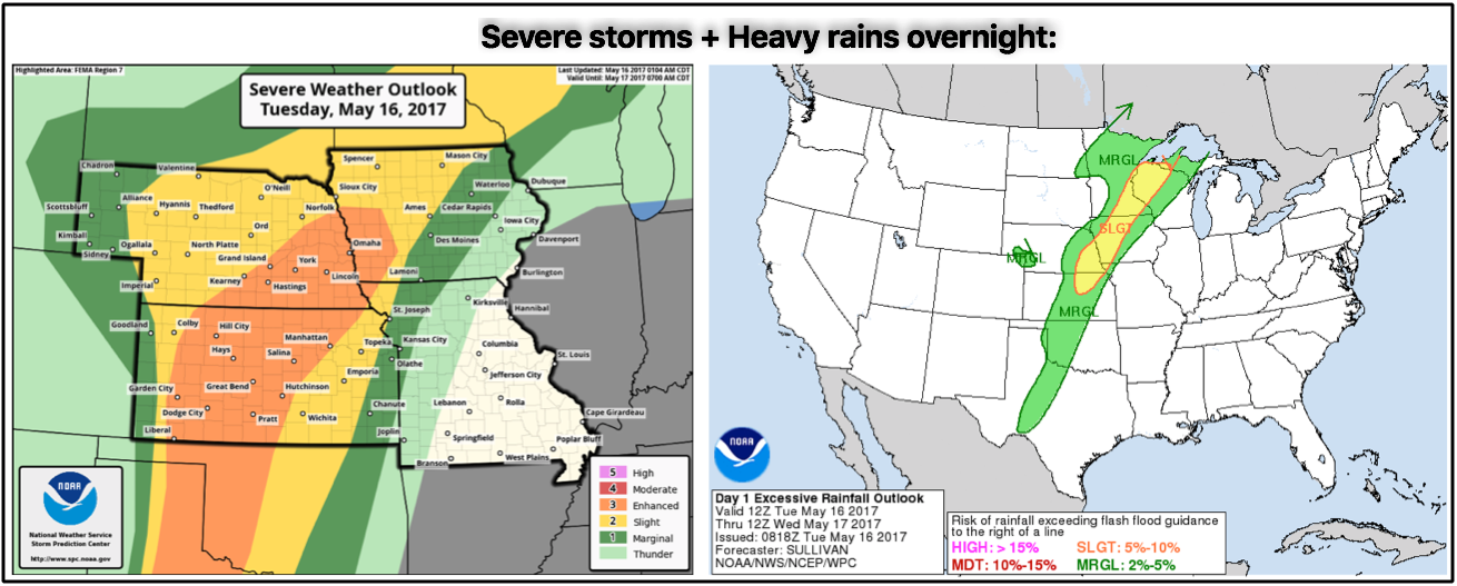
Severe storms with the threat of damaging winds, large hail and tornadoes will be possible tonight into Wednesday morning, along with the threat for very heavy rainfall and flash flooding. We go into the “why” behind these threats in the video.
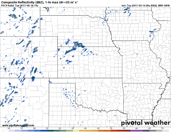
Simulated radar…expecting things to really get going across Kansas and Nebraska ~6-7pm and then continue into Iowa and NW Missouri later tonight into Wednesday morning.
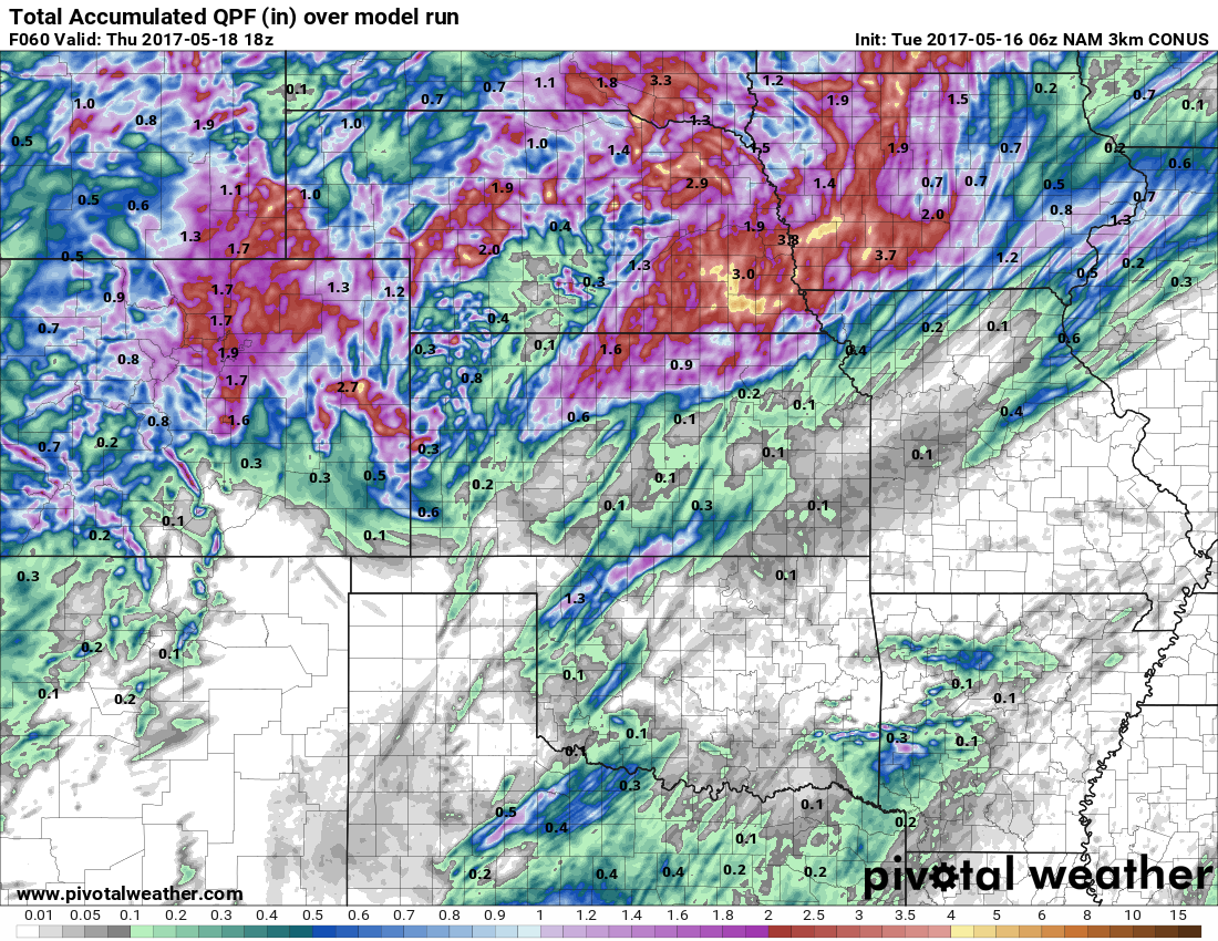
I think the latest 3km-NAM has a good handle on where the heaviest rainfall of 2″+ will fall across eastern Nebraska, western Iowa, northern Kansas into NW Missouri. Wouldn’t be shocked to see isolated 3-4″ amounts here as well.
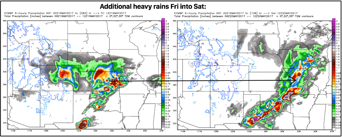
Additionally heavy rains will be possible Friday into Saturday as well from west to east across the central Plains:
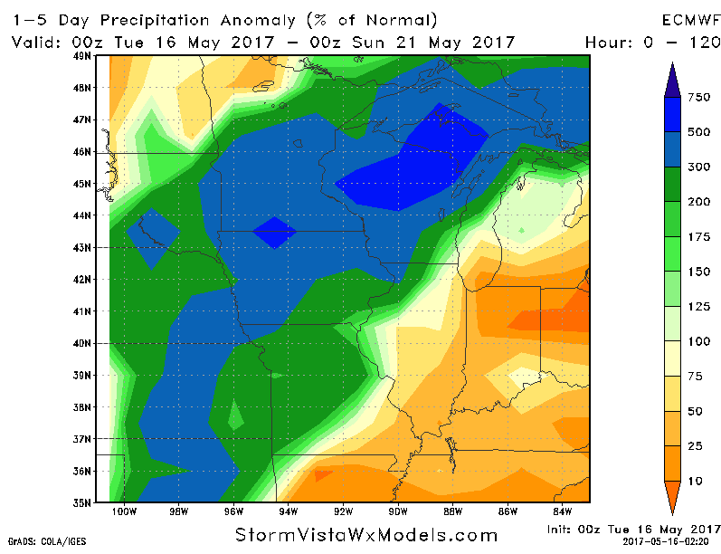
Percent normal rainfall next 5 days is very high…I don’t think it’s out of the question to see some spots at 300%+ with multiple inches of rain through the weekend.
Confidence and Risk:
- Above average confidence showers and storms increase tonight into Wednesday morning.
- Average risk for very heavy rainfall and severe storms overnight across parts of the central Plains as well.
- Overall confidence is average for spots seeing 200%+ the normal rainfall next 5 days.
Today’s video (7 min):