Key Points – Thursday, July 6, 2017:
Synopsis: Good Thursday morning! Today we discuss the active rains across the central Plains today into Friday, some being strong to severe. Overall coverage expected to be slightly less into the weekend but coverage, especially the further east your location, expands into next week under northwest flow. We turn up the furnace as well across Zone 8 locations getting into next week as discussed in the video…locations further west, unfortunately, stay drier as well missing out on the flow of moisture over the ridge. If you have any questions please don’t hesitate to reach out, have a blessed day!
Strong storms possible later today into tonight mainly across Iowa and Nebraska…could see some stronger storms across western Kansas later tonight as well:
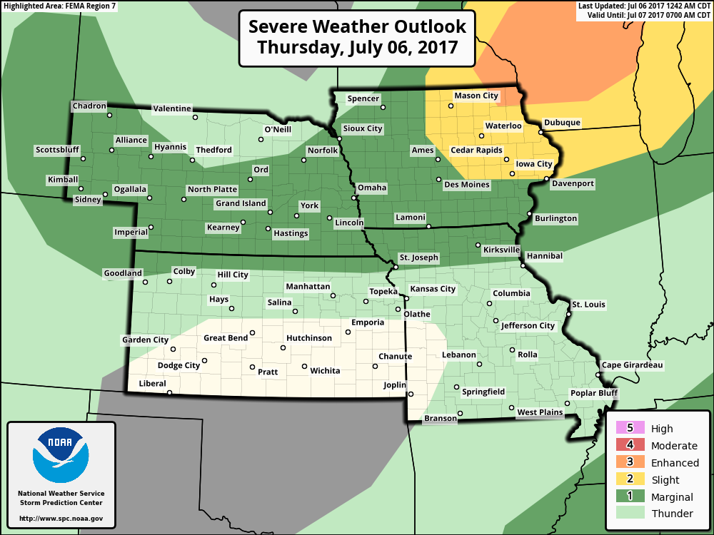
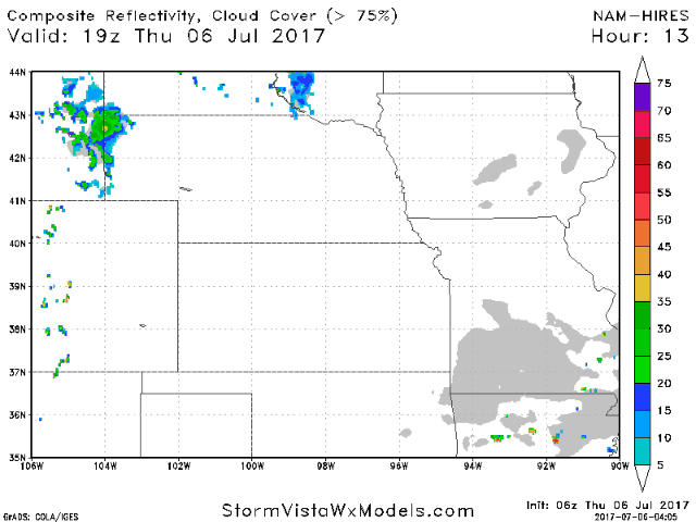
Simulated radar guidance through today into Friday morning shows a cluster of storms moving east across Iowa as well across the western half of Nebraska and Kansas.
Thinking some strong storms will also be possible across western zone locations on Friday:
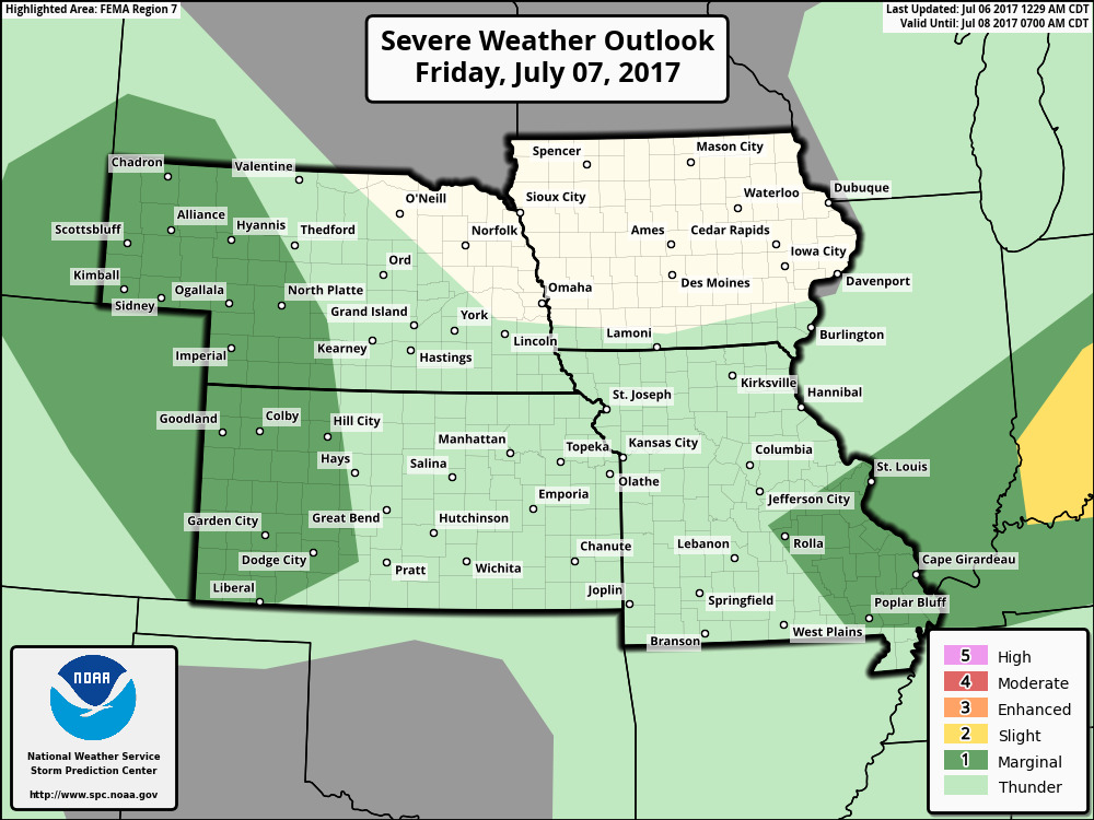
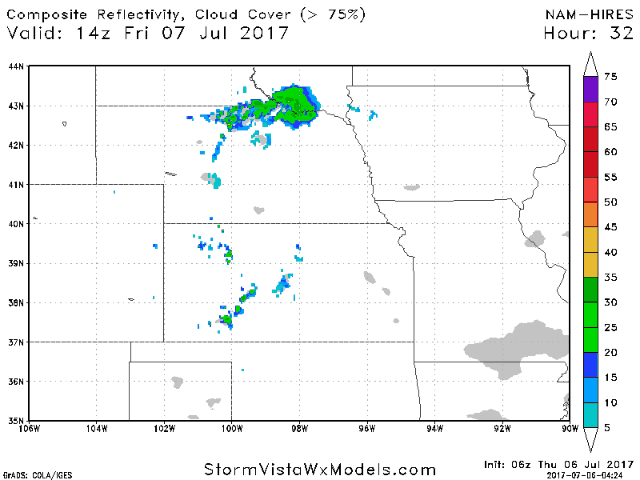
Wouldn’t be shocked to see some residual showers hanging around Friday across Nebraska, western Iowa and Kansas as well as far NW Missouri. Getting into late Friday night into Saturday morning we need to watch for an additional round of storms, some strong, across western Kansas and Nebraska.
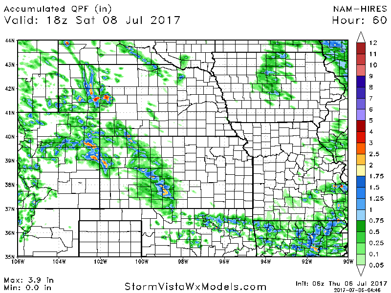
Latest thoughts on total rainfall over the next 60 hours…likely underdone in spots especially across Iowa and the western Zone locations who could certainly see localized 1-3″+.
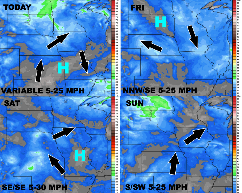
Wind forecast through Sunday:
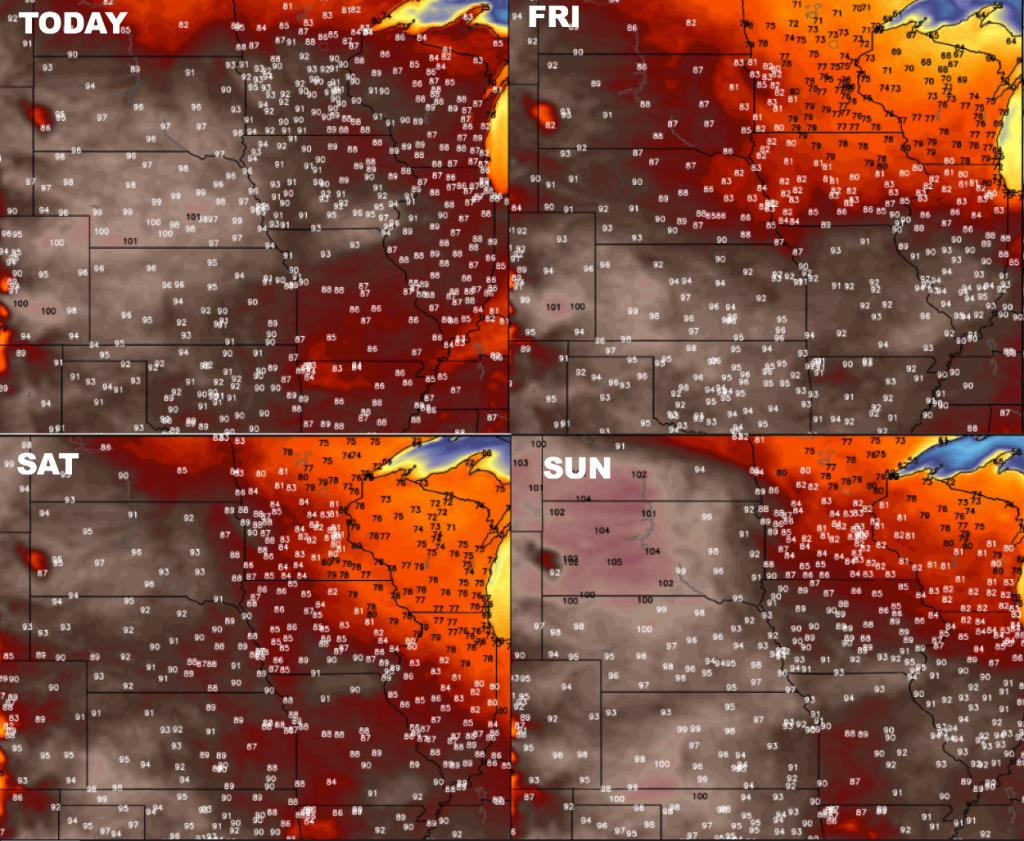
Temperatures through Sunday…going to be overall very warm by late weekend.
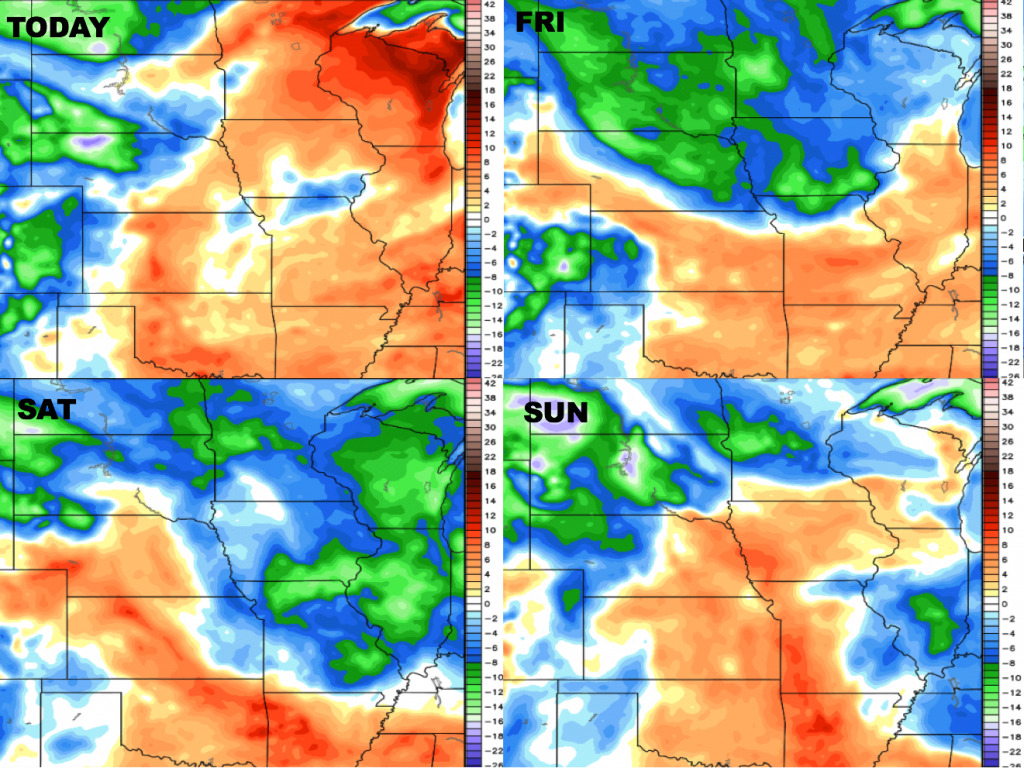
Here are the dew points from normal through Sunday. Most areas will stay rather humid, with drier air advecting into northwest Nebraska. Much drier air will settle south heading into Friday and Saturday, with more humid air returning on Sunday.
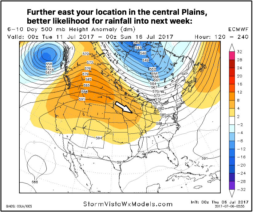
Getting into late weekend into next week we continue to see a classic northwest flow set up shop across parts of the central plains, especially locations situated further east. Unfortunately, locations further west in this type of flow will remain warm and drier.
Video (8 min):