Key Points – Monday, April 10, 2017
Synopsis: Good Monday morning, we hope you all had a wonderful weekend! A few showers on-going across pushing east across southeast IA into Missouri this morning, as well as showers across northern Nebraska wrapping around the low pressure that will continue throughout the day. High pressure continues into early week, we will even see some sunshine working in today into Tuesday. Additional shower and storm chances increase later Wednesday into late week and into the weekend…will be difficult to find a dry window beyond the next few days to get out into the field. Overall the next week is warmer than normal on average, however getting into week 2 some cooler risks arise especially for the northern Zone locations. Have a great week!
Current Radar:
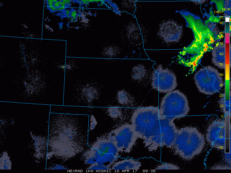
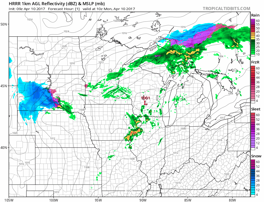
Simulated radar today some showers and clouds possible across northern Nebraska into northern Iowa today, otherwise sunshine is expected across the southern half of the Zone with temps getting into the 60s/70s here as well…cooler to the north with highs staying in the 40s and 50s where those clouds and showers hang around.
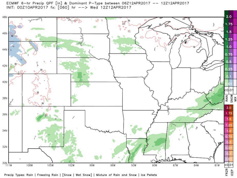
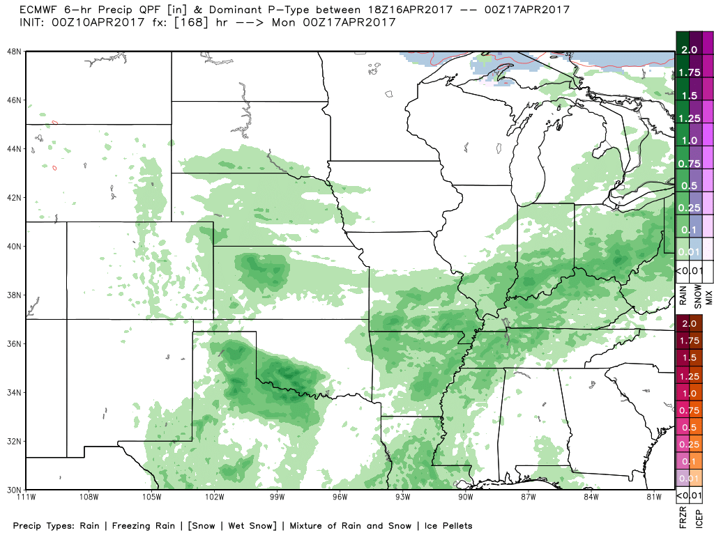
High pressure keeps things dry on Tuesday into the first half of Wednesday, before our next chance for showers and storms coming Wednesday afternoon across Nebraska and western Kansas heading east into Iowa by the evening hours. A warm front lifts into the area by Thursday bringing additional showers and storms to Zone.
Showers and some storms move off to the east into Friday and Saturday across eastern NE/KS and more-so into northern MO into Iowa by Saturday, will be difficult to find that dry window long enough to get into fields late week into the weekend.
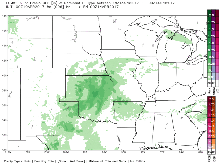
And again, another system moves in late weekend into early weekend…the theme here we want you to take away is how difficult it’s going to be a to find a dry window over the next week.
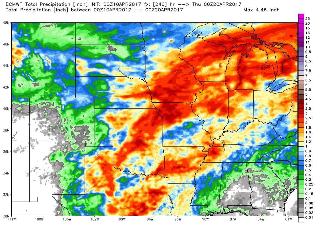
Rainfall totals over the next 10 days from the European…possibly 3″+ possible from eastern NE/KS through northern MO into most of Iowa…not the type of weather pattern we need to dry out and start planting preparations.
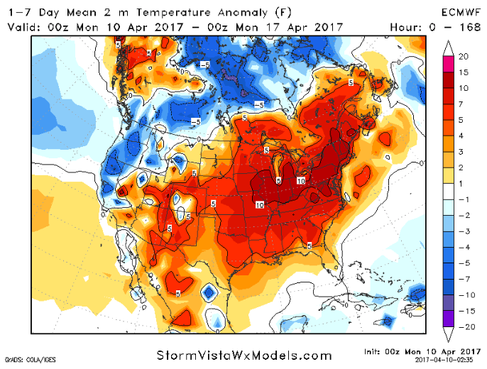
Overall the next week temperatures will be above normal…by late week/early weekend we should be back into the 70s even 80s even!
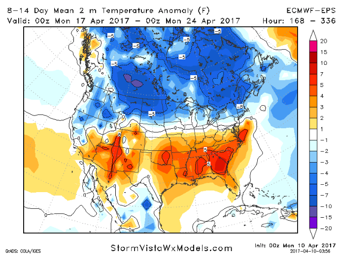
However, colder risks return getting into the week 2 forecast for extreme northern Nebraska into northern Iowa…if you can’t get out into the fields over the next few days, more planting problems will ensue.
Confidence and Risk:
- Above average confidence scattered showers possible across northern Nebraska into northern Iowa today into tonight.
- High confidence we are overall above normal in the temperature department this week.
- Above average confidence numerous shower and storm chances arise mid-week beyond into the weekend…will be difficult to find a prolonged dry window this week.
- Above average risk for cooler than normal anomalies getting into week 2 especially the far northern Zone locations.
Today’s video (time):