Key Points – Friday, June 23, 2017:
Synopsis: Good Friday morning! Seeing heavy rain across northwestern Kansas today, as we go throughout today expecting the showers and storms to continue south and east before weakening later this evening. Overall a nice weekend sets up shot, however expecting additional rains later Sunday evening into Monday as well as multiple storm chances getting into next week; the active pattern continues here throughout the central Plains as we start to experience more “northwest flow”…all the details in the video. Have a blessed weekend!
Current Radar:

Simulated Radar…more widespread rains possible across southern Nebraska today, weakening by early afternoon. By 5-6pm this evening we turn rather dry with “popcorn” scattered showers across Iowa today into tonight.
Rainfall totals…models REALLY struggling with how much rainfall is possible here…we’ve noted below an area where we think 0.5-1.0″ will be possible over the next 24 hours:
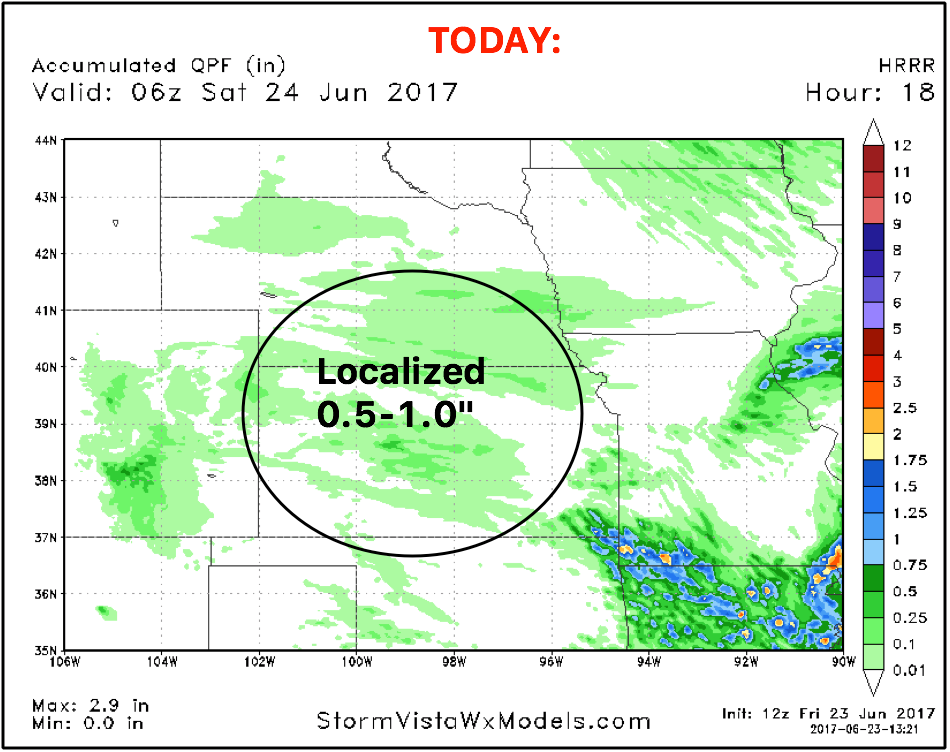
Looking into Saturday and through the weekend…expecting a nice day here with very light showers across Iowa, north Kansas and Nebraska…~10-20% coverage at best. Sunday evening into Monday we see a nice little disturbance from northwest to southeast with ~50% coverage.
Glance at the winds over the next 4 days:
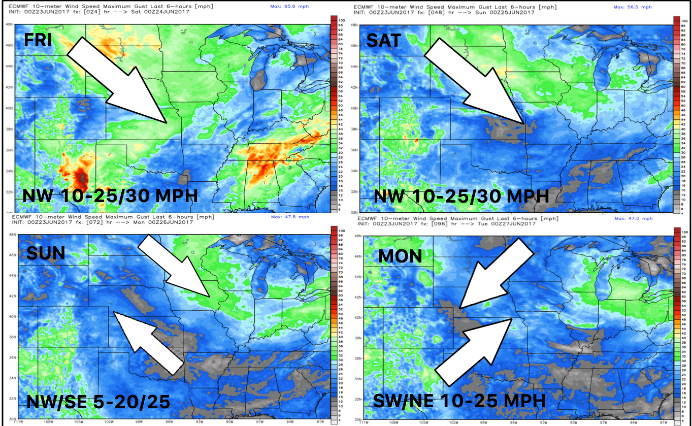
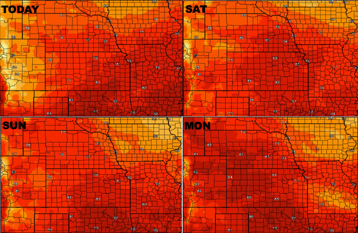
Here’s how temps are shaping up into early next week:
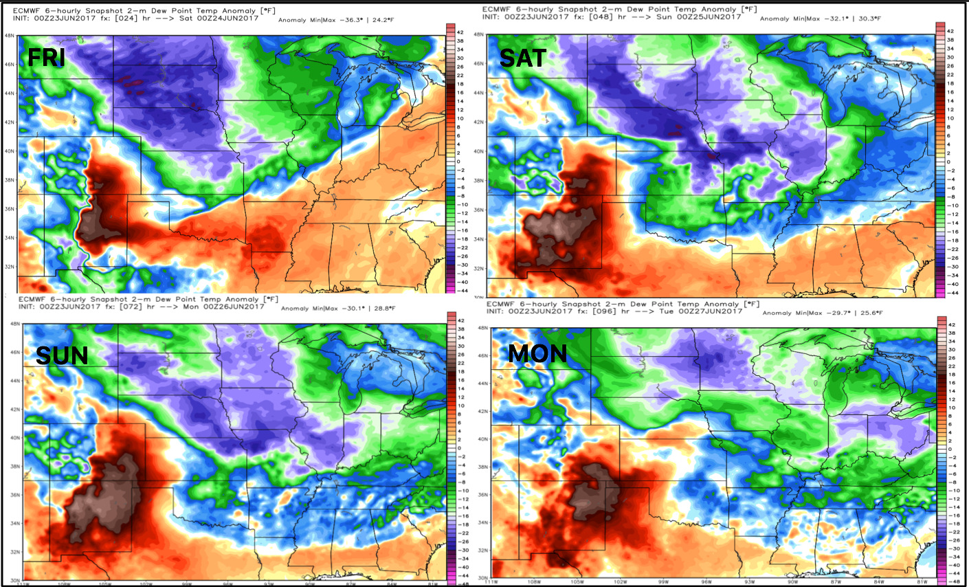
Looking at dew point anomalies tells us that much more comfortable air is settling in into early next week as well. With that being said, we can’t rule out some localized dew formation here into early next week as the overnight lows really take a dive over areas that have received rainfall.
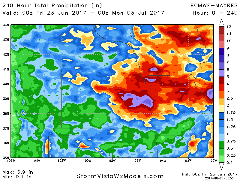
Total rain next 10 days using guidance…as you can see here we stay very active across many locations seeing potential for 2″+,, however, there will be spots especially further west across Nebraska/Kansas that may see lower totals missing out on the flow.
Confidence:
- Above average confidence showers and storms continue east and south throughout the day before weakening this evening.
- Above average confidence the weekend stays overall nice, expecting more scattered showers late Sunday evening into Monday.
- Average confidence we stay continued active into next week across the central Plains as we experience more northwest flow.
Video (7 min):