Key Points – Tuesday, June 20, 2017:
Synopsis: Good Tuesday morning! Today we discuss the storm threats, some being strong, over the next 3 days across the central Plains. It should be noted that not everyone gets in on the rains here once again, but isolated heavy rainfall will be possible in localized spots as discussed below. We stay warm over the next 2-3 days before a front crashes through on Friday, knocking down temperatures starting the cooler pattern that we’ve been mentioning for quite some time now. Have a blessed day!
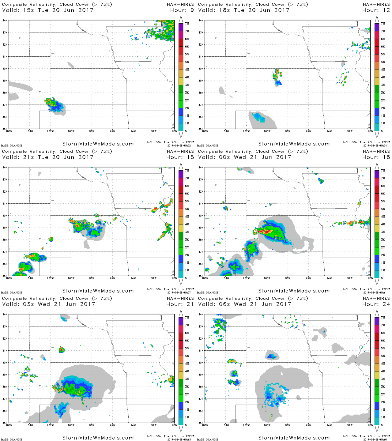
Watching ~2-3pm across northern Kansas for storms to pop moving south and west through the evening…isolated storms across northern Missouri possible as well ~20-30%. Can’t rule out a strong storm risk across western Kansas today as well.
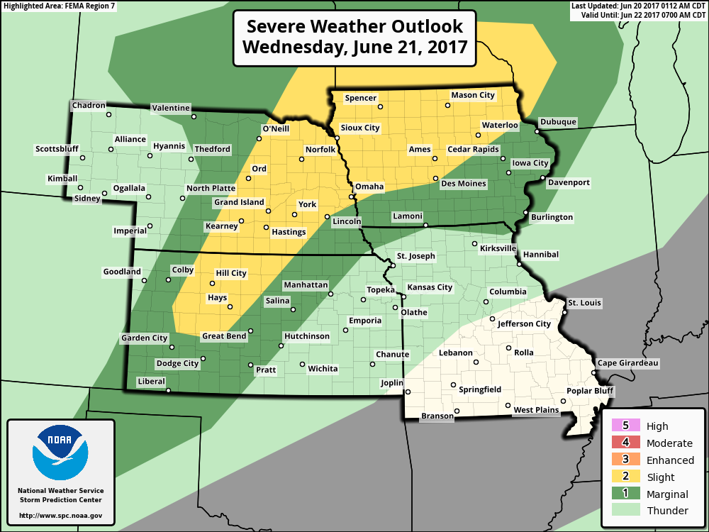
Slight Risk noted on Wednesday as well for strong storms…main threats here will be large hail, damaging winds and an isolated tornado through spanning from parts of Kansas, Nebraska and Iowa.
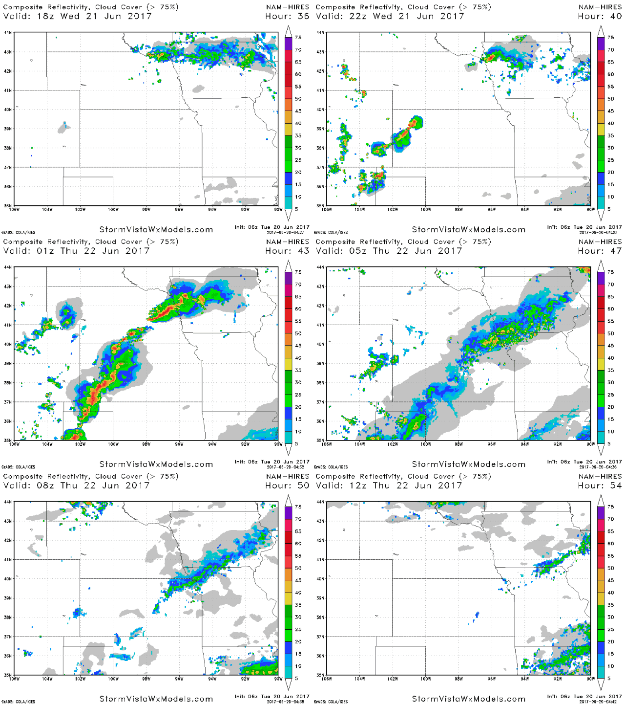
Glancing at simulated radar guidance here, the threat looks to develop later Wednesday evening into Thursday morning from west to east across parts of Kansas, eastern Nebraska, Iowa and northern Missouri.
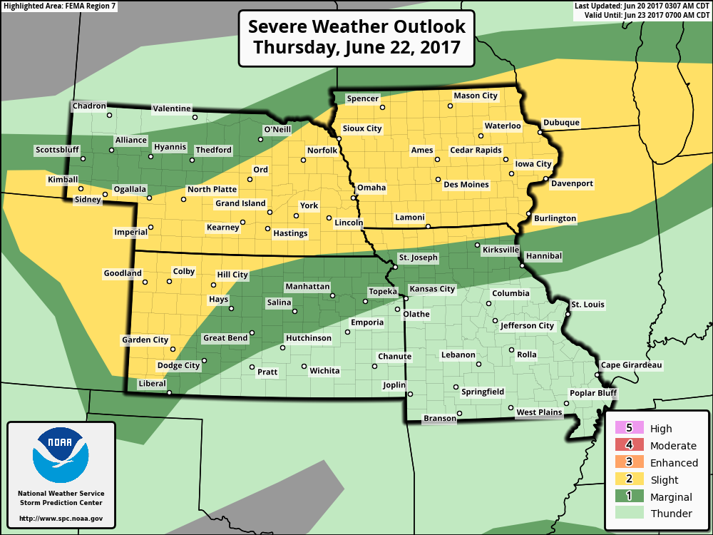
Risk for strong storm on Thursday as well…so quite the active period over the next 3 days:
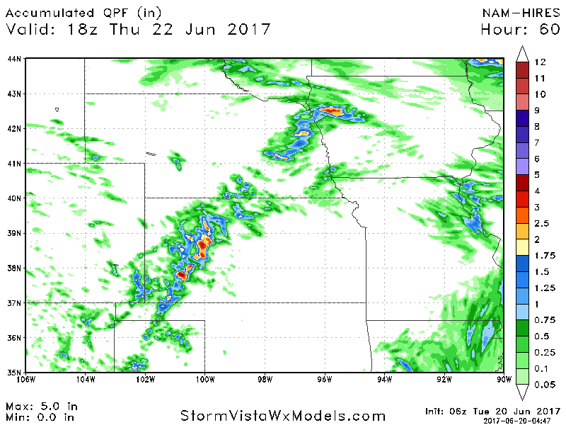
Rainfall next 60 hours based off of latest guidance…again, many locations stay dry here, but we will see isolated spots across parts of Iowa, Nebraska and Kansas of 1.5-2.0″+.
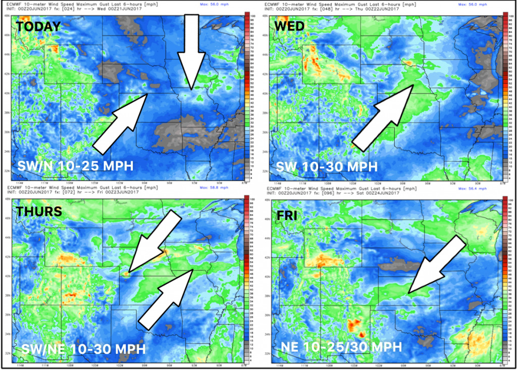
Wind forecast over the next 4 days:
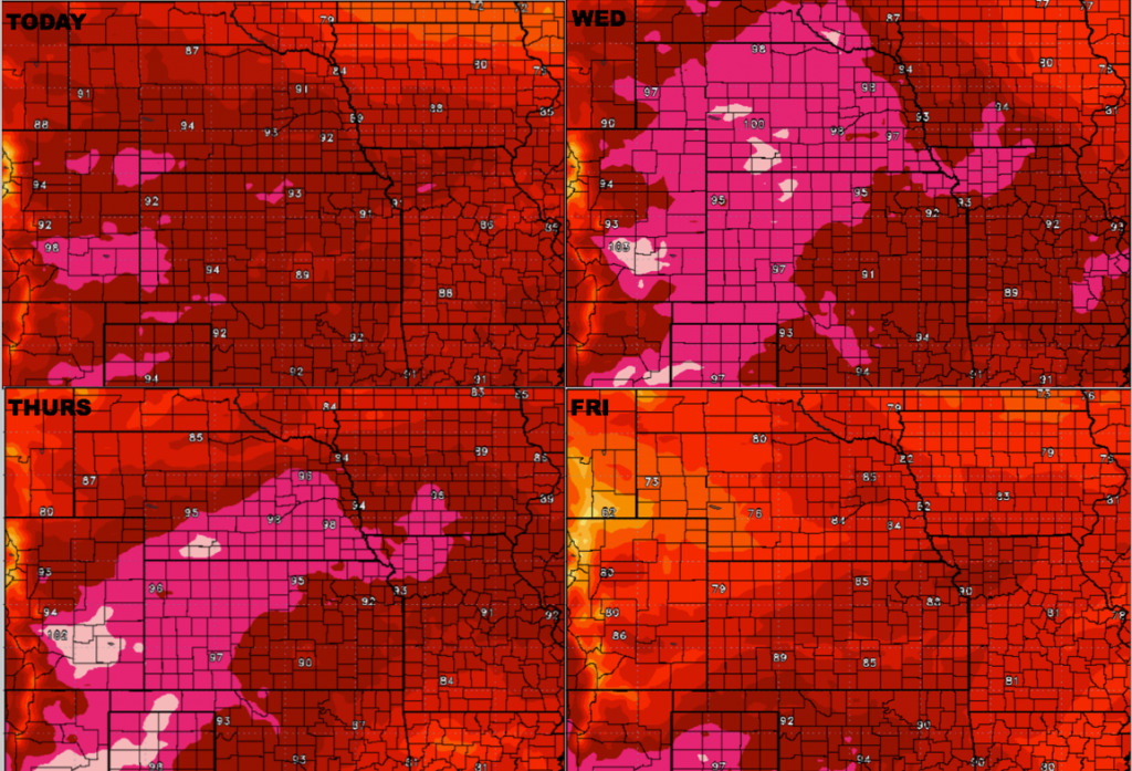
Temperature forecast over the next 4 days…very warm through Friday before the front moves through and knocks these temps down starting a cooler trend in the pattern.
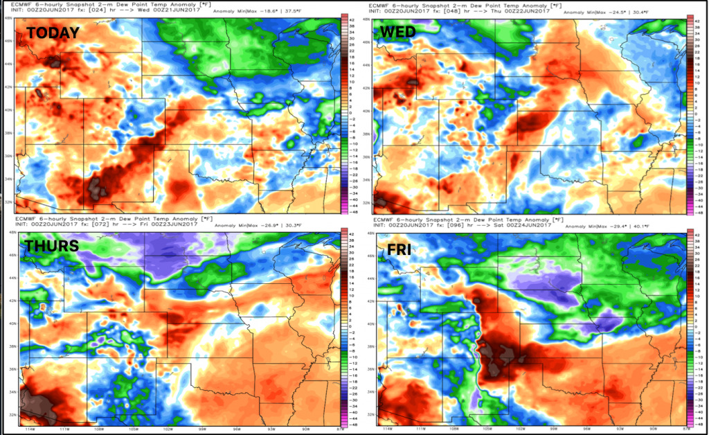
Dew points from normal over the next 4 days…you can really see how the front knocks down the humidity coming Friday.
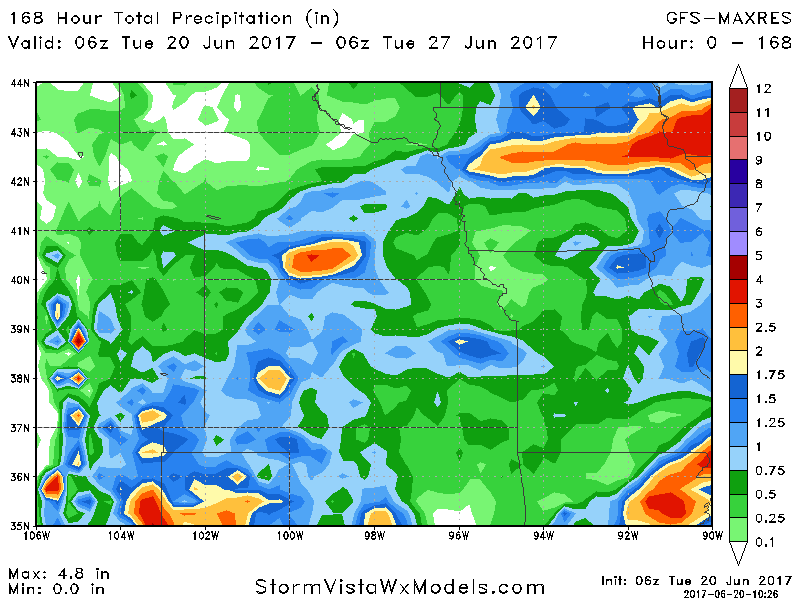
Latest thoughts on rainfall over the next 7 days from latest GFS guidance… 1-2″+ possible in isolated areas, while others see little to none…it’s very hit or miss, have’s and have-nots continues across the central Plains.
Confidence:
- Above average confidence we see scattered storms over the next 3 days across parts of the central Plains.
- Average confidence some of these storms will be strong to severe in nature with isolated large hail, damaging winds, isolated tornadoes and isolated heavy rainfall.
- Average and increasing confidence we turn cooler as we head into late week into next week as a trough starts digging in across the central US.
Video (7 min):
