Key Points – Monday, May 22, 2017:
Synopsis: Good Monday morning! The heavy rainfall pattern continues to be relentless, we see this persisting going forward, it’s just not going to relax. We target multiple chances for rains this week into the Holiday weekend, as well as feature below normal temperatures across the central Plains overall. Have a blessed week!
Current Radar:
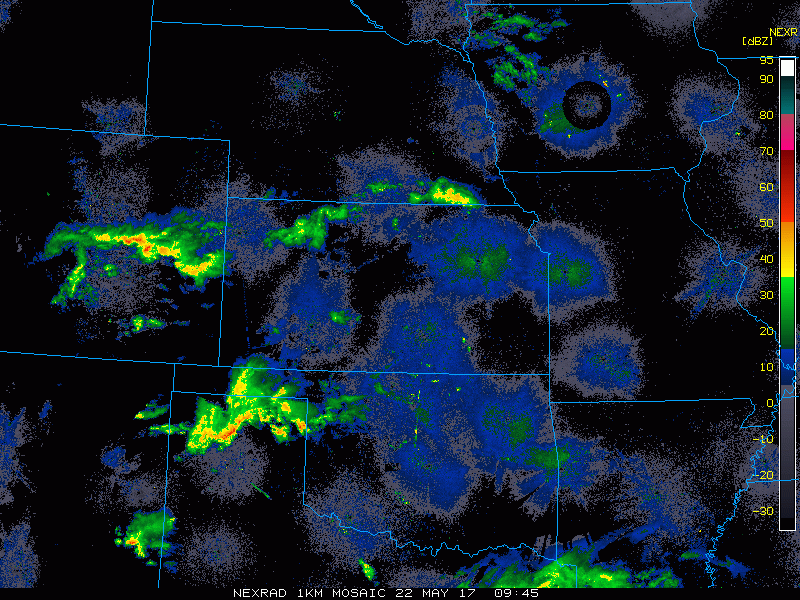
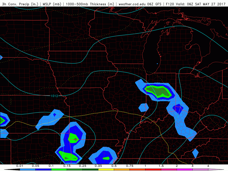
Simulated radar next 2 days…watching for storms to develop along a cold front tonight into Tuesday from northwest to southeast that could feature some heavy rains and even a few strong storms will be possible.
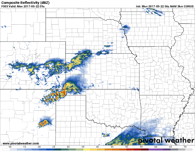
Can’t rule out a strong storm here as well across parts of eastern Nebraska, Kansas, Iowa and Northwest Missouri tonight into Tuesday, with the main threats being gusty winds and hail.
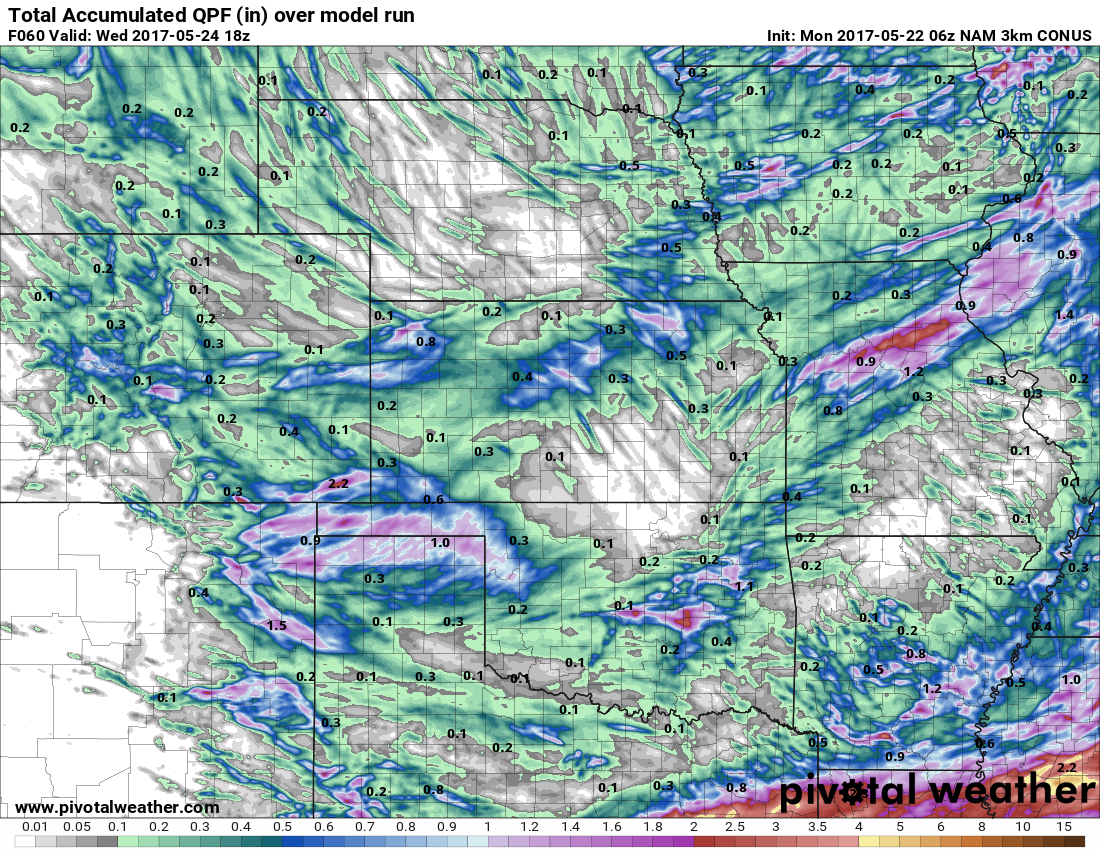
Total rainfall over the next 60 hours…not everyone gets in on the heavier rains here being scattered in nature, but those that do likely see 1-2″, with isolated higher amounts possible in stronger storms.
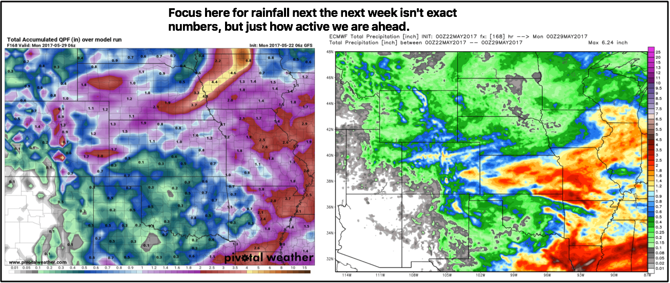
Another system starts to work in Thursday night into Friday morning especially across Iowa and Missouri, and then the next heavy rain maker moves in Saturday into Sunday across much of the central Plains. We need to keep close eyes on this weekend system as we have a good amount of support that this could be another heavy rainmaker especially if the frontal boundary stalls out and hangs around longer. Check back often on this.
Total rainfall next 7 days…slight discrepancies between the GFS and European as to where the heaviest rainfall sets up, but the takeaway here is that the pattern continues to be relentless to end the month with another 2-3″+ on the table in some locations. For more specifics please don’t hesitate to reach out.
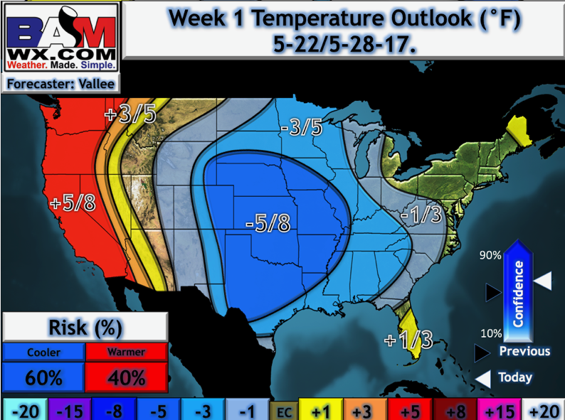
Temperatures this coming week via our updated long-range outlooks will feature cooler than normal temperatures across the central Plains.
Confidence:
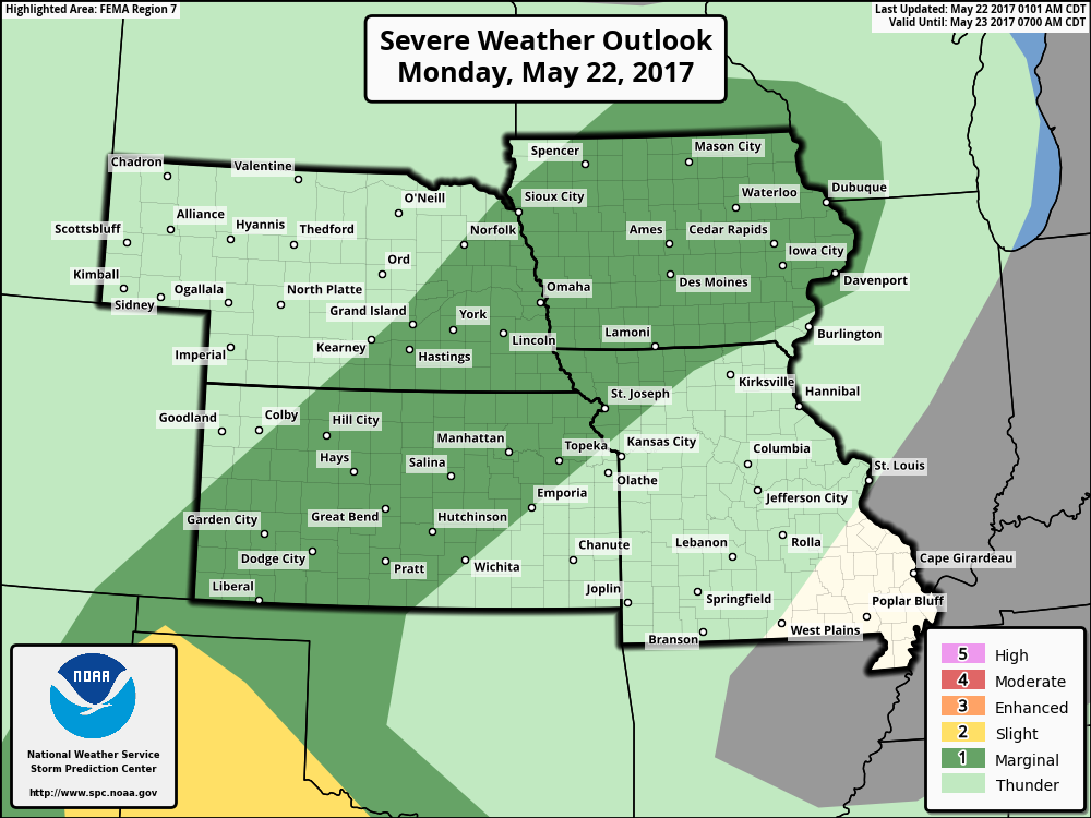
- Above average confidence scattered showers and storms move northwest to southeast across a cold front today into Tuesday.
- Average confidence we could see a strong storm along the front as well with gusty winds and isolated large hail on the table.
- Average confidence our next chance for rain comes Thursday into Friday and then this weekend that could feature additional heavy rainfall across the central Plains.
- Overall above average confidence we are cooler than normal over the next week across Zone 8.
Today’s video (8 min):