Key Points – Tuesday, March 28, 2017:
Synopsis: Good Tuesday morning and thanks for checking out the latest forecast! Showers and some patchy fog continue across portions of Nebraska and Kansas this morning, our next system ejects from the southwest that will bring additional showers and thunderstorms with it. We also discuss our next system late weekend into early next week, however we are seeing data suggesting a dry stretch the first to second week of April that we discuss. Have a great day!
Current Radar:
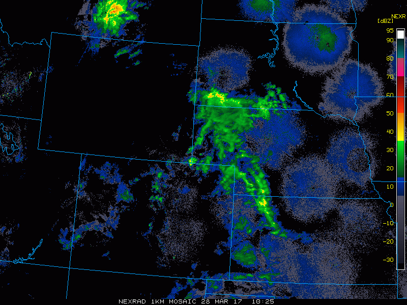
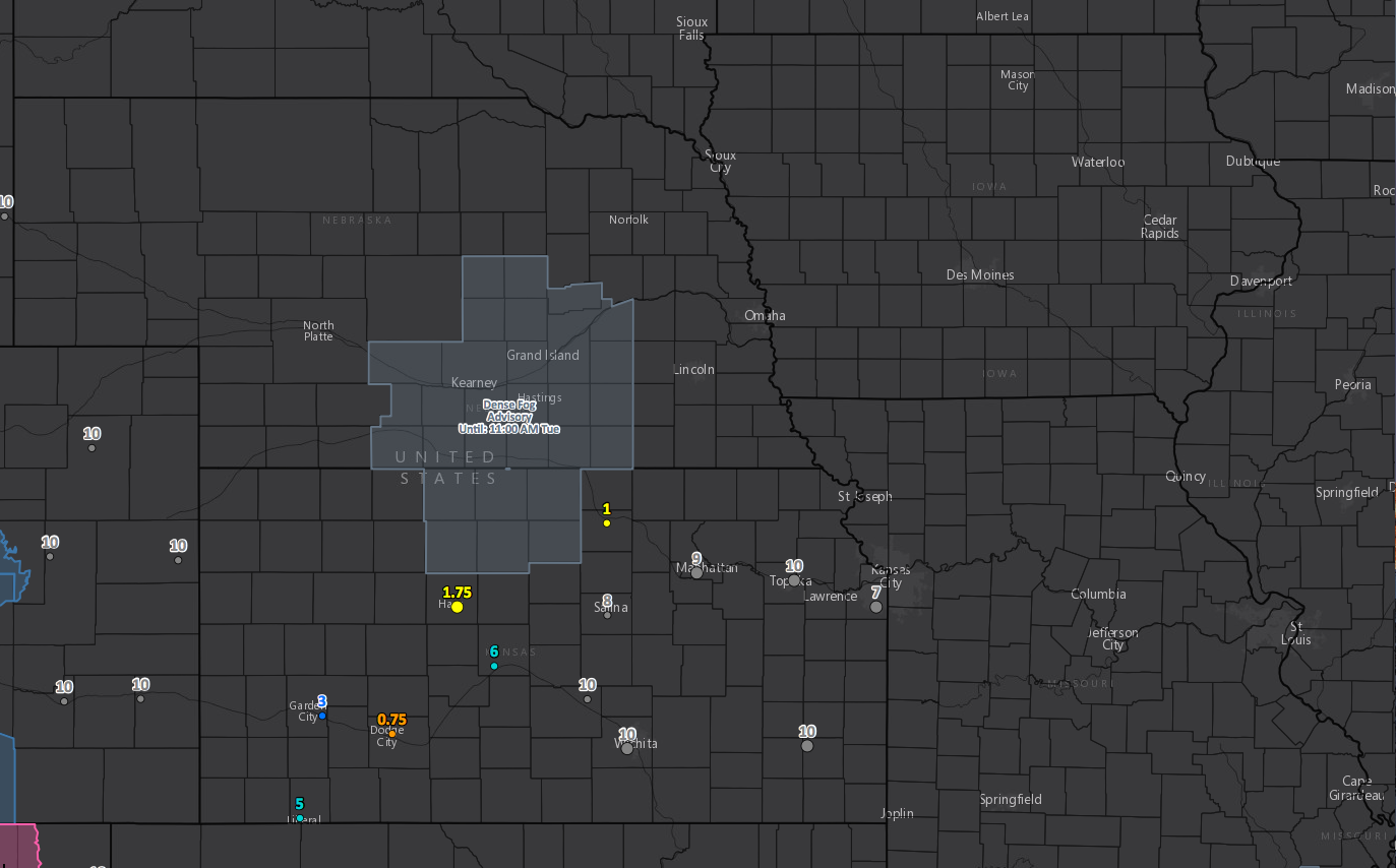
A little patchy fog/mist hanging around across portions of Nebraska and Kansas this morning as well.
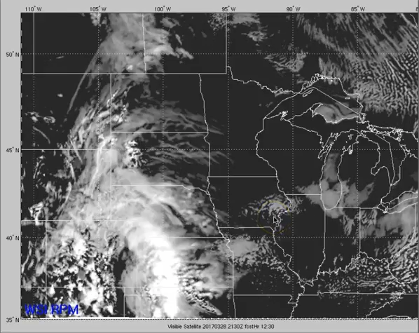
Increasing clouds across Nebraska and Kansas today, meanwhile Iowa and Missouri have opportunities for some sunshine today as seen well by our forecasted cloud cover product below.
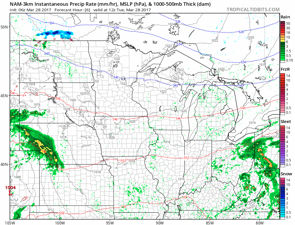
Showers possible today across Nebraska and Kansas, with more thunderstorms likely across Kansas. Some heavy rains will be possible as well with isolated 2.0″+ amounts forecasted.
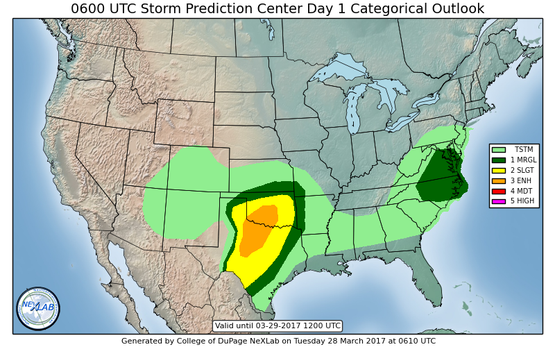
A few gusty storms with isolated hail possible across southern Kansas to southwest Missouri today into tonight.
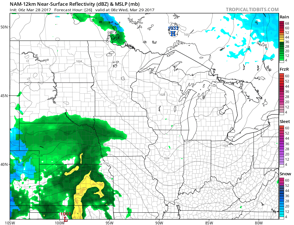
As the low pressure slowly tracks east Wednesday we introduce more shower and storms across eastern Nebraska, eastern Kansas into Iowa and Missouri. These won’t be “gully-washers” by any means and will be more scattered in nature…but some isolated heavier rains possible.
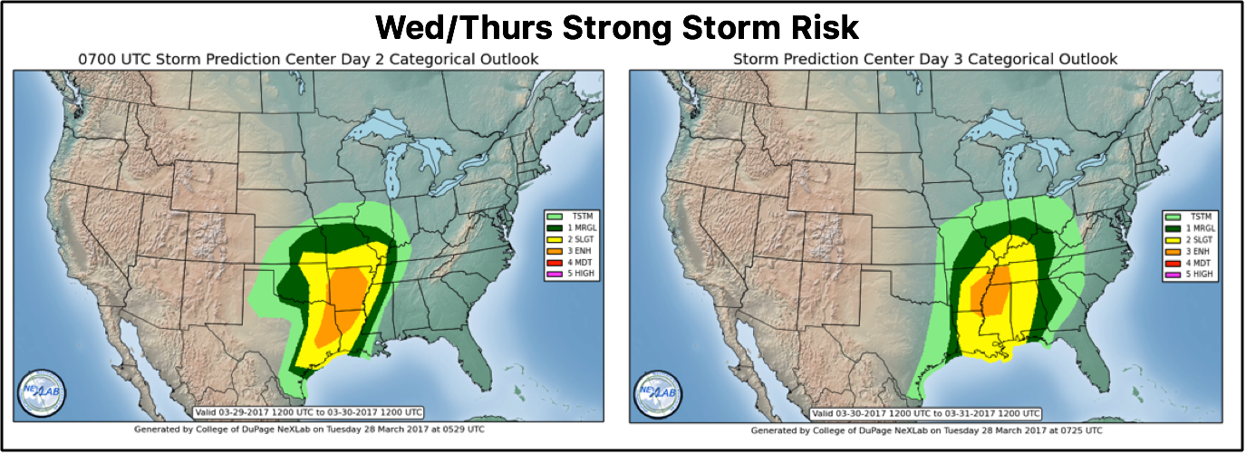
Here’s a glance at where some strong storms including gusty winds and hail will be possible Wednesday into Thursday. Wednesday they will be focused across eastern Kansas to Missouri, while Thursday will be mainly across Missouri.
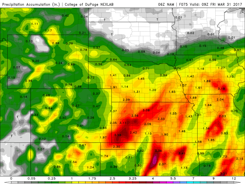
Rainfall totals through Friday…total accumulation of 2.0″+ will be possible as this low pressure treks east…would not be shocked to see a few isolated reports of 3.0″+ as well which should help how out immensely where we’ve been dry.
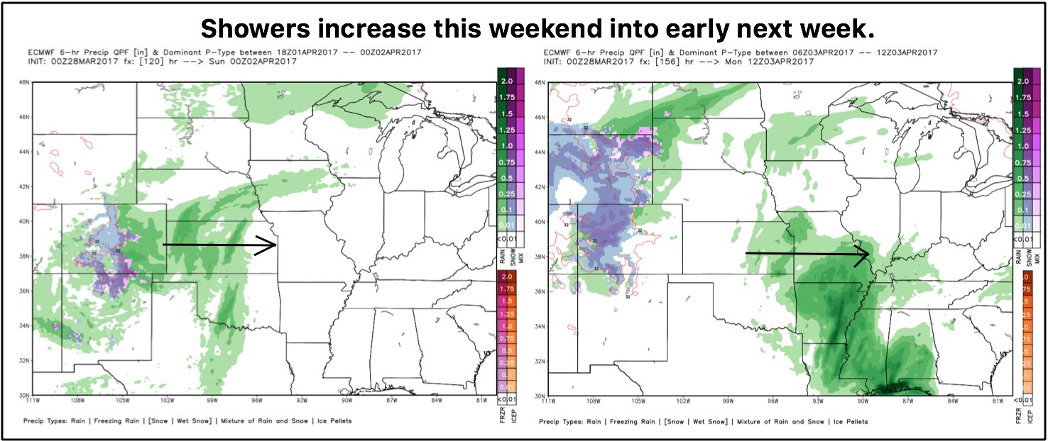
Some drier time expected Friday into Saturday with additional rain chances as mentioned in the video this weekend into early next week from west to east as our next low pressure system treks into the Zone.
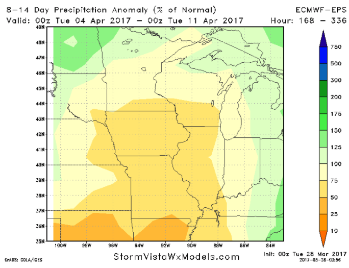
Despite all of the discussion on rainfall, we do however notice a solid window for a drier than normal stretch coming the first to second week of April…we are watching this very closely.
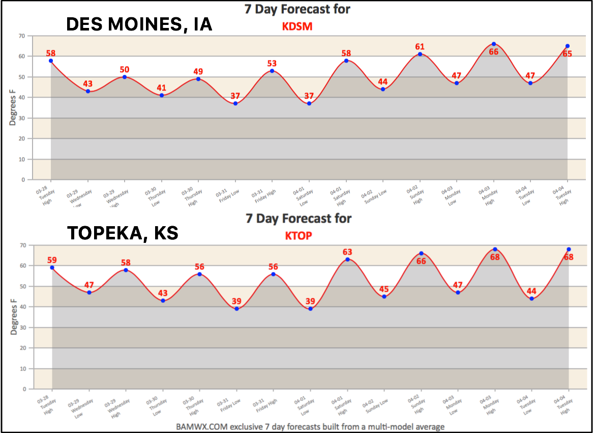
Today’s 7-day forecasts from Des Moines, IA and Topeka, KS
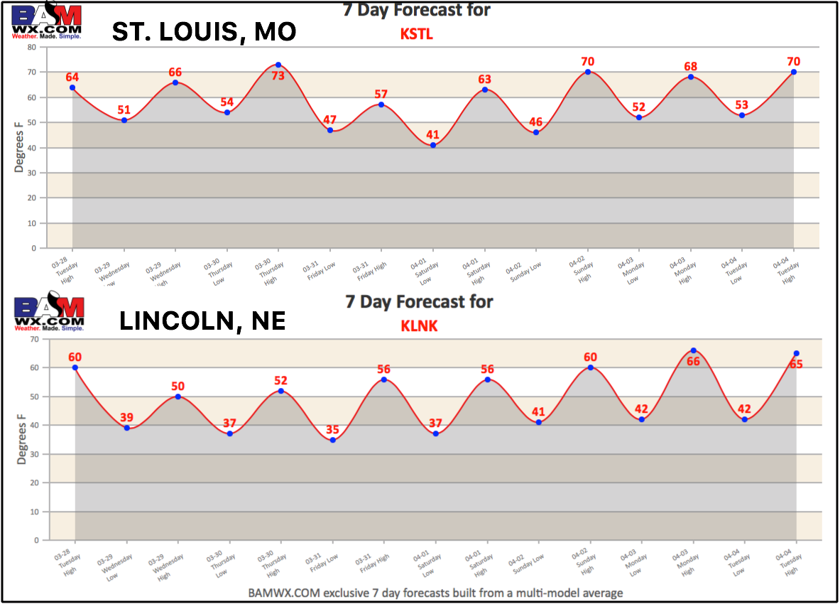
Today’s 7-day forecast for St. Louis, MO and Lincoln, NE
Confidence and Risk:
- Above average confidence of showers and storms across NE and KS today.
- Average risk for some stronger storms across southern Kansas as well.
- Above average confidence of showers and storms moving east Wednesday into Thursday more into Iowa and Missouri.
- Average risk for strong storms across eastern Kansas to Missouri on Wed/Thur as well.
- Above average risk for a dry stretch during the first to second week of April.
Today’s video (8 min):