#NDwx #SDwx #WIwx #MNwx #AGwx #plant17 Showers and Storms Today, Drier Times Into Next Week? E.
Key Points: May 3, 2017
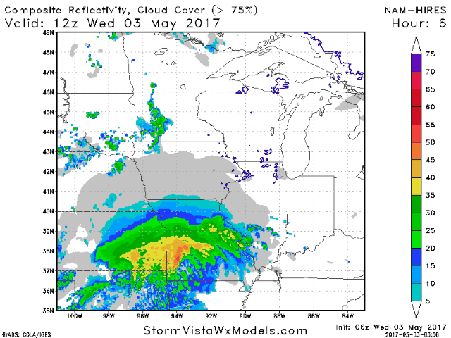
Synopsis: Good Wednesday morning! We are tracking a few showers across the region this morning, as well as a stronger system passing off to our south and east. A few showers and thunderstorms will be around this afternoon and evening across the Dakotas and Minnesota on the leading edge of the some warmer air. Another weak disturbance will bring some showers to eastern areas Friday night, then beyond this it looks to be a dry stretch with warm temperatures especially west. Some shower and thunderstorm opportunities will arise mid week as well as our region will be on the periphery of an upper level ridge. Have a great day!
- Current radar shows a few showers around this morning.

- Showers and even a few storms will be around western areas today.
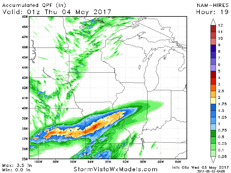
- Most areas see less than 0.25″ of rain through tonight, but if you get under a shower, you may see upwards of 0.50″.
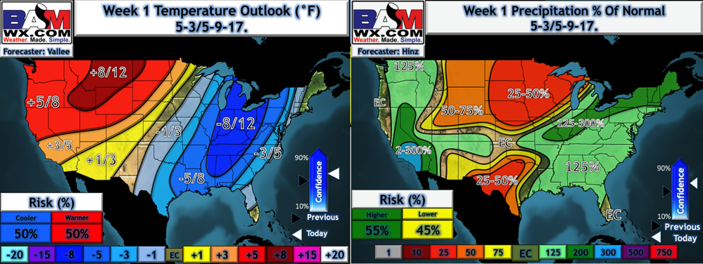
- A weak disturbance will bring showers Friday night, but overall it appears to be a rather dry and warm stretch through the middle of next week. Here’s our week 1 precipitation and temperature forecast.
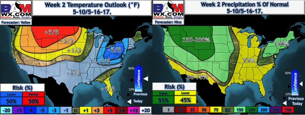
- Week 2 likely features wetter times with shower and thunderstorm chances especially west. Warmer times likely continue as well.
Confidence and Risks:
- Above average confidence in a few showers and storms this afternoon.
- Above average confidence in the northwestern extent of rainfall Wednesday night through Friday with the system to our southeast. The region likely misses out on rains.
- Increasing confidence in favorable planting conditions this weekend into next week with warmer conditions expected.
Today’s Video (4 minutes):