#NDwx #SDwx #WIwx #MNwx Active Pattern This Week, Colder Risks Week 2? Details Here! E.
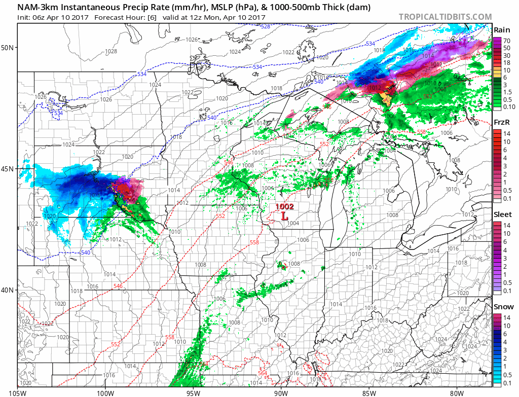
Synopsis: Good Monday morning! We are dealing with some snow and mixed precipitation across South Dakota this morning with a few showers across Wisconsin as an area of low pressure moves through the region. This will continue today into the overnight as the system moves on out. Our next threat for rain comes Wednesday afternoon through Thursday across the southern half of the region once again as an area of low pressure moves through. Dry conditions return for the end of the week ahead of our next rain maker next weekend. Along with some active times, cold conditions are becoming more likely in week 2, with freezes still a concern.
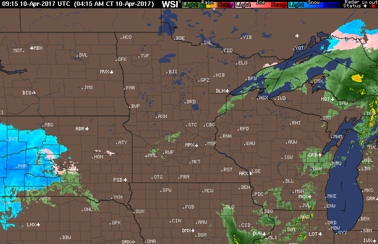
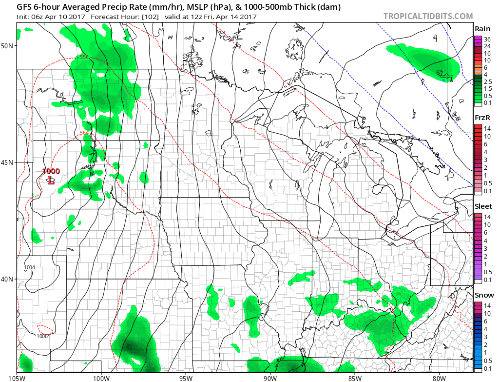
Current radar this morning shows that mixed precipitation across South Dakota with showers farther east.
This system will push eastward into tonight, leaving us with dry conditions for Tuesday.
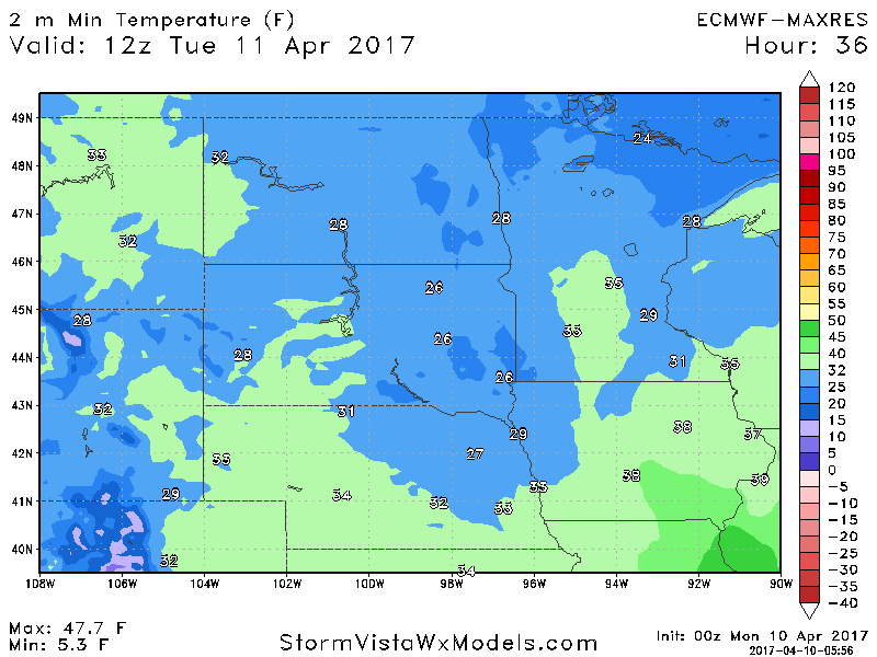
Behind this system, another freeze is expected for many. Expected low temperatures tonight into Tuesday.
Our next rain maker arrives Wednesday into Thursday, especially south.
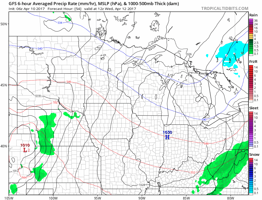
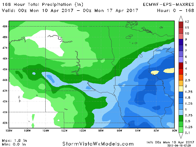
Active times continue into the weekend with another system expected Saturday.
Total rainfall through next Sunday looks active especially south and east once again.
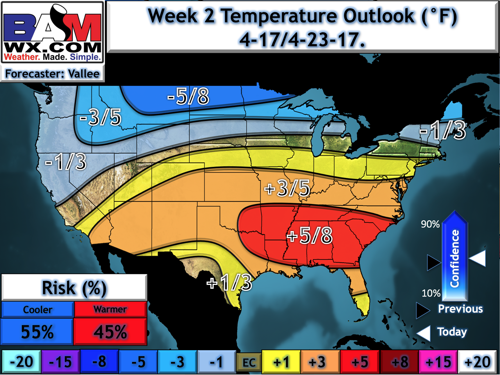
Temperatures stay warm through the weekend, but looking into week 2, colder risks along with frost and freeze potential arise across the region. Here’s our official week 2 temperature departure from normal forecast.
Confidence and Risk:
- Above average confidence in an active regime this week especially south along with above normal temperatures overall.
- Above average confidence in frost and freeze potential Tuesday morning for many.
- Increasing confidence in colder risks in week 2 along with frost and freeze threats continuing.
Today’s Video (6 minutes):