#NDwx #SDwx #WIwx #MNwx Active Few Days Upcoming, Cooler Early Next Week. E.
Key Points: June 16th, 2017
Synopsis: Good Friday morning! An active few days are expected through the weekend as an area of low pressure moves through the northern Plains and Upper Midwest. This will lead to some widespread rainfall especially north and east. Unfortunately, dry areas in South Dakota may stay drier than preferred as the storm track stays north of that region. Cooler conditions are expected to begin next week, but warmer conditions likely return across the Dakotas by the end of next week. Have a blessed weekend!
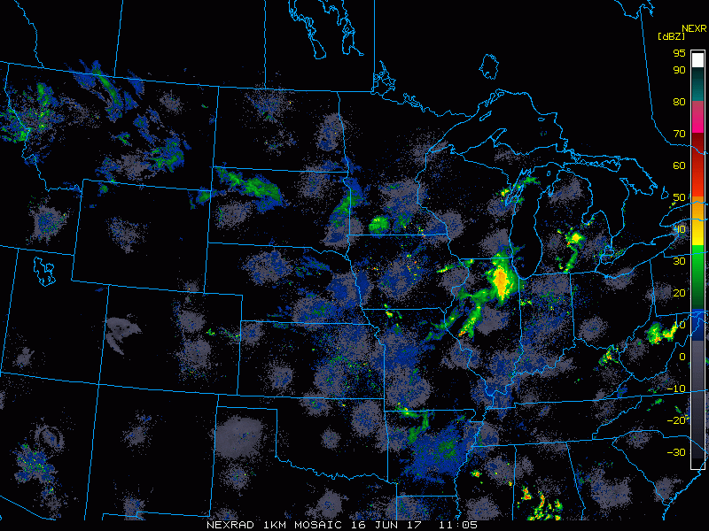
- Radar this morning shows some showers across South Dakota and Minnesota.
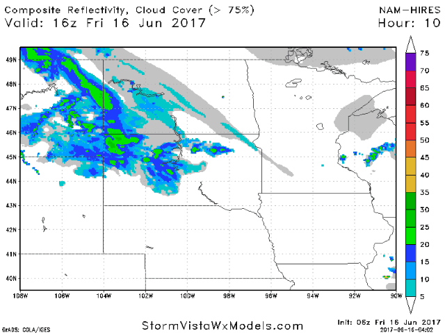
- An active few days is expected, Here’s the projected radar through Saturday evening.
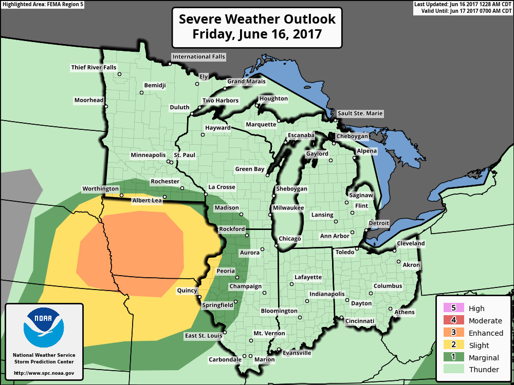
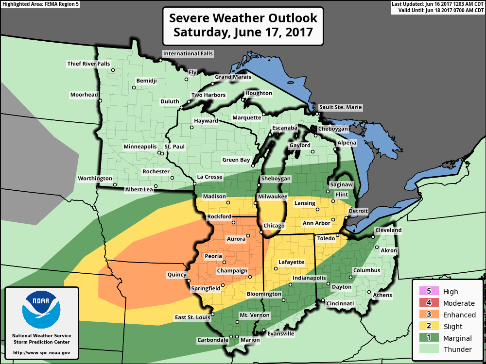
- Severe weather is possible southeastern areas both days. SPC outlooks are shown below.
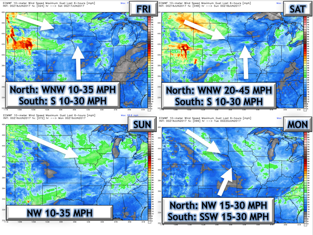
- The wind forecast over the next 4 days is shown below.
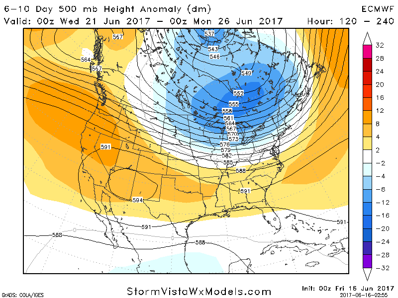
- The 6-10 day looks to feature Northwest flow. This impacts of this are shown in the video!
- This regime will certainly bring some cooler air into the region especially east, but some intermittent heat is possible west. Here’s a look at our week 2 temperature forecast.

Total rainfall through day 10 is shown below. 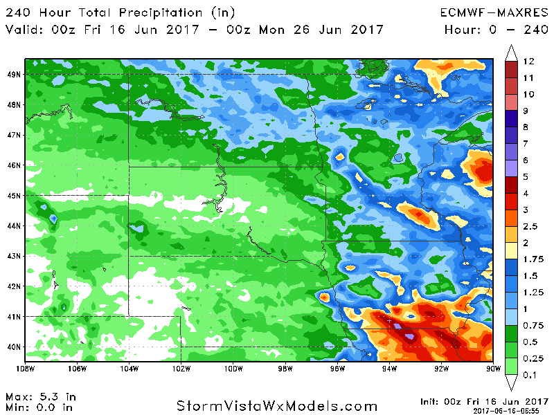 Confidence and Risk:
- Above average confidence in rains through the weekend.
- Above average confidence in cooler conditions to start next week.
- Increasing confidence in northwest flow and periodic heat later next week, especially west.
Today’s Video (6 minutes):