#NDwx #SDwx #MNwx #WIwx Widespread Rain Threat Saturday, Cooler Early Next Week. E.
Key Points: June 15th, 2017
Synopsis: Good Thursday morning! Radar is quiet this morning for the first time in quite a while. As we move through today, a few spotty storms may develop, but it will be largely dry. A complex of storms may move just south of the region overnight – certainly something to watch for impacts in southern areas. Another area of low pressure will approach the region tomorrow afternoon into Saturday with more widespread showers and storms. Cooler conditions will follow this system into early next week before another ridge tries to pump up in the west. This will spark some storm complexes next week, but timing and location remain uncertain. Have a blessed day!
- A few storms are possible later today and overnight.
- A more widespread rainfall is expected Friday night into Saturday as an area of low pressure moves through.
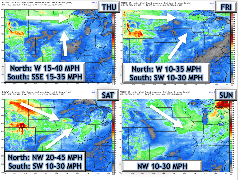
- The next 4 days of wind are shown below.
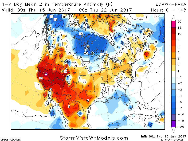
- Week 1 temperatures behind this system will be near to even below normal.
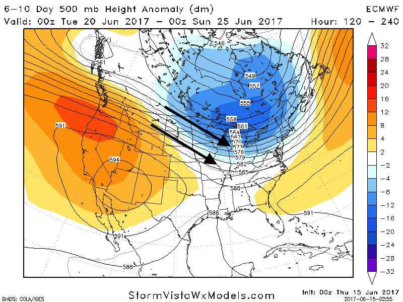
- Next week looks to feature cool conditions to start, then northwest flow will take over as a ridge develops to our west. This will promote clusters of storms midweek next week into next weekend.
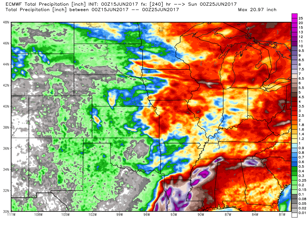
- Total rainfall next 10 days.
Confidence and Risk:
- Above average confidence in showers and storms Saturday, heaviest north.
- Above average confidence in cooler conditions into next week.
- Increasing confidence in northwest flow bringing occasional complexes of storms into week 2.
Today’s Video (7 minutes):