#NDwx #SDwx #MNwx #WIwx Wet This Week South, Warm Region Wide. Details Here!
Synopsis: Good morning! High pressure will allow for a quiet day today with some sunshine. This theme of high pressure will continue through the week, keeping the heaviest rain across the extreme southern parts of the forecast area on southward. As is still typical this time of the year, we will be tracking the threat for some freezes especially north and west over the next 2 weeks as we head toward Plant 2017.
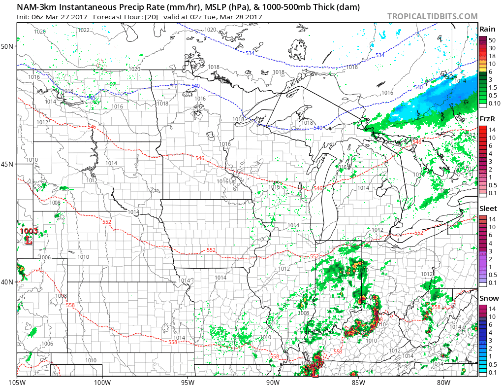
Today will be a largely dry day, but some moisture will stream up from the south across the western Dakotas, with even some snow in the Black Hills overnight into Tuesday. Here’s the radar tomorrow morning through tomorrow evening.
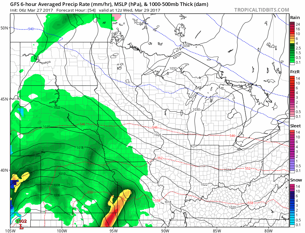
This moisture will spread east along with an area of low pressure into Wednesday. This spreads rain across southern SD, MN, and WI through Thursday night.
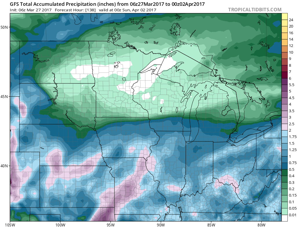
 The latest precipitation forecast through Saturday illustrates the sharp gradient in precipitation across the forecast area.
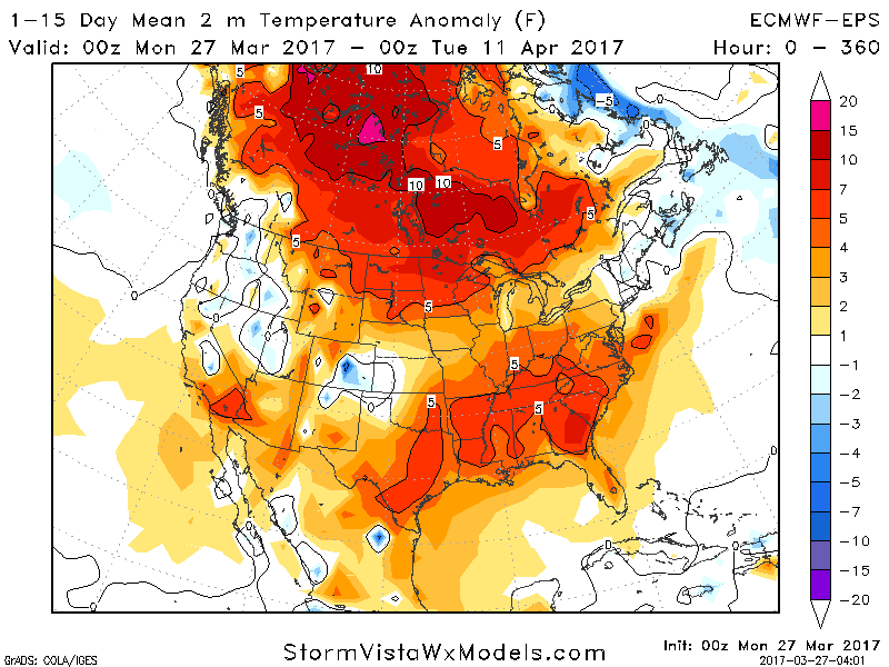
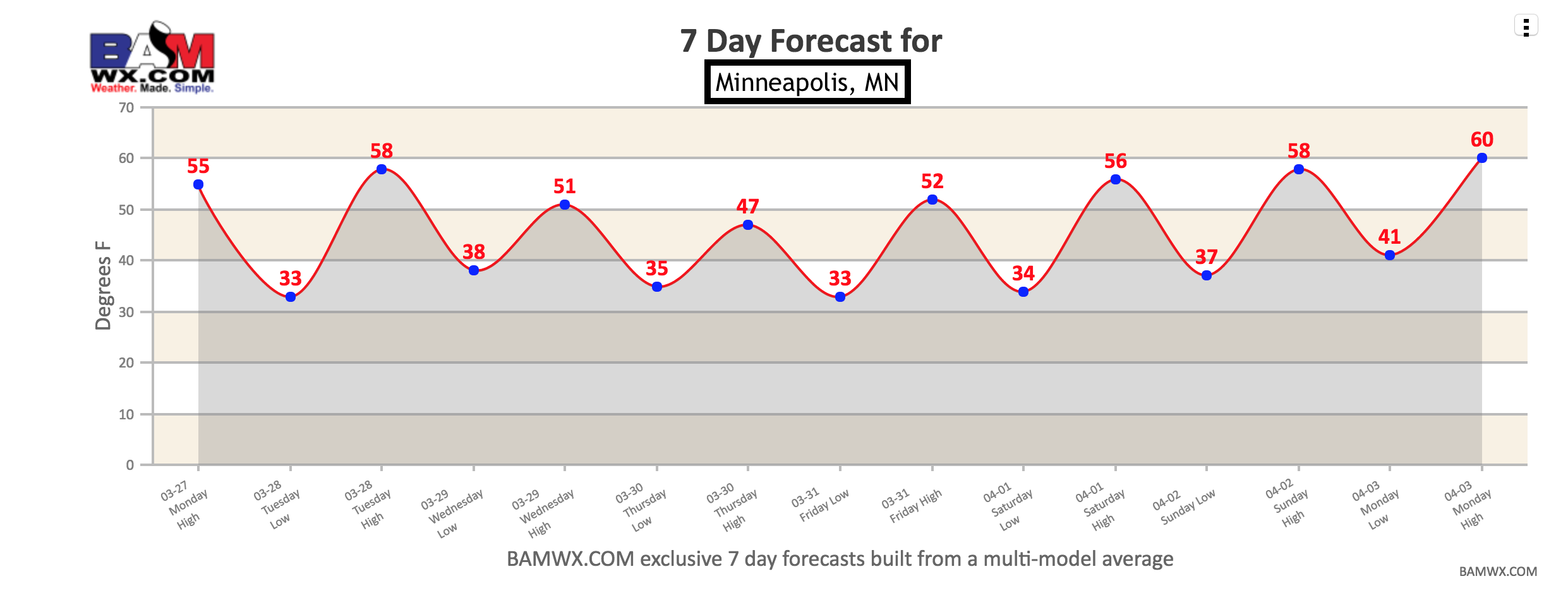
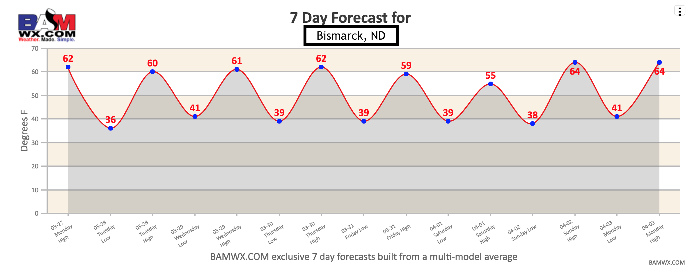
Temperatures look warm compared to normal over the next 15 days region wide.
In particular, our exclusive 7 day forecasts for Bismarck, ND and Minneapolis, MN show this above normal risk with temperatures well into the 50s and 60s during the day.
Confidence and Risks:
- Above average confidence in above normal temperatures over the next 15 days.
- Above average confidence in a tight precipitation gradient in southern portions of the forecast area through the weekend.
The video (7 min) breaks it all down. Have a great day! ~Ed