#NDwx #SDwx #MNwx #WIwx Storm risks into mid-week. N.
Good Monday morning! The next few days will offer up t’storm risks, with the best chances coming in Tuesday into Wednesday with a severe weather threat. Cooler and drier air will build in area-wide by Thursday with very nice weather expected. More details in the video at the end of the post. Have a great day, and let us know if you have any questions!
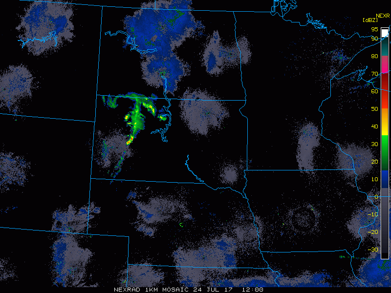
Current radar shows an area of showers and t’storms moving across South Dakota associated with a disturbance moving to the east.
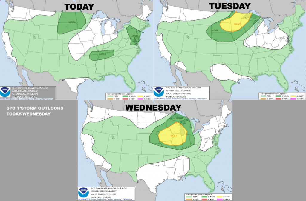
Here are the severe t’storm outlooks into mid-week. Marginal risk over MN/SD/ND today, then a slight risk on Tuesday over much of MN/ central and eastern SD, and southeast ND.
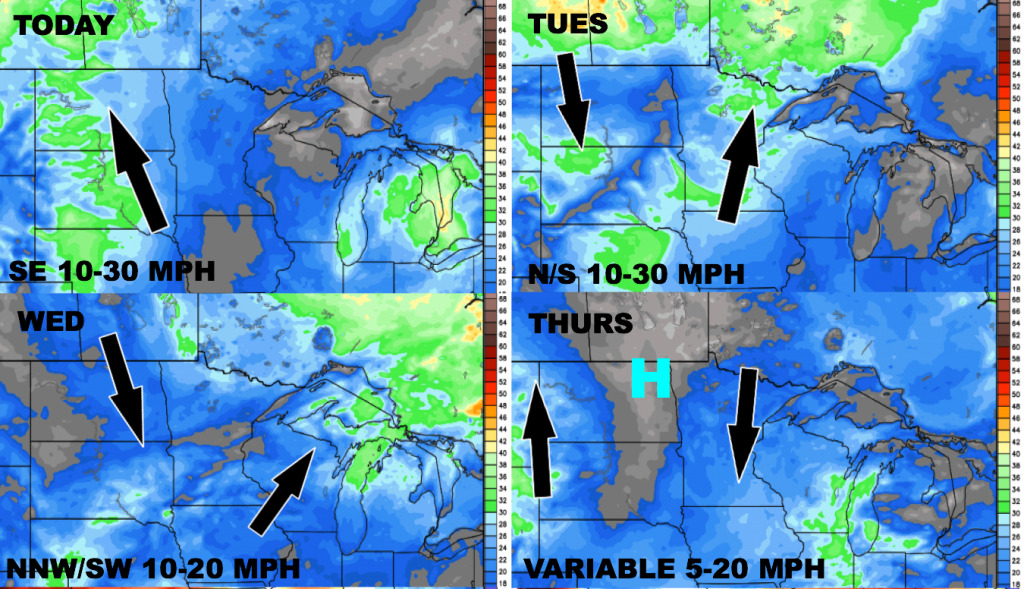
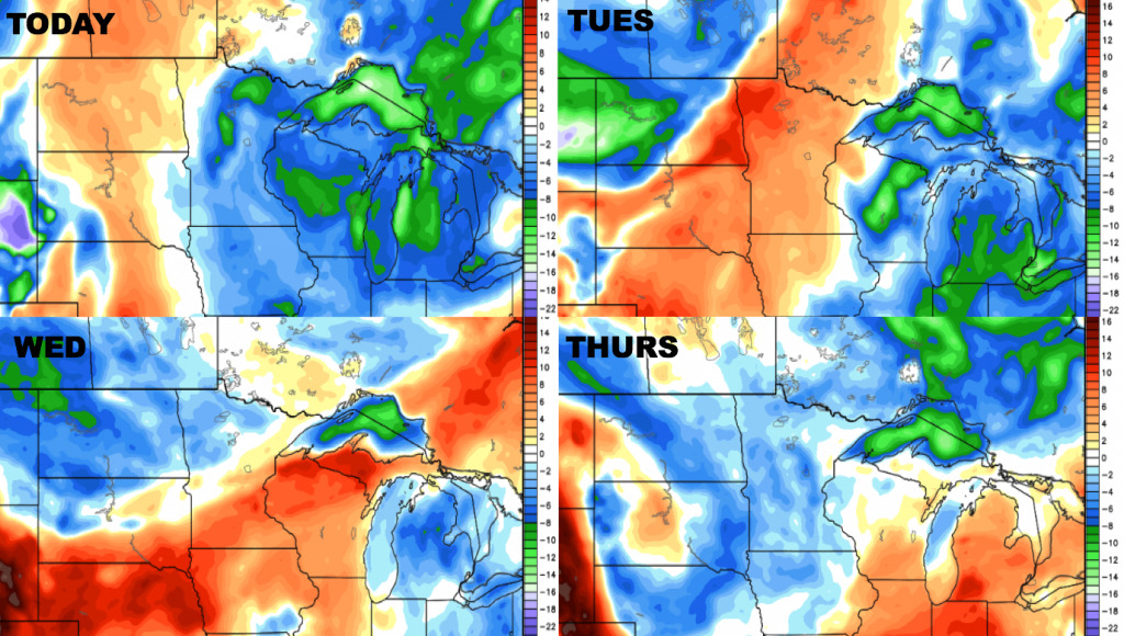
Here is the wind forecast over the next 4 days.
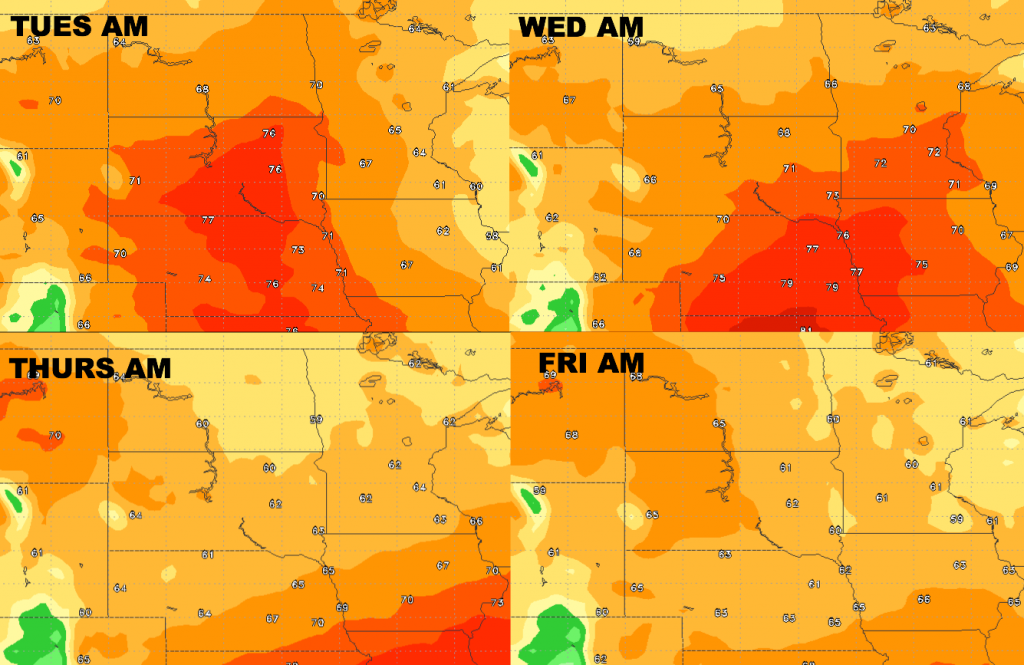
Here is a look at high temperatures over the next 4 days. Heat will increase over the next couple of days, with much of it situated over South Dakota. Cooler temperatures arrive mid to late week. 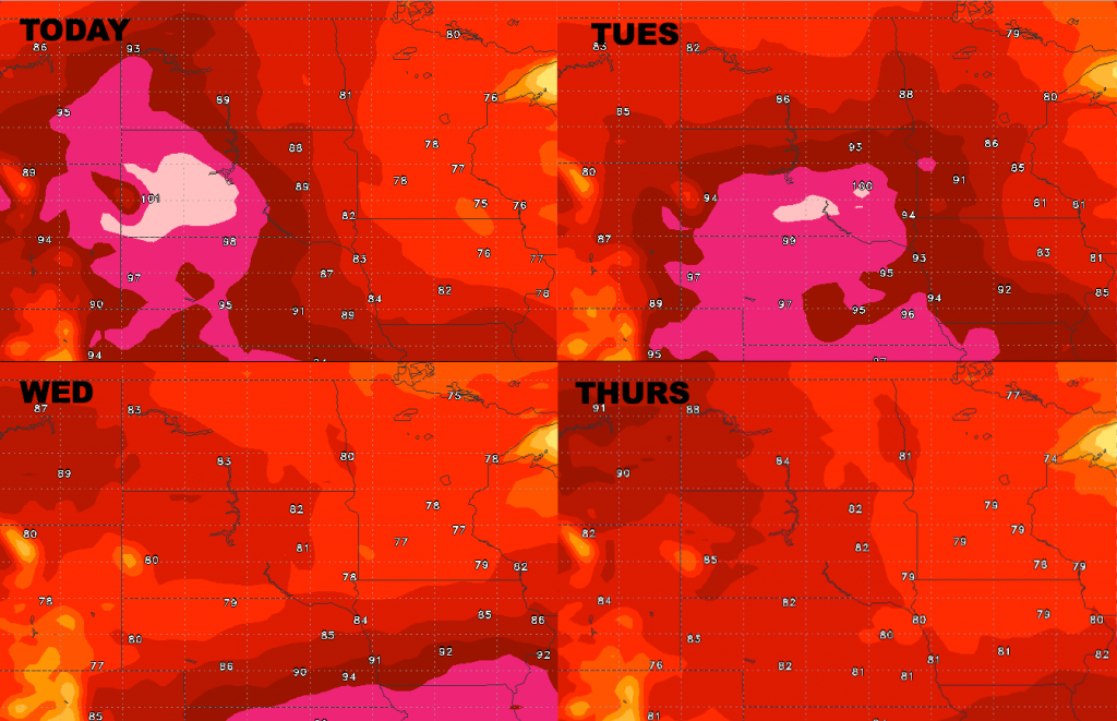
Low temperatures will be warm across the southern portions of the area into Wednesday, with much cooler morning lows for Thursday and Friday mornings area-wide.
Humidity levels will increase today into Tuesday with southerly winds, then drier air builds in Wednesday into Thursday behind the frontal passage.
Today’s Video (6 min)