#NDwx #SDwx #MNwx #WIwx Spotty Rains Into Next Week, Warmer and Drier Into Week 2. E.
Key Points: May 26, 2017
Synopsis: Good Friday morning! We are tracking a few showers in Minnesota and Wisconsin this morning, otherwise the remainder of the region is quiet. Those showers will continue in the east today most other areas largely dry with some sunshine. A disturbance will bring some rainfall across southern South Dakota into southern Minnesota tonight into Saturday, with only some spotty afternoon showers expected elsewhere through the weekend. This regime will persist into early next week before warmer and drier conditions make a return by next weekend and beyond. Have a blessed day!
- Current radar shows those showers in eastern areas.
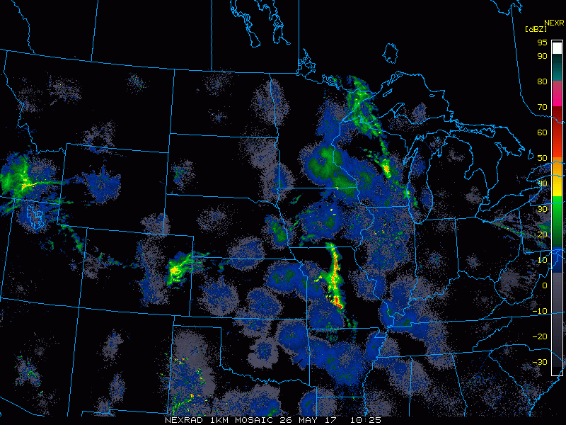
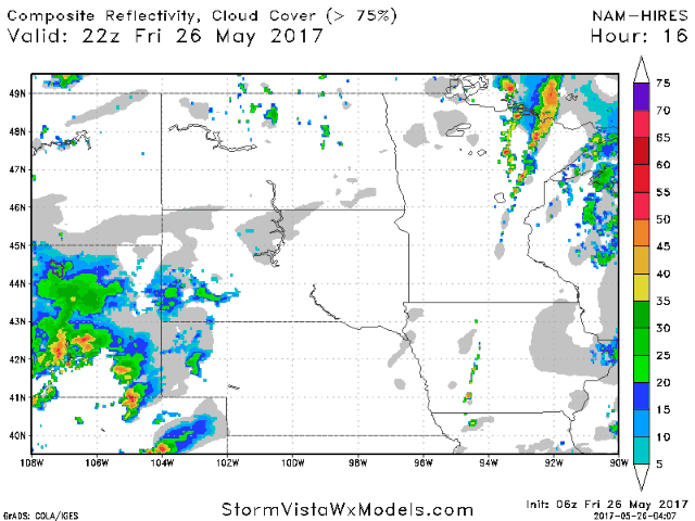
- Our next disturbance arrives tonight into tomorrow across southern areas. A few spotty afternoon showers and storms are possible across the entire region as well.
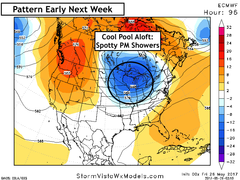
- The pattern into early next week will be dominated by a cool pool of air aloft, leading to spotty afternoon shower chances region wide. Coverage will be low.
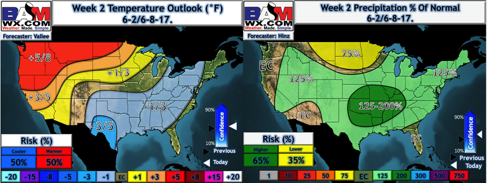
- As we move through the week, we will begin to feel the effects of an upper level ridge moving in from the west, leading to warmer and drier conditions as we head into next weekend and beyond. Our week 2 forecast temperature and precipitation from normal maps are below.
Confidence and Risks:
- Above average confidence in showers tonight across South Dakota and southern Minnesota.
- Above average confidence in very spotty PM showers each day region wide through nearly next week thanks to cool air aloft.
- Above average confidence in warmer and drier conditions developing in week 2.
Today’s Video (6 minutes):