#NDwx #SDwx #MNwx #WIwx Some Dry Time This Weekend, Rains Return Next Week. E.
Key Points: May 10, 2017
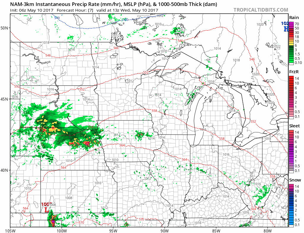
Synopsis: Good Wednesday morning! We are tracking showers and thunderstorms across South Dakota this morning along a frontal boundary while areas to the north remain dry. These showers and storms will push east into Minnesota this afternoon, then give way to what looks to be a fairly warm and dry period of weather through early next week. That being said, active times look to return through next week and beyond as we trend a bit cooler especially across the Dakotas. Have a wonderful day!
- Current radar shows those showers and storms across South Dakota this morning.
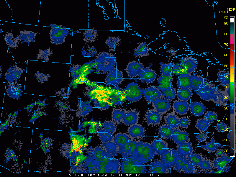
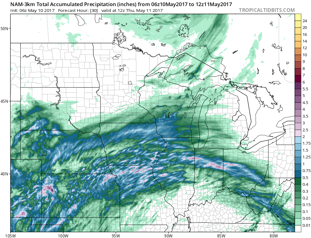
- Throughout the day today and into tonight, these showers will push eastward into Minnesota. and Wisconsin.
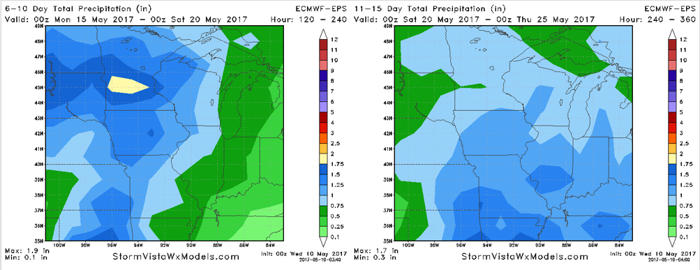
- Total rainfall looks to range from 0.25-1.00″ in southern South Dakota, Minnesota, and Wisconsin. Further north, not much rain is expected thanks to Canadian high pressure.
- A warm, dry stretch of weather is expected Friday through early next week as a ridge of high pressure moves into the region.
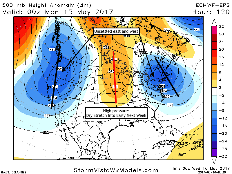
- Active times do look to return next week as the ridge moves east and weakens. Here’s a look at rainfall in the 6-10 and 11-15 day periods. Timing of rains are discussed in the video.
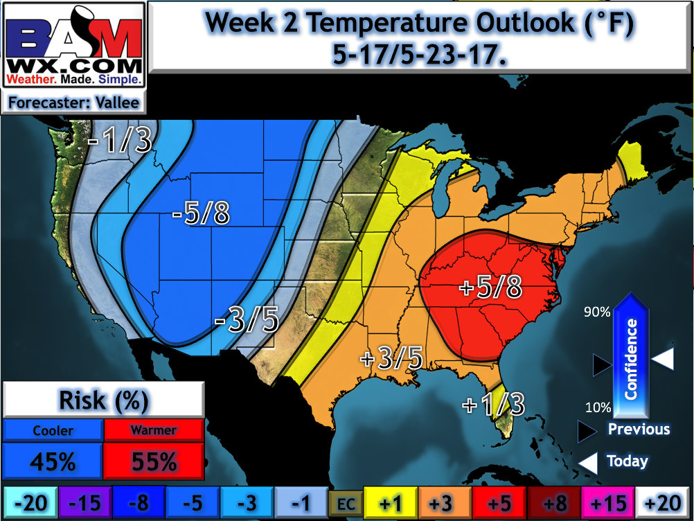
- Temperatures in week 2 look to trend cooler, especially west, as a battle ground between cool and warm sets up over the region.
Confidence and Risks:
- Above average confidence in showers in southern portions of the forecast area through tonight.
- Above average confidence in a dry stretch over the weekend into early next week before rains return.
- Increasing confidence in cooler than normal temperatures west and above normal temperatures east developing next week.
Today’s Video (6 minutes):