#NDwx #SDwx #MNwx #WIwx…Severe storm threat today into Saturday…quieter by Sunday. N.
Good Friday morning! Stormy set-up for today into Saturday with more rounds of storms expected, along with severe weather concerns. The weather will turn much quieter by the second half of the weekend as a cold front moves through the region and high pressure builds in. All the details, including more on the longer range forecast can be found in the video at the end of this post. Have a blessed day!
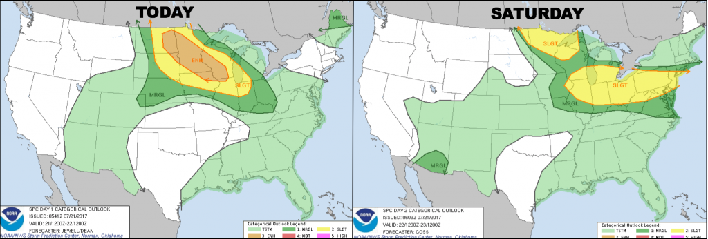
Here are the NOAA Storm Prediction Center outlooks for today and Saturday. Note a large area under a ENHANCED threat today, from eastern North Dakota into central Minnesota and southwestern Wisconsin.
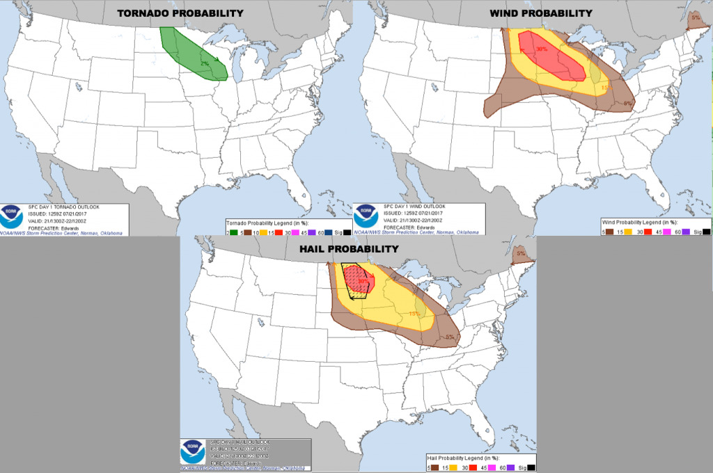
Here are the probabilities of tornadoes/wind/hail. Greatest risk is for damaging winds and large hail.
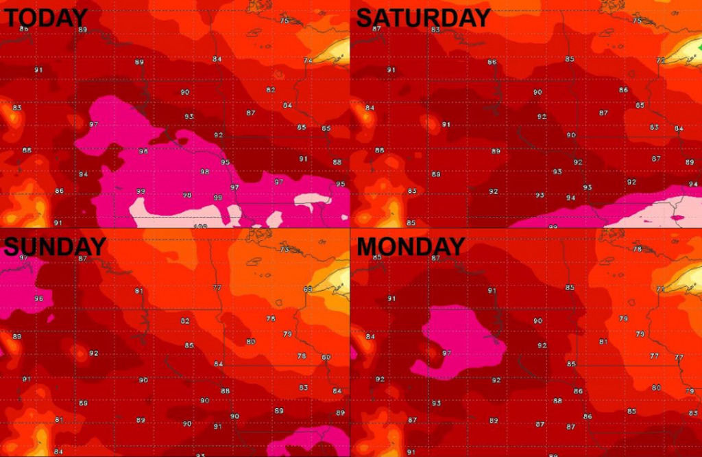
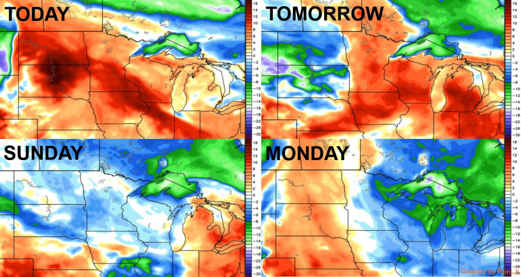
Here is a look at high temperatures into early next week. Heat to the south will give way to cooler temperatures heading through the weekend. Temperatures begin to increase over the Dakotas early next week.
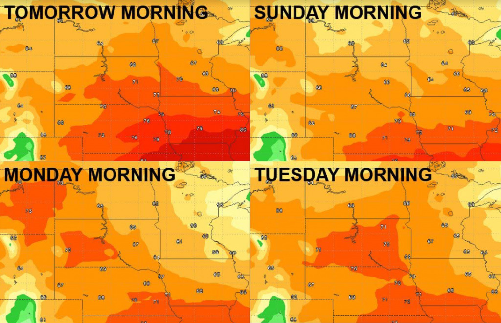
Here is a look at low temperatures over the next several mornings. Pleasant air begins to move in this weekend, with many 60s for lows Sunday and Monday morning, and possibly some 50s. Warmer lows heading into early next week.
Here are the dew point anomalies into early next week. Humid air for today, but drier air filters in heading through the weekend.
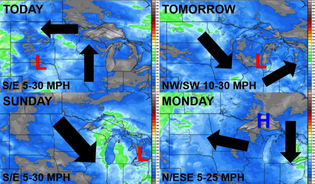
The wind forecast for the next 4 days is shown below.
Confidence and Risk:
- High confidence in rounds of storms today into Saturday, which will have potential to bring damaging winds, large hail, and isolated tornadoes.
- High confidence in drier conditions for the second half of the weekend as surface high pressure builds in.
Today’s Video (5:45 min)