#NDwx #SDwx #MNwx #WIwx Severe storm potential today…quieting down mid-week. N.
Good Tuesday morning! Thunderstorm risks will continue today, with the risk for severe storms. Thunderstorms will gradually shift south of the region mid-week as surface high pressure builds in from Canada. This will lead to a break in storm chances.
Today’s Video (8:58):
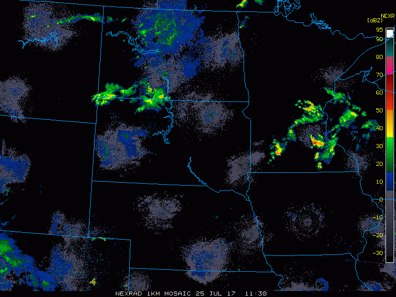
Current radar as of 7:05 AM CDT shows some scattered storms working across portions of the Dakotas, with more storm activity situated across southeast Minnesota this morning.
Here is the SPC severe weather outlook for today. Enhanced threat in a swath from central South Dakota into west central Minnesota. Slight risk surrounding that. 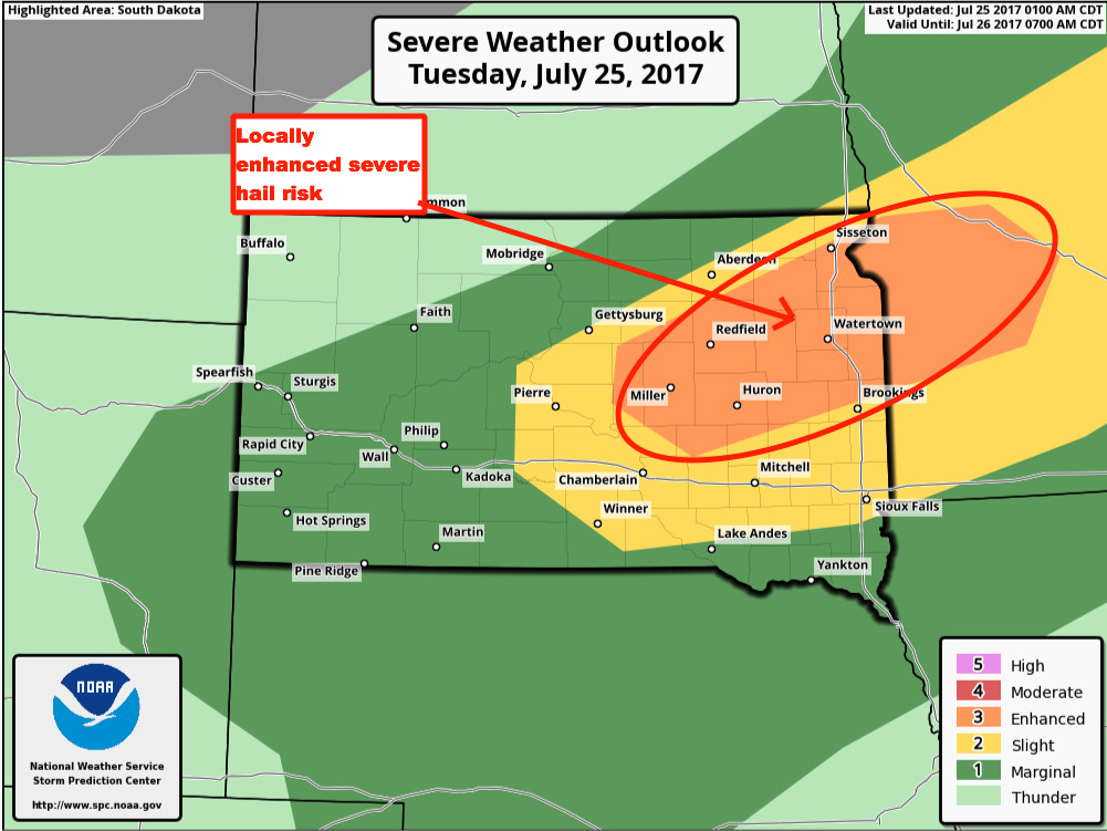
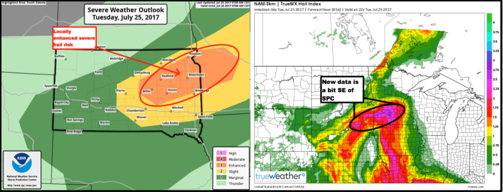
New data is a bit southeast of where SPC places the highest hail risk. Be mindful that locally severe hail will be possible.
Tornado threat is also elevated this evening.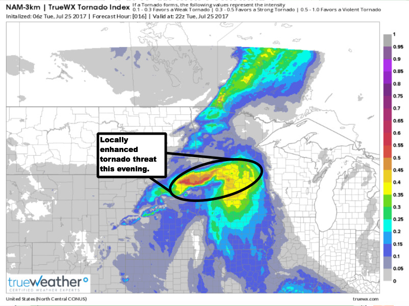
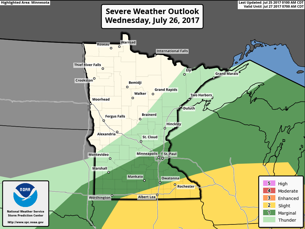
On Wednesday, the severe risk will shift across southeast Minnesota into Wisconsin. Drier air will build in from the northwest.
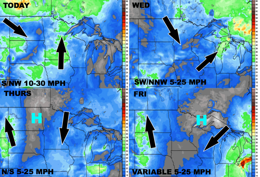
Here is the wind forecast over the next 4 days:
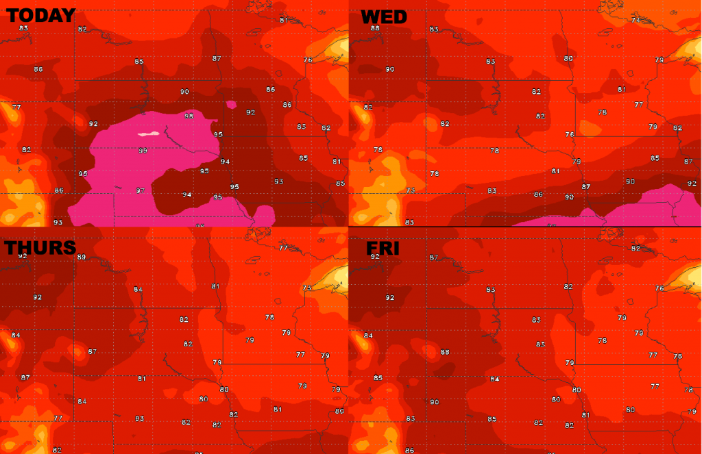
High temperatures through Friday…pleasant mid-week on the way.
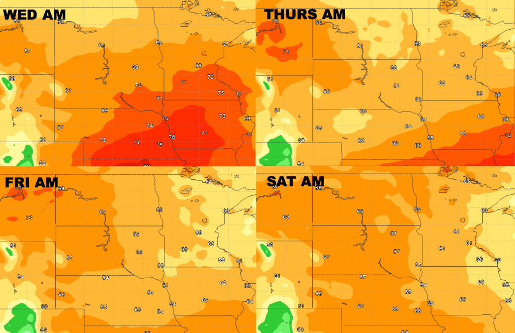
Low temperatures through Saturday morning are shown below.
Dewpoints from normal…nice drop in humidity works in mid to late week!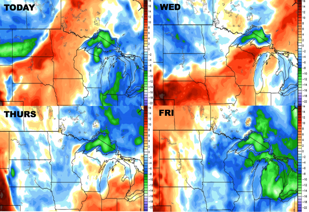
Have a great day, and let us know if you have any questions!