#NDwx #SDwx #MNwx #WIwx Scattered storms focused mainly west into the weekend. N.
Good Thursday morning!
Synopsis: The best storm chances over the next few days will remain confined over the western half of the region. Not expecting anything overly widespread, with marginal severe risks over the western Dakotas into the weekend. The video goes into detail regarding the pattern through next week. Have a great day, and let us know if you have any questions!
Today’s Video (7 min):
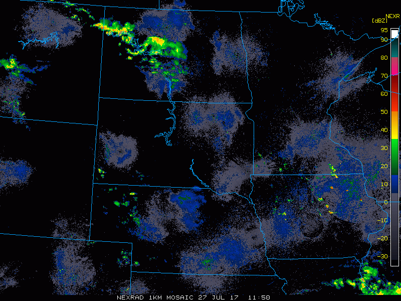
Current radar shows scattered showers and storms working across North Dakota this morning. Note the radar returns over Iowa/southern Minnesota are false.
Heading through the day, widely scattered showers and storms can be expected across the Dakotas, with isolated pop-ups over northern Minnesota into Wisconsin.
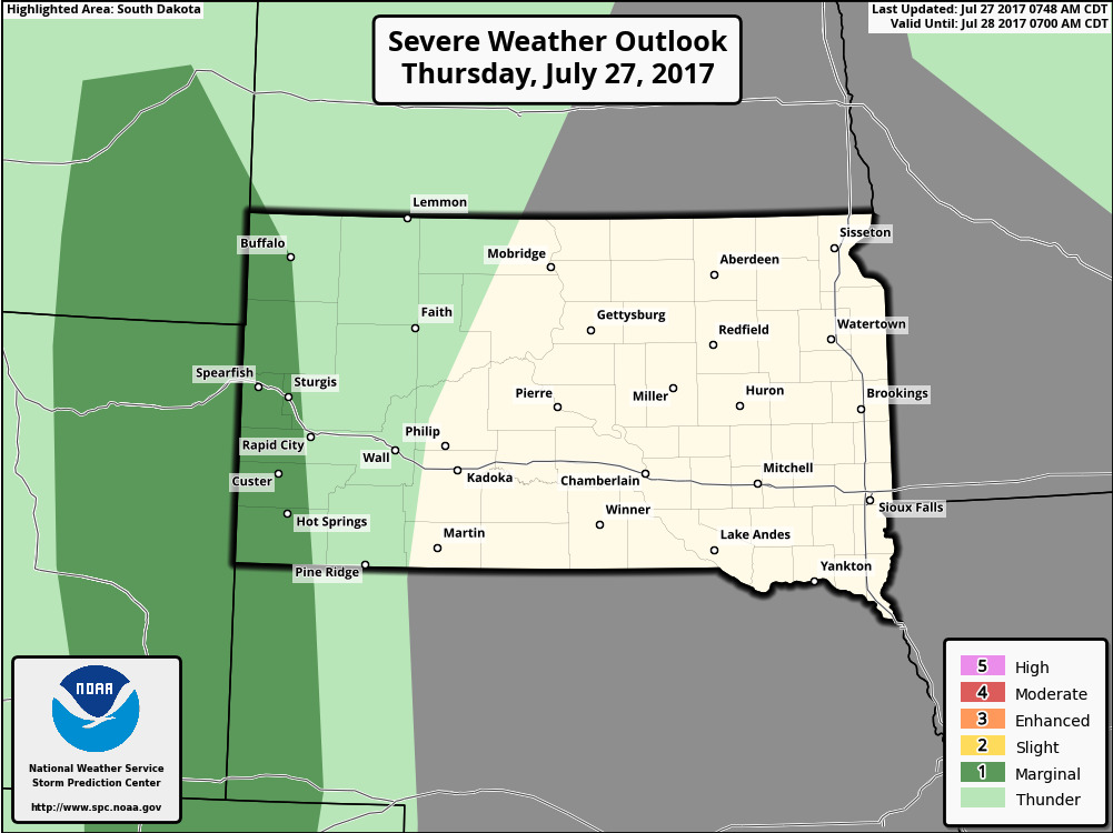
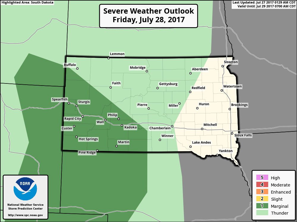
There is a marginal severe risk over extreme western South Dakota and southwest North Dakota. Wind/hail main threats.
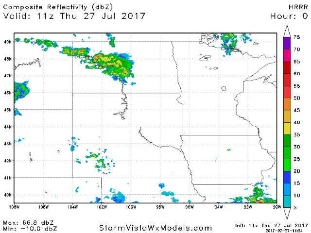
Heading into Friday, widely scattered storm risks continue across the Dakotas. Here is the hi-res NAM future radar going through the day tomorrow.
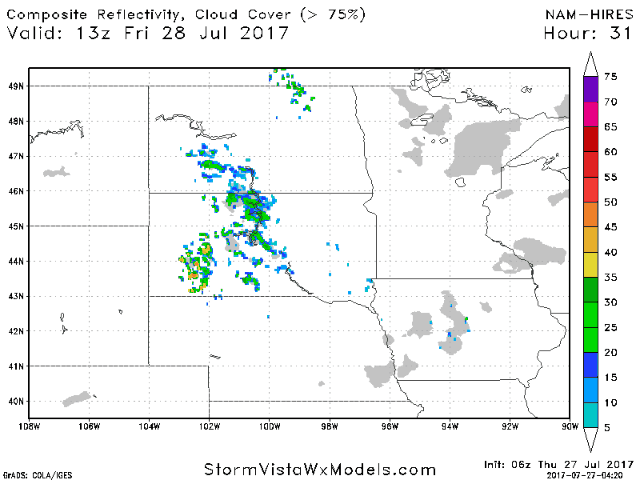
A marginal risk for severe storms is in place for the southwestern half of South Dakota.
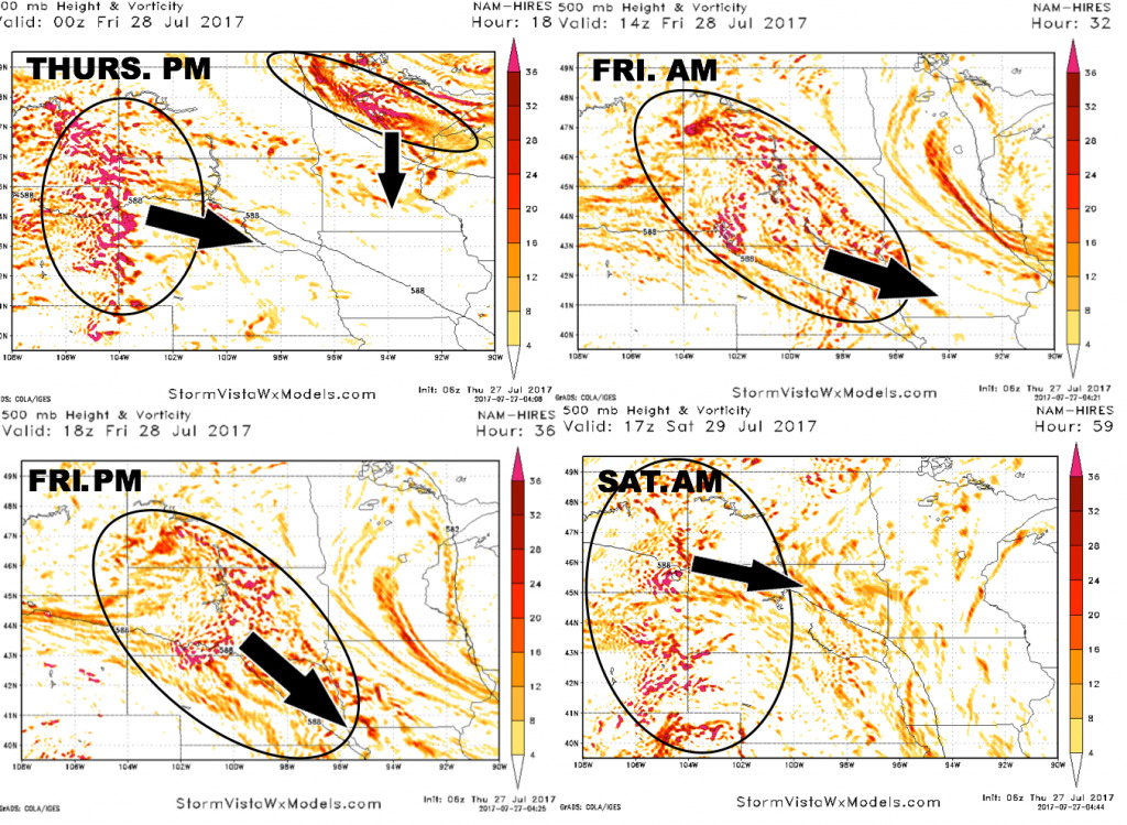
Here is a look at the upper-level energy forecast into Saturday. This gives a better idea of where the best risks for t’storms will take shape. That said, not expecting anything overly widespread or heavy.
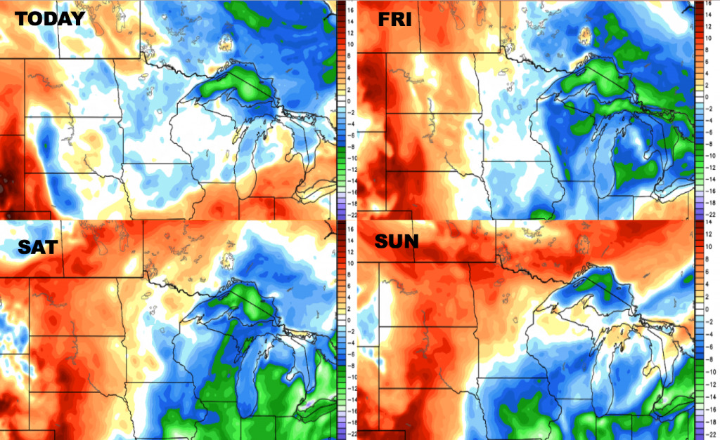
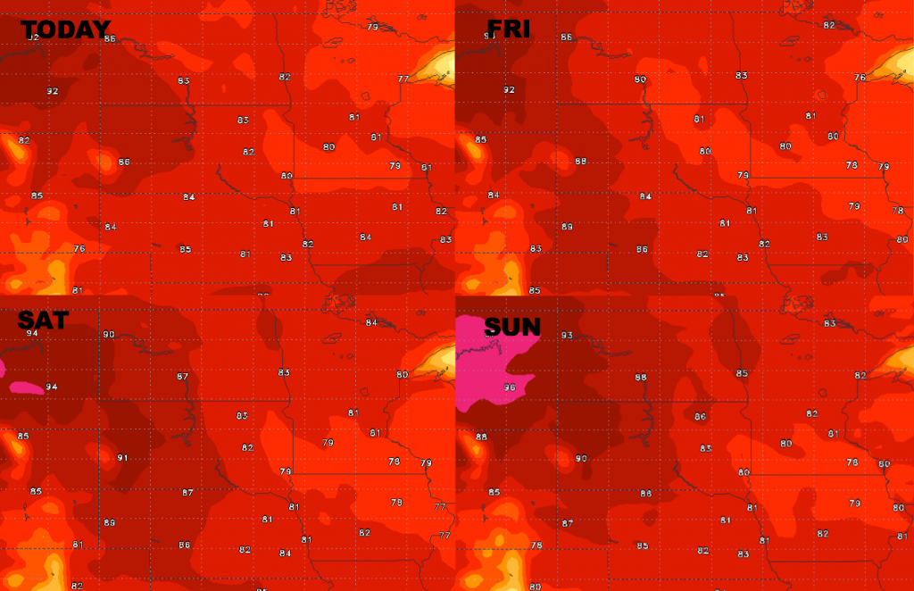
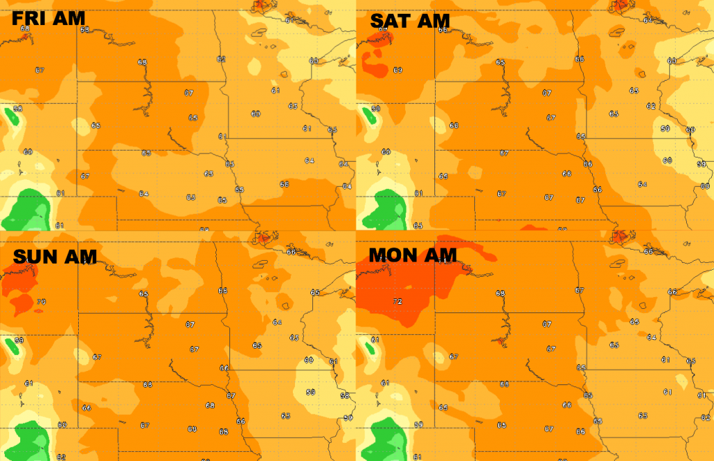
Here is the high temperature guidance for the next 4 days. Heat will build a bit over the western Dakotas this weekend, but overall fairly pleasant for late July.
Low temperature guidance over the next several days.
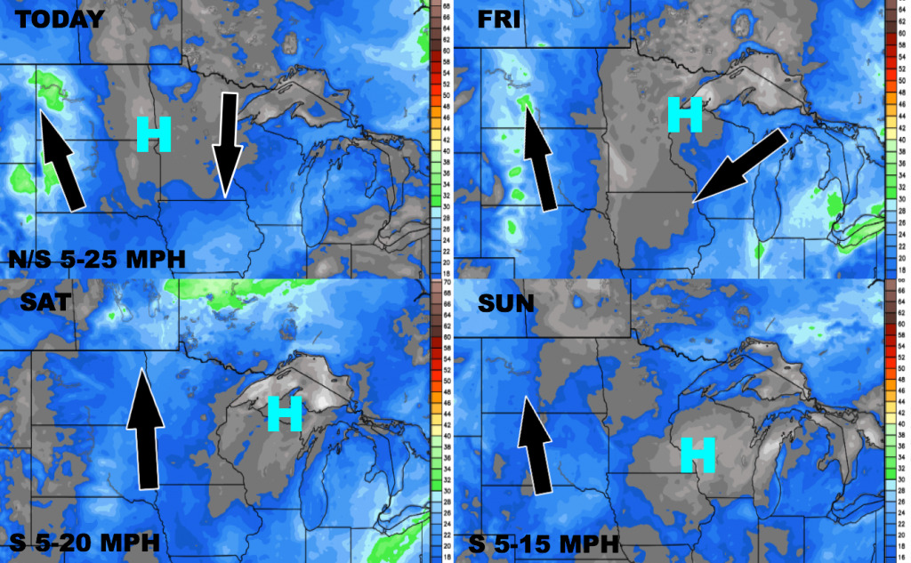
Here is the wind forecast over the next 4 days.
Here are the dew points from normal into the weekend. More humid air builds over the western half of the area through the weekend.