Good Wednesday morning!
In today’s video we discuss the numerous rounds of storms and severe risks over the next several days. Full analysis in the video. Have a blessed day, and let us know if you have any questions.
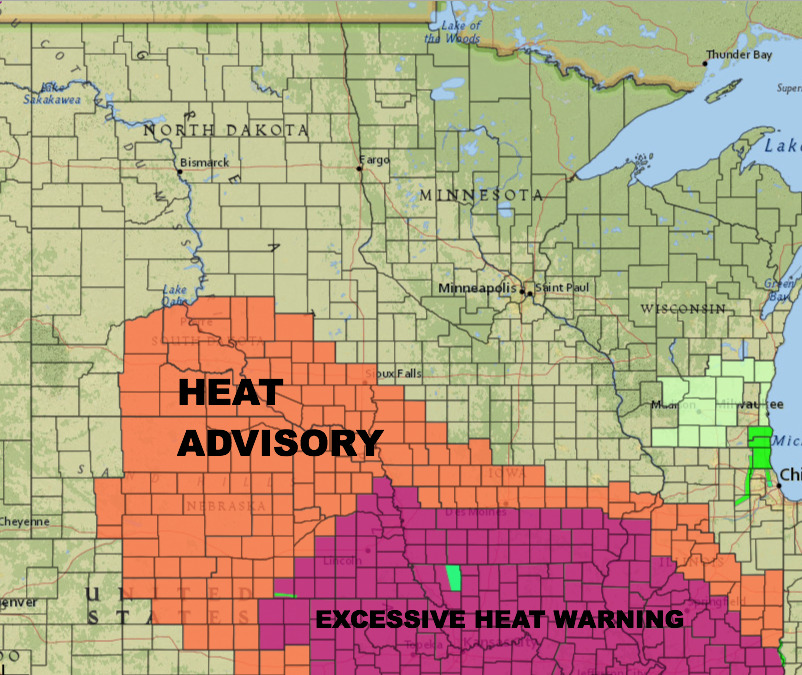
Heat advisory is in effect for central and southern South Dakota today where peak heat indices are expected to reach 105-110.
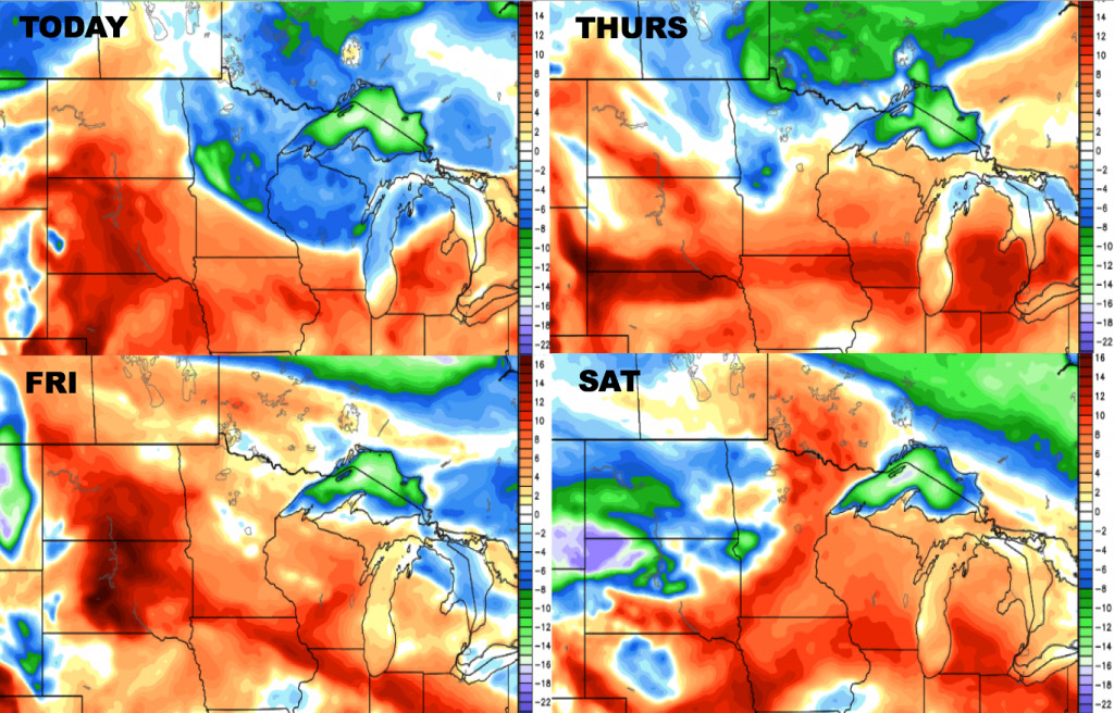
Here are the forecast high temperatures over the next 4 days. 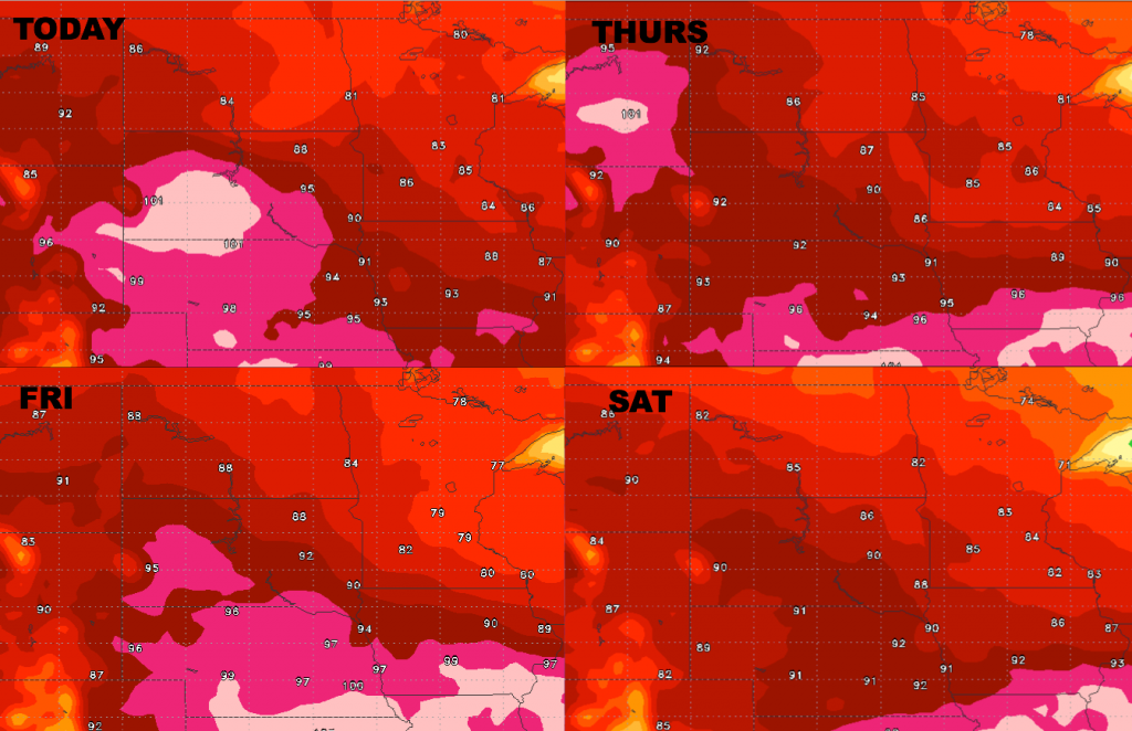
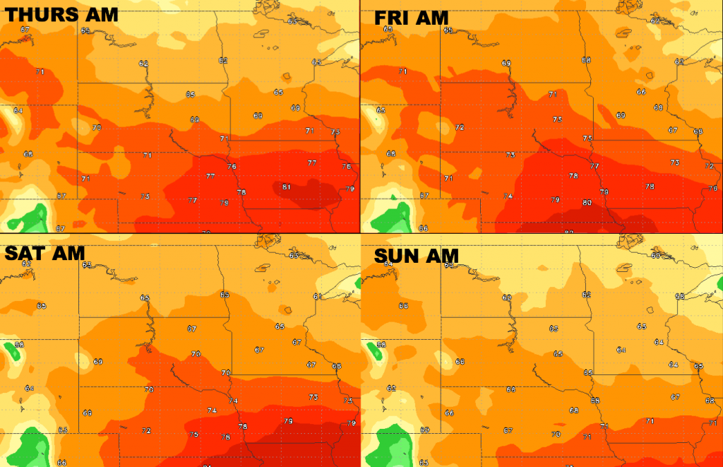
Overnight lows will be warm over the southern portions of the area over the next few days, with cooler air area-wide by Sunday morning.
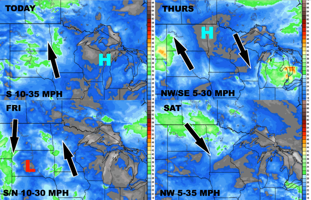
Here is the wind forecast over the next 4 days.
Here are the dew point anomalies over the next 4 days. Some drier air to the north today into Thursday, and very humid over South Dakota. Humid air area-wide by Friday. Drier air will move back in from the northwest this weekend.
Today’s video (5:28):