Good Thursday morning! More rounds of storms are on the way over the next few days, including severe risks. Detailed analysis in the video at the end of the post. Have a blessed Thursday!
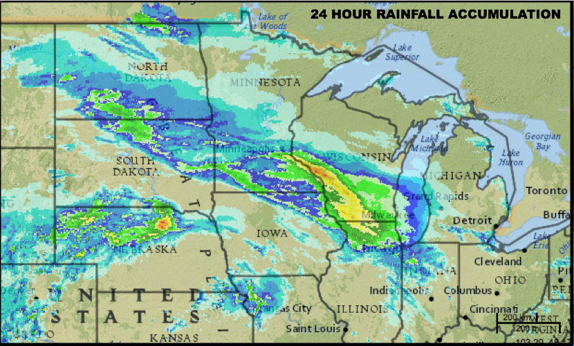
Here is a look at rainfall amounts over the past 24 hours. A decent swath of rains from portions of the Dakotas through Minnesota and southern Wisconsin. Some very heavy totals over southwest Wisconsin.
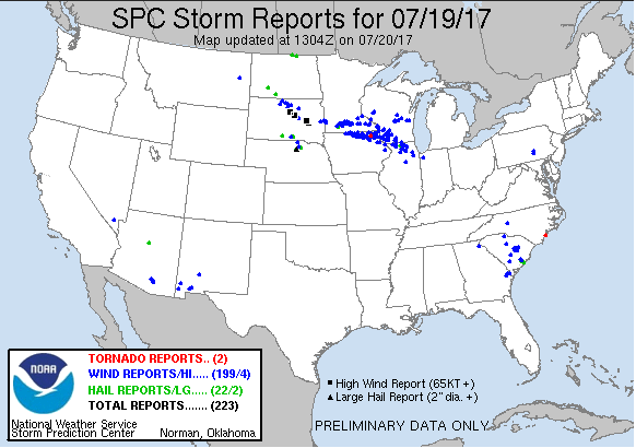
Check out the storm reports from yesterday…many high wind reports.
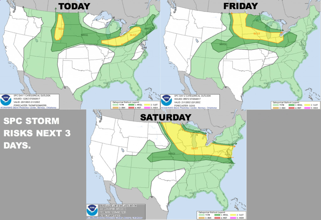
Here are the Storm Prediction Center severe risks through Saturday.
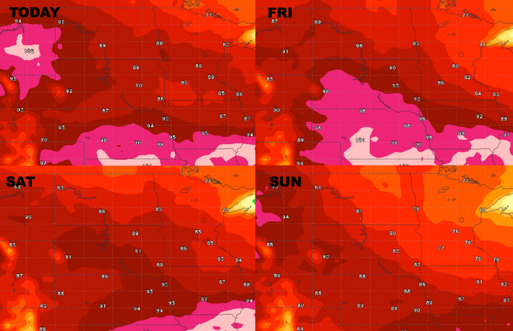
Here is a look at high temperatures through Sunday. Hot to the southwest over the next few days, then gradually turning cooler heading through the weekend.
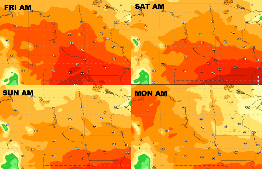
Here is a look at low temperatures over the next several days. Progressively cooler nights heading through the weekend. 50s on the map by Monday morning over portions of Minnesota.
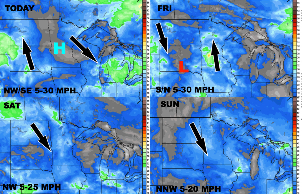
Here is the wind forecast over the next 4 days.
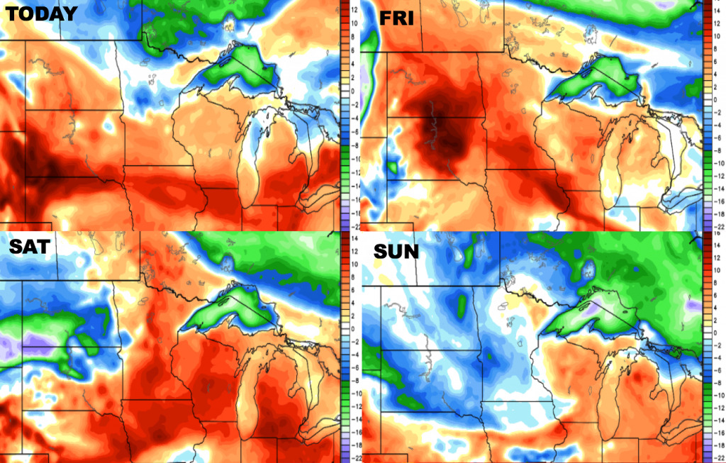
Check out the dew point anomalies over the next 4 days. Humid through Saturday, with drier air by Sunday.
Today’s video (4 min):