Key Points – Wednesday August 2, 2017:
Synopsis: Good Wednesday morning! In today’s update we discuss a potent storm system that will track across the area today into Thursday, bringing widespread rain and storm chances. This system slowly exits to the east late week with drier and unseasonably cool air moving in.
Today’s Video:
Current radar:
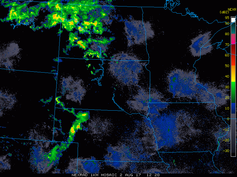
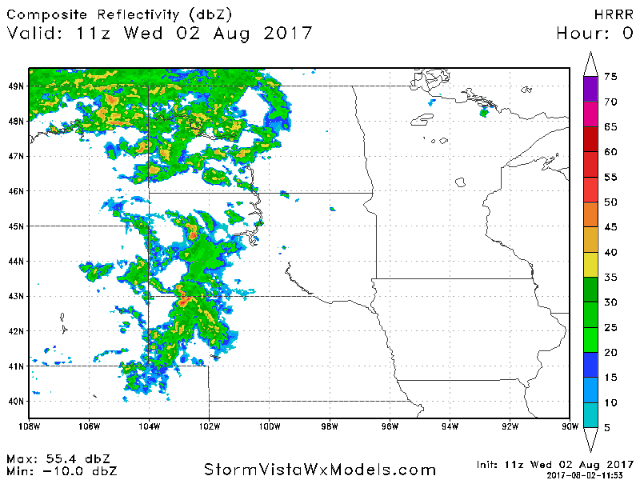
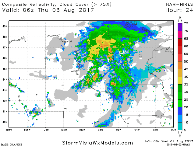
Showers and storms will continue to increase in coverage across the Dakotas, and spread east into Minnesota late this afternoon into tonight. Posted below is the HRRR model through midnight.
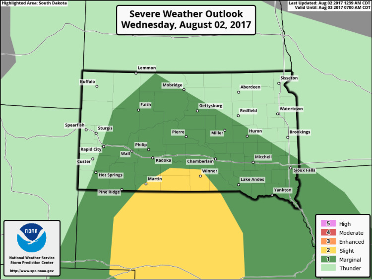
The Storm Prediction Center has a marginal severe risk extending into much of South Dakota, with a slight risk over extreme south-central South Dakota. Large hail and damaging wind will be the main threats, although we cannot rule out an isolated tornado with spin in the atmosphere.
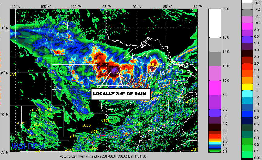
As we go through Thursday, the storm system will slow down as it moves east across Minnesota. This will lead to a heavy rain threat. Below is an animation of the hi-res NAM from 1am tonight to 7am Friday morning. Notice how long the rain lingers over portions of Minnesota, while the western half of the area dries out.
Heavy rain amounts are likely, especially across Minnesota into Wisconsin where a swath of 3″+ totals look likely. Flooding will definitely be a concern due the sluggish movement of this system.
Here is the wind forecast heading into the weekend. Very windy for areas near the low pressure on Thursday. 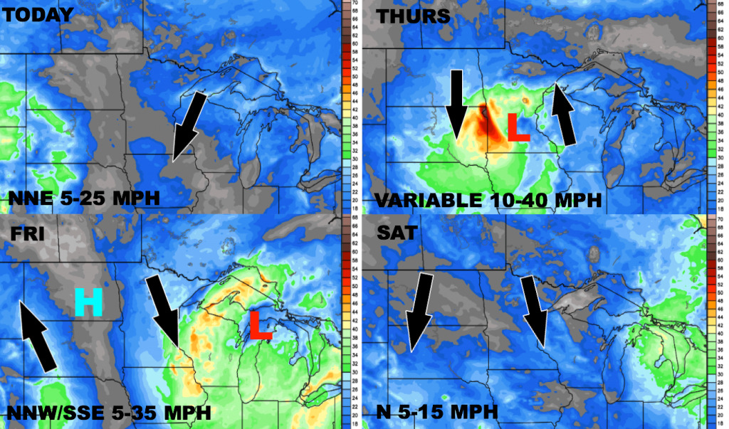
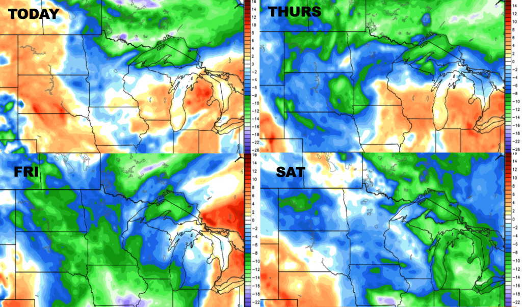
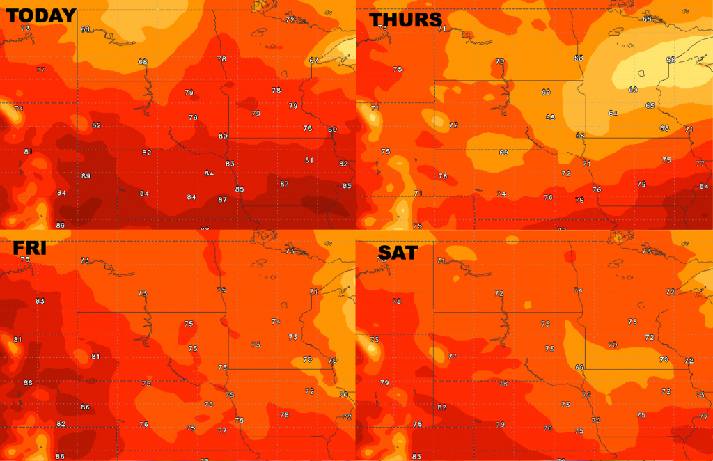
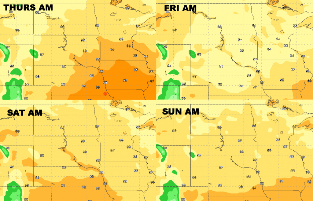
High temperature forecast over the next 4 days is shown below. Unseasonably cool air spills in late week, with highs Thursday in the 60s for many areas!
Low temperature guidance over the next 4 days is shown below.
Dewpoints from normal…anomalously dry air mass moves in behind the storm system late week.