#NDwx #SDwx #MNwx #WIwx Drier air works in today…late week storm chances west. N.
Good Thursday morning! Thunderstorm risks will continue to shift southeast today, with most areas seeing a dry day with increasing sun as drier air works in. Over the next few days, risk for t’storms will remain focused over portions of the Dakotas, with areas further east across Minnesota into Wisconsin looking to stay dry under surface high pressure. All the details can be found in the video. Have a great day, and let us know if you have any questions!
Today’s Video (7 min):
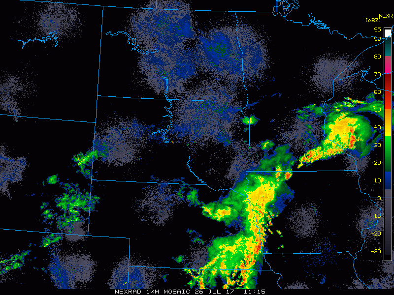
Current radar shows t’storm activity moving across southeast Minnesota into Wisconsin this morning, with more activity to the south.
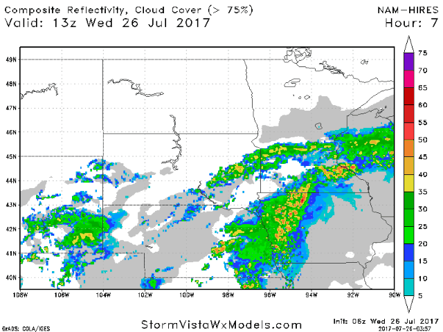
Drier air will continue to build in throughout the region today. Below is an animation of the hi-res NAM, showing storms gradually exiting southeast Minnesota and Wisconsin this afternoon.
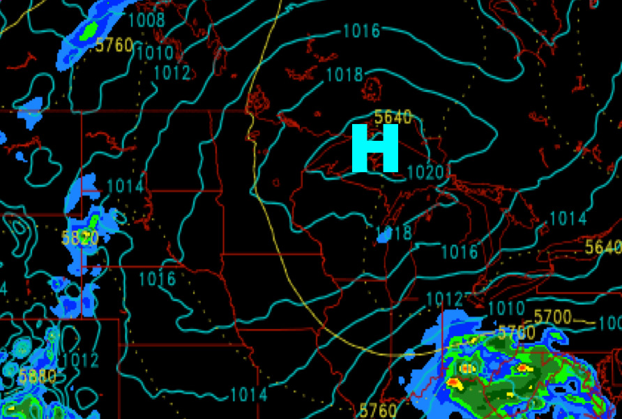
Heading through late week into the weekend, surface high pressure will dominate over much of Minnesota and Wisconsin, keeping those areas dry. Return flow on the backside of the high will bring some shower/storm chances over the Dakotas.
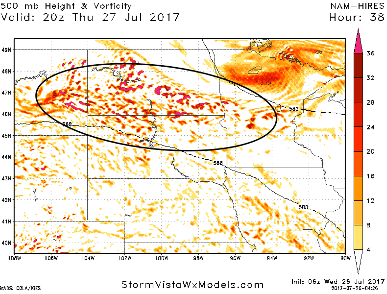
The hi-res NAM shows ripples of energy moving across the Dakotas on Thursday, bringing increased clouds and widely scattered storm chances over the western Dakotas.
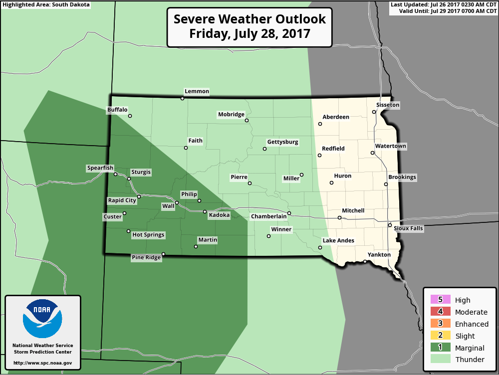
Heading into Friday, the Storm Prediction Center has western South Dakota under a marginal severe risk. May eventually see this expand into western North Dakota as well.
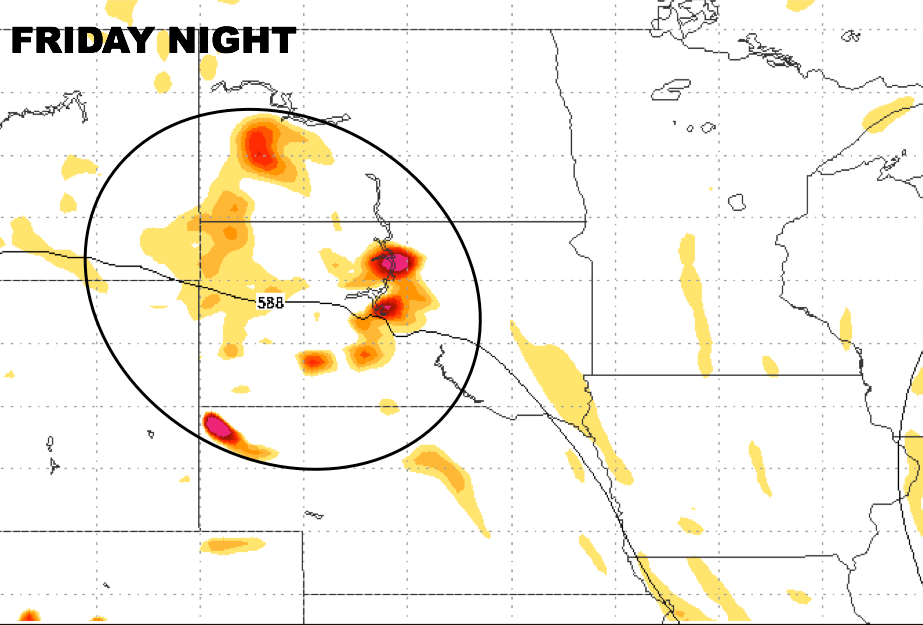
Looking at upper-level energy, the NAM model shows ripples of energy working in across the western Dakotas on Friday leading to storm risks, with areas further east expected to stay dry.
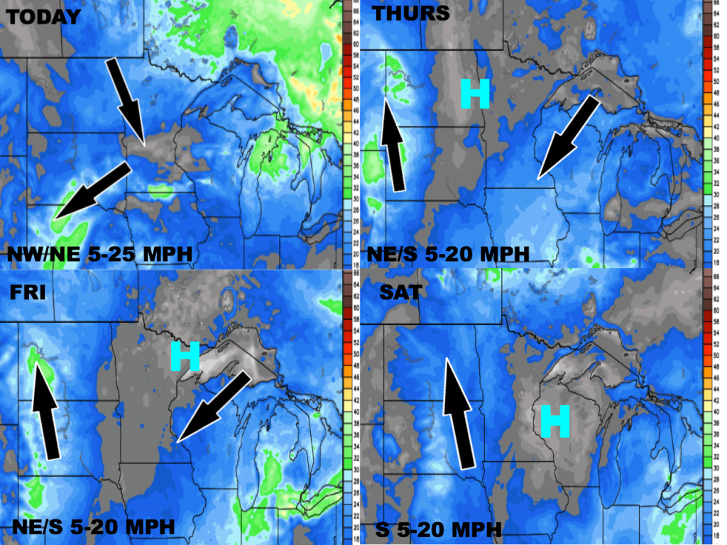
Wind forecast over the next 4 days is shown below.
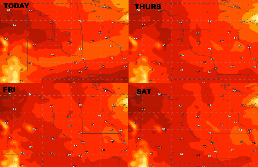
High temperatures over the next several days look rather pleasant for late July.
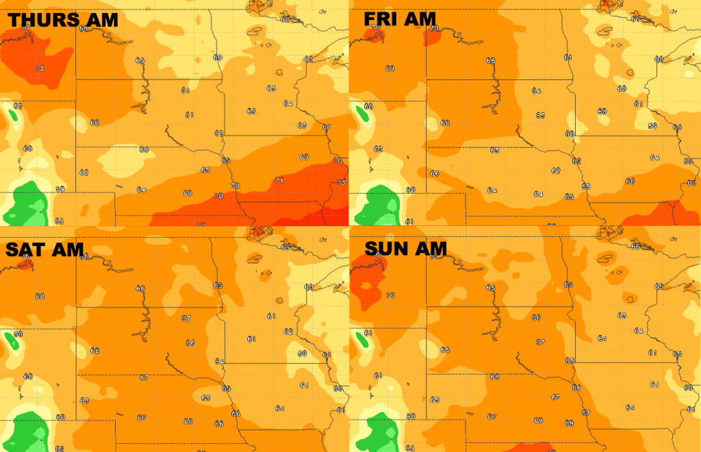
Forecast low temperatures over the next 4 days are shown below.
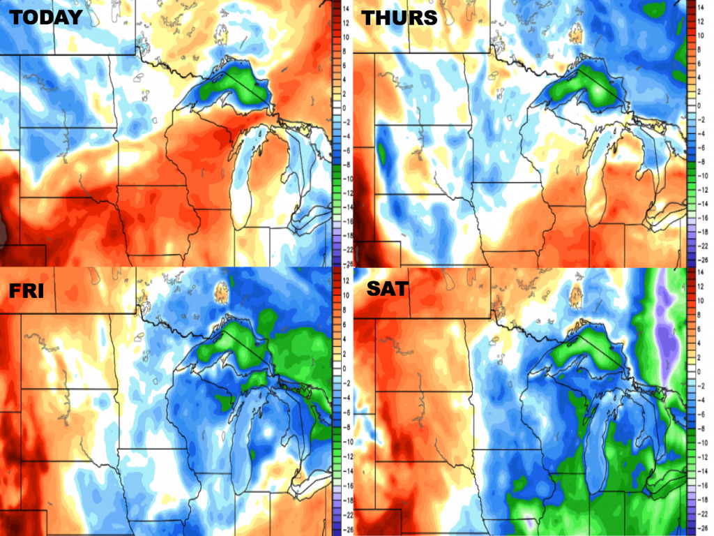
Dewpoints from normal are shown below. Drier air works in from the northwest today, with Wisconsin and southeast Minnesota hanging on to higher humidity. Everyone will get a break in the humidity late week, with higher moisture building over the Dakotas.